


What is Flood Risk Assessment?
Flood risk assessment is a comprehensive analytical process that evaluates the probability and potential consequences of flooding on a specific area or project site. This technical service combines hydrological data, terrain analysis, and advanced modeling to identify vulnerable zones and recommend mitigation strategies.
Professional flood risk analysis involves systematic evaluation of water flow patterns, drainage systems, historical flood data, and climate projections. The assessment delivers actionable insights for developers, planners, and regulatory authorities to make informed decisions about land use and infrastructure development.
Why Infrastructure Projects Need Flood Risk Assessment
Every construction and development project faces potential water-related hazards that can compromise structural integrity, operational efficiency, and human safety. Conducting a thorough flood hazard assessment before project initiation prevents costly damages and ensures long-term sustainability.
Regulatory frameworks across India mandate flood risk evaluation for projects in flood-prone areas. State pollution control boards and environmental clearance authorities require detailed flood risk mapping as part of project approval documentation.
Without proper assessment, projects face:
- Structural damage during monsoon seasons
- Operational disruptions and revenue losses
- Non-compliance with environmental regulations
- Increased insurance premiums and liability risks
- Threats to public safety and property
Applications Across Multiple Sectors
Transportation Infrastructure
Highways and expressways require comprehensive flood modeling to ensure year-round connectivity. Assessment identifies vulnerable sections, designs adequate drainage systems, and recommends elevation adjustments to prevent waterlogging.
Airport planning demands precise flood risk analysis to protect runways, taxiways, and terminal facilities. Water accumulation on operational surfaces poses serious safety hazards that proper assessment can eliminate.
Railway corridors spanning diverse terrains need detailed evaluation to prevent track submersion and ensure uninterrupted service during extreme weather events.
Industrial and Commercial Development
Manufacturing facilities, warehouses, and industrial parks require flood hazard assessment to protect machinery, inventory, and production continuity. Strategic site selection based on risk evaluation minimizes operational vulnerabilities.
Urban Development Projects
Residential layouts, townships, and commercial complexes must undergo rigorous flood risk evaluation to ensure resident safety and property protection. Modern urban planning integrates assessment findings into drainage design and landscape planning.
Agricultural and Rural Projects
Irrigation schemes, farm infrastructure, and rural development initiatives benefit from flood risk mapping to optimize water management and protect agricultural investments.
Renewable Energy Installations
Solar parks, wind farms, and hydroelectric projects require specialized assessment to safeguard expensive equipment and maintain consistent power generation.
Professional Flood Risk Assessment Methodology
Data Collection and Desktop Study
The process begins with gathering topographic maps, satellite imagery, meteorological records, and historical flood data. Existing drainage networks, soil characteristics, and land use patterns are documented for comprehensive analysis.
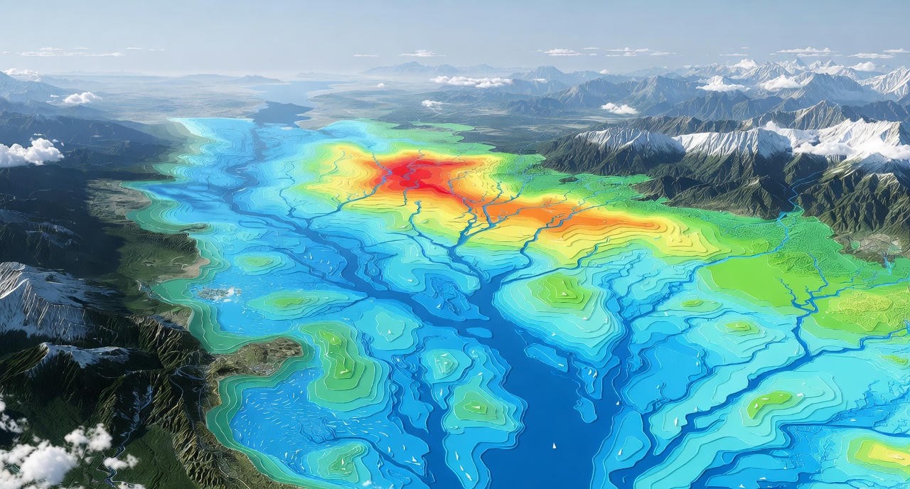
Terrain and Elevation Analysis
Advanced GIS technology processes digital elevation models to identify low-lying areas, natural drainage paths, and water accumulation zones. Slope analysis reveals surface runoff patterns critical for understanding flood behavior.
Hydrological Modeling
Rainfall-runoff models calculate potential water volumes from different storm scenarios. Peak discharge rates, time of concentration, and watershed characteristics are analyzed to predict flood magnitudes.
Hydraulic Modeling
Sophisticated software simulates water flow through channels, culverts, and drainage structures. Two-dimensional models demonstrate flood extent, depth, and velocity across the project area under various scenarios.
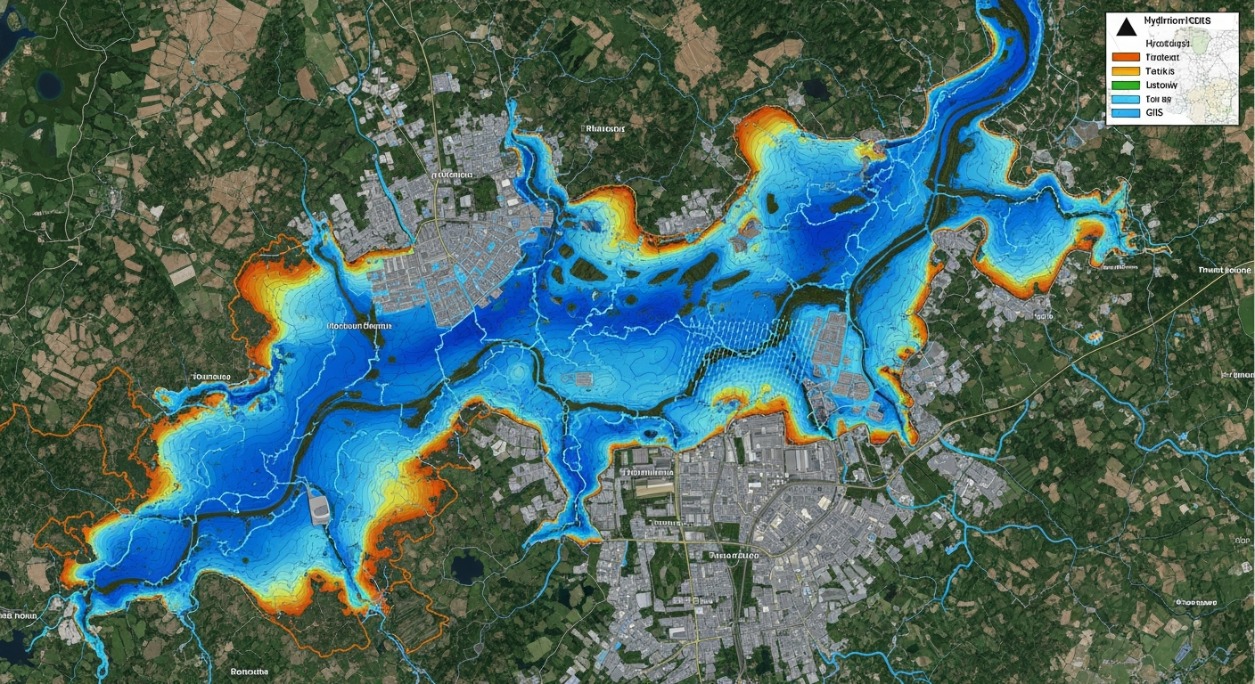
Flood Hazard and Risk Mapping
Results are visualized through detailed maps showing flood depths, inundation extents, and risk zones. These maps categorize areas into low, moderate, and high-risk classifications for decision-making.
Flood Risk Assessment Services Across India
Flood Risk Assessment in Madhya Pradesh
Madhya Pradesh faces significant flood challenges from rivers like Narmada, Chambal, and Betwa. Our comprehensive Flood Risk Assessment Madhya Pradesh services help infrastructure projects, urban developments, and agricultural zones manage monsoon flooding, river overflow, and dam-related flood risks. We provide detailed hydrological studies, flood mapping, and mitigation strategies tailored to MP's central Indian plateau terrain, ensuring regulatory compliance and long-term project safety across districts like Jabalpur, Hoshangabad, and Sehore.
Flood Risk Assessment in Maharashtra
Maharashtra's diverse geography—from Western Ghats to Konkan coast to Vidarbha plains—creates varied flood scenarios. Our Flood Risk Assessment Maharashtra services address coastal flooding, riverine inundation in Krishna-Godavari basins, and urban flooding in Mumbai, Pune, and Nagpur. We deliver advanced flood modeling, dam break analysis, and climate-resilient design solutions for highways, industrial zones, residential townships, and critical infrastructure, helping projects navigate Maharashtra's complex monsoon dynamics and regulatory requirements efficiently.
Flood Risk Assessment in Uttarakhand
Uttarakhand's Himalayan terrain presents extreme flood hazards including cloudbursts, glacial lake outbursts, and flash floods. Our specialized Flood Risk Assessment Uttarakhand services support hydropower projects, mountain highways, tunnel developments, and pilgrimage infrastructure across Alaknanda, Bhagirathi, and Kosi river basins. We provide GLOF risk analysis, debris flow modeling, and steep-slope hydrology expertise essential for safe construction in challenging districts like Chamoli, Rudraprayag, and Uttarkashi, ensuring compliance with stringent environmental clearance requirements.
Flood Risk Assessment in Gujarat
Gujarat experiences flooding from cyclonic storms, Narmada-Tapi river overflow, and intense monsoon rainfall. Our Flood Risk Assessment Gujarat services protect industrial corridors, port infrastructure, and urban centers from coastal inundation and riverine flooding. We deliver storm surge modeling, drainage system design, and flood forecasting solutions for projects in Surat, Vadodara, Ahmedabad, and coastal districts, combining advanced hydraulic analysis with practical mitigation strategies that address Gujarat's unique combination of coastal and inland flood risks.
Flood Risk Assessment in Karnataka
Karnataka faces flooding across diverse landscapes—from Western Ghats to coastal plains to Krishna-Cauvery river valleys. Our comprehensive Flood Risk Assessment Karnataka services support infrastructure development in flood-prone districts like Uttara Kannada, Belagavi, and Kodagu. We provide detailed hydrological studies, reservoir operation analysis, and urban drainage design for projects in Bengaluru, Mysuru, and Mangaluru, ensuring developments withstand monsoon intensity while meeting environmental clearance standards and protecting communities from recurring flood disasters.
Flood Risk Assessment in Goa
Goa's coastal geography makes it vulnerable to tidal flooding, river overflow, and monsoon inundation in low-lying areas. Our specialized Flood Risk Assessment Goa services address unique challenges facing tourism infrastructure, residential developments, and commercial projects near Mandovi, Zuari, and other estuarine systems. We deliver coastal flood modeling, drainage optimization, and climate adaptation strategies that protect investments in Panaji, Margao, and beach resort areas while ensuring compliance with Coastal Regulation Zone requirements and state disaster management guidelines.
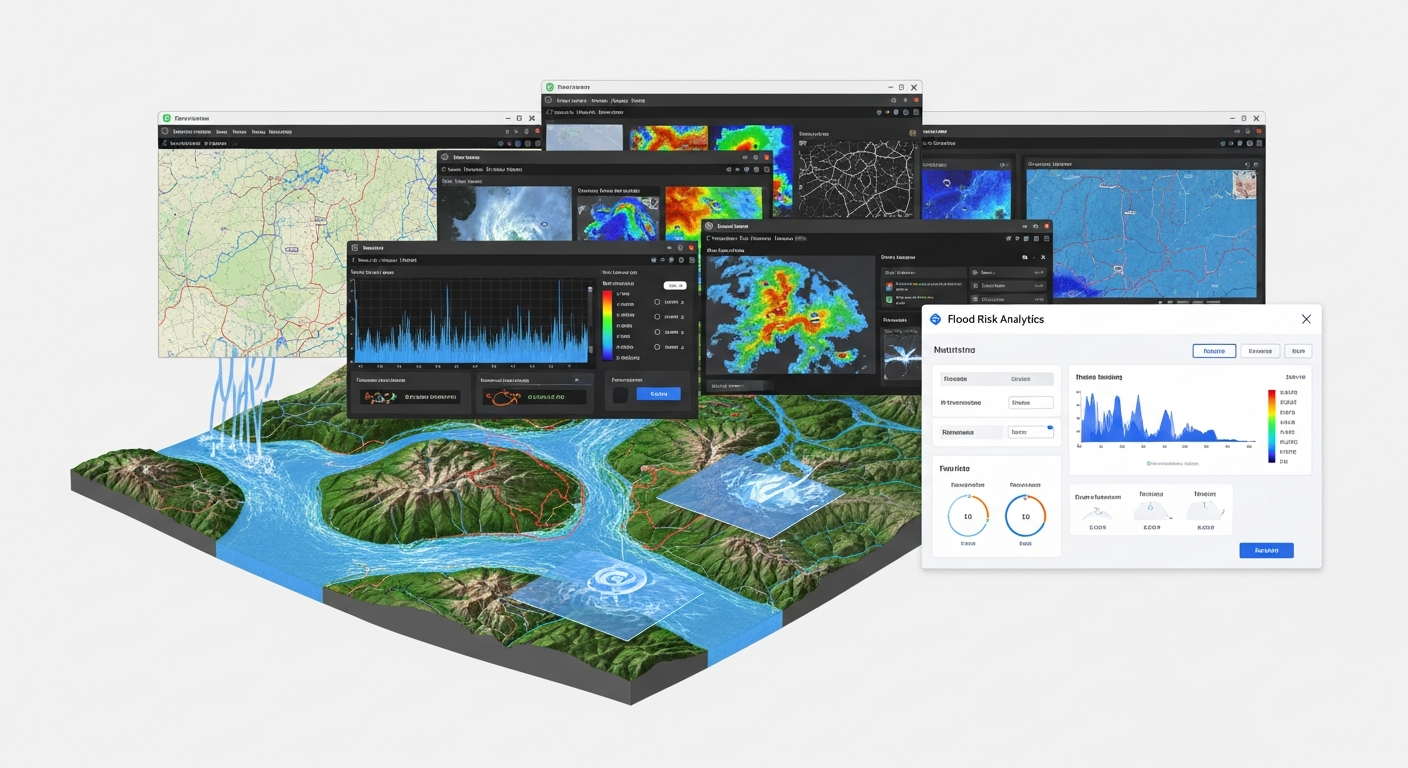
Advanced Tools and Technology Integration
Modern flood risk assessment leverages cutting-edge GIS platforms and specialized hydraulic modeling software. Tools like HEC-RAS, SWMM, and MIKE FLOOD enable precise simulation of complex hydrological processes.
Remote sensing data from satellites provides real-time land cover information and change detection. LiDAR technology delivers high-resolution elevation data essential for accurate modeling.
Cloud-based platforms facilitate collaborative analysis and scenario testing, allowing stakeholders to visualize potential impacts and evaluate mitigation options interactively.
Benefits of Professional Assessment Services
- Engineering Specifications: Technical data for drainage design, foundation depth, and structural protection measures
- Insurance Advantages: Favorable premiums through comprehensive risk documentation
- Financial Benefits: Better financing terms from reduced investment risk
- Regulatory Compliance: Streamlined approval processes with professional documentation
- Stakeholder Confidence: Demonstrated commitment to safety and environmental responsibility
Regulatory Compliance and Project Approvals
Environmental Impact Assessment notifications require flood risk evaluation for projects in ecologically sensitive zones. State-level clearances for construction near water bodies mandate detailed hydrological studies.
Building codes increasingly incorporate flood-resistant design requirements based on local risk assessments. Municipal authorities reference these evaluations when approving development plans and issuing construction permits.
Disaster management authorities utilize assessment data for emergency preparedness planning and evacuation route designation. Integration with broader climate resilience strategies enhances regional adaptive capacity.
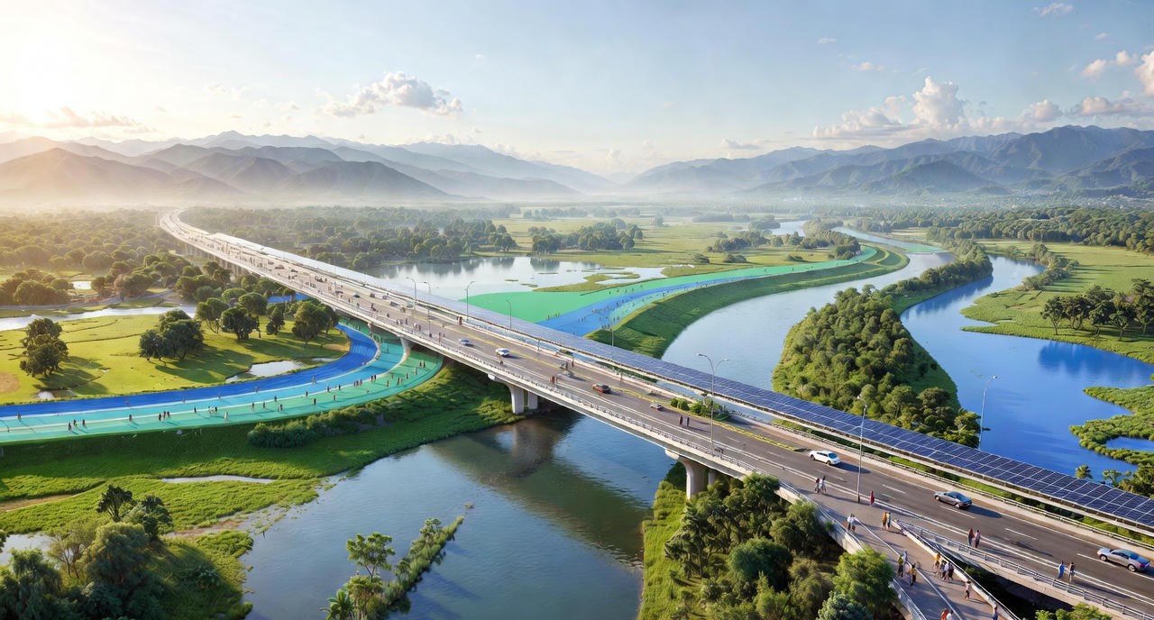
Supporting Sustainable Development Goals
Flood risk assessment aligns development activities with climate adaptation objectives. Projects designed with risk awareness contribute to resilient infrastructure and sustainable urbanization.
Protecting investments from flood damage reduces resource wastage and supports circular economy principles. Green infrastructure recommendations from assessments promote nature-based solutions that provide multiple environmental benefits.
Water-sensitive urban design informed by thorough assessment creates livable cities that harmonize with natural hydrological cycles rather than disrupting them.
Bhoojal Survey: Your Trusted Partner in Flood Risk Assessment
Bhoojal Survey plays a vital role in flood modeling and risk assessment by combining groundwater science, surface water analysis, and advanced GIS-based hydrological tools to deliver reliable and practical flood risk solutions. Working across diverse projects such as national highways, airports, industrial developments, urban infrastructure, and agricultural planning, Bhoojal Survey supports informed decision-making at both project and policy levels.
Through scientifically developed flood models, our organization helps reduce flood damage, improve water management, and promote sustainable development practices. Our multidisciplinary expertise and involvement in large-scale development projects reflect strong institutional capability, contributing not only to flood risk mitigation but also to long-term environmental conservation and water security initiatives.
With over two decades of experience since 2001, we have established ourselves as a trusted partner for government agencies, private developers, and multinational corporations. Our team of hydrological experts, GIS specialists, and environmental consultants bring comprehensive knowledge to every project we undertake.