Satellite Land Survey Services
A satellite survey can provide high-resolution images of the Earth's surface in GeoTIFF, HDF JPEG, KML format. These images serve as raw data for GIS software to design 3D models of contours, elevations, and other important models required for flood modeling and hydrology, infrastructure planning in hilly regions, and simulating solar energy potential. Further output from GIS software like classified images (GeoTIFF), vector boundaries (Shapefile), and reports summarizing area percentages (CSV) can be converted to AutoCAD files for better understanding purposes.

Key Components of Satellite Land Surveys
- Satellite Imagery: Captured by Earth observation satellites like Landsat, Sentinel, or commercial satellites like those from Maxar or Planet. Provides high-resolution images in visible, infrared, and radar spectrums.
- Remote Sensing Technologies: Optical Sensors detect sunlight reflected off the Earth's surface; Radar (SAR) captures data regardless of cloud cover or lighting conditions; Thermal Sensors measure heat emissions from the Earth's surface.
- Geographical Information Systems (GIS): Used to analyze and interpret satellite data for mapping and spatial analysis.
- Global Positioning System (GPS): Provides precise geographic coordinates for integration with satellite data.
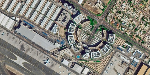
Applications of Satellite Land Surveys
The applications of groundwater modeling span various sectors:
- Land Use and Land Cover Mapping: Identifies changes in vegetation, urbanization, water bodies, and agricultural fields.
- Agriculture: Tracks crop health, soil moisture levels, and yields. Assists in precision farming.
- Environmental Monitoring: Observes deforestation, desertification, and wetland conservation. Monitors air and water pollution.
- Disaster Management: Provides real-time data for managing floods, wildfires, earthquakes, and tsunamis. Helps in post-disaster assessment.
- Urban Planning: Supports infrastructure development and urban expansion management. Analyzes population density and land availability.
- Forestry and Wildlife: Monitors forest health, illegal logging, and wildlife habitats.
- Climate Studies: Tracks glaciers, sea-level rise, and weather patterns.
Advantages of Satellite Land Surveys
- Global Coverage: Satellites can capture data from remote or inaccessible areas.
- Consistency: Provides periodic updates allowing for time-series analysis.
- Cost-Effective: Reduces the need for extensive ground surveys.
- Non-Invasive: Does not disturb the natural environment.
Popular Satellite Programs
- NASA Landsat Program: Longest-running Earth observation satellite program providing free access to data.
- European Space Agency's Sentinel: Part of the Copernicus program offering multi-spectral imaging.
- Commercial Satellites: Offer very high-resolution images (up to 30 cm), suitable for detailed analysis.
Frequently Asked Questions (FAQs)
1. What is a satellite land survey?
A satellite land survey involves using satellite imagery and remote sensing technology to observe, map, and analyze the Earth's surface.
2. What are the key components of a satellite land survey?
Key components include satellite imagery capture by Earth observation satellites, remote sensing technologies (optical sensors, radar), GIS for spatial analysis, and GPS for precise geographic coordinates.
3. What applications do satellite surveys have?
Applications include land use mapping, agriculture monitoring, environmental protection, disaster management planning, urban development support, forestry management, and climate studies.
4. What are the advantages of using satellite surveys?
Advantages include global coverage of remote areas, consistency with periodic updates for time-series analysis, cost-effectiveness by reducing ground survey needs, and non-invasive methods that do not disturb environments.
For more information about our services or to schedule a consultation, visit our website at Bhoojal Survey & Recharging.

