


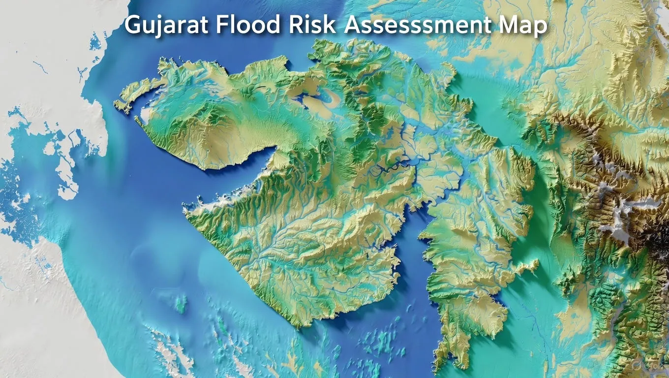
Understanding Flood Risk Assessment in Gujarat
Gujarat faces serious flooding challenges every monsoon and cyclone seasonâ€"from the busy streets of Surat and Ahmedabad to the Tapi and Sabarmati river basins. Flood risk assessment helps identify which areas are most vulnerable to flooding and how we can protect lives, businesses, homes, and farms before water arrives.
In simple terms, it means studying rainfall patterns, river behavior, land slopes, drainage systems, coastal tides, and past flood records to predict where flooding might happen. This knowledge helps the government, builders, industries, and city planners make smart decisions about construction, drainage design, and emergency planning across Gujarat.
Why Gujarat Needs Flood Risk Assessment
Gujarat is one of India's most industrialized and economically vibrant states, but it also faces unique flooding challenges. The state has a long coastline, major rivers like Sabarmati, Tapi, and Mahi, rapidly growing cities, and vulnerability to cyclonic storms from the Arabian Sea.
Every monsoon season brings heavy rainfall that overwhelms urban drainage systems, causes rivers to overflow, and triggers widespread flooding in low-lying areas. Cyclones hitting the Saurashtra and Kutch coasts add another layer of flood riskâ€"combining storm surge with intense rainfall. Without proper Flood Risk Assessment, these recurring floods will continue causing massive damage to Gujarat's economy and communities.
Key Flooding Challenges Gujarat Faces:
- Heavy monsoon rainfall concentrated in just 3-4 months causing river flooding
- Rapid urbanization in Ahmedabad, Surat, Vadodara reducing natural drainage areas
- Rivers overflowing when upstream dams release water suddenly
- Coastal flooding from cyclones combining storm surge with heavy rain
- Outdated drainage systems unable to handle today's water volumes
- Construction in flood zones without proper risk analysis
- Saurashtra and Kutch regions facing flash floods and cyclonic rainfall
Major Flood-Prone Areas in Gujarat
Different regions of Gujarat face different types of flooding. Understanding these patterns is essential for effective Flood Risk Assessment and planning.
Sabarmati River Basin (Ahmedabad & Gandhinagar)
The Sabarmati river flows through Gujarat's capital region, including Ahmedabad and Gandhinagar. When heavy monsoon rains fall in the catchment area or when upstream dams release water, the Sabarmati can rise quickly and flood low-lying neighborhoods.
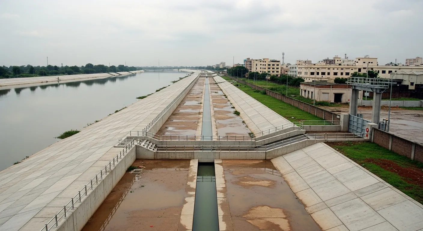
Ahmedabad has experienced several major Sabarmati river floods in recent decades. Areas along the riverbanks, old city neighborhoods, and low-lying zones face waterlogging during peak monsoon. Urban development has reduced natural drainage, making flood mapping in Gujarat essential for safe construction planning.
Tapi River Region (Surat & Bardoli)
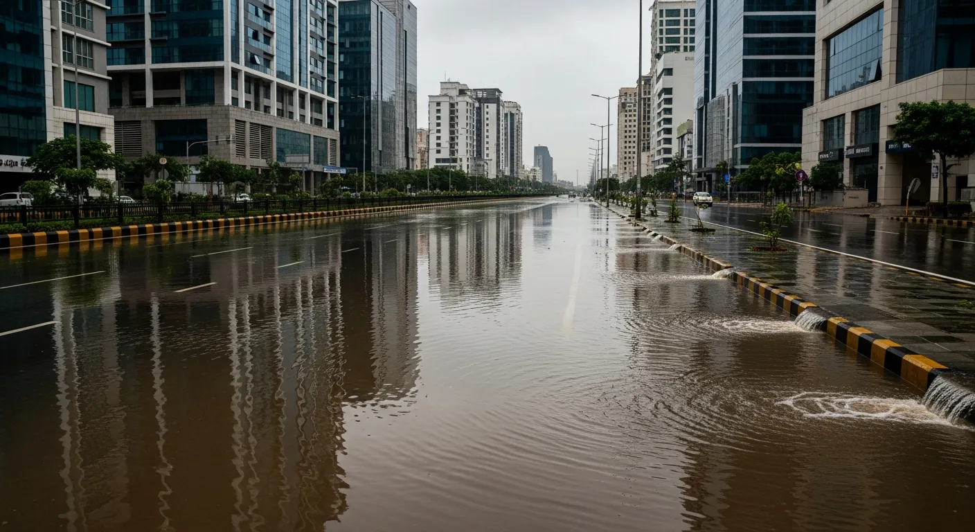
Surat faces some of the most severe urban flooding in Gujarat. The Tapi river, combined with heavy monsoon rainfall and poor drainage in many areas, causes regular Surat urban flooding that disrupts life and business.
The 2006 Surat floods remain a stark reminder of what happens without proper flood prevention planning. Entire neighborhoods were submerged for days, thousands of people evacuated, businesses shut down, and economic losses ran into thousands of crores. Since then, Surat has improved its systems, but flooding still occurs in low-lying areas during heavy rain combined with Tapi river overflow.
Bardoli and surrounding Tapi basin areas also face agricultural flooding when the river swells during monsoon, affecting crops and rural infrastructure.
Mahi River Basin (Vadodara & Anand)
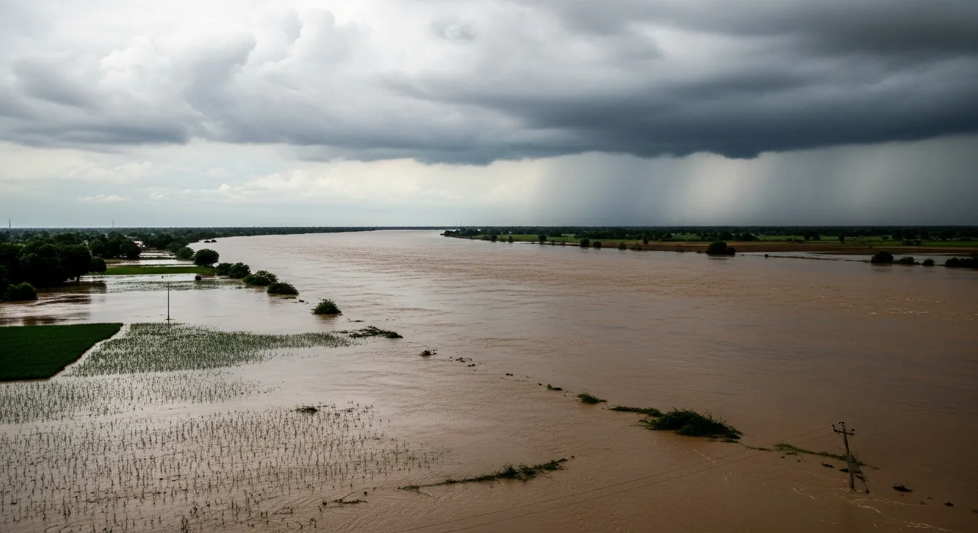
The Mahi river flows through central Gujarat, affecting Vadodara, Anand, and surrounding districts. When monsoon arrives or when the Kadana dam releases water, the Mahi can flood agricultural land and low-lying villages.
Vadodara city itself faces urban flooding in several areas during heavy rainfall. The combination of river proximity, inadequate drainage capacity, and increasing concrete surfaces creates flood risk zones Gujarat planners must address.
Saurashtra Region (Rajkot, Jamnagar, Junagadh)
Saurashtra faces a unique challengeâ€"it's normally water-scarce, but when heavy rain or cyclones strike, flash flooding occurs rapidly. The region's hard rock terrain and steep slopes mean rainwater runs off quickly, creating sudden floods in low-lying areas.
Cities like Rajkot and Jamnagar experience waterlogging during intense rainfall events. Junagadh and the Gir forest region face flash floods when cloudburst rainfall hits the hills. Farmers lose crops, roads get washed out, and villages get temporarily cut off.
Kutch Region (Bhuj & Coastal Areas)
Kutch is mostly arid, but cyclones from the Arabian Sea can bring devastating flooding. Storm surges combined with heavy cyclonic rainfall inundate coastal villages and salt pans. Bhuj and interior areas face flash flooding when intense rain falls on the hard, dry ground that cannot absorb water quickly.
After years of drought, sudden intense rainfall creates dangerous conditions as dry riverbeds become raging torrents within hours.
How Flood Risk Assessment Works
Flood Risk Assessment is a scientific process done by experts using modern technology. Here's how it works in simple, practical steps:
Step 1: Collect Detailed Data
Experts gather comprehensive information including:
- Rainfall patterns and intensity data from weather stations
- River water level records and flood history
- Land elevation and terrain slopes using satellite data
- Soil types and their water absorption capacity
- Existing drainage network maps and capacity
- Historical flood extent from past events
- Cyclone track and storm surge data for coastal areas
Step 2: Analyze Terrain and Water Flow
Using advanced GIS software, experts create detailed 3D digital models showing:
- How water flows naturally across the land
- Low-lying areas where water collects
- Steep slopes where water runs off rapidly
- Bottlenecks in drainage systems
- River channel capacity and overflow points
- Urban areas with inadequate drainage
Step 3: Run Flood Simulations
Computer models simulate various flood scenarios:
- Normal monsoon rainfall patterns
- Heavy rainfall events (100mm+ in 24 hours)
- Extreme cloudbursts and intense storms
- Dam water release scenarios
- Cyclone-induced flooding with storm surge
- Combined river overflow and urban waterlogging
These simulations show exactly how deep water will get, how fast it will flow, which areas flood first, and how long water will remain standing.
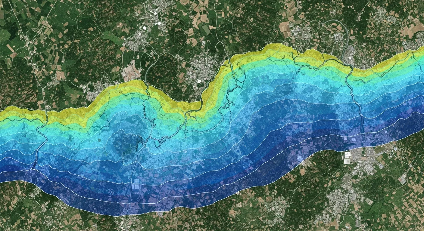
Step 4: Create Detailed Risk Maps
Based on comprehensive analysis, detailed flood risk maps are prepared showing:
- Low Risk Zones (Green) – Safe areas with minimal flood chance
- Medium Risk Zones (Yellow) – Occasional flooding possible during extreme events
- High Risk Zones (Red) – Frequent flooding likely, construction restricted
- Expected water depths for different scenarios
- Flow velocities and danger zones
- Safe evacuation routes and shelter locations
These maps guide all planning, construction, and emergency response decisions across Gujarat.
Benefits of Flood Risk Assessment in Gujarat
Proper Flood Risk Assessment brings multiple practical benefits to Gujarat's people, cities, industries, and economy:
For Cities and Urban Areas:
- Better drainage system design that handles peak monsoon flows
- Identification of flooding hotspots for priority improvements
- Smart urban planning avoiding construction in dangerous flood zones
- Reduced traffic disruption and business losses during monsoon
- Protection of critical infrastructure like power stations and hospitals
- Lower insurance premiums for well-protected buildings
For Industries and Businesses:
- Site selection that avoids flood-prone locations
- Factory design with elevated critical equipment and materials
- Business continuity planning based on realistic flood scenarios
- Supply chain protection through alternative route planning
- Reduced downtime and revenue losses during floods
- Compliance with environmental clearance requirements
For Transportation Projects:
- Highways and bridges designed above predicted flood levels
- Railway tracks protected from monsoon submersion
- Proper culvert and bridge sizing preventing road washouts
- Alternative routes planned for emergency access
- Airport runway protection from waterlogging
For Farmers and Rural Communities:
- Early flood warning systems protecting crops and livestock
- Better irrigation planning accounting for flood cycles
- Government assistance targeted to genuine high-risk zones
- Reduced crop losses through preventive bunding and drainage
- Farm pond and check dam placement optimized for flood safety
A Real Example from Gujarat
A manufacturing company planned to build a large industrial facility near Vadodara on land that seemed perfect – flat, well-connected by road and rail, and available at a reasonable price. The location was close to the Mahi river but appeared safe since no flooding had occurred there in recent years.
During the environmental clearance process, authorities required a comprehensive Flood Risk Assessment. The study revealed something the company hadn't consideredâ€"during extreme monsoon events or when the Kadana dam releases excess water, the Mahi river swells significantly and its floodwaters reach this area.
The flood simulations showed that once every 10-15 years, water could reach depths of 0.5 to 1 meter across the proposed site. For a facility handling sensitive machinery and chemical materials, even this level of flooding would cause catastrophic damage and environmental hazards.
Based on the Flood Risk Assessment findings, the company made smart changes. They elevated the entire facility by 1.5 meters above natural ground level. Critical equipment rooms and electrical panels were placed even higher. A protective bund was constructed around the perimeter. Storm water pumps were installed to handle rainwater quickly. All chemical storage was designed to remain watertight even if partially submerged.
Three years after construction, an extreme monsoon event occurred with record rainfall and major dam releases. The Mahi flooded exactly as the models predictedâ€"water spread across the surrounding area reaching 0.8 meters depth. But the industrial facility remained completely safe and operational. While nearby unprotected structures suffered damage, this factory continued production without interruption.
The company's investment in Flood Risk Assessment and protective design paid for itself many times over by preventing losses during just that one flood event. This is the real power of proper flood planningâ€"turning potential disasters into manageable situations through smart engineering.

Moving Forward with Flood Safety in Gujarat
Climate change is making weather patterns more unpredictable across Gujarat. The state may face more intense rainfall events, longer dry periods, and stronger cyclones. These extremes create complex challengesâ€"severe floods during monsoon, water scarcity during summer, and sudden weather shifts that catch communities unprepared.
Flood Risk Assessment must become standard practice for all development in Gujarat. Every new projectâ€"whether it's a residential complex, industrial park, highway, or commercial development – should include professional flood analysis from the planning stage.
Cities like Ahmedabad, Surat, and Vadodara need continuous updates to their flood maps as urban development changes natural drainage patterns. The Tapi, Sabarmati, and Mahi river basins need coordinated flood management with early warning systems for dam releases. Coastal areas of Saurashtra and Kutch need enhanced cyclone and storm surge preparedness based on scientific flood modeling.
With proper Flood Risk Assessment and coordinated action between government agencies, engineers, urban planners, and communities, Gujarat can significantly reduce flood damage while continuing economic growth. We can protect more lives, save businesses from losses, keep critical infrastructure functioning, and build a more resilient state ready for tomorrow's challenges.
Bhoojal Survey's Work in Gujarat
Bhoojal Survey plays a vital role in flood risk assessment across Gujarat by combining groundwater science, surface water analysis, and advanced GIS-based hydrological tools to deliver reliable and practical flood safety solutions. Working across diverse projects from the Sabarmati river basin to the Tapi region, Saurashtra coast to Kutch, we support informed decision-making for urban development, industrial facilities, infrastructure projects, and agricultural planning.
Through scientifically developed flood models and detailed flood mapping in Gujarat, our team helps reduce flood risks, improve drainage systems, and promote climate-resilient development practices. We understand Gujarat's unique challenges – from Surat urban flooding to Sabarmati river flood dynamics, from coastal storm surge to inland flash floods. Our expertise in handling these diverse flood scenarios reflects strong technical capability and deep local knowledge.
We contribute not only to immediate flood prevention planning but also to long-term water resource sustainability, groundwater recharge optimization, and climate resilience initiatives across Gujarat. Our multidisciplinary approach integrates flood risk assessment with broader water security goals, ensuring development projects succeed while protecting communities and ecosystems for future generations.