Comprehensive Ground Water Survey Services for Borewell and Tubewell
Groundwater is a vital natural resource, forming the backbone of our agricultural, industrial, and domestic water supply. However, its invisible nature makes locating and harnessing it a significant challenge. At Bhoojal Survey, we specialize in transforming this uncertainty into a predictable science. Our team provides state-of-the-art groundwater survey services designed to precisely locate potential drilling points for borewells and tubewells, ensuring a sustainable and high-yield water source.
A professional groundwater survey goes beyond mere guesswork. It is a systematic investigation of subsurface hydrological conditions. The primary goal is to identify aquifer zones — underground layers of water-bearing permeable rock, rock fractures, or unconsolidated materials. By mapping these zones, we can estimate the optimal depth for a borewell to achieve a good yield, analyze the underlying rock strata, and predict the long-term sustainability of the water source. This scientific approach minimizes the risk of failed drilling attempts, saving valuable time, resources, and investment.
Why a Professional Groundwater Survey is Important
Many people still rely on traditional methods like dowsing or local knowledge to find water. But these methods often fail. A scientific borewell survey gives you real data about what is happening underground. Here is why you should always choose a professional groundwater survey before drilling:
- Saves Money: Drilling a dry borewell can cost lakhs of rupees. A groundwater survey identifies the best spot before you spend a single rupee on drilling.
- Reduces Risk: Scientific methods dramatically reduce the chance of hitting a dry well. Our success rate is over 95%.
- Gives Accurate Depth Estimate: A borewell survey tells you exactly how deep to drill so you reach the water-bearing zone without wasting time or money.
- Identifies Water Quality: The hydrogeological survey also checks whether the water is safe and suitable for drinking, farming, or industrial use.
- Supports Long-Term Planning: Our groundwater survey report helps you plan for future water needs and understand how long the source will last.
- Legal and CGWA Compliance: In many areas, a hydrogeological survey report is required by the Central Ground Water Authority (CGWA) before drilling permission is granted.
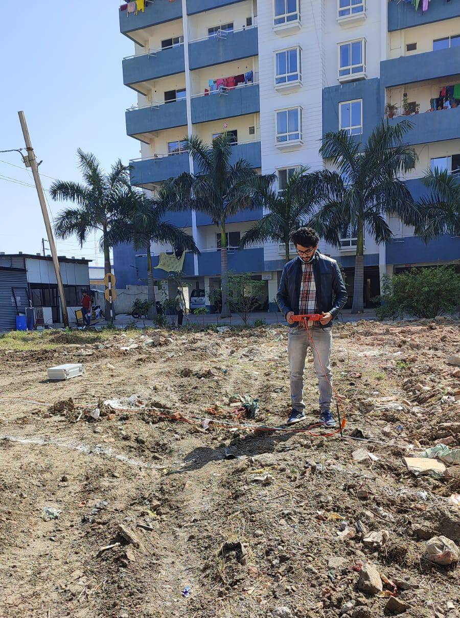
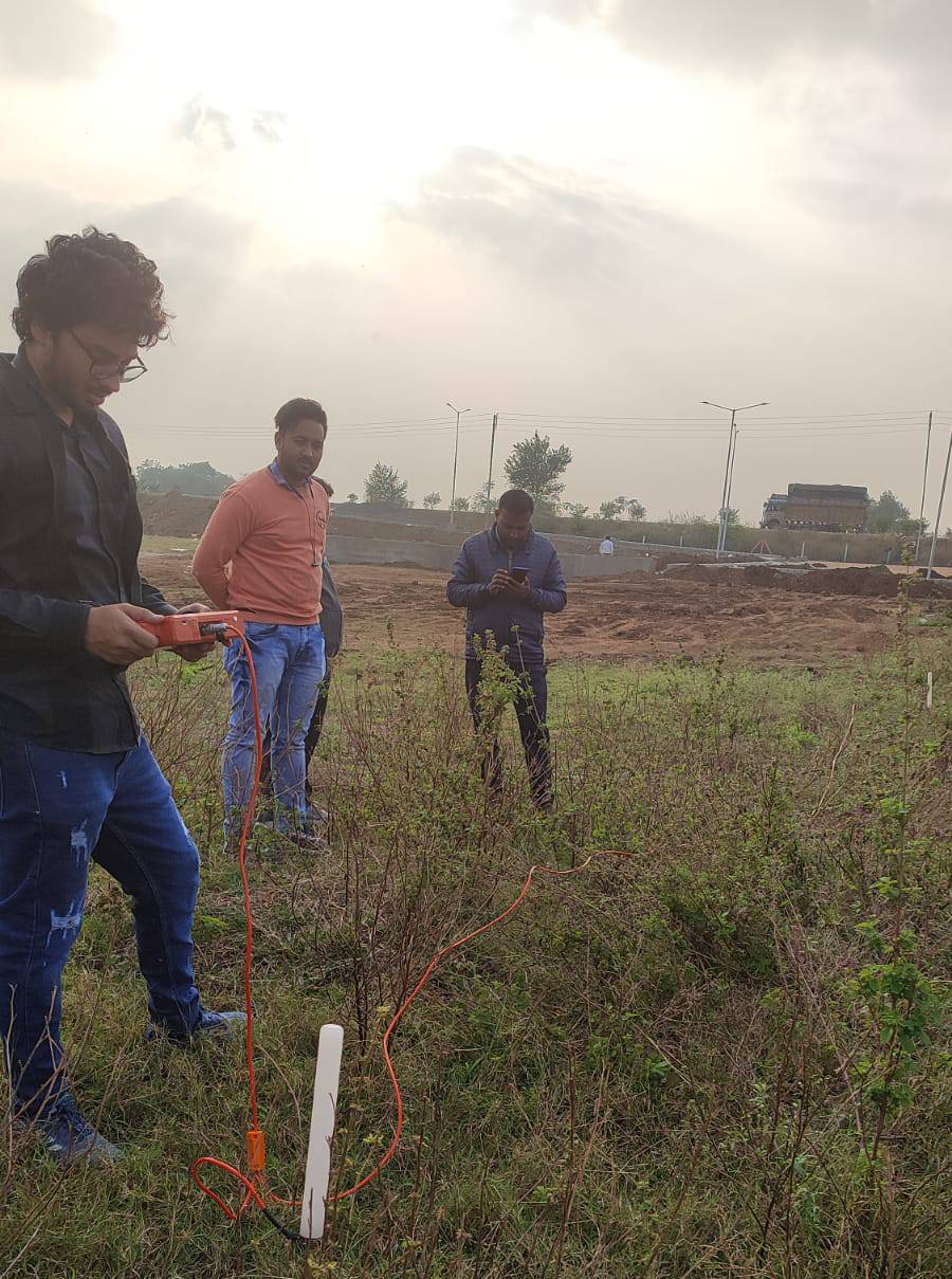
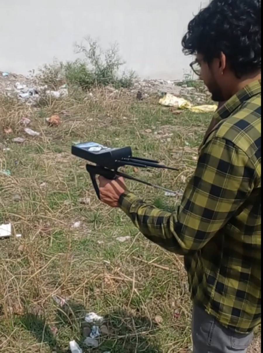
At Bhoojal Survey, our methodology is comprehensive. We begin by analyzing the Lithological Map of the area, which provides crucial information about the rock formations and strata. This preliminary analysis helps us understand the geological context and plan the on-site survey effectively. A dedicated team of hydrogeologists then utilizes the data collected from the field to create a detailed report. This report includes precise recommendations on the depth of the borewell, details about fractured rock zones, and the most suitable type of borewell to be drilled for that specific location. Our services, often referred to as hydrogeological and geophysical surveys, are the first and most critical step towards successful water well construction.
What Does a Groundwater Survey Report Include?
After completing the borewell survey, our team prepares a detailed report. This report is easy to understand and gives you all the information you need before drilling. A typical groundwater survey report includes:
- Site Location Details: GPS coordinates, maps, and photos of the surveyed area.
- Geology of the Area: Description of the soil type, rock formation, and subsurface layers based on the lithological map.
- Recommended Drilling Point: The exact spot where the borewell should be drilled for the best water yield.
- Estimated Depth of Water: How deep the borewell needs to go to reach a reliable aquifer zone.
- Expected Water Yield: An estimate of how much water can be extracted per hour from the borewell.
- Type of Borewell Recommended: Whether to drill a standard borewell or a tubewell based on the geology.
- Water Quality Indicators: Initial assessment of whether the groundwater is suitable for the intended use.
- Resistivity Data and Graphs: Technical data from geophysical instruments like the GER Detect or Schlumberger resistivity meter.
Advanced Groundwater Survey Using Geophysical Instruments
Modern groundwater exploration relies heavily on advanced geophysical instruments. These tools allow us to "see" beneath the ground without excavation, providing a detailed picture of the subsurface. At Bhoojal Survey, we employ a range of instruments, including Resistivity Meters and Magnetic Resonance-based detectors, chosen based on the specific geological conditions of the site. The application of these technologies is crucial in identifying locations for borewells that promise an optimal and sustainable yield.
It's a staggering fact that 99% of the Earth's liquid freshwater is stored underground as groundwater. However, its distribution is far from uniform, varying significantly with climatic conditions and subsurface geology. While the hydrologic cycle naturally recharges groundwater through precipitation, the rate of extraction often outpaces the rate of replenishment. This makes scientific water exploration more critical than ever for sustainable water management.
Key Geophysical Instruments We Use for Groundwater Survey
Our team uses the best available tools for borewell survey and water exploration. Each instrument has a specific role in giving us an accurate underground picture:
- GER Detect Instrument: Uses electrical resistivity to find underground water. It sends a small current into the ground and measures how easily electricity passes through different layers. Water-bearing zones show low resistivity.
- Schlumberger Resistivity Meter: A highly precise instrument used to probe deep underground layers. It is excellent for identifying low-resistivity aquifer zones at varying depths.
- PQWT Instrument (Proton Quantity Water Detector): Uses the principle of Nuclear Magnetic Resonance (NMR) — the same technology used in MRI scans — to directly detect water molecules underground.
- Wenner Array: Another resistivity configuration used for shallow aquifer mapping and near-surface groundwater detection.
- Seismic Refraction Equipment: Sends sound waves into the ground to map rock layers and detect fractures where water may be stored.
Our Track Record of Successful Ground Water Surveys
Bhoojal Survey has established a reputation for excellence, having successfully conducted thousands of survey projects across India with outstanding results. Our commitment to precision and reliability has made us a trusted partner for major industries and corporations, including IOCL, HPCL, John Deere, NMDC, NTPC, Reliance, and HUL. The success of these projects is a testament to the expertise and dedication of the Bhoojal's team.
Industries We Serve with Our Groundwater Survey Services
Our borewell survey and hydrogeological survey services cover a wide range of sectors. We provide groundwater survey solutions for:
- Agriculture: Farmers need a reliable and affordable water source for irrigation. Our groundwater survey helps identify the best drilling spot for farm borewells to ensure crop water supply all year round.
- Residential: Housing societies, villas, and apartments need a private groundwater source. We survey and locate suitable aquifer zones for residential borewells.
- Industrial Plants: Factories and manufacturing plants need large volumes of water. Our geophysical survey helps identify high-yield borewells to meet industrial water demand.
- Hospitals and Schools: Critical institutions need a guaranteed water supply. We help locate reliable groundwater sources that do not fail even in summer.
- Government Projects: We assist government bodies and municipalities in planning borewells for drinking water supply schemes in rural and urban areas.
- Mining and Construction: Our water exploration surveys also help in understanding groundwater conditions important for safe digging and excavation.
Locating Underground Water with GER Detect Instruments
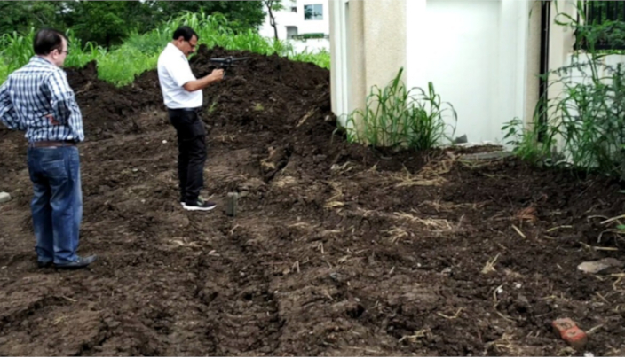
The GER Detect instrument is a powerful tool in our arsenal, utilizing the principles of electrical resistivity to map underground water resources. The process involves placing electrodes into the ground in a specific array. A controlled, small electrical current is then passed between two electrodes, while the potential difference (voltage) is measured between two other electrodes. Since water is a better conductor of electricity than dry rock or soil, areas with higher water content exhibit lower electrical resistivity.
By taking multiple readings across the survey area, our geophysicists can identify anomalies in resistivity that indicate the presence of groundwater. This data is then processed using specialized software to create a 2D or 3D subsurface model. This model clearly visualizes the depth, thickness, and geographical extent of underground water tables or aquifers. This non-invasive method is invaluable for water resource management, precise well site selection, and assessing the long-term sustainability of groundwater sources, making it a cornerstone of modern hydrogeological and environmental studies.
How the GER Detect Groundwater Survey Works — Step by Step
- Step 1 – Site Preparation: Our team visits the site and studies the local geology and nearby water sources before starting the borewell survey.
- Step 2 – Electrode Placement: Electrodes are placed in the ground in a specific pattern — either Schlumberger, Wenner, or Dipole-Dipole array — depending on the depth and type of aquifer expected.
- Step 3 – Current Injection: A small controlled electrical current is passed between two current electrodes. The GER Detect instrument measures the voltage difference between two other potential electrodes.
- Step 4 – Resistivity Measurement: The instrument calculates the apparent resistivity of the underground layers. Low resistivity values indicate water-saturated zones or fractured rock with water.
- Step 5 – Data Processing: The collected data is fed into computer software that generates a 2D or 3D underground map showing the depth and extent of water-bearing zones.
- Step 6 – Report Generation: Our hydrogeologists prepare a clear groundwater survey report with drilling recommendations, expected depth, and yield estimates.
Groundwater Mapping with Schlumberger Resistivity Method
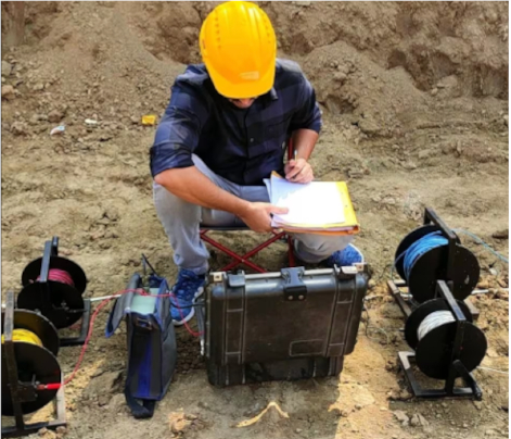
The Schlumberger array is a specific, highly effective configuration used in resistivity surveys. This method is vital for locating low-resistivity zones, which are strong indicators of groundwater presence. In a Schlumberger survey, the spacing of the current electrodes is systematically increased, allowing us to probe deeper into the subsurface formations while keeping the potential electrodes fixed for longer intervals.
This technique provides excellent vertical resolution, helping us distinguish between different geological layers. Low-resistivity zones identified through this method typically correspond to water-saturated porous formations or fractured rock zones filled with water. Such surveys are indispensable for drilling operations, as they enable the precise identification of the most promising locations to access groundwater. By targeting these scientifically verified low-resistivity zones, drillers can significantly increase their success rate, making this method crucial for efficient and sustainable water resource management.
Benefits of Using the Schlumberger Method for Borewell Survey
- Deep Penetration: The Schlumberger configuration can probe deep underground layers, making it ideal for finding deep aquifers in areas where shallow water is scarce.
- High Accuracy: This method provides very precise resistivity readings, helping us confidently identify water-bearing zones before any borewell drilling starts.
- Cost-Effective: Because it identifies the best drilling spot from the surface, it eliminates the need for expensive trial-and-error drilling.
- Detailed Vertical Profile: It creates a detailed depth-wise profile of the underground layers, showing exactly where water is likely to be found.
- Widely Proven: The Schlumberger method has been used successfully in geophysical surveys worldwide for decades and is a trusted standard in groundwater exploration.
Pinpointing Feasible Drilling Locations with PQWT Instruments
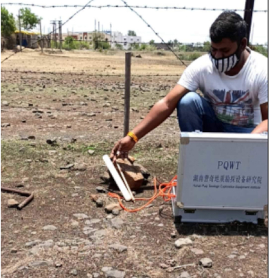
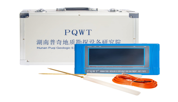
A borewell survey conducted with a PQWT (Proton Quantity Water Detector) instrument represents a leap forward in groundwater detection technology. The PQWT instrument utilizes the principle of Nuclear Magnetic Resonance (NMR), the same technology used in medical MRI scans. It directly detects the presence of water molecules by sending electromagnetic pulses into the ground and analyzing the response from hydrogen nuclei in the water.
This direct detection method helps in assessing not just the location but also the quantity of underground water. The survey results can pinpoint the depth of water-bearing layers and provide an estimate of the potential water volume. By identifying optimal drilling locations based on robust PQWT results, we can maximize water availability, ensure the success and long-term sustainability of borewell projects, and ultimately conserve resources by minimizing drilling costs and avoiding dry wells.
Advantages of PQWT Instrument in Groundwater Survey
- Direct Water Detection: Unlike resistivity methods that infer water presence from electrical properties, PQWT directly detects water molecules. This makes it highly accurate for borewell surveys.
- Quantity Estimation: The PQWT instrument can estimate how much water is present underground, helping plan the expected yield of the borewell.
- Non-Invasive: No need to dig or drill during the groundwater survey. The instrument works entirely from the surface, keeping the environment and property safe.
- Works in Difficult Terrain: PQWT instruments work well even in rocky areas and hard geological formations where other methods may give unclear results.
- Fast Results: The PQWT borewell survey can be completed quickly, giving you accurate groundwater data within hours so drilling can start without delay.
Our Multi-Faceted Survey Approach
To provide the most accurate and reliable results, we integrate several survey techniques:
- 1. Geophysical Surveys: This is the core of our fieldwork. We utilize electrical, magnetic, and seismic methods to map subsurface geology and determine the location, depth, and characteristics of underground water resources. Explore our Geodetic Survey Services for precise results.
- 2. Hydrogeological Surveys: This involves a broader study of the water cycle in the region. We measure water levels in existing wells, assess stream flow rates, and conduct water quality tests through our specialized Hydrogeological Survey to understand water dynamics.
- 3. Remote Sensing and GIS: This modern approach involves using satellite and aerial imagery for assessment. We analyze geological structures and soil moisture using Remote Sensing Surveys to identify high potential areas before ground deployment.
- 4. Groundwater Modeling: For large-scale projects, we use computer simulations to model the behavior of the aquifer. Our Groundwater Modeling helps predict long-term flow and recharge rates for sustainable management.
How to Choose the Right Groundwater Survey Service Provider
Not all groundwater survey companies are the same. Choosing the wrong provider can waste your money and still lead to a dry borewell. Here are the key things to check before hiring a groundwater survey team:
- Experience and Track Record: Look for a company with proven results across many different types of soil and rock formations. Bhoojal Survey has completed thousands of successful groundwater surveys across India.
- Modern Instruments: Ensure the team uses advanced geophysical instruments like GER Detect, PQWT, or Schlumberger resistivity meters — not just guesswork or basic dowsing rods.
- Qualified Hydrogeologists: The team should include certified geologists and hydrogeologists who understand groundwater behavior in your specific region.
- Detailed Written Report: Always ask for a full groundwater survey report with data, maps, and clear drilling recommendations. Avoid companies that give only verbal advice.
- Client References: Ask for references from previous clients, especially from your industry or region. A trusted groundwater survey provider will have many satisfied customers willing to share their experience.
- After-Survey Support: Choose a team that stays available even after the survey — to help you understand the report and guide the drilling contractor during borewell construction.
Common Mistakes to Avoid Before Borewell Drilling
Many people lose money on failed borewells because they skip the groundwater survey or make poor decisions. Here are the most common mistakes and how to avoid them:
- Drilling Without a Survey: This is the biggest mistake. Without a geophysical survey, you are simply guessing where the water is. The chance of hitting a dry borewell is very high.
- Trusting Only Local Knowledge: Local villagers or neighbors may know general water levels, but they cannot tell you the exact aquifer zone, depth, or yield for your specific plot. Always get a scientific borewell survey done.
- Choosing the Cheapest Driller: A low-cost driller may use outdated equipment or skip important steps. Always compare quality, not just price.
- Ignoring Water Quality: Even if a borewell gives good water quantity, the quality may be poor — high fluoride, arsenic, or salinity. A proper hydrogeological survey includes water quality assessment.
- Not Getting the Report in Writing: A verbal recommendation is not enough. Always get the groundwater survey report in written form with data and maps so you can share it with the drilling team.
- Drilling in a Legally Restricted Zone: Some areas are notified by CGWA as over-exploited zones where drilling is restricted. Our team checks all legal requirements before the survey.
Frequently Asked Questions (FAQs): Groundwater Survey
What is an underground water survey?
An underground water survey, also known as a groundwater survey, is a scientific process that uses geophysical techniques, geological assessments, and hydrogeological analysis to locate, map, and assess subterranean water resources. Its purpose is to identify the best location and depth for drilling a borewell to ensure a reliable water supply.
How do you test groundwater quality?
Groundwater quality is tested by collecting water samples from existing wells or during the drilling process. These samples are then sent to a laboratory for chemical and biological analysis to determine properties like pH, hardness, mineral content, and the presence of contaminants like nitrates, arsenic, or bacteria.
What is a geophysical survey for groundwater?
A geophysical survey for groundwater is a non-invasive method of studying the subsurface. It employs techniques like electrical resistivity, seismic wave analysis, and magnetic field measurements to map underground geological formations and identify water-bearing zones (aquifers) without the need for drilling.
What are the primary methods of a water survey?
The primary methods include geophysical surveys (like resistivity and NMR), exploratory drilling (test wells), hydrogeological mapping (studying rock types and water levels), and remote sensing (using satellite imagery to identify potential water zones).
What are the two main types of underground water aquifers?
The two main types are unconfined aquifers, which have a permeable layer above them and are directly recharged by surface water seeping down, and confined aquifers, which are trapped between two layers of impermeable rock or clay and are under pressure.
Is there a single formula for groundwater?
There isn't a single "formula for groundwater." Its study involves various hydrological formulas, the most famous being Darcy's Law, which calculates the flow rate of groundwater through porous material: Q = KIA (where Q is discharge, K is hydraulic conductivity, I is the hydraulic gradient, and A is the cross-sectional area).
At what depth is groundwater typically found?
The depth of groundwater (the water table) varies greatly depending on climate, season, and local geology. It can be found just a few meters below the surface in river valleys or several hundred meters deep in arid regions or areas with complex geological formations.
How do you check the groundwater level?
Groundwater levels are checked by measuring the depth to the water surface in existing wells or borewells. This is done using tools like an electronic water level meter (which beeps upon contact with water) or by observing dedicated monitoring wells called piezometers.
Is a groundwater survey a 100% guarantee of finding water?
While a scientific groundwater survey dramatically increases the probability of success to over 95%, it is not an absolute 100% guarantee. Geology can be complex with unforeseen micro-fractures or clay lenses. However, a survey is the most reliable method to minimize risk and make an informed decision before investing in drilling.
How long does a borewell survey take?
A standard groundwater survey for a single plot or small farm typically takes one to two days. This includes the field survey using geophysical instruments and preparation of the survey report. Larger projects covering multiple locations may take longer depending on the site area and complexity of the geology.
What is the cost of a groundwater survey in India?
The cost of a groundwater survey depends on the size of the area, the type of instruments used, and the location of the project. At Bhoojal Survey, we offer competitive pricing with a free initial consultation. Contact us at +91-9691858058 to get a customized quote for your borewell survey requirement.
Investing in a professional groundwater survey is the most critical first step towards securing a sustainable water future. By leveraging advanced technology and expert analysis, we remove the guesswork from water exploration. For more information about our services or to schedule a consultation, visit our website at Bhoojal Survey & Recharging.


