


Understanding Flood Risk Assessment in Goa
Goa may be famous for its beautiful beaches and vibrant tourism, but the coastal state faces serious flooding challenges every monsoon season. From the busy streets of Panaji to the port town of Vasco da Gama, Flood risk assessment helps identify which areas are most vulnerable to flooding and how we can protect lives, businesses, homes, and tourist infrastructure before the water arrives.
In simple terms, it means studying monsoon rainfall patterns, river behavior, tidal movements, land elevation, drainage systems, and past flood records to predict where flooding might happen. This knowledge helps the government, builders, resort owners, and city planners make smart decisions about construction, drainage design, and emergency planning across Goa's unique coastal landscape.
Why Flood Risk Assessment Matters in Goa
Goa is a small state with a big tourism economy and rapidly growing urban centers. The state has major rivers like Mandovi and Zuari, extensive low-lying coastal areas, and development pressures that increase flood vulnerability. Every monsoon season brings challenges that proper Flood Risk Assessment can help address.
Key Flooding Challenges Goa Faces:
- Heavy monsoon rainfall concentrated in June to September causing widespread waterlogging
- Coastal flooding from high tides pushing seawater inland during monsoon
- River overflow when Mandovi, Zuari, Chapora, and Sal rivers swell with rainwater
- Poor drainage systems in tourist areas and growing urban zones
- Construction near rivers and wetlands reducing natural water absorption areas
- Low-lying geography making many coastal villages vulnerable to flooding
- Estuary regions facing combined river and tidal flooding during peak monsoon
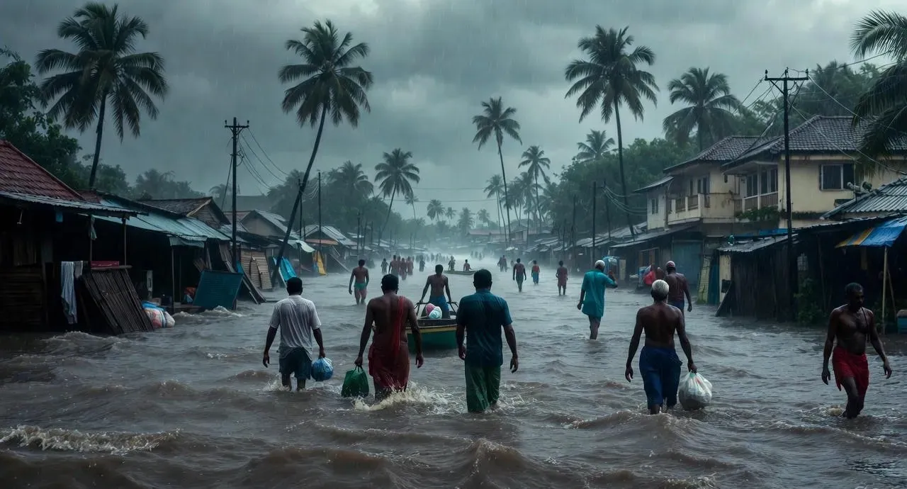
The impact extends beyond inconvenience. Flooding disrupts Goa's tourism industry, damages roads and bridges, affects local businesses, threatens heritage sites, and displaces families from low-lying neighborhoods. Without proper Flood Risk Assessment, these problems will worsen as climate patterns become more unpredictable.
Major Flood-Prone Areas in Goa
Different regions of Goa face different types of flooding. Understanding these patterns is essential for effective Flood Risk Assessment and planning.
Panaji and Urban Centers
Panaji, Goa's capital city, experiences urban flooding in Panaji during heavy monsoon rains. Low-lying areas near the Mandovi river face waterlogging when intense rainfall coincides with high tide. Streets get submerged, traffic stops, and businesses close temporarily. The Santa Inez area and parts of Campal often see knee-deep water during peak monsoon.
Mapusa and Margao also face similar urban flooding challenges. Rapid construction, inadequate drainage capacity, and reduced open spaces create conditions where even moderate rainfall causes significant waterlogging.
Mandovi River Basin
The Mandovi river is Goa's lifeline but also a source of monsoon flooding. Areas along its banks—including Panaji, Old Goa, and several villages upstream—face flood risks when heavy rainfall swells the river. The combination of upstream flow and tidal backflow from the Arabian Sea can trap water in low-lying riverside communities.
Tourist destinations near the Mandovi, including popular river cruise spots and waterfront restaurants, must account for seasonal flood patterns in their operations and infrastructure design.
Zuari River Region
The Zuari river flows through southern Goa, affecting Vasco da Gama, Cortalim, and surrounding areas. Vasco faces waterlogging during intense monsoon rainfall, with several neighborhoods experiencing repeated flooding. The railway station area and industrial zones near the port are particularly vulnerable.
Villages along the Zuari's course face agricultural flooding when the river overflows. Rice fields and coconut plantations can be submerged for days, affecting local farming communities and food production.
Chapora and Sal River Areas
North Goa's Chapora river and the Sal river in southern Goa create flood challenges for surrounding villages and agricultural land. When monsoon rains are heavy, these rivers overflow rapidly, affecting paddy fields and rural roads. Small bridges and causeways get submerged, cutting off village access temporarily.
Coastal Villages and Low-Lying Areas
Goa's extensive coastline includes many low-lying villages vulnerable to coastal flooding. During monsoon, high tides combined with heavy rainfall push seawater inland through estuaries and tidal creeks. Villages in Pernem taluka, parts of Bardez, and southern coastal areas face this dual challenge of river and sea water convergence.
Beach areas popular with tourists can experience erosion and temporary flooding during monsoon storms. While beaches typically recover quickly, infrastructure near the shoreline—including shacks, restaurants, and access roads—faces seasonal flood risks.
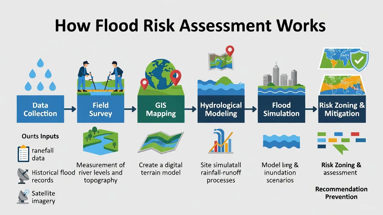
How Flood Risk Assessment Works
Flood Risk Assessment in Goa follows a scientific process that combines local knowledge with modern technology:
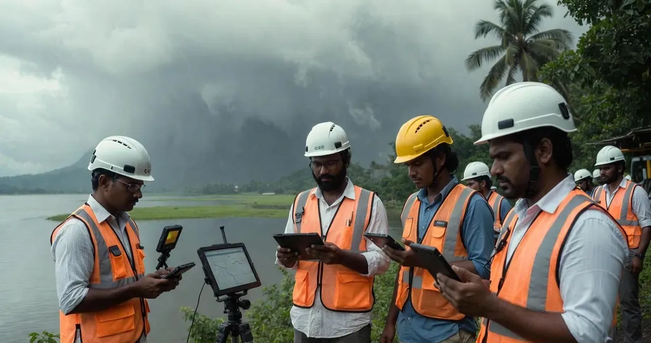
Step 1: Data Collection
Experts gather detailed information including monsoon rainfall patterns, river water level records, tidal data from the Arabian Sea, land elevation maps, soil absorption capacity, existing drainage network details, and historical flood extent from past monsoon seasons. Satellite imagery and ground surveys help create accurate digital terrain models.
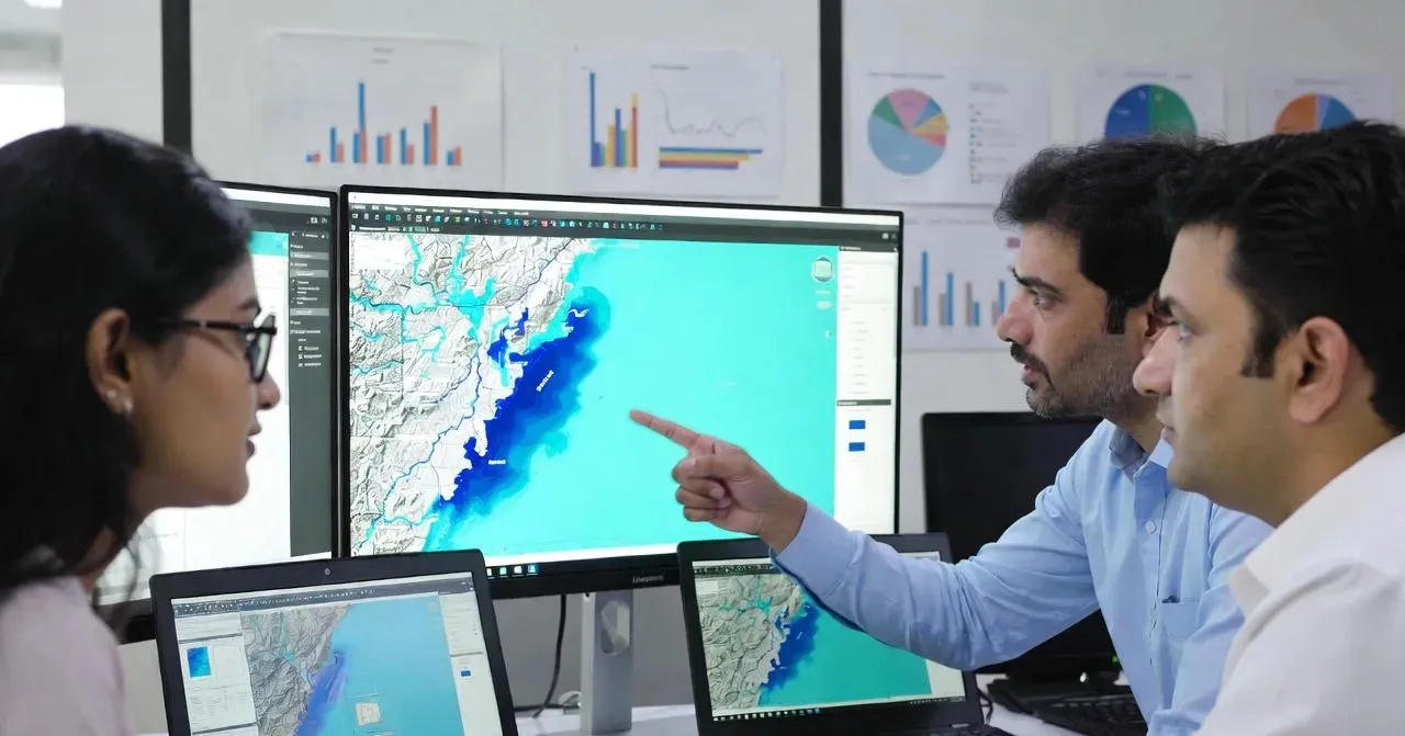
Step 2: Flood Mapping and Analysis
Using GIS software, specialists create detailed maps showing how water flows across Goa's landscape. They identify low-lying areas where water naturally collects, river overflow zones, tidal influence areas, and drainage bottlenecks. The analysis reveals which areas face highest flood risks and why.
Step 3: Risk Zone Identification
Based on comprehensive analysis, areas are classified into flood risk zones in Goa:
- High Risk Zones – Areas that flood frequently during normal monsoons
- Medium Risk Zones – Areas that flood occasionally during heavy rainfall
- Low Risk Zones – Areas with minimal flood risk under most conditions
These classifications guide all development decisions, building codes, and emergency planning efforts.
Step 4: Recommendations and Planning
Flood experts prepare detailed reports with practical recommendations. These include drainage improvements needed, safe construction practices, elevation requirements for new buildings, emergency evacuation routes, and flood warning systems. The goal is turning flood risk data into actionable flood safety planning that protects communities and infrastructure.

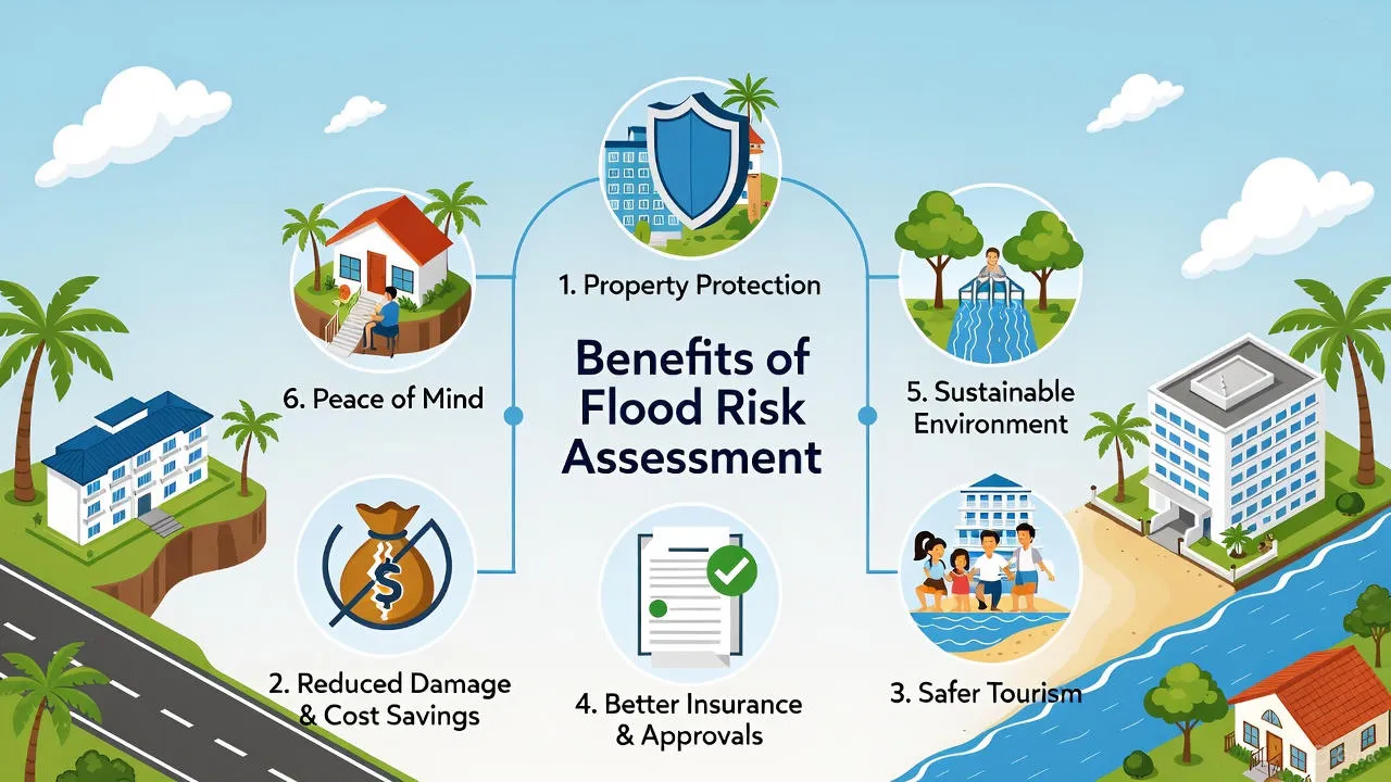
Benefits of Flood Risk Assessment in Goa
Proper Flood Risk Assessment brings multiple practical benefits to Goa's tourism industry, urban development, and local communities:
For Tourism Industry:
- Resorts and hotels designed above flood levels protecting investments
- Better planning for seasonal operations during monsoon
- Reduced business disruptions and guest inconvenience
- Protection of waterfront restaurants and beach facilities
- Insurance benefits for flood-protected properties
For Urban Development:
- Smart city planning avoiding high-risk flood zones
- Improved drainage systems handling monsoon peak flows
- Protected roads and bridges remaining functional during floods
- Critical infrastructure (hospitals, power stations) safe from flooding
- Reduced waterlogging in residential neighborhoods
For Infrastructure Projects:
- Highways and bridges built above predicted flood levels
- Railway tracks protected from seasonal submersion
- Airport facilities safe from waterlogging
- Port operations continuing despite heavy monsoon
- Proper culvert sizing preventing road washouts
For Local Communities:
- Early flood warning systems protecting lives
- Safer housing in flood-prone villages
- Better agricultural planning around flood cycles
- Government assistance targeted to genuine high-risk areas
- Reduced losses during monsoon season
Understanding Flood Risk in Neighboring Karnataka
While Goa faces coastal and riverine flooding, neighboring Karnataka deals with different flood challenges from the Western Ghats. Heavy rainfall in the mountain ranges causes rivers like Krishna, Cauvery, and Tungabhadra to flood downstream areas. Cities like Bangalore face urban waterlogging, while districts bordering Goa experience similar monsoon patterns. Flood Risk Assessment in Karnataka addresses these Western Ghats rainfall impacts and dam release flooding that affects multiple river basins across the state.
Moving Forward with Flood Safety
Goa's unique position as a coastal state with major rivers, extensive tourism infrastructure, and growing urban centers makes Flood Risk Assessment essential for sustainable development. Climate change brings more unpredictable weather—intense monsoon bursts, changing tidal patterns, and sea level rise all add complexity to flood management.
Every new development in Goa should include professional Flood Risk Assessment from the planning stage. Whether building a resort, residential complex, commercial center, or infrastructure project, understanding flood risks protects investments and ensures long-term viability.
The state needs continuous updates to flood mapping in Goa as development changes natural drainage patterns. Coastal areas require enhanced protection considering sea level projections. River basins need better coordination between development and environmental conservation. Tourist zones must balance commercial growth with flood resilience.
With proper Flood Risk Assessment and coordinated action, Goa can continue thriving as a tourist destination while protecting communities from monsoon flooding. Smart planning today prevents disasters tomorrow, ensuring Goa remains beautiful, safe, and prosperous for future generations.
Bhoojal Survey's Work in Goa
Bhoojal Survey plays a vital role in flood risk assessment across Goa by combining groundwater science, coastal hydrology expertise, and advanced GIS-based flood modeling tools. Working on projects from Panaji to Vasco, from Mandovi riverbanks to coastal villages, we support informed decision-making for resort development, urban planning, infrastructure projects, and community safety initiatives.
Through scientifically developed flood models and detailed coastal flooding analysis, our team helps reduce Goa monsoon flooding risks, improve drainage systems, and promote climate-resilient development practices specific to Goa's unique geography. We understand the challenges of tidal influences, estuary flooding, and the interaction between river flow and sea level that makes Goa's flood dynamics complex.
Our expertise contributes not only to immediate flood safety planning but also to long-term sustainable development, groundwater conservation, and water security initiatives across Goa. By integrating flood risk management with broader environmental goals, we help ensure that development projects succeed while protecting Goa's natural beauty and community wellbeing for generations to come.