Flood Modeling
For any industrial, infrastructure project prior setting up the plant it is important to analyze flood risk through simulation software to overcome risk of damage to structure and workers at the time of run off due to peak rainfall and floods .
A flood model can provide inputs on how to mitigate risk in case of floods and how to overcome losses by providing effective solutions to drain out flood water from premises during the incident of heavy rains.
A Flood model is used to test the impact of flood alleviation options upon local communities affected by flooding and also explore the impacts upon the wider catchment
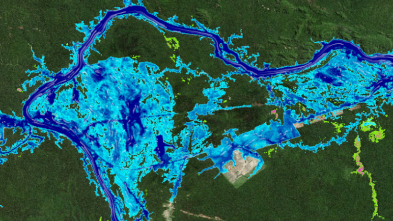
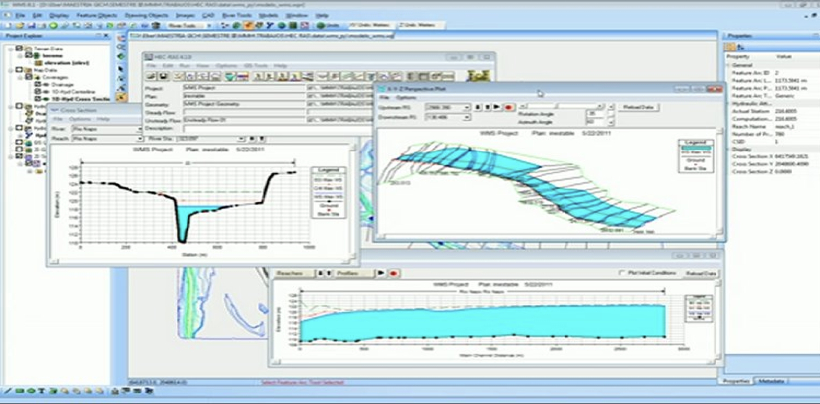
FLOOD MODELLING USING HEC RAS – SIMULATION SHOWING WATER AFFECTED ZONES IN CASE OF PEAK RAINFALL AND FLOODS
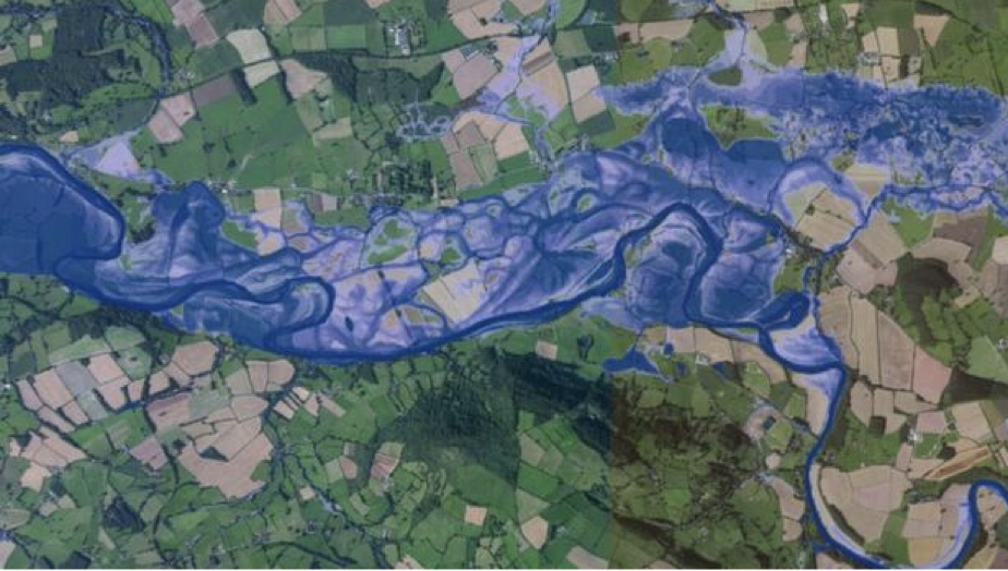
At bhoojal Survey we use digital terrain models through latest software’s and technology , including metrological data to examine peak rainfall , geological study for runoff calculation , High resolution counter maps data maps to access how water flows across given area and feed above details to provide an accurate flood model for a given area to overcome flood hazards.
Our key service areas include:
- 1. Dam failure impact assessment
- 2. Flood impact assessment and development feasibility
- 3. Catchment management studies
- 4. Floodplain risk management studies – damage and safety analysis
- 5. Flood mitigation option investigations
- 6. Flood warning systems
- 7. Historical flood analysis and stream gauging
- 8. Sizing major hydraulic structures such as bridges and culverts
- 9. Hydrographic survey
- 10. Urban and rural catchment flood investigations
- 11. 3D flood rendering and animation
Flood modeling approaches include
Hydrologic modeling: Uses computer tools to analyze water flow in a river or stream system
Hydraulic modeling: Uses the results of hydrologic analysis to simulate water movement during a floo
Flood modeling has evolved into a crucial instrument in the management of flood risk, assisting academics and professionals in comprehending and predicting the behavior of floods, as well as making defensible choices to lessen their effects.
FAQs: Flood Modeling
What is flood modeling?
Flood modeling is the process of using computer simulations to predict the extent and impact of flooding in a given area. These models can forecast flood depths, velocities, and extents based on various input data such as rainfall, topography, and land use.
Why is flood modeling important?
Flood modeling is crucial for disaster preparedness and mitigation. It helps communities understand their flood risk, plan evacuation routes, design flood defenses, and manage land use to reduce flood impacts.
What data is required for flood modeling?
Flood modeling requires various data inputs, such as: Topographic data, Hydrological data, Land use and land cover data, Soil type and infiltration rates, Meteorological data
How accurate are flood models?
The accuracy of flood models depends on the quality of the input data and the complexity of the model. High-resolution data and detailed models can provide more accurate predictions. However, all models have some level of uncertainty.
Can flood models predict flash floods?
Yes, some flood models are designed to predict flash floods, which are sudden and intense floods caused by heavy rainfall. These models require high-resolution temporal and spatial rainfall data and fast processing to provide timely warnings.
How long does it take to complete a flood modeling project?
The duration of a flood modeling project depends on the scope and complexity of the study. Simple assessments may take a few weeks, while comprehensive studies for large areas can take several months.
What is the cost of flood modeling services?
The cost varies widely based on the project's scale, data requirements, and complexity. It's best to request a quote from the service provider to get an accurate estimate.
Can flood modeling help with climate change adaptation?
Absolutely. Flood modeling is a critical tool for understanding and adapting to the impacts of climate change. It helps identify areas at increased risk due to sea level rise, increased rainfall intensity, and other climate-related factors.
Do flood models consider the impact of infrastructure like dams and levees?
Yes, advanced flood models can incorporate the effects of infrastructure such as dams, levees, and drainage systems. These models can simulate how such structures influence flood behavior and risk.


