


Flood Risk in Uttarakhand – Understanding the Challenge
Uttarakhand's stunning Himalayan landscape brings unique flood challenges that demand careful assessment and planning. Flood risk assessment in this mountainous state goes beyond typical river flooding—it must account for cloudbursts, glacial lake outbursts, landslide-induced dam bursts, and flash floods that can devastate infrastructure within minutes. For highway projects, hydropower developments, tunnels, and urban settlements in valley floors, understanding flood dynamics is not optional—it's essential for safety and project viability.
- Steep Himalayan slopes accelerate water flow during heavy rainfall
- Glacier-fed rivers like Alaknanda and Bhagirathi experience sudden discharge variations
- Cloudburst events drop extreme rainfall in concentrated areas without warning
- Landslides frequently block rivers, creating temporary dams that burst catastrophically
- Infrastructure projects in narrow valleys face amplified flood risk compared to plains
- The 2013 Kedarnath disaster demonstrated how quickly conditions can turn deadly
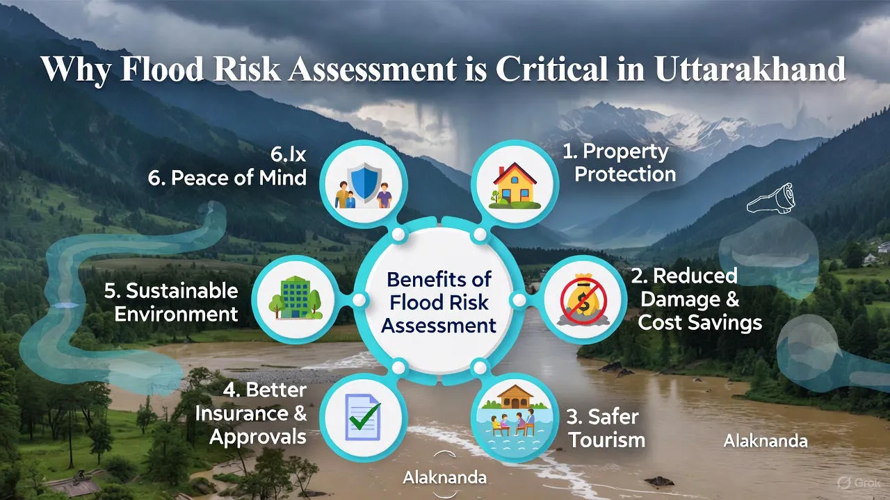
Why Flood Risk Assessment is Critical in Uttarakhand
Every infrastructure project in Uttarakhand operates within a complex flood environment where multiple hazards can combine. Professional flood risk study in Uttarakhand protects human lives, prevents costly infrastructure damage, ensures regulatory compliance, and supports sustainable mountain development.
Risks to Human Life
- Pilgrims and tourists traveling on mountain roads during monsoon season
- Workers at construction sites near rivers and in valley bottoms
- Residents of riverside settlements in districts like Chamoli, Rudraprayag, Uttarkashi
- Emergency responders who must operate during flood events
- Communities downstream of potential landslide dam failures
Damage to Infrastructure
- Highway bridges washed away during flash floods cutting critical connectivity
- Hydropower intake structures damaged by debris-laden flood flows
- Tunnel portals submerged or buried under landslide debris
- Power transmission lines destroyed when tower foundations erode
- Water supply schemes disrupted affecting towns and villages
Regulatory and Clearance Requirements
- Environmental Impact Assessments now mandate detailed flood hazard analysis
- National and state disaster management authorities require flood vulnerability studies
- Ministry of Road Transport and Highways specifies flood design standards for mountain roads
- Central Electricity Authority mandates comprehensive hydrological studies for hydropower
- Forest clearances require demonstration of flood risk mitigation measures
Cost of Ignoring Flood Studies
- Reconstruction costs often exceed 300-500% of original construction budget
- Project delays extending 2-5 years affecting financial viability
- Legal liabilities and compensation claims following preventable disasters
- Loss of investor confidence and difficulty securing future project funding
- Damage to organizational reputation that persists for years
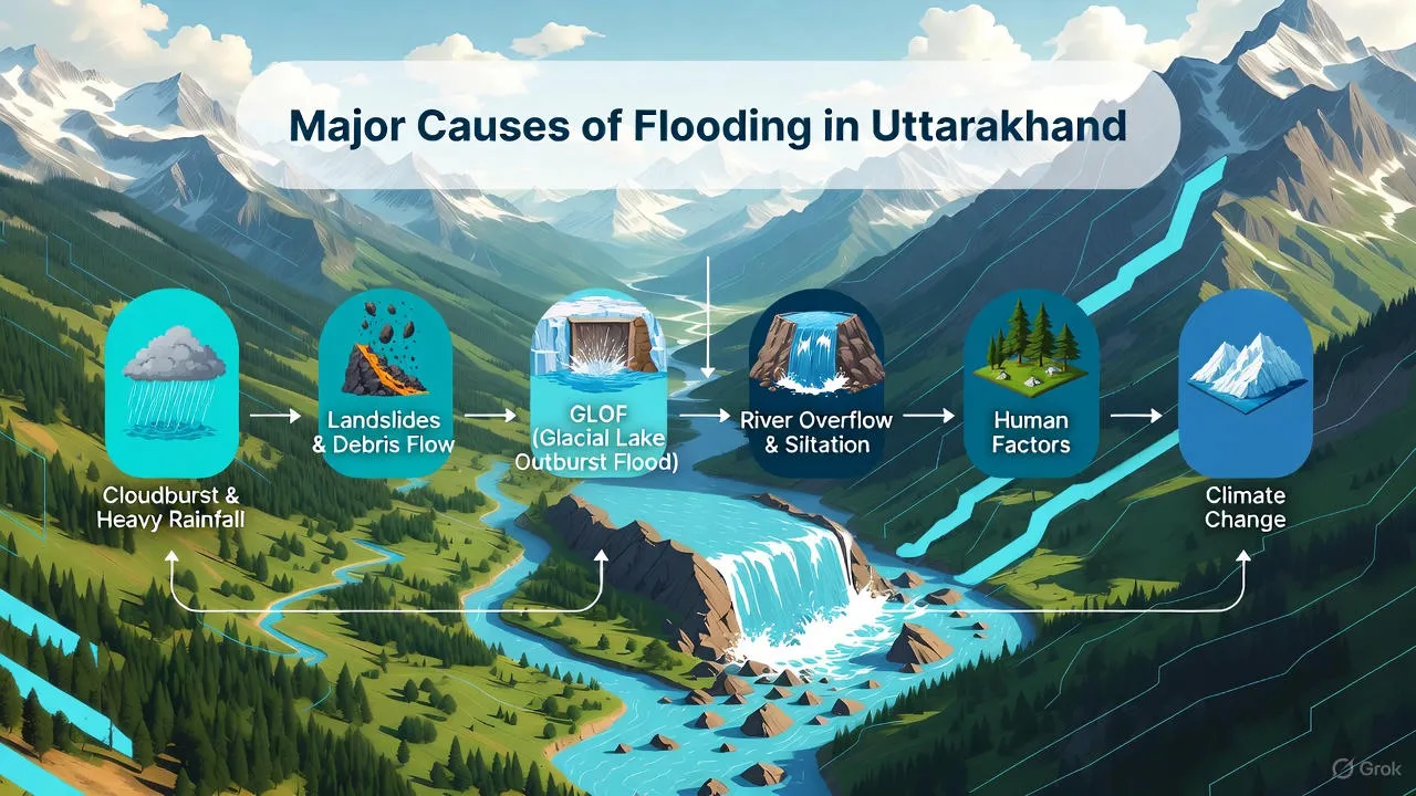
Major Causes of Flooding in Uttarakhand
Understanding what triggers floods in Uttarakhand's complex terrain helps in designing effective mitigation strategies. The state faces multiple flood mechanisms, often acting in combination.
Cloudbursts
- Extremely localized rainfall events dropping 100+ mm in less than an hour
- Occur most frequently during July-August monsoon peak
- Trigger devastating flash floods in small catchments within 15-30 minutes
- Recent cloudburst events in Kedarnath (2013) and Chamoli (2021) caused massive destruction
- Impossible to predict with current technology—risk assessment focuses on vulnerability reduction
Glacial Melt and GLOF (Glacial Lake Outburst Floods)
- Climate change accelerating glacier retreat creating unstable glacial lakes
- Lake breaches release millions of cubic meters of water within hours
- Downstream valleys experience sudden flood waves with no rainfall
- Alaknanda and Bhagirathi basins contain numerous high-risk glacial lakes
- GLOF events can travel 50-100 km downstream devastating everything in path
River Overflow During Monsoon
- Sustained heavy rainfall throughout catchment raises river levels for days
- Rivers like Kosi, Mandakini, and Ramganga overflow natural banks
- Valley floor settlements and infrastructure face prolonged inundation
- Combines with high sediment loads making water more destructive
- Agricultural lands and tourism facilities in valley bottoms most affected
Landslides Blocking Rivers
- Heavy rainfall or seismic activity triggers massive slope failures
- Landslide debris dams rivers creating temporary lakes upstream
- Lakes fill rapidly—within hours to days depending on river discharge
- Dam failure releases accumulated water as catastrophic flood wave
- The 2021 Rishiganga disaster originated from a landslide-dammed lake failure
Sudden Dam Water Release
- Multiple hydropower projects operate in Uttarakhand's river basins
- Emergency spillway releases during extreme inflow events
- Coordinated releases from multiple upstream projects amplify downstream discharge
- Insufficient warning time for downstream communities and projects
- Affects construction activities and temporary works near river channels
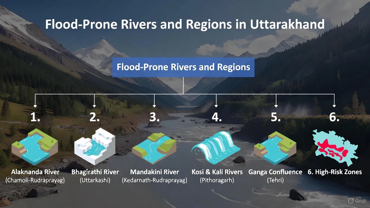
Flood-Prone Rivers and Zones in Uttarakhand
Different river basins in Uttarakhand present distinct flood characteristics requiring tailored assessment approaches. Knowing which zones face highest risk helps in project planning and site selection.
Alaknanda and Bhagirathi River Basins
- Form the headwaters of the Ganges—most sacred and most hazardous
- Districts: Chamoli, Rudraprayag, Uttarkashi, Tehri Garhwal
- High concentration of hydropower projects increasing vulnerability
- Pilgrimage routes to Kedarnath, Badrinath, Gangotri, Yamunotri cross multiple risk zones
- Steep valley sides with active landslide zones adjacent to rivers
- GLOF risk from upstream glacial lakes requires continuous monitoring
Mandakini River Valley
- Joins Alaknanda at Rudraprayag—witnessed 2013 Kedarnath disaster
- Extremely narrow valley with limited space for infrastructure
- Flash flood travel times measured in minutes not hours
- High pilgrim traffic during Char Dham yatra season (May-October)
- Reconstruction projects ongoing—must incorporate flood risk assessment
Kosi River (Kumaon Region)
- Flows through Almora district—relatively gentler terrain than Garhwal
- Supports significant agricultural activity in valley bottoms
- Urban centers like Ramnagar face flooding during extreme monsoon events
- Confluence with Ramganga creates flood risk amplification zone
- Tourism infrastructure near Jim Corbett National Park requires flood assessment
Pithoragarh District
- Located in far eastern Uttarakhand bordering Nepal and Tibet
- Kali River and tributaries prone to cross-border flood impacts
- Limited road connectivity makes flood damage particularly disruptive
- High-altitude settlements face combined flood and landslide hazards
- Strategic border infrastructure requires comprehensive risk assessment
Nainital District
- Contains multiple lakes—unique flood dynamics compared to river valleys
- Urban flooding in Nainital town due to inadequate drainage during heavy rainfall
- Tourism-dependent economy makes flood resilience economically critical
- Flat valley sections near Haldwani face river overflow flooding
- Rapid unplanned urbanization increasing flood vulnerability
Haridwar District
- Where Ganges enters the plains—receives cumulative discharge from entire Uttarakhand
- Extensive agricultural areas and industrial zones in flood-prone areas
- Major hydropower and irrigation canals complicate flood management
- Urban areas of Haridwar and Rishikesh face flooding during extreme events
- Coordinated basin-wide flood management essential for risk reduction
What is Flood Risk Assessment? (Service Explanation)
Flood risk assessment is a systematic technical service that combines hydrology, hydraulics, geomorphology, and GIS technology to understand and quantify flood hazards at a project site. For Uttarakhand's challenging terrain, this goes well beyond standard flood studies.
Hazard Identification
- Cataloging all potential flood sources—river overflow, cloudbursts, GLOF, landslide dams
- Reviewing historical flood records and disaster reports
- Identifying upstream hazards that could impact the project site
- Assessing proximity to known landslide zones and unstable slopes
- Evaluating influence of existing and planned upstream hydropower projects
Flood Depth and Extent Analysis
- Calculating maximum expected flood levels for different return periods (25-year, 50-year, 100-year)
- Determining probable maximum flood (PMF) for critical infrastructure
- Mapping spatial extent of inundation at various flood scenarios
- Estimating flow velocities and stream power during peak discharge
- Accounting for debris and sediment loads that increase destructive force
Impact on Infrastructure
- Assessing whether project components fall within identified flood zones
- Evaluating foundation stability during flood-induced erosion
- Determining structural loading from water pressure and debris impact
- Analyzing access road vulnerability and potential isolation during floods
- Identifying critical equipment and facilities requiring flood protection
Risk Zoning for Projects
- Creating detailed flood hazard maps showing low, medium, and high-risk zones
- Establishing no-construction zones within extreme flood risk areas
- Defining minimum elevation requirements for habitable structures
- Recommending setback distances from river channels and unstable slopes
- Providing technical basis for land-use planning decisions
How Flood Risk Assessment is Done (Step-by-Step)
Professional flood impact assessment in Uttarakhand follows a rigorous methodology combining field investigation, advanced modeling, and expert interpretation. Each step builds on the previous to create a comprehensive understanding of flood hazards.
Step 1: Data Collection
- Gathering rainfall data from IMD stations and automatic weather stations in the region
- Obtaining river discharge records from Central Water Commission gauging stations
- Collecting historical flood information from local communities and disaster management authorities
- Accessing satellite imagery showing past flood extents and land use changes
- Reviewing geological and geotechnical data for landslide risk assessment
- Compiling information on existing and planned water resources projects upstream
Step 2: Topography and DEM Analysis
- Creating high-resolution Digital Elevation Models from survey data and LiDAR where available
- Mapping river channel geometry including cross-sections at critical locations
- Identifying drainage divides, flow paths, and natural ponding areas
- Analyzing slope gradients and terrain ruggedness affecting runoff generation
- Determining catchment boundaries and calculating catchment characteristics
Step 3: Rainfall and Discharge Analysis
- Performing frequency analysis to estimate design rainfall for various return periods
- Developing Intensity-Duration-Frequency curves for cloudburst scenarios
- Calculating peak discharge using rational method, SCS curve number, or unit hydrograph
- Estimating probable maximum precipitation and probable maximum flood
- Accounting for snowmelt contribution in glacier-fed catchments
- Evaluating upstream reservoir operations and potential dam break scenarios
Step 4: Flood Modeling and Mapping
- Setting up 1D/2D hydraulic models (HEC-RAS, MIKE FLOOD, or similar) for river reaches
- Calibrating models using observed high-water marks from past flood events
- Running simulations for multiple scenarios—normal monsoon, extreme events, dam breaks
- Generating flood inundation maps showing depth, velocity, and extent
- Creating flood animation videos to visualize flood wave propagation
- Producing flood hazard maps combining depth and velocity criteria
Step 5: Risk Interpretation
- Translating technical modeling results into actionable project recommendations
- Identifying specific project components at risk and quantifying exposure
- Developing mitigation strategies—structural and non-structural measures
- Preparing risk matrices showing likelihood and consequence of different flood scenarios
- Providing early warning protocols and emergency response guidelines
- Documenting findings in comprehensive reports meeting regulatory requirements

Applications of Flood Risk Assessment in Uttarakhand
Professional flood vulnerability mapping serves diverse sectors across Uttarakhand, each with unique requirements and risk profiles.
Highway and Tunnel Projects
- Determining safe alignment for new highway corridors avoiding maximum flood zones
- Designing bridge spans and pier locations to pass design floods safely
- Sizing culverts and cross-drainage structures for adequate discharge capacity
- Protecting tunnel portals from flooding and debris accumulation
- Planning construction activity windows to avoid monsoon flood risk
- Establishing maintenance protocols for flood-damaged sections
Hydropower Projects
- Locating intake structures above maximum expected flood levels
- Designing coffer dams and diversion works for safe construction
- Sizing spillways to pass probable maximum flood without overtopping
- Protecting powerhouse and switch yard from flooding
- Assessing upstream GLOF risk to project facilities
- Developing emergency action plans for dam safety
Urban Development
- Identifying suitable areas for residential and commercial development
- Designing urban drainage systems to handle cloudburst events
- Establishing building codes specifying minimum plinth levels
- Creating flood evacuation routes and shelter locations
- Protecting critical infrastructure—hospitals, schools, emergency services
- Implementing nature-based solutions like retention ponds and green corridors
Tourism Infrastructure
- Siting hotels and resorts away from high-risk flood zones
- Designing adventure tourism facilities accounting for river level variations
- Creating tourist safety protocols for monsoon season
- Protecting pilgrimage route infrastructure along Alaknanda and Bhagirathi
- Planning seasonal operation schedules based on flood risk windows
Government Planning
- Supporting district disaster management plans with technical flood data
- Prioritizing flood mitigation investments in highest-risk zones
- Guiding land-use regulations and development control rules
- Planning flood early warning system deployment
- Coordinating basin-level flood management across state boundaries
Benefits for Projects and Authorities (Transactional Angle)
Investing in professional flood hazard analysis delivers measurable returns throughout project lifecycle—from planning through operation. These benefits justify the assessment cost many times over.
Reduced Project Risk
- Avoiding construction in areas where flood damage is inevitable
- Designing structures to withstand expected flood forces
- Minimizing unplanned repairs and reconstruction costs
- Protecting workforce safety during construction and operation
- Maintaining project schedules by avoiding flood-related delays
Faster Approvals
- Meeting environmental clearance requirements comprehensively
- Satisfying disaster management authority concerns with technical data
- Reducing back-and-forth with regulatory agencies seeking clarifications
- Demonstrating due diligence to financial institutions and investors
- Building stakeholder confidence through transparent risk disclosure
Better Design Decisions
- Optimizing layouts to balance flood risk and functional requirements
- Right-sizing flood protection measures—neither over-designed nor inadequate
- Selecting materials and construction methods suited to flood environment
- Planning phased development to test and refine flood management approaches
- Incorporating adaptive design features for future climate scenarios
Long-term Safety and Compliance
- Creating permanent record of flood basis for future reference
- Establishing maintenance standards for flood protection measures
- Documenting compliance with applicable codes and standards
- Supporting insurance coverage and favorable premium rates
- Protecting against liability claims arising from flood-related incidents
Why Professional Flood Risk Assessment Matters
Not all flood studies are equal. Uttarakhand's unique challenges demand experienced professionals using proven methodologies and appropriate tools. Cutting corners on flood assessment invites disaster.
Accuracy of Models
- Himalayan hydrology requires specialized modeling approaches
- Generic plain-river methods fail to capture steep-slope dynamics
- Proper calibration needs local knowledge and historical data
- Experienced analysts recognize when model results are unrealistic
- Peer review by independent experts validates critical assumptions
Regulatory Acceptance
- Authorities reject studies lacking required analysis components
- Reports must follow prescribed formats and standards
- Professional qualifications of study team matter for approval
- Established consultants have credibility built through past work
- Documentation quality directly impacts approval timeline
Expert Interpretation
- Raw model output requires engineering judgment for practical application
- Experienced professionals identify model limitations and uncertainties
- Context matters—book knowledge insufficient without field experience
- Mitigation recommendations must be technically sound and economically feasible
- Clear communication helps non-technical stakeholders understand risks
Decision-Ready Reports
- Well-structured reports facilitate informed decision-making
- Visual presentation through maps and graphics aids understanding
- Executive summaries distill complex analysis into key points
- Recommendations prioritized by risk level and implementation feasibility
- Supporting calculations and data provided for verification
Planning Safe Development in Uttarakhand
Uttarakhand's development trajectory demands balance between economic growth and environmental sustainability. Flood risk assessment provides the technical foundation for this balance—enabling progress while respecting natural hazards that cannot be eliminated.
- Early-stage flood studies prevent costly design revisions later in project development
- Transparent risk assessment builds public trust in development projects
- Learning from past disasters improves future flood preparedness
- Climate adaptation requires ongoing reassessment as conditions change
- Sustainable mountain development protects both people and ecosystems
- Professional expertise transforms flood vulnerability into manageable risk
Every infrastructure project in Uttarakhand—whether national highway connecting remote valleys, hydropower harnessing glacier-fed rivers, or urban expansion accommodating growing populations—must account for flood hazards from the very beginning. The investment in comprehensive flood risk assessment pays dividends in avoided disasters, faster approvals, better designs, and long-term safety.
Bhoojal Survey's Work in Uttarakhand
Bhoojal Survey brings extensive experience in flood risk assessment across Uttarakhand's diverse terrain—from high-altitude glacial catchments to valley-floor settlements. Our multidisciplinary team combines hydrogeologists, civil engineers, GIS specialists, and disaster management experts who understand the unique challenges of Himalayan flood assessment.
We have supported highway projects navigating narrow valleys, hydropower developments managing extreme flood scenarios, and urban planning initiatives in districts like Chamoli, Rudraprayag, Uttarkashi, Pithoragarh, Nainital, and Haridwar. Our work integrates advanced hydraulic modeling with practical field experience to deliver actionable flood risk solutions.
Whether you're planning infrastructure in the Alaknanda-Bhagirathi basin, managing development along the Mandakini valley, or expanding urban areas in the Kosi region, Bhoojal Survey provides the technical expertise and regulatory knowledge to navigate Uttarakhand's complex flood environment successfully.