


Understanding Flood Risk Assessment in Karnataka
Karnataka faces unique flooding challenges every monsoon—from the heavy rains along the coastal belt to the Western Ghats downpours, river basin floods, and even urban flooding in tech-savvy Bengaluru. Flood risk assessment helps us understand which areas are most vulnerable and how we can protect lives, homes, businesses, and farmland before floodwaters arrive.
In simple words, it means studying rainfall patterns, river behavior, land slopes, drainage systems, and past flood records to predict where flooding might happen. This knowledge helps the government, builders, farmers, and city planners make smart decisions about where to build, how to design drainage, and how to prepare for emergencies.
Why Karnataka Needs Flood Risk Assessment
Karnataka is a diverse state with coastal areas, hill ranges, river basins, and rapidly growing cities. Each region faces different types of flooding. The coastal belt receives extremely heavy monsoon rain. The Western Ghats and Malnad region see intense rainfall that triggers flash floods. Major rivers like Krishna, Tungabhadra, and Cauvery overflow during peak monsoon or when upstream dams release water.
Bengaluru, once known for its pleasant weather and lakes, now faces regular urban flooding because of rapid construction, encroachment on lake beds, and blocked drainage systems. Without proper Flood Risk Assessment, these recurring problems will continue causing damage to property, disrupting daily life, and threatening public safety.
Key Challenges Karnataka Faces:
- Extremely heavy rainfall in coastal Karnataka during monsoon months
- Western Ghats receiving intense rainfall that flows down quickly
- River flooding when dams release water from Krishna, Tungabhadra systems
- Rapid urban growth in Bengaluru reducing natural drainage areas
- Encroachment on lakes and water channels blocking natural flow
- Old drainage systems unable to handle today's rainfall intensities
Major Flood-Prone Areas in Karnataka
Different parts of Karnataka face different flooding patterns. Understanding these regional differences is essential for effective Flood Risk Assessment.
Coastal Karnataka
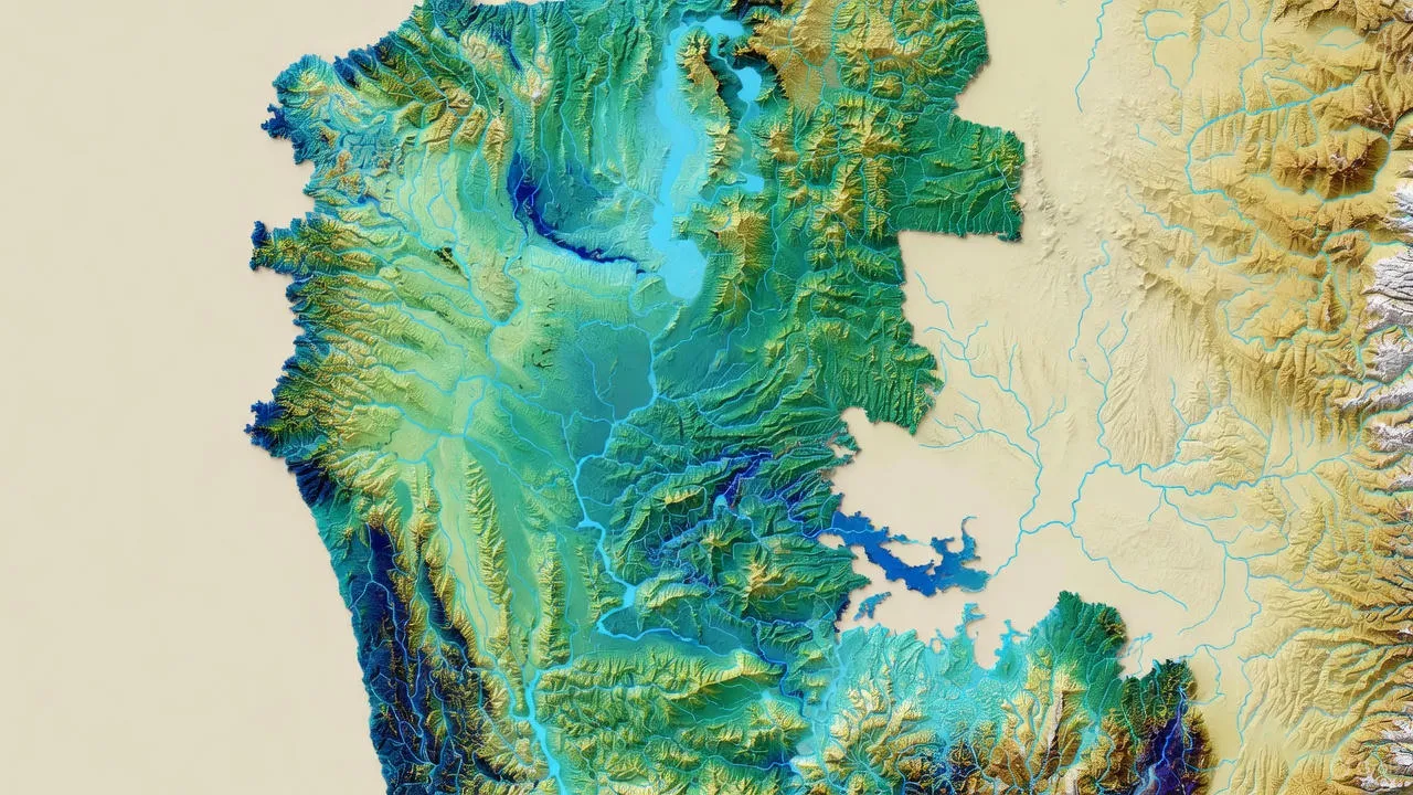
Dakshina Kannada, Udupi, and Uttara Kannada districts receive some of the heaviest rainfall in India. During peak monsoon, these areas face severe flooding, landslides, and river overflow. Towns like Mangaluru, Udupi, and Karwar experience regular waterlogging and property damage.
The problem here is not just heavy rain—the terrain is hilly with rivers flowing rapidly toward the sea. When heavy rain combines with high tide, water cannot drain properly, causing widespread coastal flooding. Roads get submerged, villages get cut off, and agricultural land suffers damage.
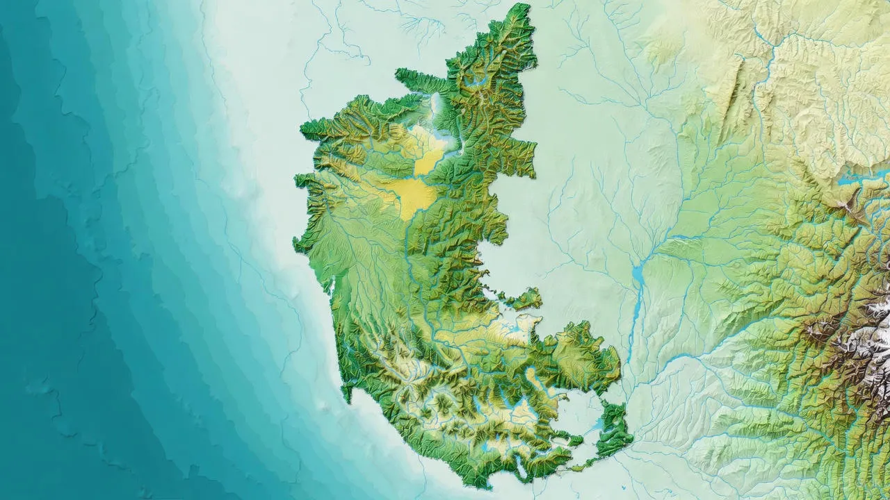
Western Ghats and Malnad Region
Districts like Kodagu (Coorg), Chikkamagaluru, and Hassan receive intense rainfall during monsoon. The steep slopes of Western Ghats mean water runs down fast, causing flash floods in valleys and low-lying areas. Coffee plantations, spice gardens, and villages in these regions face regular flood threats.
Kodagu district has seen devastating floods in recent years. Entire hillsides collapsed, villages were isolated, and thousands of people had to evacuate. This is exactly the kind of disaster that proper Flood Risk Assessment helps prevent or minimize through early warning and smart planning.
Krishna River Basin
Districts like Belagavi, Vijayapura, and Bagalkot in northern Karnataka face flooding from the Krishna river and its tributaries. When heavy rain falls in upstream areas or when dams in Maharashtra release water, these districts experience river flooding.
Agricultural lands along river banks get submerged, destroying crops. Villages near the river face water entering homes and livestock losses. Roads connecting rural areas get damaged, making relief operations difficult.
Tungabhadra Basin
Districts like Ballari and Koppal face flooding from the Tungabhadra river, especially when the Tungabhadra dam releases excess water during heavy monsoon. Farmers depend on this water for irrigation, but sudden releases can cause unexpected flooding downstream.
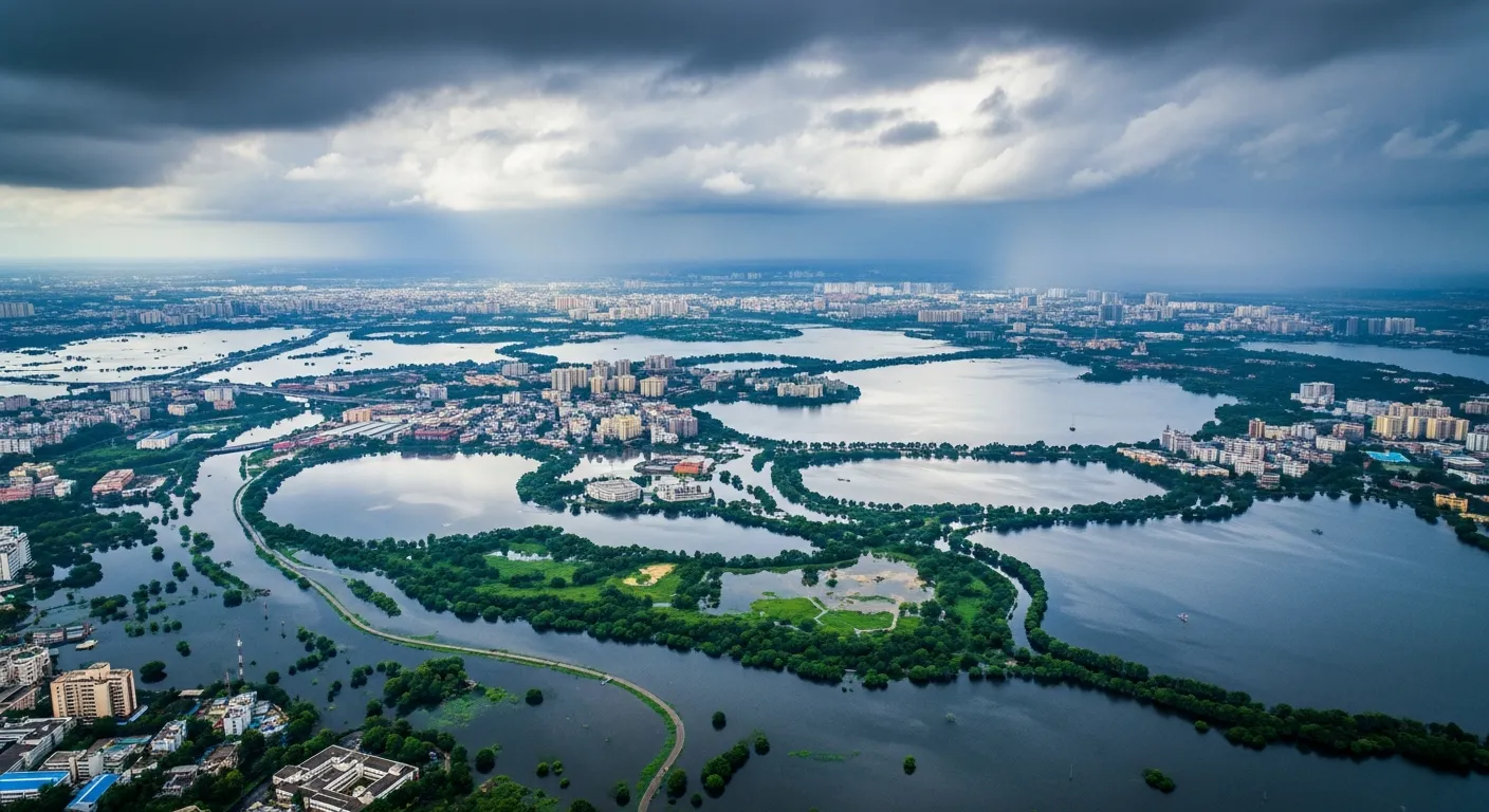
Urban Flooding in Bengaluru and Mysuru
Bengaluru, India's IT capital, faces increasing urban flooding problems. Areas like Yelahanka, Mahadevapura, Bellandur, and Whitefield regularly flood during heavy rain. The problem is rapid construction on lake beds and natural drainage channels, combined with inadequate storm drain capacity.
Mysuru also faces similar issues in low-lying areas. Old city drainage cannot handle modern rainfall intensities and increased water runoff from new developments.
How Flood Risk Assessment Works
Flood Risk Assessment is a scientific process done by experts using modern technology. Here's how it works in simple steps:
Step 1: Collect Data
Experts gather information about rainfall patterns, river levels, land elevation, soil types, drainage networks, lake locations, and historical flood data. Satellite images and survey data help create accurate digital maps of the area under study.
Step 2: Analyze Terrain and Water Bodies
Using GIS software, experts create 3D models showing how water flows across the land. They identify low-lying areas where water naturally collects, steep slopes where water runs fast, blocked drainage channels, and encroached lake beds that have lost their water-holding capacity.
Step 3: Run Flood Simulations
Computer models simulate different scenarios—normal monsoon, heavy rainfall, extreme cloudbursts, dam releases, or combinations of these events. These simulations show how deep water will get, how fast it will flow, which areas will flood first, and how long water will stay.
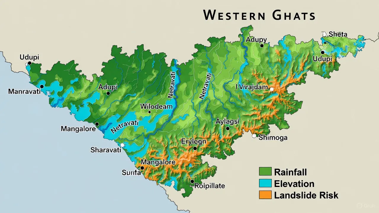
Step 4: Create Risk Maps
Based on the analysis, detailed flood risk maps are created. These maps color-code areas into low risk (safe), medium risk (occasional flooding possible), and high risk (frequent flooding likely). These maps guide all planning and construction decisions.
Benefits of Flood Risk Assessment in Karnataka
Proper Flood Risk Assessment brings multiple benefits to Karnataka's people, cities, and economy:
For Cities and Urban Areas:
- Better drainage system design for Bengaluru and other growing cities
- Protection of IT parks, tech campuses, and commercial zones from flooding
- Smart urban planning that avoids construction on lake beds and natural drains
- Reduced traffic disruption and business losses during monsoon
- Protection of metro stations, underpasses, and critical infrastructure
For Roads and Transportation:
- National highways designed to stay above flood levels in coastal regions
- Railway tracks protected from submersion in Malnad and coastal areas
- Proper culvert sizing on hilly roads to prevent washouts
- Alternative routes planned for emergency situations during floods
For Dams and Water Management:
- Better dam operation schedules that minimize downstream flooding
- Early warning systems for villages downstream of major dams
- Coordinated water release planning across multiple dams in a river basin
- Balancing irrigation needs with flood safety requirements
For Farmers and Rural Areas:
- Early warning systems help farmers protect crops and livestock
- Better irrigation planning that accounts for flood risks
- Government assistance targeted to high-risk agricultural zones
- Reduced crop losses in coffee plantations and paddy fields
For Industries and Tech Sector:
- Site selection that avoids flood-prone locations for new IT parks
- Factory and data center design with elevated critical equipment
- Business continuity planning based on realistic flood scenarios
- Lower insurance costs due to demonstrated risk management
A Real Example from Karnataka
A few years ago, a large IT park was planned in the Whitefield area of Bengaluru. The developer found a good-sized plot at a reasonable price and started planning office buildings that would house thousands of employees.
During the environmental clearance process, authorities required a Flood Risk Assessment. The study revealed something important—the site was part of a natural drainage channel that historically carried rainwater from surrounding areas toward nearby lakes. Years of development had blocked most of this natural flow, but during heavy rain, water still tried to follow its original path.
The flood simulations showed that during peak monsoon rainfall, this area could experience significant waterlogging, with depths reaching up to one meter in the lowest sections. This would affect ground floor parking, electrical rooms, and access roads.
Based on these findings, the developer made important changes. The site layout was redesigned to include a restored drainage channel through the property. Buildings were positioned away from this channel. Ground floors were elevated well above predicted flood levels. Underground parking was moved to less vulnerable areas. Additional storm drains were incorporated to handle peak flow.
When the IT park opened and Bengaluru experienced its next heavy monsoon, nearby areas faced severe flooding. But the IT park remained operational. The restored drainage channel carried water safely through the property. Not a single building was damaged, employees could access their offices safely, and the developer's foresight was validated.
This real example shows the practical value of Flood Risk Assessment—it turns potential disasters into well-managed situations through smart planning and design.

Moving Forward with Flood Safety
Climate change is making weather patterns more unpredictable. Karnataka may face more intense rainfall events in shorter periods. Coastal areas might see stronger storms. Western Ghats could experience more landslides. Urban areas will continue growing, putting more pressure on natural drainage systems.
Flood Risk Assessment needs to become a standard part of all development planning in Karnataka. Every new project—whether it's a tech park in Bengaluru, a coffee estate in Kodagu, a highway in coastal Karnataka, or a housing layout in Mysuru—should include proper flood analysis from the start.
Bengaluru urgently needs to update its flood maps and enforce strict rules against lake encroachment and drainage blocking. Coastal districts need better coordination with weather forecasting agencies for early warnings. Dam authorities need to work together on release schedules that minimize downstream flooding while meeting irrigation needs.
With proper Flood Risk Assessment and coordinated action between government, engineers, businesses, and communities, Karnataka can significantly reduce flood damage. We can protect more lives, save more property, keep businesses running, preserve agricultural lands, and build a more resilient state for the future.
Bhoojal Survey's Work in Karnataka
Bhoojal Survey plays a vital role in flood risk assessment across Karnataka by combining groundwater science, surface water analysis, and advanced GIS-based hydrological tools to deliver reliable and practical flood safety solutions. Working across diverse projects from coastal Karnataka to Western Ghats, river basins, and urban centers like Bengaluru and Mysuru, Bhoojal Survey supports informed decision-making for IT parks, industrial projects, agricultural planning, and infrastructure development.
Through scientifically developed flood models and detailed flood mapping in Karnataka, the organization helps reduce monsoon flood impact, improve water management, and promote sustainable development practices. Our expertise in handling unique challenges like coastal flooding in Dakshina Kannada, Western Ghats flash floods, river basin management, and Bengaluru urban flooding reflects strong institutional capability. We contribute not only to immediate flood risk mitigation but also to long-term water resource sustainability and climate resilience initiatives across Karnataka.