Introduction
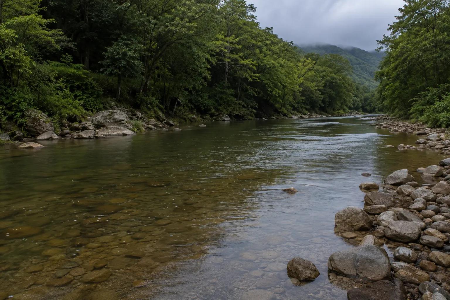
Regional hydrological conditions refer to the natural balance of water movement within a specific geographic area — including rainfall, surface runoff, river flow, groundwater recharge, and evapotranspiration. When this balance is maintained, ecosystems thrive, agriculture flourishes, and communities have reliable access to water.
But today, what has seriously affected the regional hydrological conditions is no longer a single factor — it is a combination of human activities and climatic shifts that have disrupted the entire water cycle. From shrinking rivers to falling groundwater tables, the signs are visible across India and globally. For environmental planners, civil engineers, and water resource managers, understanding these disruptions is the first step toward effective intervention.
Understanding Regional Hydrological Conditions
Regional hydrological conditions describe how water moves, stores, and distributes itself across a landscape. The key components include:
- Precipitation — rainfall and snowmelt that feed rivers and aquifers
- Surface runoff — water flowing over land into streams and rivers
- Groundwater recharge — infiltration of water into underground aquifers
- Evapotranspiration — water lost from soil and plants to the atmosphere
- River basin dynamics — the interconnected system of drainage networks
These elements form a continuous hydrological cycle. Disruption in any one component creates a cascading effect across the entire regional water system, impacting both ecological health and human water security.
Major Factors That Have Seriously Affected Regional Hydrological Conditions
Multiple forces — both natural and man-made — have seriously affected the regional hydrological conditions across India and South Asia.
1. Climate Change and Rainfall Variability Shifting monsoon patterns, erratic rainfall, and extreme weather events have made precipitation unpredictable. Some regions face intense flooding while others experience prolonged drought — both signs of a deeply disrupted hydrological cycle.
2. Groundwater Over-Extraction Excessive pumping for agriculture, industry, and urban supply has significantly reduced groundwater levels. Falling water tables reduce base flows in rivers and springs, weakening the regional water balance.
3. Deforestation and Land Degradation Forest cover plays a critical role in water retention and groundwater recharge. Deforestation accelerates runoff, reduces infiltration, and triggers soil erosion — all of which degrade watershed health and affect regional hydrological conditions.
4. Rapid Urbanization Expanding cities replace permeable land with concrete, reducing natural water infiltration. Urban stormwater systems alter natural drainage patterns, increasing flood risk while reducing groundwater recharge.
5. River Channel Modifications Dams, embankments, river diversions, and sand mining disrupt natural flow regimes. These interventions affect sediment transport, floodplain ecology, and downstream water availability.
6. Population Growth and Agricultural Pressure Rising water demand for food production intensifies pressure on both surface and groundwater resources, pushing regional systems beyond sustainable limits.
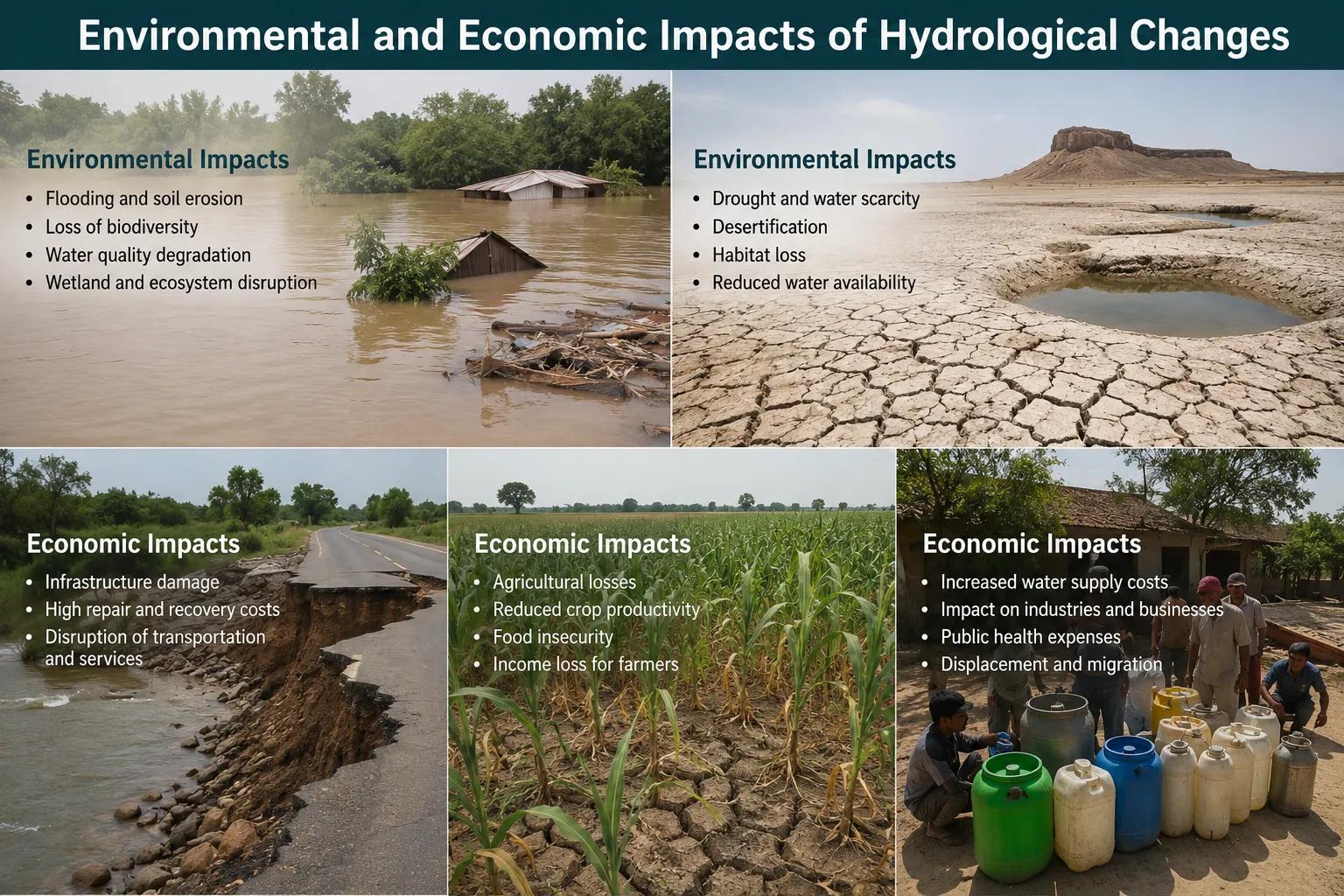
Environmental and Economic Impacts of Hydrological Changes
The consequences of hydrological imbalance are wide-ranging:
- Water scarcity affecting millions of households and farmers
- Increased flood frequency damaging infrastructure and displacing communities
- Prolonged droughts reducing crop yields and threatening food security
- Ecosystem degradation impacting wetlands, rivers, and biodiversity
- Deteriorating water quality from reduced dilution flows
Accurate assessment of these impacts requires advanced scientific tools. Professional agencies today are conducting hydrogeological surveys using instruments like SSRMPATS, GER DETECT, and PQWT at field sites for open well and borewell location identification. These advanced hydrological and geophysical survey solutions, combined with scientific watershed investigation and analysis, help generate reliable data for planning and decision-making.
Solutions for Improving Regional Hydrological Conditions
Restoring regional hydrological conditions requires a multi-layered approach:
- Watershed management — protecting and restoring catchment areas to improve water retention
- Artificial groundwater recharge — check dams, recharge wells, and percolation tanks
- Rainwater harvesting — capturing precipitation at the source before it is lost as runoff
- Sustainable land use planning — integrating hydrological sensitivity into development decisions
- Flood risk management — hydrological modelling and early warning systems
- Continuous hydrological monitoring — real-time data collection for adaptive water management
India's national programs — including Jal Shakti Abhiyan and Atal Bhujal Yojana — reflect growing government recognition of the urgency to address hydrological degradation at the regional scale.
Why Choose Bhoojal Survey
Bhoojal Survey is a trusted professional hydrological consultancy delivering scientific water resource solutions across India. Our team of experienced hydrologists and environmental experts provides:
- Comprehensive hydrological investigation and assessment
- Watershed analysis and river basin management studies
- Groundwater resource surveys using advanced geophysical instruments
- Flood mapping and modelling for infrastructure and disaster planning
- Customized water resource management solutions for government, industry, and development projects
We combine field expertise with cutting-edge technology to deliver accurate, actionable hydrological data that supports sustainable planning decisions nationwide.
Conclusion
What has seriously affected the regional hydrological conditions is a convergence of climate change, land degradation, groundwater overuse, and unplanned urbanization. The impacts are already visible — and without scientific intervention, they will deepen.
Addressing these challenges requires professional hydrological assessment, data-driven watershed planning, and responsible water resource management. Bhoojal Survey brings the expertise, technology, and field experience to help clients navigate these challenges effectively.
Contact Bhoojal Survey today for professional hydrological investigation, watershed assessment, and water resource consultancy services across India.
Frequently Asked Questions (FAQs)
Q1. What are regional hydrological conditions? Regional hydrological conditions refer to the state of water movement, storage, and distribution within a geographic area, including rainfall patterns, groundwater levels, river flows, and watershed health.
Q2. What factors have seriously affected regional hydrological conditions? Key factors include climate change, irregular rainfall, groundwater over-extraction, deforestation, rapid urbanization, river modifications, and increasing population pressure on water resources.
Q3. How does climate change impact regional water resources? Climate change alters rainfall timing and intensity, increases evaporation, and causes more frequent extreme events like floods and droughts — all of which disrupt the regional hydrological cycle.
Q4. Why is groundwater depletion a major hydrological concern in India? Groundwater supports over 60% of India's irrigation and a large share of drinking water. Over-extraction without adequate recharge reduces water availability, lowers water tables, and weakens river base flows.
Q5. How can regional hydrological conditions be improved? Through watershed management, groundwater recharge programs, rainwater harvesting, sustainable land use planning, scientific hydrological monitoring, and professional consultancy-driven water resource assessments.