Bhoojal Survey provides professional hydrogeological survey services across India, helping residential, agricultural, and industrial clients identify reliable groundwater sources before any borewell drilling begins.
Our team of certified hydrogeologists and geophysicists uses proven electrical resistivity methods to map subsurface geology, locate aquifer zones, and recommend accurate borewell depths — reducing the risk of drilling failures and unnecessary expenditure.
With over 30 years of experience in hydrogeology and groundwater investigation, we have completed 10,000+ surveys across the country, serving clients ranging from individual landowners and farmers to large corporations like IOCL, HPCL, P&G, and Adani Wilmar.
30+ Years of Experience| 10,000+ Surveys Completed| Pan-India Coverage| 95%+ Borewell Success Rate
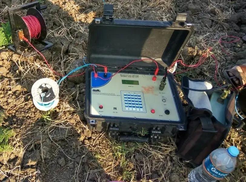
Hydrogeological Survey using Electrical Resistivity Meter — Bhoojal Survey Field Team
What is a Hydrogeological Survey?
A hydrogeological survey is a scientific investigation of subsurface geology and groundwater conditions at a specific site. It involves deploying geophysical instruments on the ground to measure how electrical resistivity varies across different rock and soil formations at various depths. Aquifer zones and water-saturated formations display distinctly lower resistivity values compared to dry or consolidated rock, allowing our hydrogeologists to accurately map groundwater occurrence, estimate depth, and assess likely yield.
In practical terms, a hydrogeological survey eliminates all guesswork — giving you a clear drilling target and an accurate borewell depth before any machinery arrives on site.
Hydrogeological Survey Methodology
Our surveys are conducted using established Electrical Resistivity Survey methods. Depending on the nature of the site and the purpose of the investigation, our team selects the most appropriate technique:
Schlumberger Method — used for borewell site surveys and deep aquifer investigation
Wenner Method — suited for openwell investigations and shallower groundwater mapping
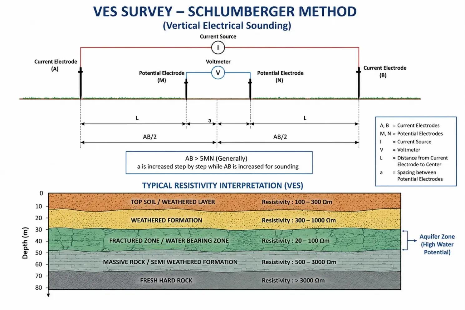
Vertical Electrical Sounding (VES) — provides layer-by-layer resistivity data and depth estimates
Groundwater Potential Zone Identification — systematic zoning of high-yield areas within a plot
Aquifer Mapping and Fracture Zone Analysis — locating fractured rock and permeable formations
The VES method is particularly widely used. It provides a resistivity profile of the ground at progressive depths, and from this data our hydrogeologists can identify water-bearing formations, fractured rock zones, weathered formations, and aquifer continuity — all of which determine where and how deep to drill.
VES Survey Methodology — Resistivity Measurement of Subsurface Formations
Electrical Resistivity Tomography (ERT) Surveys
For sites with complex or uncertain geology, we also offer ERT surveys. This is an advanced geophysical method that generates a 2D cross-section image of subsurface resistivity — essentially a slice-view of what lies beneath the ground. It is considerably more detailed than a standard VES and is especially useful when a site has:
Irregular or faulted rock formations
Multiple aquifer layers at varying depths
Significant lateral variation in geology across the site
Previous failed borewells where standard survey was inconclusive
ERT is also the preferred method for mining projects, dam site investigations, infrastructure engineering studies, and environmental impact assessments involving groundwater.
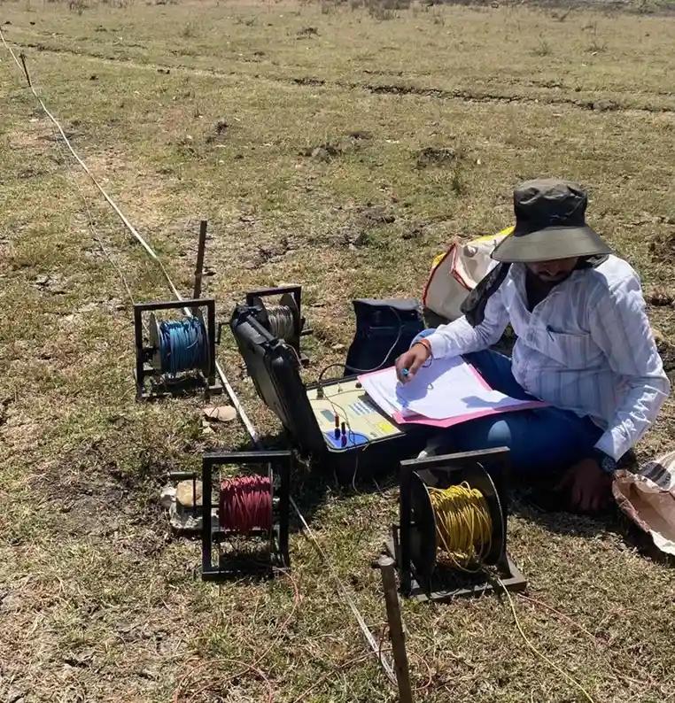
Site Work — Hydrogeological Survey in Progress
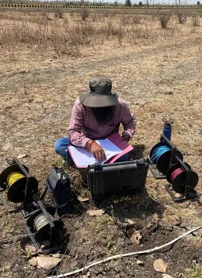
Hydrogeological and Geophysical Survey using Schlumberger Method — Field Investigation
Instruments and Software Used
Accurate results depend on the quality of instruments and interpretation. We use the following equipment and software on every hydrogeological survey:
Instruments:
SSR-MP-ATS Resistivity Meter — high-resolution multi-channel resistivity system
Terrameter — precision Swedish instrument for VES and electrical profiling
Garmin GPS Device — for precise borewell location marking with coordinates
Interpretation Software:
IPI2WIN — industry-standard 1D resistivity inversion and curve-fitting software
WinResist — VES data interpretation and depth modelling software
All field data is processed using these tools to produce a detailed Hydrogeological Report. This report can also be submitted for CGWA NOC applications, project documentation, and government regulatory requirements.
Our Hydrogeological Survey Process
Every survey follows a structured field process to ensure reliable, actionable results for the client:
Step 1: Site Inspection and Geological Assessment — our hydrogeologist visits the site, reviews satellite imagery, geological maps, and notes surface indicators such as rock outcrops, drainage patterns, and existing water structures.
Step 2: Electrical Resistivity Survey — electrodes are deployed at the site and resistivity measurements are taken along multiple survey lines.
Step 3: Vertical Electrical Sounding (VES) Testing — depth-specific data is collected at the proposed borewell location.
Step 4: Data Collection and Interpretation — raw resistivity data is processed using IPI2WIN and WinResist to produce subsurface layer profiles.
Step 5: Aquifer Zone Identification — the team identifies the most promising water-bearing zones and evaluates formation characteristics.
Step 6: Borewell Depth Recommendation — a recommended drilling depth range is provided based on aquifer depth and expected yield.
Step 7: Final Hydrogeological Report — a detailed technical report is prepared, including GPS coordinates, resistivity curves, depth estimates, strata description, and drilling recommendations.
Where is a Hydrogeological Survey Used?
Our groundwater survey services are used across a wide range of sectors and project types throughout India:
Borewell site selection for homes, farms, and housing societies
Openwell investigation and deepening studies
Industrial water supply for factories, processing plants, and campuses
Water sourcing assessment for residential colonies, housing societies, and township developments
Agricultural irrigation borewells for farmers and agri-businesses
Mining and infrastructure projects requiring groundwater impact assessment
Government and PSU projects — Jal Jeevan Mission, CGWA compliance requirements
Environmental and ecological investigations involving groundwater resources
VES Survey — Resistivity Data Collection for Borewell Depth Recommendation
Why Clients Across India Choose Bhoojal Survey
There are many groundwater survey providers in India. Here is what separates our team, based on 30 years of consistent field work and direct client feedback:
Deep field experience — 30+ years in hydrogeology across diverse Indian geological settings: Deccan basalt, alluvial plains, hard rock terrain, and coastal formations.
Scale of completed work — 10,000+ surveys across 15+ states provide a practical, ground-level understanding of regional groundwater behaviour.
GPS-marked borewell points — every recommended drilling location comes with precise GPS coordinates, eliminating guesswork on drilling day.
CGWA-compliant reports — our hydrogeological reports meet the documentation standards required for CGWA NOC applications.
Straightforward findings — if a site does not have a viable aquifer, we communicate that clearly rather than recommending a borewell that is likely to fail.
Pan-India coverage — our team works regularly across MP, Maharashtra, Gujarat, Rajasthan, Odisha, Karnataka, UP, and other states.
Hydrogeological Survey Services Across India
We provide hydrogeological and geophysical survey services across the following states and regions:
Hydrogeological and Geophysical Survey — Graphite India Industrial Site, Titlagarh, Odisha
Vertical Electrical Sounding (VES) for Openwell Investigation — Village Palsud, Madhya Pradesh
Hydrogeological Survey for Groundwater Investigation — Textile Park MIDC, Amravati, Maharashtra
Groundwater Survey for Borewell — Township Project, Bangalore, Karnataka
Hydrogeological and Geophysical Survey — IOCL (PSU), Patan, Gujarat
Geophysical Survey for Industry — NPL, Udaipur, Rajasthan
Hydrogeological Survey for Borewell Location — P&G, Baddi, Chandigarh Region
Groundwater Survey for Township Project — Sarojini Nagar, Delhi
Groundwater Investigation for Metro Rail Project — Tata Projects, Pune, Maharashtra
Groundwater Survey for Road Infrastructure Project — GR Infra, Jhabua, Madhya Pradesh
Groundwater Survey for Jio BP Petrol Pump Projects — Madhya Pradesh and Gujarat
Frequently Asked Questions
What is the difference between a hydrogeological survey and a geophysical survey?
A hydrogeological survey is the broader investigation — it covers groundwater occurrence, movement, quality, and depth based on site geology. A geophysical survey is the specific field measurement technique used within that investigation. In practice, both terms are often used interchangeably when referring to an electrical resistivity survey conducted for borewell location purposes.
How long does a hydrogeological survey take?
For a standard residential or agricultural borewell survey, field work is typically completed in half a day to one full day on site. The technical report is prepared within 2-3 working days, and includes GPS coordinates and the recommended drilling depth.
Is a hydrogeological survey report required for CGWA NOC?
Yes. The Central Ground Water Authority (CGWA) requires a hydrogeological survey report as part of the documentation for groundwater extraction NOC applications. Our reports are prepared in a format accepted by CGWA and include all required technical data.
What if no groundwater is found at the survey site?
If survey data indicates the site does not have a viable aquifer at drillable depths, we communicate this clearly in the report with an explanation of the subsurface conditions observed. In some cases we suggest an alternative location on the same property or indicate the depth at which a limited yield might be possible.
Can a survey be done for an existing borewell with low water yield?
Yes. We conduct diagnostic surveys for existing borewells with declining or insufficient yield. The data helps determine whether deepening the existing borewell, drilling in a new location, or exploring an adjacent aquifer zone would be more practical and cost-effective.
Get Free Expert Assistance
What Our Clients Say
I recently used the soil resistivity website and was impressed with the accuracy and ease of use of the tools provided. The site helped me to accurately measure the resistivity of the soil on my property and provided me with all the necessary information I needed for my project. I highly recommend this site to anyone looking for reliable soil resistivity data.
Raman Arora
Geotechnical Engineer
Bhoojal Survey website is a game-changer for our business. I recently used the earth resistivity testing services provided by Bhoojal Survey, and I must say I was thoroughly impressed. The website was easy to navigate and provided all the information I needed to understand the testing process and the benefits it could provide for my business.
Vivek Agrawal
Environmental Scientist
I recently had to obtain a NOC from CGWA for groundwater extraction, and I must say that the process was made extremely simple and efficient thanks to the team at Bhoojal Survey. The website provided all the necessary information, and the team was always available to answer any questions I had throughout the process.