Hydrogeological Survey Equipment
Securing a dependable water supply is a critical priority for industrial developments, infrastructure projects, and agricultural planning across India. Relying on guesswork for borewell drilling frequently leads to failed attempts, wasted capital, and depleted resources. To eliminate this risk, modern developers rely on advanced scientific instruments.
Hydrogeological survey equipment refers to a specialized suite of scientific survey instruments and geophysical survey instruments used to detect subsurface water, map geological layers, and locate sustainable aquifers. By analyzing electrical resistivity, electromagnetic signals, and seismic responses underground, this specialized groundwater survey equipment tells engineers exactly where to drill, how deep to go, and what quantity of water to expect.
For infrastructure companies, mining operators, and farmers, investing in a professional assessment using cutting-edge hydrogeological survey equipment ensures long-term water security and high-yielding borewell locations.
What is Hydrogeological Survey Equipment?
Hydrogeological survey equipment comprises technical, field-ready instruments engineered to scan underground strata without drilling exploratory holes. The primary purpose of these hydrogeological investigation tools is to measure physical properties of the earth—such as electrical resistance or electromagnetic wave variations—that indicate the presence of water-bearing fractures and fractures.
In professional groundwater exploration equipment deployment, these tools provide the empirical data required for scientific decision-making. Instead of selecting an open well or borewell spot based on surface observations, hydrogeologists use these instruments to generate subsurface profiles, ensuring that your water supply infrastructure is built over a high-capacity, rechargeable aquifer.
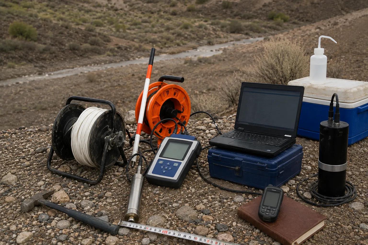
Essential Types of Hydrogeological Survey Equipment
Professional hydrogeological investigation services in India rely on multiple layers of technology to accurately evaluate deep aquifer mapping studies and groundwater development projects.
- Electrical Resistivity Meters: These instruments inject electrical currents into the ground via steel electrodes. By measuring structural resistance variations, an electrical resistivity meter easily distinguishes between dry rock, dense clay, and water-rich sand or gravel layers.
- Groundwater Detection Instruments: Utilizing advanced multi-channel frequencies, these tools capture natural or induced electromagnetic signals to trace localized water paths.
- Borehole Logging Tools: Deep sensing probes lowered directly down a pilot hole to read real-time rock porosity, water quality, and sediment formations.
- Water Level Indicators: High-precision acoustic and electronic meters used as standard groundwater monitoring instruments to check static water table levels.
To deliver maximum accuracy, modern field teams deploy specific, industry-recognized hardware systems:
PQWT Equipment
Natural electric field frequency selection systems that scan multi-channel depths quickly, rendering clear, real-time 2D and 3D subsurface profiles on-site.
SSRMPATS Instrument & GER DETECT
Highly precise resistivity and thermal imaging systems optimized for detecting hidden structural fractures, underground caverns, and deep water-bearing faults in challenging terrains like hard-rock basalt or granite.
Applications in Real-World Projects
Advanced groundwater assessment equipment is vital across diverse industrial, civil engineering, and rural developmental landscapes.
High-Yield Borewell Site Selection
Locating sustainable water sources in complex terrains requires integrating multiple surface and subsurface data points. Bhoojal Survey provides advanced groundwater and geophysical survey solutions, conducting hydrogeological survey using SSRMPATS Instrument, GER DETECT, and PQWT at site for open well / borewell location. This systematic workflow maximizes drilling success rates and ensures long-term yield.
Infrastructure and Mining Groundwater Assessment
Large-scale infrastructure projects require detailed water resource survey instruments to calculate excavation dewatering volumes, evaluate slope stability, and secure dedicated water pipelines for processing facilities.
Smart Aquifer Management
Government bodies and conservation groups utilize specialized aquifer investigation tools to execute regional groundwater storage tracking and monitor artificial rainwater harvesting injection wells.
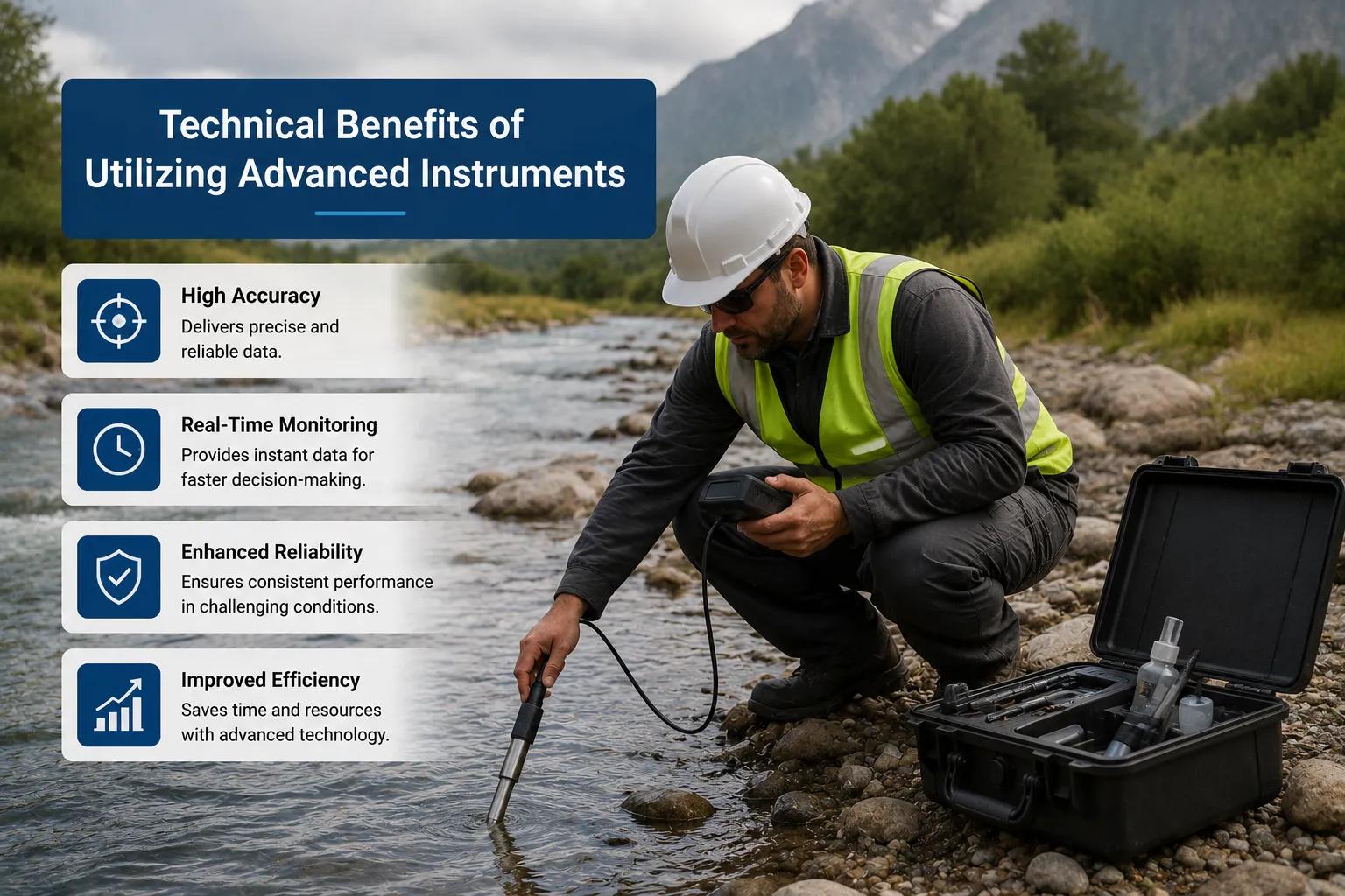
Technical Benefits of Utilizing Advanced Instruments
Using high-tier hydrogeological testing equipment transforms project economics and enhances long-term operational security.
[Advanced Geophysical Tools] │ ▼ [Precision Subsurface Mapping] │ ┌───────┴───────┐ ▼ ▼ [Dry Holes Avoided] [Drilling Costs Slashed] │ │ └───────┬───────┘ ▼ [Sustainable Aquifer Yield]
By leveraging modern borewell location instruments, project planners eliminate the financial losses associated with drilling multiple dry holes. Precise data allows engineers to specify the exact casing depth required, optimize pump selection sizes, and establish highly effective water management routines that shield operations from seasonal drought impacts.
Why Choose Bhoojal Survey?
Bhoojal Survey is an industry-leading professional groundwater survey company, providing top-tier scientific groundwater investigation and analysis across India.
- Certified Technical Expertise: Our veteran hydrogeologists and geophysicists possess over 15 years of field experience interpreting complex raw data.
- State-of-the-Art Fleet: We own and maintain an inventory of premium hydrogeological survey equipment, including authorized PQWT, SSRMPATS, and advanced resistivity setups.
- Actionable Data Reports: Our comprehensive documentation features clear geological cross-sections ready for regulatory environmental clearances.
- Versatile Field Delivery: From localized agricultural exploration to heavy industrial geophysical survey consultancy, we execute projects nationwide.
Conclusion
The deployment of specialized hydrogeological survey equipment is the single best investment you can make to secure your site's water infrastructure. Relying on rigorous, instrument-driven data safeguards your capital, ensures drilling success, and protects vital underground water reserves from over-exploitation.
Take the risk out of your next water project. Partner with Bhoojal Survey today for precision hydrogeological survey services backed by industry-leading technology.
Frequently Asked Questions
1. What is hydrogeological survey equipment?
It refers to scientific instruments—such as resistivity meters, logging tools, and electromagnetic detectors—used to scan subsurface layers and identify water aquifers without excavation.
2. How do PQWT groundwater detection instruments work?
PQWT instruments measure variations in the earth's natural electromagnetic field across multiple frequencies, instantly processing the data to map out water-bearing geological structures.
3. Why is resistivity survey equipment critical for Indian terrains?
India's diverse geology includes hard basalt, granite, and loose alluvial plains. Resistivity meters read the distinct electrical resistance of these layers, making it easy to isolate target water-bearing zones.
4. How accurate is advanced hydrogeological field equipment?
When deployed by experienced geophysicists and calibrated for local soil conditions, advanced field instruments provide exceptional structural accuracy, dropping dry-hole failure rates to an absolute minimum.
5. What industries rely on scientific groundwater survey solutions?
Mining firms, heavy industries, residential real estate developers, commercial agricultural projects, and government water boards all utilize these technologies to ensure structural safety and water supply security.