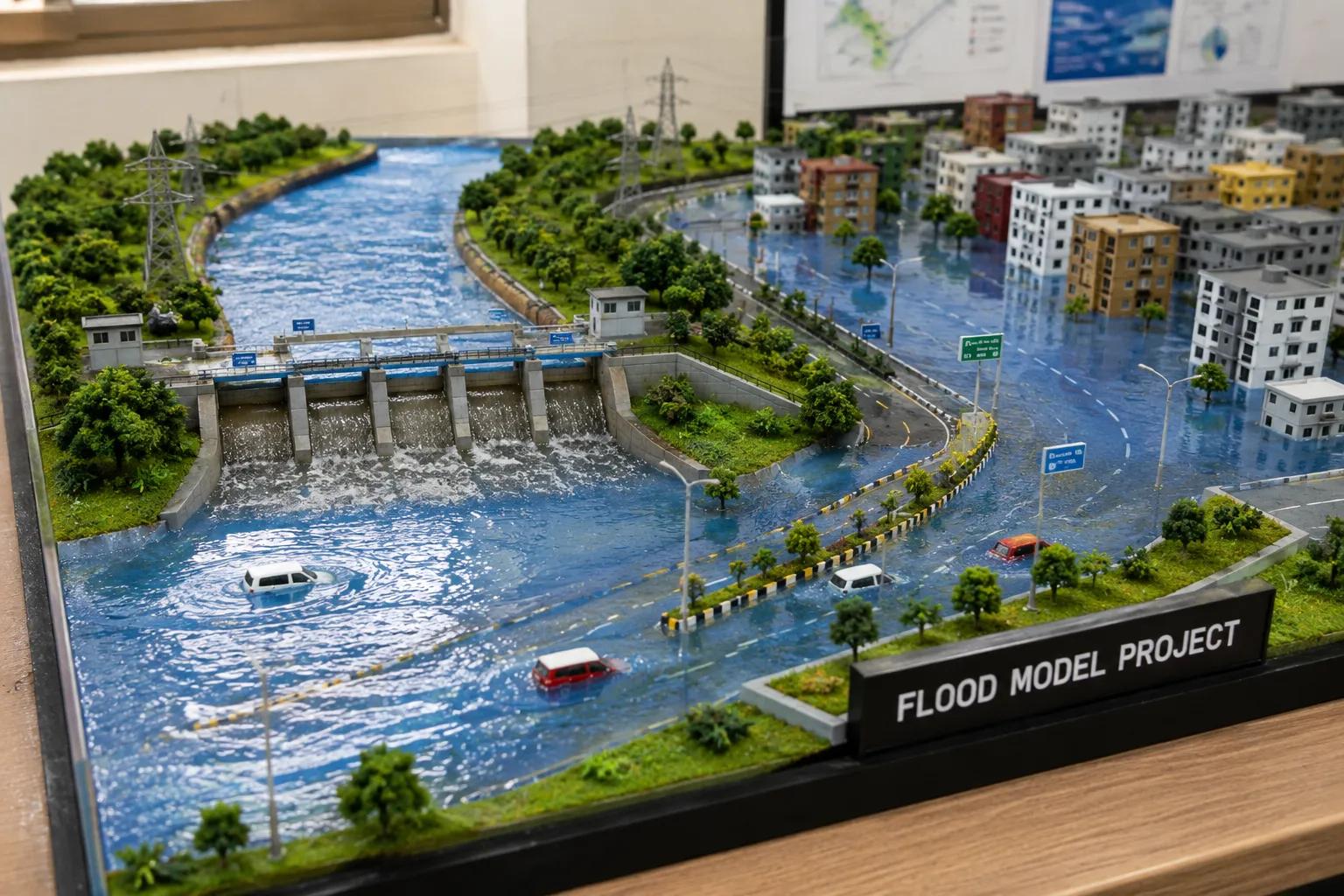
A flood model project is a scientific approach to understanding, simulating, and predicting flood behavior in a specific area. Using hydrological and hydraulic analysis, professionals can assess flood risks, map inundation zones, and support infrastructure planning. Whether you are developing highways, smart city zones, or river basin projects, knowing how to make a flood model project is essential for safe and sustainable development.
Flood modelling plays a critical role in disaster risk management, floodplain mapping, and environmental compliance across India. From urban drainage studies to large-scale watershed analysis, a well-structured flood model project helps engineers, planners, and government agencies make data-driven decisions.
What is a Flood Model Project?
A flood model project is a technical study that uses hydrological data, terrain information, and simulation software to predict how floodwaters behave during heavy rainfall or river overflow events.
The primary purpose of a flood model project is to:
- Identify flood-prone zones and vulnerable infrastructure
- Estimate flood depth, velocity, and inundation extent
- Support flood hazard assessment and flood risk assessment
- Guide flood management planning and disaster preparedness
Applications include river flood analysis for bridge design, urban flood mitigation planning, environmental impact assessments, and Smart City drainage master plans across India.
Data Required to Make a Flood Model Project
Before starting a flood model project, collecting accurate and reliable data is critical. The key data inputs include:
- Rainfall records – Long-term rainfall data from IMD or regional stations
- River discharge data – Historical streamflow and peak discharge records
- Topographic survey – Detailed ground elevation data from field surveys
- Digital Elevation Model (DEM) – High-resolution terrain data from satellite or drone surveys
- Watershed characteristics – Catchment area, land use, slope, and soil type
- Historical flood records – Past flood events, affected areas, and damage reports
Accurate data collection is the foundation of any reliable flood simulation project. Missing or poor-quality data directly affects the accuracy of flood prediction modelling.
Step-by-Step Process to Make a Flood Model Project
Here is a practical step-by-step process for making a flood model project:
1. Site Assessment Visit the project area to understand the topography, drainage network, land use patterns, and flood history. Conduct advanced hydrological and geospatial survey solutions including conducting hydrogeological survey using SSRMPATS Instrument, GER DETECT, and PQWT at site for open well / borewell location to assess subsurface conditions and groundwater interactions.
2. Data Collection Gather rainfall data, river discharge records, DEM data, satellite imagery, and historical flood information from reliable sources such as the Central Water Commission and State Water Resource Departments.
3. Watershed Analysis Delineate the catchment area and analyze watershed characteristics including drainage density, slope, land cover, and soil infiltration capacity. This step defines the hydrological response of the basin.
4. Hydrological Modelling Apply hydrological modelling techniques to estimate design storm runoff, peak discharge, and flood volumes. Tools like HEC-HMS, SWAT, and NRCS Curve Number methods are commonly used for scientific flood investigation and analysis.
5. Hydraulic Modelling Use hydraulic modelling software such as HEC-RAS, MIKE FLOOD, or TUFLOW to simulate water flow through river channels, floodplains, and drainage networks. This generates flood inundation extents for different return periods.
6. Flood Inundation Mapping Integrate hydraulic model outputs with GIS flood mapping tools to create flood hazard maps showing depth, velocity, and inundation zones. These maps support infrastructure planning and disaster risk management.
7. Validation and Reporting Compare model results with historical flood events to validate accuracy. Prepare a professional technical report including flood risk assessment findings, GIS flood maps, and recommended flood management planning measures.
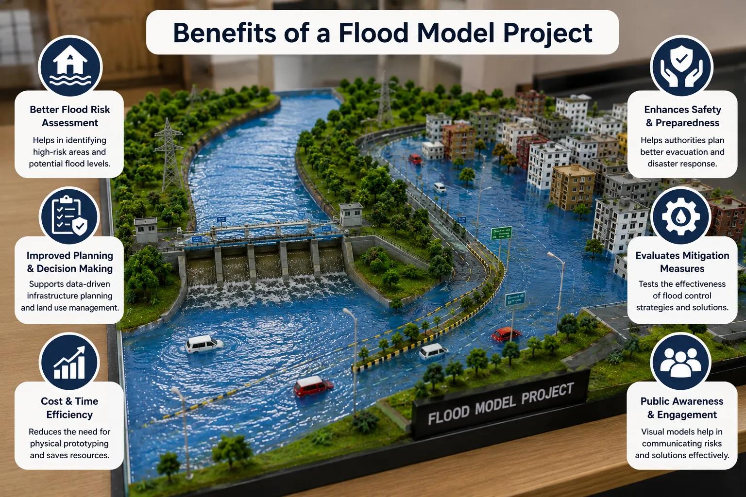
Benefits of a Flood Model Project
A professionally executed flood model project delivers significant value:
- Better flood forecasting for early warning systems
- Improved infrastructure planning for roads, bridges, and urban projects
- Reduced flood damage through proactive mitigation design
- Enhanced public safety by identifying high-risk areas
- Environmental compliance support for EIA and regulatory approvals
- Stronger disaster preparedness for government and municipal authorities
Why Choose Bhoojal Survey for Your Flood Model Project
Bhoojal Survey is a trusted hydraulic modelling company in India with extensive experience in flood modelling consultancy services, flood risk assessment services, and professional flood model project solutions.
Our team of senior hydrologists and hydraulic engineers delivers:
- Scientific flood risk assessment using advanced GIS flood mapping consultancy
- Reliable flood simulation services backed by field data
- Pan-India project execution from urban centers to remote river basins
- Customized flood management solutions for government and private clients
- Professional technical reporting aligned with NDMA and CWC guidelines
We combine field expertise with advanced technology to deliver accurate, actionable flood model projects for infrastructure developers, disaster management authorities, and smart city planners.
Conclusion
Learning how to make a flood model project requires systematic data collection, watershed analysis, hydraulic modelling, and GIS flood mapping. A scientifically sound flood model project reduces disaster risk, improves infrastructure safety, and supports sustainable development across India.
Partner with Bhoojal Survey for expert flood modelling consultancy. Contact us today to discuss your flood risk assessment, hydraulic modelling, or floodplain mapping requirements.
Frequently Asked Questions (FAQs)
Q1. How to make a flood model project? A flood model project is made by collecting hydrological data, conducting watershed analysis, applying hydrological and hydraulic modelling, generating flood inundation maps using GIS tools, and preparing a validated technical report.
Q2. What data is required for flood modelling? Key data includes rainfall records, river discharge data, Digital Elevation Models (DEM), topographic survey data, watershed characteristics, land use maps, and historical flood records.
Q3. Which software is used for flood model projects? Commonly used software includes HEC-HMS and HEC-RAS for hydrological and hydraulic modelling, SWAT for watershed analysis, ArcGIS and QGIS for GIS flood mapping, and MIKE FLOOD for advanced flood simulation.
Q4. Why is flood modelling important? Flood modelling is important for identifying flood hazard zones, supporting infrastructure design, improving disaster preparedness, ensuring environmental compliance, and reducing flood damage to communities and assets.
Q5. How accurate are flood simulation models? Flood simulation model accuracy depends on input data quality, DEM resolution, calibration with historical events, and the modelling approach used. Professionally validated models from experienced consultancies like Bhoojal Survey deliver high reliability suitable for engineering and planning decisions.