Water scarcity is one of the most pressing challenges faced by farmers, industries, and communities across India today. Whether you are planning a borewell for agricultural irrigation, industrial water supply, or domestic use, the single most important decision you will make is where to drill. A wrong borewell location means wasted investment, a dry or low-yield borewell, and months of delay. A scientifically chosen borewell point, on the other hand, delivers reliable, long-term water supply at the right depth.
The question that every landowner, farmer, and project developer asks is simple: how to detect underground water for borewell accurately and reliably?
The answer lies not in traditional guesswork or divining rods — but in advanced, proven scientific survey methods used by expert hydrogeologists. This article explains everything you need to know about underground water detection, the best methods available today, and how professional groundwater surveys dramatically improve borewell success rates across India.
What is Underground Water Detection for Borewell?
Underground water detection is the scientific process of identifying subsurface groundwater zones, aquifers, and water-bearing rock formations at a site before a borewell is drilled. Rather than drilling randomly and hoping for water, a trained hydrogeologist uses geophysical instruments and field investigation techniques to precisely locate where groundwater exists, at what depth, and in what quantity.
Groundwater does not flow in underground rivers as many people imagine. It occurs in the tiny pore spaces of soil and rock, in fractured rock zones, and in permeable geological formations called aquifers. The presence, depth, and yield of groundwater depend on the local geology, topography, rainfall patterns, soil characteristics, and regional hydrogeology — all factors that must be scientifically assessed before drilling begins.
A professional underground water detection survey maps these subsurface conditions and pinpoints the optimal borewell location with accuracy that no traditional method can match.
Why Scientific Borewell Detection is Crucial
Across India, millions of rupees are lost every year on failed borewells drilled without proper scientific investigation. A single failed borewell in hard rock terrain can cost ₹80,000 to ₹2,00,000 or more — with zero water to show for it.
Scientific borewell detection is crucial for the following reasons:
- Eliminates dry borewell risk by identifying productive water-bearing zones before any drilling cost is committed.
- Reduces drilling depth uncertainty — surveys estimate the depth at which water-bearing formations occur, preventing costly over-drilling.
- Improves borewell yield by targeting high-permeability aquifer zones rather than low-yield fractured zones.
- Supports long-term water sustainability — scientifically sited borewells tap into deeper, more stable aquifer systems that maintain yield through dry seasons.
- Reduces project risk for large infrastructure, industrial, and agricultural developments where reliable water supply is critical to operations.
- Provides documented technical evidence for regulatory compliance, environmental clearances, and CGWA NOC applications.
In short, a professional groundwater survey is not an optional luxury — it is the single most cost-effective investment you can make before drilling a borewell anywhere in India.
Traditional vs. Scientific Water Detection Methods
For generations, landowners across rural India have relied on traditional methods to find water. It is important to understand why these methods consistently fail — and why modern scientific approaches deliver reliable results.
Parameter
Traditional Methods
Scientific Methods
Basis
Belief, folklore, guesswork
Geophysical data, geology, resistivity
Instruments Used
Divining rods, coconut, intuition
Resistivity meters, VES equipment, SSRMPATS, GER DETECT, PQWT
Accuracy
Very low — 20 to 30%
High — 80 to 95%
Depth Estimation
None
Accurate depth and aquifer profiling
Data & Reporting
None
Detailed technical survey report
Cost of Failure
High — repeated dry borewells
Minimal — drilling only at confirmed points
Suitability for Hard Rock
Not applicable
Specifically designed for hard rock terrain
Regulatory Compliance
Not accepted
Accepted by CGWA and government bodies
Traditional dowsing and divining rod methods have been scientifically tested and repeatedly found to perform no better than random chance. They have no ability to assess subsurface geology, measure resistivity, or estimate aquifer depth. Relying on them is a gamble with your investment.
The Best Scientific Methods to Detect Underground Water for Borewell
Electrical Resistivity Survey
The Electrical Resistivity Survey is the most widely used and reliable method for underground water detection in India. It works on a simple but powerful principle: different subsurface materials conduct electricity differently. Dry rock and soil have high electrical resistivity. Water-saturated soil and rock formations have significantly lower resistivity because dissolved minerals in groundwater conduct electrical current.
A resistivity survey passes controlled electrical current into the ground through metal electrodes and measures how the subsurface resists that current. A geophysical instrument then maps the resistivity values at different depths. Low-resistivity zones indicate water-saturated formations — precisely the locations where productive borewells should be drilled.
This method is highly effective in both alluvial plains and hard rock terrain and delivers accurate results in diverse geological environments across India — from the black cotton soils of Vidarbha to the granite formations of Karnataka and Rajasthan.
Hydrogeological Survey
A hydrogeological survey is a comprehensive field investigation that analyses the relationship between local geology and groundwater occurrence. A trained hydrogeologist visits the site, studies the terrain, examines exposed rock formations, assesses drainage patterns, analyses soil types, and reviews existing borewell data from the surrounding area.
This survey identifies groundwater recharge zones — areas where rainfall infiltrates into the subsurface and replenishes aquifers — and delineates the most productive zones for borewell placement. In regions with complex geology, like the Deccan Plateau or the Vindhyan sedimentary formations of Madhya Pradesh, a hydrogeological survey is essential for understanding the local groundwater system before any geophysical testing begins.
VES Survey (Vertical Electrical Sounding)
Vertical Electrical Sounding is a specialized resistivity technique that measures subsurface resistivity at progressively increasing depths by gradually expanding the spacing between electrodes on the surface. This produces a detailed resistivity profile that reveals the thickness, depth, and water-bearing potential of different geological layers from the surface down to aquifer level.
VES survey data is processed and interpreted by hydrogeological software to generate subsurface layer models — showing the depth of clay layers, weathered rock zones, fractured rock aquifers, and consolidated basement rock. This depth profiling is critical for estimating borewell depth, casing design, and expected water yield before drilling begins.
Geophysical Survey
A full geophysical survey integrates multiple investigation methods — resistivity profiling, electromagnetic surveys, and sometimes seismic refraction — to build a comprehensive picture of the subsurface conditions at a site. Where a single resistivity measurement gives a point reading, a geophysical survey produces a spatial map of groundwater potential across the entire project area.
This approach is particularly valuable for large agricultural projects, industrial facilities, real estate developments, and government infrastructure projects where multiple borewells are planned and optimal locations must be scientifically selected across a wide area.
How Experts Identify Ideal Borewell Points
Identifying the right borewell point is not a single measurement — it is a systematic, multi-step professional process. Here is how experienced hydrogeologists from Bhoojal Survey approach a borewell site investigation:
- Desk Study: Review of geological maps, satellite imagery, topographic data, and regional groundwater reports before the field visit.
- Site Inspection: Physical walkover of the site to assess terrain, drainage patterns, rock exposures, vegetation indicators, and existing water features.
- Geological Observation: Identification of rock type, fracture patterns, lineaments, and structural features that indicate groundwater pathways.
- Geophysical Testing: Deployment of resistivity instruments across the site to map subsurface water-bearing zones.
- Data Interpretation: Analysis of resistivity data using professional software to generate depth profiles and aquifer maps.
- Borewell Point Marking: GPS-referenced marking of the optimal drilling location on the ground for the drilling team.
- Depth Recommendation: Technical estimation of target aquifer depth, recommended drilling depth, and expected casing design.
- Technical Report: Delivery of a professional survey report documenting methodology, findings, borewell recommendations, and depth estimates.
Essential Instruments Used for Underground Water Detection
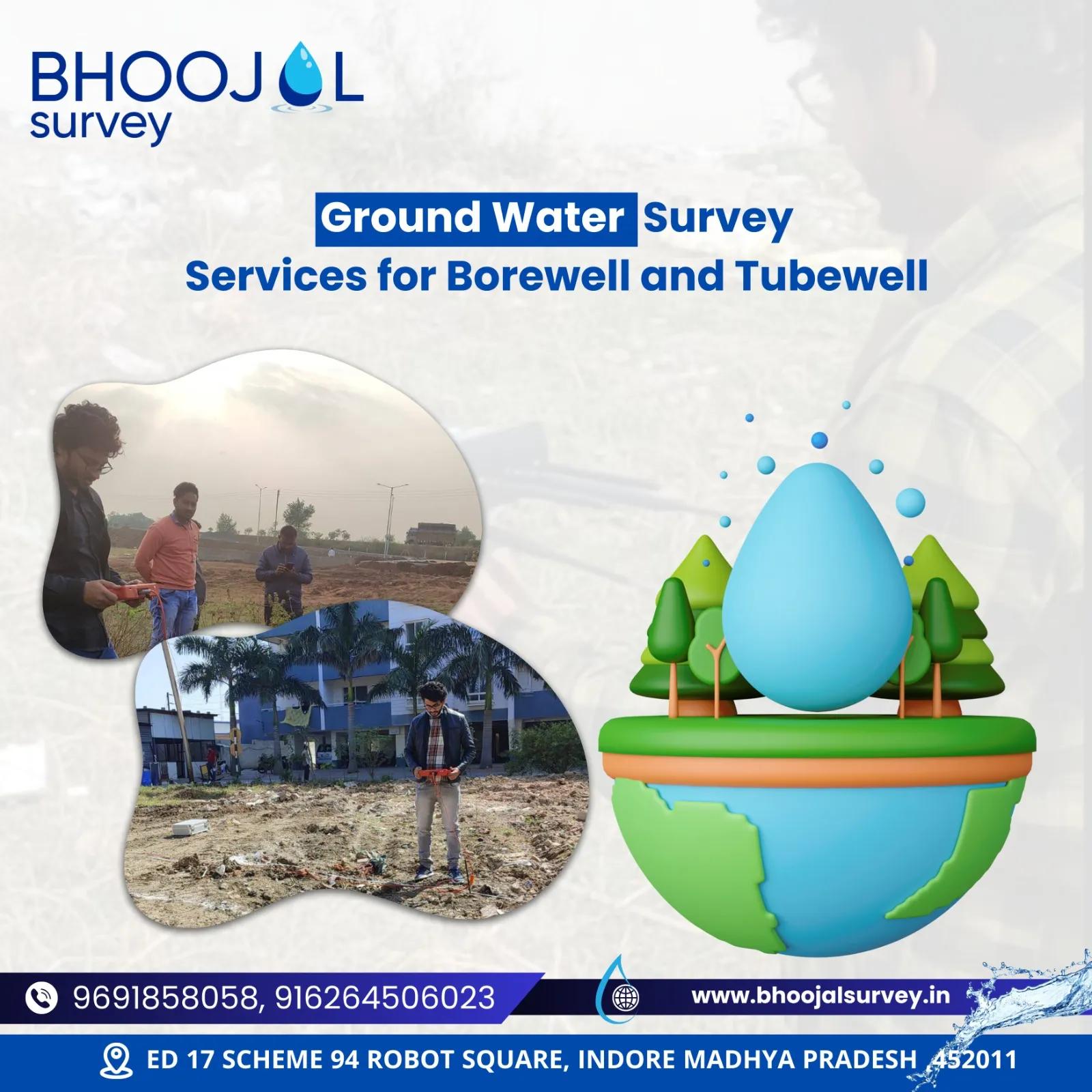
Modern groundwater detection relies on precision scientific instruments that eliminate guesswork and deliver accurate subsurface data. At Bhoojal Survey, field teams conduct hydrogeological surveys using SSRMPATS Instruments, GER DETECT, and PQWT systems for borewell and open well location surveys across all geological conditions in India.
These advanced instruments measure subsurface electrical resistivity with high accuracy, support multi-electrode resistivity profiling, produce real-time data outputs for field interpretation, and generate digital datasets for laboratory processing and report preparation.
Additional instrumentation deployed includes GPS mapping systems for georeferenced borewell point marking, electromagnetic ground conductivity meters for rapid site reconnaissance, and data logging equipment for long-term groundwater monitoring programs.
Key Factors Affecting Underground Water Availability
Even in rainfall-rich regions, groundwater availability is not uniform. These factors determine whether a site will support a productive borewell:
- Geological Formation: Alluvial formations generally yield better water than hard crystalline rocks. Fractured basalt and granite can be productive if fractures are water-bearing.
- Rock Type and Permeability: Sandstone and limestone aquifers hold more groundwater than dense granite or quartzite.
- Rainfall and Recharge: Areas with good annual rainfall and natural recharge zones support more sustainable aquifers.
- Topographic Position: Valley floors and flat terrain generally accumulate groundwater better than ridge tops and steep slopes.
- Fracture Zones and Lineaments: In hard rock terrain, fractured zones and geological lineaments are the primary groundwater pathways — locating these is a key objective of geophysical surveys.
- Seasonal Variation: Water table levels fluctuate seasonally — surveys should account for monsoon recharge and pre-monsoon minimum levels.
- Human Activity: Nearby extraction, dewatering operations, and land use change can significantly affect local groundwater availability.
The Step-by-Step Borewell Detection Process
A professional underground water detection survey for borewell follows this proven workflow:
- Initial Consultation — Client briefing, site location review, and project requirement assessment.
- Desk Study — Geological map review, satellite data analysis, and regional groundwater assessment.
- Site Visit — Field reconnaissance, terrain assessment, and geological observation.
- Survey Planning — Selection of survey lines, electrode configurations, and instrument settings based on site conditions.
- Resistivity Testing — Deployment of VES and resistivity profiling surveys across planned borewell locations.
- Data Collection — Field recording of resistivity readings, GPS coordinates, and geological observations.
- Data Processing and Interpretation — Laboratory analysis of resistivity data, aquifer depth modelling, and groundwater potential mapping.
- Borewell Point Finalisation — Scientific selection and GPS marking of the optimal borewell drilling location.
- Depth Estimation — Technical recommendation for drilling depth, casing depth, and expected aquifer zone.
- Technical Report Delivery — Comprehensive survey report documenting all findings, interpretations, and recommendations for the client and drilling team.
Common Mistakes to Avoid When Selecting a Borewell Location
These mistakes consistently lead to borewell failures and wasted expenditure:
- Random Drilling Without Survey: The most costly mistake. Drilling without geophysical data is pure guesswork in complex geological terrain.
- Relying on Traditional Divining Methods: No scientific evidence supports dowsing. Success rates are comparable to random chance.
- Ignoring Local Geology: Assuming water availability based on a neighbour's successful borewell without assessing geological differences between the two sites.
- Incorrect Depth Assumptions: Drilling too shallow misses productive aquifers; drilling without depth guidance wastes cost in unproductive formations.
- Neglecting Seasonal Variation: Surveying during monsoon peak and assuming year-round availability without assessing dry-season water table levels.
- Using Unqualified Survey Teams: Low-cost surveys with unqualified operators and uncalibrated instruments produce unreliable data and poor borewell recommendations.
- Skipping the Technical Report: Without a documented report, drilling teams have no reliable guidance on depth, casing design, or the scientific basis of the recommended borewell point.
Benefits of Professional Groundwater Survey Services
Investing in a professional underground water detection survey before borewell drilling delivers measurable returns throughout the project lifecycle:
- Higher borewell success rates — professionally surveyed locations consistently outperform randomly selected drilling points.
- Significant cost savings — one successful borewell costs far less than two or three failed attempts without survey guidance.
- Accurate depth estimation — reduces unnecessary drilling depth and associated drilling costs.
- Long-term water availability — scientifically selected aquifer zones deliver more sustainable yields through seasonal variation.
- Regulatory compliance — professional hydrogeological survey reports are accepted for CGWA NOC applications and environmental clearances.
- Documented evidence — technical reports provide legal and technical documentation for project records and regulatory submissions.
- Better investment decisions — for agricultural land buyers, real estate developers, and industrial projects, a groundwater survey confirms water availability before major investment commitments are made.
Why Choose Bhoojal Survey for Underground Water Detection
Bhoojal Survey brings over two decades of hands-on hydrogeological field experience to every groundwater survey and borewell location project across India. Our team of experienced hydrogeologists, geophysicists, and groundwater specialists has successfully located productive borewell points for farmers in water-scarce Rajasthan, industrial facilities in Madhya Pradesh's hard rock terrain, large agricultural estates in Maharashtra, and government infrastructure projects across multiple states.
We deploy advanced scientific instruments including SSRMPATS, GER DETECT, and PQWT systems — combined with professional VES survey methodology, electrical resistivity profiling, and comprehensive hydrogeological field investigation — to deliver accurate, reliable borewell location recommendations backed by detailed technical reports.
Our pan-India services cover diverse geological environments — from alluvial Indo-Gangetic plains to Deccan Basalt formations, from Rajasthan's arid crystalline terrain to the laterite-covered Western Ghats — giving our clients the confidence that their borewell investment is guided by genuine scientific expertise and field experience.
With 1170+ satisfied clients, 24+ specialist team members, and expertise across 12+ sectors — Bhoojal Survey is India's trusted partner for professional groundwater detection and borewell location surveys.
Call us today for a free expert consultation: +91-9691858058
Frequently Asked Questions
1. How to detect underground water for borewell scientifically? Underground water for borewell is detected using geophysical methods including Electrical Resistivity Survey, Vertical Electrical Sounding (VES), and hydrogeological field investigation. These methods measure subsurface resistivity to identify water-bearing formations, aquifer depth, and the optimal borewell drilling location with high accuracy.
2. Which method is best for groundwater detection before borewell drilling? The Electrical Resistivity Survey combined with VES (Vertical Electrical Sounding) is the most accurate and widely used method for groundwater detection in India. It delivers reliable subsurface data across both alluvial plains and hard rock formations — giving engineers precise borewell location and depth recommendations.
3. How accurate is a resistivity survey for borewell location? A professionally conducted electrical resistivity survey achieves borewell location accuracy of 80 to 95% in most geological conditions. Accuracy depends on survey methodology, instrument quality, data interpretation expertise, and local geological complexity. Combined with hydrogeological field investigation, accuracy improves further.
4. Can underground water be detected without drilling? Yes. Geophysical survey methods — particularly electrical resistivity and VES surveys — detect water-bearing formations at depth without any drilling. These non-invasive techniques map subsurface groundwater zones from the surface and deliver reliable aquifer depth estimates before a single metre of drilling is undertaken.
5. What is a VES survey for borewell? VES (Vertical Electrical Sounding) is a geophysical technique that measures subsurface electrical resistivity at progressively increasing depths by expanding electrode spacing on the surface. It produces a layered depth profile showing aquifer zones, weathered rock layers, and water-bearing formations — essential for accurate borewell depth estimation.
6. How deep should a borewell be drilled in India? Borewell depth varies significantly by location, geology, and season. In alluvial plains, productive aquifers often occur between 50–150 metres. In hard rock terrain — basalt, granite, and quartzite — productive fractured zones may occur between 100–300 metres. A professional VES survey provides site-specific depth estimates before drilling begins.
7. What is a hydrogeological survey for borewell? A hydrogeological survey is a comprehensive field investigation that assesses the geological and groundwater conditions at a site. It includes terrain analysis, rock formation study, drainage pattern assessment, and existing borewell data review — providing the scientific foundation for accurate borewell location and aquifer characterisation.
8. How much does a groundwater survey cost in India? Groundwater survey costs depend on the area to be covered, number of survey points, geological complexity, and reporting requirements. A professional survey investment is always significantly lower than the cost of one failed borewell. Contact Bhoojal Survey for a project-specific cost estimate with no obligation.
9. Why do borewells fail without proper survey? Borewells fail without survey because drilling locations are selected based on guesswork, tradition, or neighbour experience — without assessing local geology, groundwater depth, aquifer type, or seasonal water table variation. Scientific surveys eliminate these uncertainties and dramatically reduce borewell failure rates.
10. Which instruments are used for underground water detection? Professional groundwater detection uses instruments including resistivity meters, VES electrode arrays, electromagnetic conductivity meters, and GPS mapping systems. Bhoojal Survey uses SSRMPATS Instruments, GER DETECT, and PQWT systems for precision borewell location surveys across all geological conditions in India.
11. Is groundwater survey mandatory for CGWA NOC? Yes. A professional hydrogeological survey report is a mandatory requirement for CGWA NOC applications for groundwater extraction. The report must document aquifer characteristics, groundwater depth, seasonal variation, and sustainable yield — all deliverables from a professional Bhoojal Survey groundwater investigation.
12. How long does a groundwater survey take? A standard single-site groundwater survey and borewell location survey typically takes one to two days for field investigation, data collection, and instrument deployment. Processing, interpretation, and technical report preparation takes an additional two to five working days depending on site complexity and report requirements.
13. What is the difference between a groundwater survey and a hydrogeological survey? A groundwater survey focuses on locating water-bearing zones and identifying borewell drilling points using geophysical instruments. A hydrogeological survey is broader — it assesses the entire groundwater system including aquifer type, recharge zones, groundwater flow direction, water quality potential, and long-term sustainability — essential for larger projects and regulatory compliance.
14. Can scientific surveys locate water in hard rock areas? Yes. Electrical resistivity surveys and VES techniques are specifically effective in hard rock terrain where groundwater occurs in fractured zones and geological lineaments. Bhoojal Survey has successfully located productive borewells in granite, basalt, quartzite, and other hard rock formations across Madhya Pradesh, Rajasthan, Karnataka, and Maharashtra.
15. What should I do before calling a borewell drilling company? Always complete a professional groundwater survey before contacting a borewell drilling company. The survey provides a GPS-marked borewell location, recommended drilling depth, technical report, and aquifer information — giving the drilling team precise guidance and giving you documented evidence that your borewell location is scientifically selected.
Conclusion
Understanding how to detect underground water for borewell is the foundation of every successful borewell project in India. Whether you are a farmer in water-scarce Rajasthan, an industrial developer in Madhya Pradesh, or a real estate project in Maharashtra, the decision of where to drill determines whether your borewell investment delivers reliable water or a costly dry hole.
Scientific groundwater detection — using electrical resistivity surveys, VES, hydrogeological investigation, and modern geophysical instruments — has transformed borewell success rates across India. It eliminates guesswork, reduces drilling costs, improves yield, and provides the documented technical evidence required for CGWA NOC compliance.
Do not leave your borewell investment to chance. Contact Bhoojal Survey today for a professional, scientific groundwater detection survey — and drill your borewell with confidence.
Call: +91-9691858058 | Visit: bhoojalsurvey.in