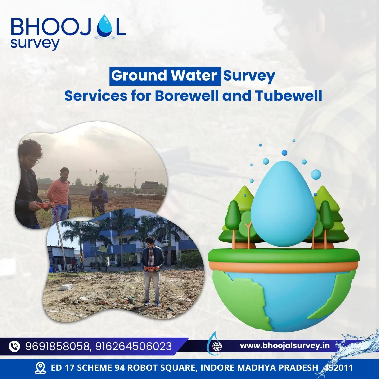
A professional groundwater hydrogeology survey.
A groundwater hydrogeology survey is a systematic scientific investigation that identifies, analyses, and maps underground water resources beneath the earth's surface. It combines geological field analysis, geophysical resistivity testing, aquifer mapping, and hydrogeological investigation to locate optimal groundwater zones with precision and accuracy.
For farmers, developers, industries, mining companies, and government departments across India, understanding where groundwater exists — and how reliably it can be accessed — directly impacts project success, operational efficiency, and long-term water security.
Without a proper groundwater hydrogeology survey, borewell drilling becomes guesswork. A scientific approach significantly reduces dry borewell risk, saves drilling costs, and enables sustainable groundwater management.
What is a Groundwater Hydrogeology Survey?
A groundwater hydrogeology survey is a multi-disciplinary investigation combining surface geology, geophysical analysis, and hydrogeological interpretation to understand how water moves through and is stored within subsurface rock and soil formations.
Groundwater naturally occurs in aquifer systems — permeable underground formations that store and transmit water. These aquifers exist in fractured rock, alluvial sediments, weathered zones, or consolidated geological formations. Without scientific investigation, the depth, yield potential, and water quality of these aquifers remain unknown.
A hydrogeological investigation maps these aquifer systems scientifically, helping water resource planners and project engineers make informed decisions about groundwater exploration and extraction.
Key components of a groundwater hydrogeology survey include:
1. Hydrogeological terrain analysis and geological mapping
2. Electrical resistivity survey for subsurface profiling
3. Aquifer identification and depth estimation
4. Groundwater recharge analysis and sustainability assessment
5. Scientific groundwater resource assessment and reporting
Why is a Groundwater Hydrogeology Survey Important?
Groundwater is a critical natural resource across India — for agriculture, industry, municipalities, and rural water supply. However, unscientific groundwater exploration leads to wasted investment, failed borewells, and unsustainable water use.
A professional groundwater hydrogeology survey delivers these key advantages:
1. Accurate Groundwater Detection: Pinpoints precise borewell locations with scientific confidence.
2. Better Borewell Success Rate: Reduces dry borewell risk significantly by identifying high-yield aquifer zones.
3. Sustainable Groundwater Management: Supports long-term water planning by understanding recharge and extraction balance.
4. Cost Efficiency: Saves drilling costs by avoiding unproductive zones before breaking ground.
5. Scientific Planning: Provides reliable data for irrigation projects, industrial water systems, and infrastructure development.
For agricultural landowners and borewell contractors across India, these advantages translate directly into project success and reduced operational risk.
Methods Used in Groundwater Hydrogeology Survey
Bhoojal Survey employs advanced scientific methods that combine field investigation with modern geophysical technology to deliver accurate groundwater investigation services.
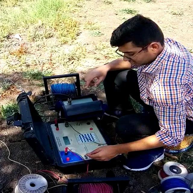
1. Electrical Resistivity Survey: The most widely used geophysical technique for groundwater detection. This method measures subsurface electrical resistance to differentiate between water-bearing and dry rock formations, producing detailed subsurface resistivity profiles.
2. Hydrogeological Investigation: Comprehensive field analysis of geological structures, rock formations, drainage patterns, lineaments, and soil types to understand groundwater occurrence and flow behaviour.
3. Geological Terrain Analysis: Systematic study of surface geology, topography, and structural features to identify areas with high groundwater recharge potential.
4. GIS and Satellite Groundwater Mapping: Remote sensing and geographic information system (GIS) analysis enables large-area groundwater potential mapping by integrating satellite data with field investigation results.
5. Aquifer Interpretation: Scientific interpretation of resistivity and geological data to identify aquifer depth, thickness, and yield potential, forming the foundation of accurate borewell site selection.
Bhoojal Survey's field teams conduct hydrogeological surveys using advanced instruments including the SSRMPATS Instrument, GER DETECT, and PQWT at site for open well and borewell location identification — ensuring the highest accuracy in groundwater detection.
These advanced groundwater and geophysical survey solutions, combined with scientific groundwater investigation and analysis capabilities, position Bhoojal Survey as a leading hydrogeology consultancy services provider across India.
Applications of Groundwater Hydrogeology Survey
A groundwater hydrogeology survey supports a wide range of project types and industries. Key application areas include:
1. Agricultural Irrigation Projects: Identifying reliable groundwater sources for irrigation borewells, canal recharge, and farm water planning.
2. Industrial Groundwater Systems: Supporting industrial water supply planning for manufacturing plants, food processing units, and chemical industries.
3. Infrastructure and Construction: Groundwater feasibility surveys for highways, bridges, tunnels, and large civil infrastructure projects.
4. Mining Projects: Groundwater potential assessment to manage dewatering requirements and underground water inflows in mining operations.
5. Government Water Resource Planning: Supporting national and state water supply schemes, watershed development, and aquifer recharge projects.
6. Real Estate and Township Developments: Groundwater mapping for residential and commercial township projects requiring reliable water supply systems.
Why Choose Bhoojal Survey for Groundwater Hydrogeology Survey?
Bhoojal Survey is a trusted name in professional groundwater investigation consultancy across India. With experienced hydrogeologists, advanced geophysical survey instruments, and a proven track record across agricultural, industrial, and infrastructure projects, we deliver results that project teams can rely on.
What sets Bhoojal Survey apart:
1. Qualified and experienced hydrogeologists and geophysical survey experts
2. Advanced instruments — SSRMPATS, GER DETECT, PQWT — for accurate aquifer mapping
3. Comprehensive scientific groundwater investigation and analysis at every site
4. Detailed professional technical reports with clear borewell recommendations
5. Pan-India groundwater survey services covering diverse geological terrains
6. Customised groundwater exploration solutions for agriculture, industry, and infrastructure
7. Strong domain expertise in groundwater recharge analysis and aquifer analysis services
Whether you need a groundwater feasibility survey for a new borewell, an aquifer mapping survey for an irrigation project, or a complete hydrogeological investigation for an industrial facility, Bhoojal Survey delivers accurate, reliable, and cost-effective solutions.
Conclusion
A groundwater hydrogeology survey is not an optional step — it is the scientific foundation of every successful groundwater project. From identifying productive aquifer zones to determining sustainable extraction rates, scientific groundwater investigation protects your investment and ensures long-term water security.
Bhoojal Survey brings the expertise, technology, and professional rigor required for accurate groundwater resource assessment — across every geological terrain and every sector in India.
■ Contact Bhoojal Survey today for a professional groundwater hydrogeology survey consultation.
Frequently Asked Questions (FAQ)
1. What is a groundwater hydrogeology survey?
A groundwater hydrogeology survey is a scientific investigation that uses geological analysis, geophysical resistivity testing, and aquifer mapping techniques to locate, assess, and map underground water resources. It helps determine the best borewell locations, aquifer depth, and groundwater yield potential before drilling begins.
2. Why is a hydrogeological investigation important before borewell drilling?
A hydrogeological investigation identifies productive groundwater zones scientifically, significantly reducing the risk of dry borewells. It ensures that drilling is targeted at high-yield aquifer formations, saving time, money, and effort — particularly important for agricultural and industrial projects across India.
3. Which methods are used for a groundwater hydrogeology survey?
The primary methods include electrical resistivity survey, hydrogeological terrain analysis, GIS-based aquifer mapping, geological field investigation, and scientific aquifer interpretation. Bhoojal Survey uses advanced instruments such as the SSRMPATS Instrument, GER DETECT, and PQWT for accurate subsurface groundwater detection.
4. How accurate is a resistivity survey for groundwater detection?
A resistivity survey for groundwater is highly accurate when conducted by experienced hydrogeologists using calibrated instruments. When combined with geological terrain analysis and hydrogeological interpretation, it provides reliable aquifer depth and yield estimates, significantly improving borewell success rates across different geological terrains.
5. Which industries and sectors require a groundwater hydrogeology survey in India?
Groundwater hydrogeology surveys are essential for agriculture and irrigation projects, industrial water supply systems, mining and construction projects, real estate and township developments, government water resource schemes, and infrastructure development. Any project requiring reliable groundwater access benefits from a professional groundwater investigation.