Understanding Groundwater Surveys
A Groundwater survey is a methodical scientific process designed to locate, evaluate, and map underground water reserves. Using a combination of hydrogeological analysis and geophysical instrumentation, the survey examines subsurface rock formations, water-bearing layers, fractured zones, and aquifer systems to determine where groundwater exists and at what depth it can be accessed.
Unlike conventional or traditional water-finding approaches, a modern scientific groundwater survey relies on electrical resistivity analysis, Vertical Electrical Sounding (VES), and topographic mapping to generate data-driven recommendations for borewell placement and water source identification — removing all guesswork from the process.
At a Glance: A groundwater survey uses advanced geophysical techniques and hydrogeological expertise to determine the presence, depth, estimated yield, and quality of underground water — transforming borewell site selection from intuition into precision science.
Why a Groundwater Survey Matters
Investing in a professional groundwater survey offers four fundamental benefits for any water-dependent project or development:
Eliminate Dry Borewells — Pinpoint water-bearing formations before any drilling begins, dramatically reducing the risk of unsuccessful boreholes and financial loss.
Cut Drilling Expenses — Accurate site selection minimizes unnecessary drilling depth and overall expenditure, delivering significant cost savings.
Support Long-Term Water Management — Scientific subsurface data enables effective planning for aquifer recharge and sustainable water usage over time.
Enable Smarter Infrastructure Decisions — Roads, buildings, dams, and industrial facilities all require reliable subsurface information, making groundwater surveys a critical part of any large-scale project.
Scientific Techniques Employed in Groundwater Surveys
Bhoojal Survey applies a rigorous combination of proven geophysical and hydrogeological methods to deliver dependable subsurface assessments and accurate borewell recommendations.
Electrical Resistivity Survey
This method measures the electrical resistance of subsurface materials to detect water-saturated zones, geological boundaries, and aquifer depth. Effective in both hard-rock and alluvial terrain, electrical resistivity surveying is the most widely adopted geophysical approach for groundwater detection across India.
Hydrogeological Survey
A hydrogeological survey involves in-depth geological investigation, surface terrain analysis, fracture zone mapping, and aquifer evaluation across the target area. It forms the scientific backbone of any comprehensive groundwater exploration program.
VES Survey (Vertical Electrical Sounding)
VES progressively expands electrode spacing to generate a subsurface resistivity profile at increasing depths. This technique enables precise estimation of aquifer depth and layer structure, making it indispensable for planning appropriate borewell drilling depth.
Geophysical Survey
This approach integrates subsurface imaging and geological mapping to visualize water-bearing formations, rock composition, and structural geology. It supports large-scale groundwater resource mapping and comprehensive site assessment.
The Science Behind Groundwater Detection
Scientific groundwater detection is based on the principle of resistivity contrast — different subsurface materials conduct electricity differently. Water-saturated formations exhibit low resistivity, while dry rock, hard clay, and impermeable layers display high resistivity values.
By systematically mapping these contrasts through VES and electrical resistivity surveys, trained hydrogeologists can identify aquifer zones, fracture systems, and optimal borewell locations with a high degree of accuracy.
Key Parameters Analyzed:
- Electrical resistivity values of subsurface layers
- Aquifer depth and thickness estimates
- Fracture zone identification and analysis
- Water table depth interpretation
- Subsurface geological formation types
- Multi-layer subsurface profiling
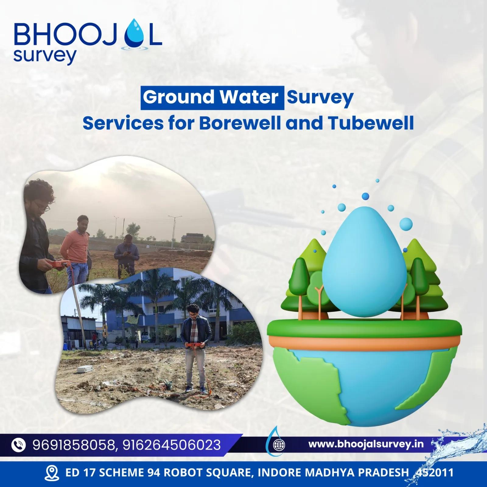
Every field investigation uses the SSRMPATS, GER DETECT, and PQWT systems for open well and borewell location assessment — providing a full-spectrum geophysical and scientific survey solution.
The Groundwater Survey Process — Step by Step
- Site Inspection — Initial field visit to assess terrain characteristics, land use patterns, and surface water conditions.
- Geological Assessment — Examination of rock types, soil profiles, fracture systems, and regional geological structures.
- Survey Design — Selection of appropriate geophysical methods, electrode configurations, and measurement point layouts.
- Resistivity Testing — Deployment of electrical resistivity and VES equipment across designated survey points in the field.
- Data Collection — Systematic recording of subsurface resistivity readings at all measurement locations.
- Data Interpretation — Computer-assisted analysis of resistivity curves and subsurface layer profiles.
- Aquifer Mapping — Delineation of water-bearing formations, aquifer boundaries, and groundwater flow directions.
- Borewell Site Marking — GPS-tagged identification of optimal drilling locations based on survey findings.
- Depth Estimation — Calculation of recommended borewell depth derived from aquifer analysis results.
- Technical Report Delivery — Comprehensive hydrogeological report with survey findings, maps, and site-specific drilling recommendations.
Applications Across Industries
Groundwater surveys serve a wide range of sectors and project types:
- Agricultural and irrigation planning
- Borewell site selection for residential and commercial use
- Highway and infrastructure development projects
- Industrial water supply development
- Mining and underground tunnelling investigations
- Real estate and township development
- Government and municipal water supply schemes
- Construction site assessments
- Environmental and ecological research
- Dam, reservoir, and canal planning
Factors That Influence Groundwater Availability
Several geological, environmental, and climatic variables determine how much groundwater is accessible at any given location:
Rock Type and Geology — Crystalline hard rocks yield groundwater primarily through fractures, while sedimentary formations store water within porous layers.
Rainfall and Recharge Patterns — Seasonal precipitation levels directly govern aquifer replenishment and fluctuations in the water table.
Soil Permeability — More permeable soils allow faster water infiltration and support deeper groundwater accumulation.
Fracture Zones — Naturally fractured rock zones are primary targets for high-yield borewell sites.
Terrain and Topography — Flat or gently sloping land retains more water; steep terrain accelerates surface runoff and reduces infiltration.
Seasonal Variation — Water table levels shift with the seasons, and survey timing can influence depth recommendations.
Key Benefits of a Professional Groundwater Survey
Higher Borewell Success Rates — Scientifically selected drilling sites yield water in over 90% of cases compared to traditional methods.
Reduced Overall Drilling Costs — Fewer failed attempts translate into significant savings on total project expenditure.
Precise Aquifer Mapping — Clients receive accurate data on depth, thickness, and yield potential of water-bearing formations.
Sustainable Water Resource Planning — Scientific findings support informed decisions for long-term water management and aquifer recharge strategies.
Reduced Project Risk — A detailed professional report provides documented evidence for decision-making and protects clients from costly uninformed drilling.
Why Choose Bhoojal Survey
Bhoojal Survey is a trusted name in scientific groundwater investigation across India. Our multidisciplinary team of hydrogeologists, geophysicists, and water resource engineers delivers precision, reliability, and thorough professional reporting on every project.
Experienced Hydrogeologists — Certified professionals with 15+ years of expertise in groundwater exploration and borewell site selection across diverse terrain.
Advanced Field Instruments — SSRMPATS, GER DETECT, PQWT, and calibrated digital resistivity meters for reliable and accurate field surveys.
Pan-India Service Coverage — Survey services available across all states for agricultural, industrial, and government water projects.
Comprehensive Technical Reports — Detailed hydrogeological reports with GPS-marked borewell sites and recommended drilling depths.
Structured Scientific Methodology — Every survey follows a proven, field-tested hydrogeological investigation protocol from site inspection through final reporting.
Book a Site Survey | Schedule Your Water Survey | Consult Our Experts
Frequently Asked Questions
Q: What exactly is a groundwater survey and when is it necessary? A groundwater survey is a scientific investigation that uses geophysical methods to locate underground water sources and identify the most suitable borewell sites. It is recommended whenever reliable water access is required — to prevent dry borewells, minimize drilling costs, and ensure a sustainable long-term water supply.
Q: How accurate is an electrical resistivity groundwater survey? When conducted by trained hydrogeologists using properly calibrated equipment, electrical resistivity surveys are highly reliable. Across most terrain types, scientific surveys achieve borewell success rates between 85% and 95% — far superior to traditional or unscientific approaches.
Q: How is VES different from a standard electrical resistivity survey? VES (Vertical Electrical Sounding) is a specialized form of electrical resistivity survey in which electrode spacing is gradually increased to measure resistivity at progressively greater depths. It is specifically used to profile aquifer layers and determine the appropriate borewell drilling depth.
Q: How deep can groundwater surveys detect water? Using advanced geophysical instruments, Bhoojal Survey can detect groundwater and aquifer zones at depths ranging from approximately 20 meters to over 300 meters, depending on the instrument type, geological conditions, and chosen survey methodology.
Q: What is aquifer mapping and why does it matter? Aquifer mapping is the process of identifying, delineating, and documenting the location, depth, thickness, and yield potential of water-bearing geological formations. It is essential for planning borewells, designing irrigation systems, and developing reliable water supply infrastructure.
Q: How long does a groundwater survey take? A standard single-site survey typically requires one to two days of fieldwork, followed by two to three days for data analysis and report preparation. Larger industrial or infrastructure projects may require a week or more depending on the size and complexity of the area.
Q: Is a groundwater survey required before drilling? While legal requirements vary by region, a professional groundwater survey is strongly recommended prior to any borewell drilling. It substantially improves success rates and is generally mandatory for government infrastructure and industrial water supply projects.
Q: What instruments does Bhoojal Survey use for groundwater detection? Bhoojal Survey uses the SSRMPATS system, GER DETECT, PQWT multi-layer water detector, digital resistivity meters, GPS survey units, and specialized hydrogeological software for precise subsurface profiling and borewell site recommendation.
Q: What is the difference between a hydrogeological survey and a geophysical survey? A hydrogeological survey involves evaluating geological formations, terrain characteristics, and aquifer conditions through field observation and analysis. A geophysical survey uses specialized instruments to measure physical subsurface properties such as electrical resistivity. Both methods are used in combination to produce the most accurate groundwater assessment possible.
Q: Can a groundwater survey guarantee water will be found? No scientific method can offer an absolute guarantee, as groundwater presence ultimately depends on natural geological conditions beyond human control. However, a professional survey conducted by Bhoojal Survey significantly improves borewell success probability to the 85–95% range — far above any unscientific alternative.
Bhoojal Survey — Precision Groundwater Investigation Across India