Geological Survey for Borewell:
Every year, thousands of borewells across India are drilled in the wrong location — hitting dry rock, striking poor-quality water, or producing yields too low to be useful. The financial loss is significant. The frustration is worse. And nearly every such failure could have been prevented with one decision made before drilling began: commissioning a proper geological survey for borewell.
Science, not instinct, is what determines whether a borewell succeeds. A structured geological survey for borewell maps what is underground, identifies where water accumulates, and tells a driller exactly where to start — and how deep to go.
What is a Geological Survey for Borewell?
A geological survey for borewell is a pre-drilling investigation that studies the physical and structural characteristics of the earth at and below a site to locate productive groundwater zones suitable for borewell development.
It is not simply walking across a field with a tool. It is a disciplined, multi-method scientific process that reads the language of rocks, soils, fractures, and formations to answer a precise question: where is water, how deep is it, and how much of it can be reliably extracted?
The geology of a site controls everything about groundwater — whether water is present at all, which rock formation holds it, how freely it flows, and whether it is chemically suitable for drinking, irrigation, or industrial use. Ignoring geology before drilling is the single most avoidable cause of borewell failure across India.
Why a Geological Survey Dramatically Improves Borewell Success
The direct benefits of a pre-drilling geological investigation are clear and proven:
- Targets the Right Formation: India's geology is extraordinarily varied. Basalt, granite, limestone, sandstone, and alluvial deposits all behave differently. A geological survey identifies which formation underlies a site and where its most productive zones lie.
- Eliminates Blind Drilling: Without subsurface data, drillers rely on past experience or local knowledge — neither of which accounts for site-specific geological variability. A survey removes that uncertainty entirely.
- Reduces Project Cost: A precisely located borewell drilled to the right depth costs far less than a failed bore followed by a second attempt somewhere else on the same property.
- Protects Long-Term Water Supply: Scientifically sited borewells draw from aquifers that can sustain extraction across seasons — critical for farms, factories, and communities that cannot afford supply interruptions.
- Identifies Water Quality Risks Early: Certain geological formations are associated with elevated fluoride, iron, or salinity. A geological survey flags these risks before drilling, allowing informed decisions about aquifer selection.
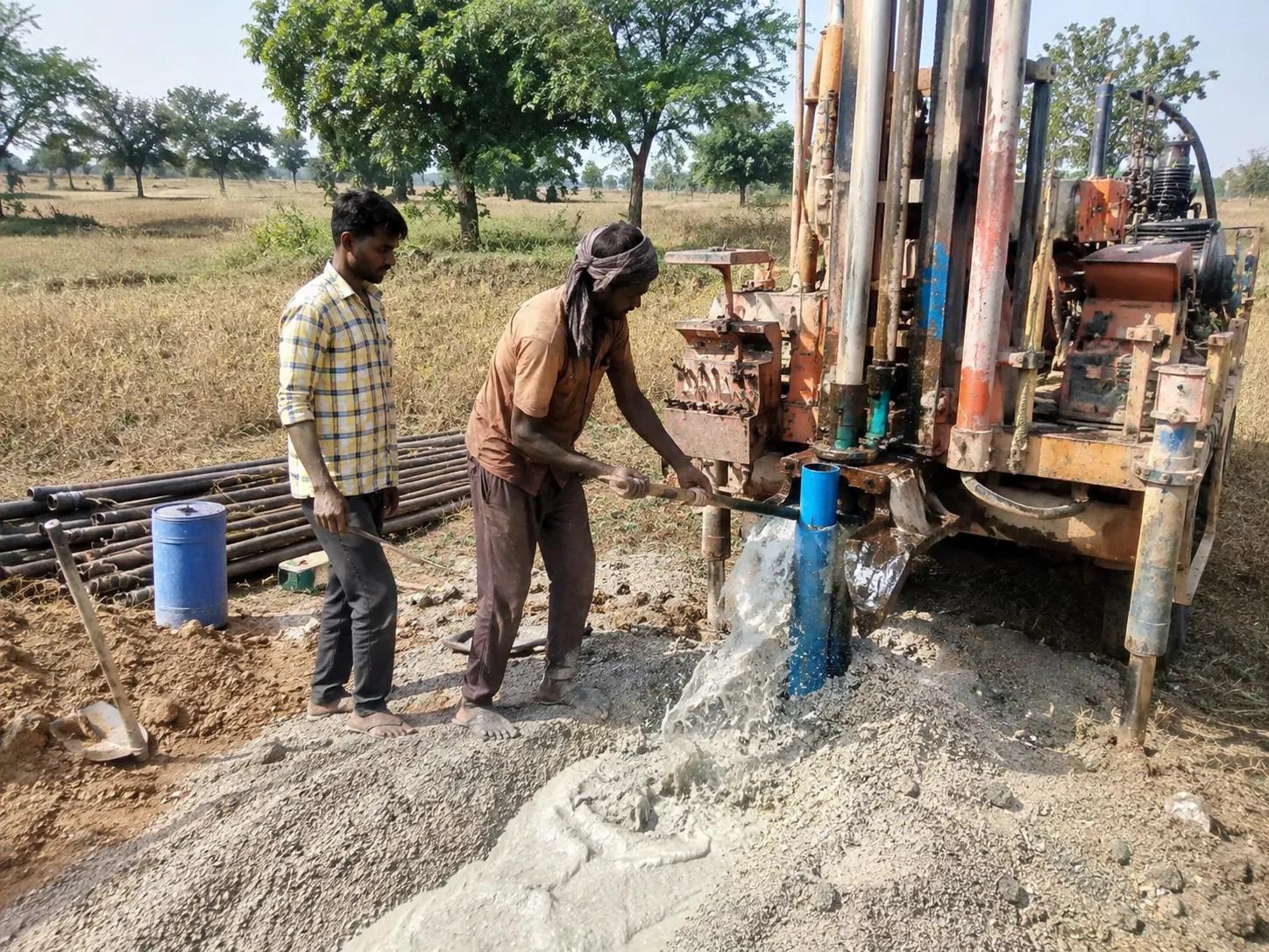
Field Methods Used in a Borewell Geological Survey
No single technique reveals the complete picture underground. A reliable geological survey for borewell combines several complementary methods:
Surface Geological Reconnaissance: A trained geologist walks the site examining exposed rocks, soil texture, topographic position, surface drainage behaviour, and visible fracture patterns — building a preliminary model of what lies beneath.
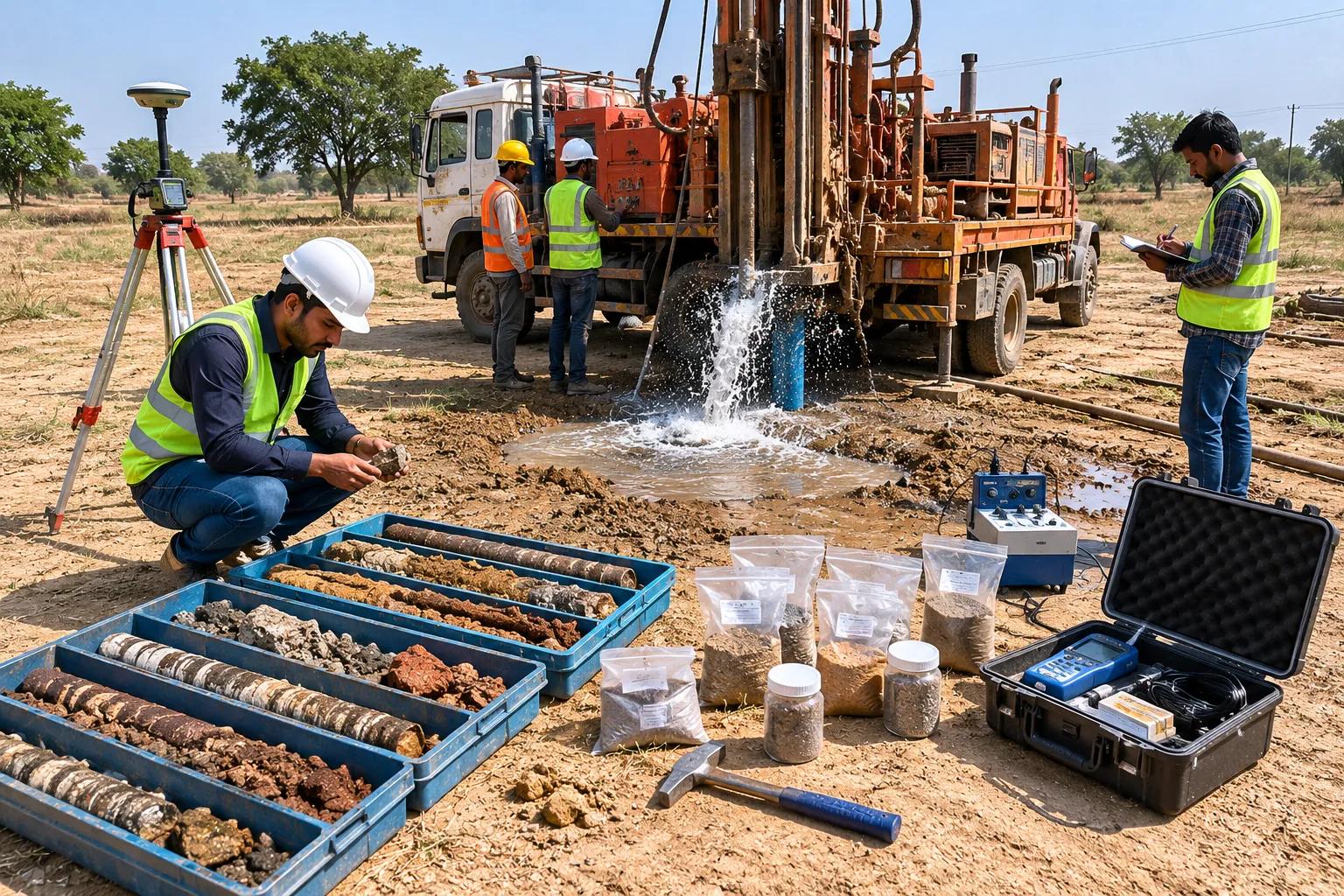
Electrical Resistivity Profiling: By passing electrical current into the ground and measuring resistance at different depths, this geophysical method reveals subsurface layers, water-saturated zones, and aquifer boundaries with remarkable clarity — all without drilling a single hole.
Lineament and Fracture Zone Mapping: In hard rock terrains — which cover a vast portion of peninsular and central India — groundwater concentrates along fractures and faults. Satellite imagery analysis identifies these lineaments precisely, directing the borewell exactly to where fracture-controlled groundwater is most accessible.
Hydrogeological Data Review: Regional water level records, existing well logs, seasonal fluctuation data, and CGWB assessment reports for the area are integrated into the site investigation to calibrate field findings against proven local groundwater behaviour.
Integrated Aquifer Interpretation: All data streams are synthesised into a coherent subsurface model with a specific borewell location recommendation, target depth, and expected yield range.
At Bhoojal Survey, our hydrogeologists conduct surveys using SSRMPATS Instruments, GER DETECT, and PQWT at site for accurate open well and borewell location identification. These advanced groundwater and geophysical survey solutions, combined with scientific groundwater investigation and analysis, ensure every recommendation we make is grounded in real subsurface evidence — not assumption.
Who Needs a Geological Survey for Borewell in India?
The answer is simple: anyone who plans to drill. But the applications span a wide range of sectors:
Farmers and Irrigation Projects: Agricultural groundwater demand in India is immense. A failed borewell at the start of a planting season causes crop losses that no amount of compensation recovers. Scientific borewell surveys protect farming investments and seasonal water security.
Industrial and Manufacturing Units: A factory with unreliable water supply cannot operate at capacity. Industrial clients need geological surveys that guarantee both yield adequacy and water quality suitability for their specific process requirements.
Real Estate and Housing Developments: Residential colonies and apartment projects in peri-urban areas drill multiple borewells. A geological survey optimises placement across the site, prevents interference between wells, and ensures the aquifer system is not overloaded.
Government Rural Water Supply Projects: Under Jal Jeevan Mission and state rural water schemes, maximising borewell success rates directly determines how many households get reliable clean water. Every failed bore is a community left without access.
Mining and Construction Projects: Subsurface water management during construction or mining requires detailed knowledge of aquifer locations, depths, and hydraulic connectivity — all delivered through systematic geological survey.
Why Bhoojal Survey is the Right Choice for Your Borewell Geological Survey
Bhoojal Survey brings together field-proven expertise, advanced instrumentation, and a rigorous scientific methodology that sets our borewell surveys apart:
- Qualified geologists and hydrogeologists with hands-on experience across alluvial, basaltic, granitic, and sedimentary terrain types across India
- State-of-the-art geophysical equipment delivering high-resolution subsurface data in diverse geological conditions
- Site-specific analysis — no generic reports, no copy-paste recommendations
- Complete investigation package from field survey to final report with precise location marking and depth guidance
- Pan-India operations covering agricultural belts, industrial corridors, tribal areas, and urban expansion zones
- Transparent, jargon-free reporting that clients and drilling contractors can actually use on the ground
Conclusion
A geological survey for borewell is not an added expense — it is the investment that makes every other borewell expenditure worthwhile. It is the difference between drilling with confidence and drilling with doubt.
India's groundwater future depends on every borewell being sited scientifically, drilled efficiently, and managed sustainably. Bhoojal Survey is committed to making that happen — one accurate, field-verified geological survey at a time.
📞 Contact Bhoojal Survey today for expert geological survey for borewell services anywhere across India — and make your next borewell your most successful one.
Frequently Asked Questions (FAQs)
Q1. What is a geological survey for borewell and what does it involve? A geological survey for borewell is a pre-drilling scientific investigation that studies subsurface rock formations, soil profiles, fracture zones, and aquifer characteristics to identify the best drilling location, target depth, and expected yield. It typically involves field geological mapping, electrical resistivity surveys, lineament analysis, and hydrogeological data review.
Q2. Why is a geological survey necessary before drilling a borewell? Groundwater does not occur uniformly underground — it concentrates in specific geological formations and fracture zones that vary significantly even across short distances. A geological survey identifies exactly where these productive zones are, preventing costly dry bores, low-yield failures, and poor water quality outcomes that result from uninformed drilling.
Q3. Which instruments are used for geological borewell surveys in India? Professional borewell geological surveys use electrical resistivity meters, ground penetrating instruments such as PQWT and GER DETECT, SSRMPATS instruments for subsurface profiling, and GIS and satellite tools for lineament and fracture zone mapping. The combination of these instruments provides a comprehensive picture of subsurface groundwater conditions.
Q4. How much does a geological survey for borewell cost in India? Survey costs vary depending on site size, terrain complexity, number of proposed borewell locations, and the scope of investigation required. However, the cost of a professional geological survey is always a fraction of the expense of a failed borewell and repeat drilling. Contact Bhoojal Survey for a project-specific quotation.
Q5. How soon can drilling begin after a geological borewell survey? Field investigation is typically completed in one to two days. The final survey report with borewell location marking, depth recommendations, and groundwater potential assessment is usually ready within five to seven working days. Drilling can begin immediately upon report delivery and site marking by our survey team.