Borewell Investigation Services
Dry borewell problems are among the most common and financially damaging setbacks in groundwater development projects across India. A borewell drilled at the wrong location — or to the wrong depth — delivers no water, wastes the entire drilling investment, and leaves the project without its planned water source. Every one of these failures is preventable with proper borewell investigation conducted before the drilling rig is mobilised.
Borewell investigation is the scientific process of identifying the optimal location, target depth, and expected yield of a borewell before any drilling begins. It combines hydrogeological field analysis, geophysical resistivity surveys, terrain assessment, and aquifer mapping to build a precise picture of subsurface groundwater conditions at your site — eliminating the guesswork that causes borewell failure.
Bhoojal Survey provides professional borewell investigation services across India, combining advanced field instruments with experienced hydrogeological expertise to deliver accurate, reliable groundwater detection results for agricultural, industrial, infrastructure, and commercial projects.
What is Borewell Investigation
Borewell investigation is a pre-drilling scientific assessment that uses geophysical, hydrogeological, and remote sensing methods to identify the subsurface groundwater conditions at a project site and determine the most productive location and depth for borewell drilling. It is the critical step between owning a site and successfully tapping its groundwater resource.
In India's diverse geological environments — from hard rock Deccan Trap basalt in Central India to
Himalayan alluvial plains, from crystalline granite in Peninsular India to sedimentary aquifers in the Indo-Gangetic belt — groundwater occurrence is highly variable. The methods and depth targets for successful borewell drilling differ significantly across these terrains, making site-specific scientific investigation essential for every project.
A professional borewell investigation delivers:
- Precise borewell location coordinates — identified from geophysical survey data
- Recommended target drilling depth — based on aquifer zone interpretation
- Expected groundwater yield estimate — derived from resistivity and hydrogeological analysis
- Subsurface geological profile — showing rock type, weathering, and aquifer layers
- Borewell casing design recommendation — matched to the identified aquifer zone
- Risk assessment — identifying geological factors that may affect drilling success
Why Borewell Investigation is Important
Across India, a substantial proportion of borewells drilled without prior scientific investigation either fail completely or produce yields too low for their intended purpose. This is not a random outcome — it is a predictable consequence of drilling without data. Borewell investigation converts a high-risk activity into a scientifically guided process with consistently better outcomes.
- Reducing Dry Borewell Risk: In hard rock geology, productive aquifer fracture zones can be just a few metres wide and separated by large volumes of dry rock. Without geophysical survey data identifying these zones precisely, even experienced drillers frequently miss them. Scientific investigation reduces dry borewell rates dramatically.
- Accurate Groundwater Identification: Electrical resistivity surveys map subsurface formations and distinguish between water-bearing fractured zones, dry compact rock, and clay layers with far greater accuracy than any surface observation method — providing data that guesswork cannot replicate.
- Better Borewell Drilling Success Rate: Sites investigated by Bhoojal Survey before drilling consistently achieve higher success rates, better yields, and more appropriate depths than uninvestigated sites — protecting the drilling investment and achieving the water supply objectives.
- Sustainable Groundwater Management: Understanding the aquifer's depth, extent, and hydraulic characteristics enables informed decisions about sustainable extraction rates, pump specifications, and water storage design — protecting the long-term productivity of the borewell.
- Cost Savings in Drilling Projects: The cost of a professional borewell investigation is a fraction of total drilling expenditure. A single avoided dry borewell saves multiple times the investigation cost — making scientific site assessment the most cost-effective investment in any borewell project.
Methods Used in Borewell Investigation
Bhoojal Survey uses a scientifically integrated multi-method approach to borewell investigation — combining geophysical measurement, hydrogeological analysis, geological mapping, and remote sensing data to build the most accurate possible picture of subsurface groundwater conditions at your site.
- Electrical Resistivity Survey:
The primary geophysical method for groundwater detection and borewell site selection. Four-electrode configurations (Wenner, Schlumberger) measure subsurface electrical resistivity at different depths — distinguishing productive water-bearing fractured zones from dry compact rock and clay-rich weathered layers. Resistivity depth profiles are processed to identify optimal borewell locations and target drilling depths.
- Hydrogeological Investigation:
Field assessment of regional geology, groundwater flow systems, drainage patterns, topographic position, and structural geology features that control groundwater occurrence. In hard rock terrain, fracture systems, lineaments, and dyke contacts that guide groundwater flow are systematically mapped. In alluvial terrain, aquifer depth, thickness, and grain-size data are assessed.
- Geological and Terrain Analysis:
Surface rock type, weathering profile, joint orientation, fracture density, and landform characteristics are mapped to characterise the relationship between surface geology and subsurface aquifer conditions. In Deccan Trap and crystalline rock terrains, this analysis directly informs resistivity survey design and interpretation.
- Satellite and GIS-Based Groundwater Mapping:
Multi-spectral satellite imagery and GIS analysis identify regional geological lineaments, fracture zones, surface drainage anomalies, and groundwater-favourable structural features. Remote sensing interpretation supports field investigation planning and provides regional groundwater context for site-specific survey results.
- Aquifer Interpretation Techniques:
All field data — resistivity profiles, geological observations, hydrogeological analysis, and remote sensing interpretation — are integrated by experienced hydrogeologists to produce a subsurface aquifer model for the survey site, forming the scientific basis for borewell location and depth recommendations.
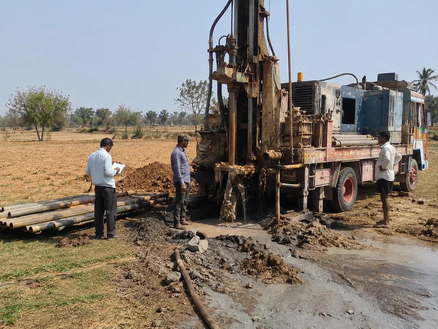
Bhoojal Survey conducts hydrogeological survey using SSRMPATS Instrument, GER DETECT, and PQWT at site for open well / borewell location — delivering advanced groundwater and geophysical survey solutions with scientific groundwater investigation and resistivity analysis.
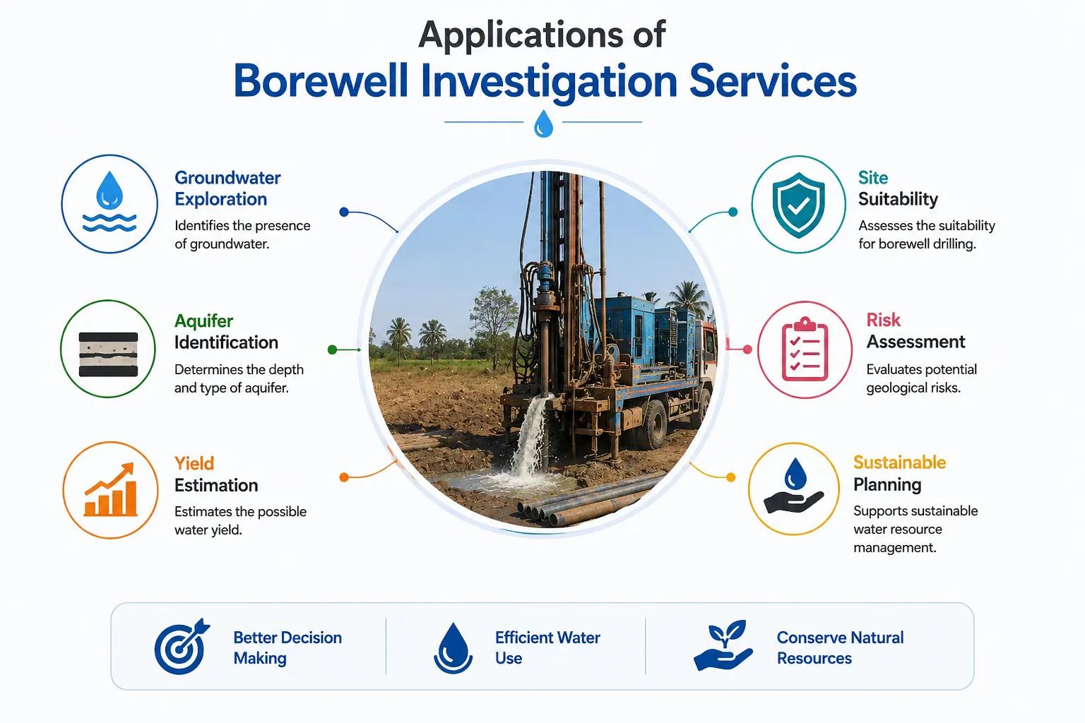
Applications of Borewell Investigation Services
Professional borewell investigation is essential across every sector that depends on groundwater for operations, irrigation, or public supply. Bhoojal Survey has delivered borewell investigation and groundwater detection services for the following application areas across India:
• Agricultural Irrigation Borewells
• Commercial & Institutional Water Supply
• Industrial Groundwater Supply Systems
• Government Rural Water Supply Schemes
• Infrastructure & Highway Projects
• Residential Townships & Developers
• Mining Area Water Investigation
• Groundwater Recharge Site Assessment
For every application, Bhoojal Survey delivers a complete borewell investigation report including field survey data, subsurface aquifer interpretation, recommended borewell location and depth, expected yield estimate, and drilling guidelines — prepared to professional hydrogeological reporting standards.
Why Choose Bhoojal Survey for Borewell Investigation Services
Bhoojal Survey is a trusted professional groundwater investigation consultancy with extensive experience in borewell investigation across India's diverse geological and hydrogeological environments. Our team of qualified hydrogeologists and geophysical survey experts brings both scientific rigour and practical field experience to every investigation project.
- Experienced Hydrogeologists and Geophysical Experts: Our team has conducted borewell investigations across hard rock basalt, granite, gneiss, and alluvial aquifer environments throughout India — bringing local geological knowledge and technical expertise to every site investigation.
- Advanced Groundwater Survey Instruments: We deploy precision geophysical instruments including SSRMPATS, GER DETECT, and PQWT for accurate subsurface resistivity measurement and reliable aquifer zone identification.
- Accurate Aquifer Mapping and Groundwater Analysis: Every borewell investigation produces a detailed subsurface aquifer profile with specific borewell location coordinates, target depth, yield estimate, and casing design — backed by scientific field data, not guesswork.
- Fast Reporting and On-Site Technical Consultancy: Investigation reports are prepared promptly after field survey, enabling your borewell project to proceed to drilling without unnecessary delays.
- Pan-India Groundwater Survey Services: Our borewell investigation services cover all Indian states and geological terrains — from Himalayan foothills to peninsular hard rock, from alluvial plains to coastal formations.
- Customised Borewell Investigation Solutions: We design investigation programmes matched precisely to your site geology, project scale, water demand, and budget — whether for a single farm borewell or a multi-well industrial groundwater system.
Conclusion
A dry borewell is not bad luck — it is the predictable outcome of drilling without scientific investigation. Borewell investigation transforms the borewell project from a high-risk gamble into a data-driven process with a significantly higher probability of success. The investment in professional hydrogeological and geophysical investigation before drilling is the single most effective step any project developer, farmer, or industry can take to protect their borewell drilling investment.
Whether you are planning an irrigation borewell on your farm, designing a multi-well industrial water supply system, or developing a township water network, Bhoojal Survey's professional borewell investigation services give you the scientific groundwater intelligence your project needs to succeed.
Contact Bhoojal Survey for professional borewell investigation and groundwater survey services across India.
Frequently Asked Questions (FAQ)
1. What is borewell investigation and why is it necessary before drilling?
Borewell investigation is a pre-drilling scientific assessment using geophysical, hydrogeological, and remote sensing methods to identify subsurface groundwater conditions and determine the optimal borewell location and depth. It is necessary because groundwater in India's diverse geological environments — particularly hard rock terrains — is stored in narrow, localised fracture zones that cannot be identified by visual inspection or guesswork. Without investigation, drilling at an incorrect location or depth results in a dry or low-yield borewell, wasting the entire drilling investment.
2. Which method is most effective for borewell groundwater detection in India?
Electrical Resistivity Survey — specifically Vertical Electrical Sounding (VES) using Wenner or Schlumberger electrode configurations — is the most widely used and effective geophysical method for borewell groundwater detection in India. It measures subsurface resistivity at different depths to identify water-bearing fractured zones, weathered aquifer layers, and dry rock formations. Bhoojal Survey uses advanced instruments including SSRMPATS, GER DETECT, and PQWT for accurate resistivity measurement, combined with hydrogeological terrain analysis for comprehensive borewell site investigation.
3. How accurate is geophysical resistivity survey for borewell location?
When conducted by qualified hydrogeologists using calibrated instruments with proper field methodology, electrical resistivity surveys achieve significantly higher borewell success rates compared to uninvestigated drilling — particularly in hard rock terrain. The accuracy of resistivity survey interpretation depends on data quality, instrument calibration, geological complexity, and the hydrogeologist's experience with local geology. Bhoojal Survey combines rigorous field methodology with deep experience across Indian geological environments to deliver reliable, scientifically validated borewell location recommendations.
4. How long does a borewell investigation take and what report is provided?
A standard borewell investigation for a single location typically requires one field day for site reconnaissance, geophysical measurements, and initial data processing. The formal hydrogeological investigation report is delivered within 3–5 working days of field survey completion. The report includes the subsurface resistivity profile, aquifer zone interpretation, recommended borewell coordinates, target drilling depth, expected yield estimate, borewell casing design, and site-specific drilling guidelines.
5. What industries and project types require professional borewell investigation?
Professional borewell investigation is required for all projects where groundwater is a critical resource — including agricultural irrigation schemes, industrial water supply systems, mining area water management, infrastructure and construction project water supply, commercial and institutional developments, residential townships, government rural water supply schemes under Jal Jeevan Mission, and any groundwater extraction project requiring CGWA NOC or state groundwater authority approval where a hydrogeological investigation report is mandatory.