Flood 3D Model:
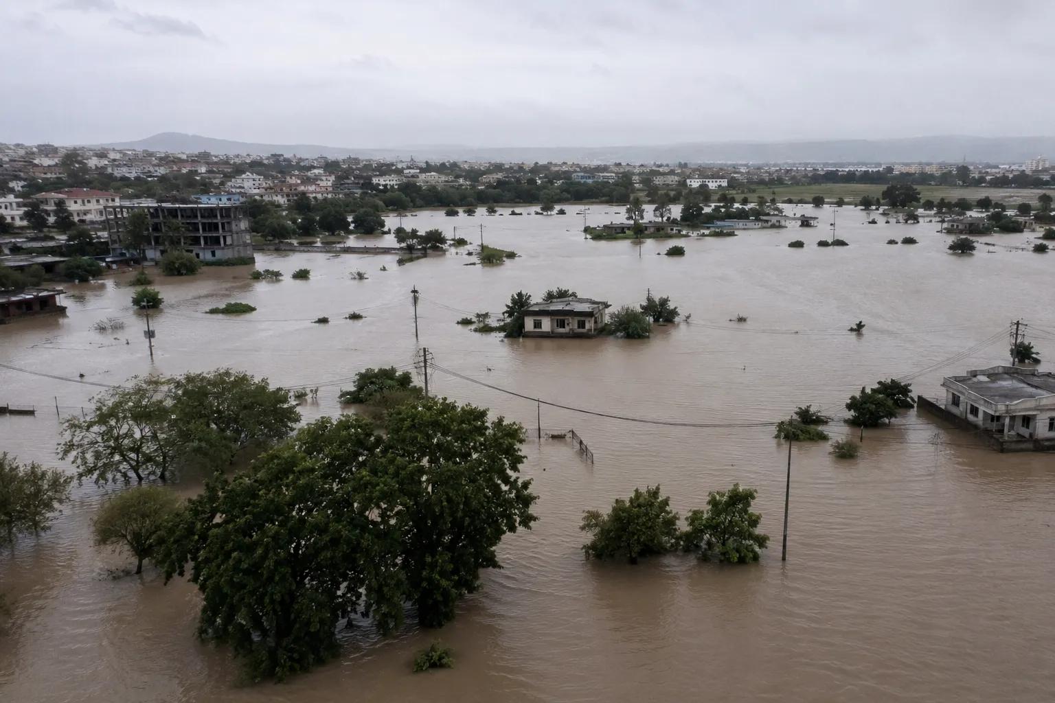
Floods are among the most destructive natural disasters affecting India every monsoon season. Accurate flood prediction, risk mapping, and infrastructure planning require more than basic data — they demand precise, visual, and scientifically validated analysis. A Flood 3D Model provides exactly that: a three-dimensional simulation of flood behaviour across real terrain, enabling engineers, planners, and disaster management agencies to make informed, life-saving decisions.
From river basin management to smart city planning, the Flood 3D Model has become an indispensable tool in modern hydrology and environmental consultancy.
What is a Flood 3D Model?
A Flood 3D Model is a digital, three-dimensional simulation that visualizes how floodwaters move, spread, and interact with the physical landscape during a flood event. It combines hydrological data, terrain elevation models, land use information, and hydraulic equations to replicate real-world flood scenarios with high spatial accuracy.
Unlike traditional 2D flood maps, a 3D flood simulation model provides depth, velocity, and flow direction data across every point of the study area. This allows analysts to see not just where flooding occurs, but how it progresses, how deep it gets, and how quickly it spreads — critical information for both flood forecasting systems and post-event analysis.
In modern hydrology, Flood 3D Models are built using Digital Elevation Models (DEMs), GIS flood mapping tools, remote sensing data, and advanced hydraulic modelling software such as HEC-RAS, MIKE FLOOD, or TUFLOW.
Benefits of Using Flood 3D Models
The advantages of 3D flood modelling over conventional methods are significant:
- Enhanced Flood Visualization: Stakeholders, government bodies, and communities can clearly understand flood extent and depth through realistic 3D flood visualization models, supporting faster and better decisions.
- Improved Flood Risk Assessment: Flood vulnerability assessment becomes more accurate when terrain interaction and flow dynamics are modelled in three dimensions.
- Accurate Flood Prediction: Flood 3D Models help simulate multiple rainfall scenarios, supporting reliable flood forecasting for early warning systems.
- Infrastructure Planning Support: Engineers designing bridges, highways, drainage networks, and urban flood barriers rely on floodplain modelling to assess risk and validate designs.
- Disaster Preparedness: Emergency response teams use flood hazard assessment outputs from 3D models to plan evacuation routes and resource deployment.
Technologies Used in Flood 3D Modelling
Building a reliable Flood 3D Model requires an integrated combination of advanced technologies:
GIS Flood Mapping: Geographic Information Systems process spatial data layers — land cover, drainage networks, soil types — to form the analytical base of every flood model.
Digital Terrain Models (DTM/DEM): High-resolution elevation data derived from LiDAR surveys, satellite imagery, or drone photogrammetry forms the three-dimensional terrain base upon which flood simulation runs.
Satellite and Remote Sensing Data: Satellite-derived flood inundation mapping provides real-time and historical flood extent data for model calibration and validation.
Hydraulic Modelling Software: Tools such as HEC-RAS 2D, MIKE FLOOD, and TUFLOW solve hydrodynamic equations across the terrain to simulate realistic flood behaviour.
Hydrological Field Investigation: Ground-truthing remains essential. At Bhoojal Survey, our field teams conduct hydrogeological surveys using SSRMPATS Instruments, GER DETECT, and PQWT at site for open well and borewell location identification. Combined with advanced hydrological and geospatial survey solutions, our scientific flood investigation and analysis ensures every model is grounded in verified field data.
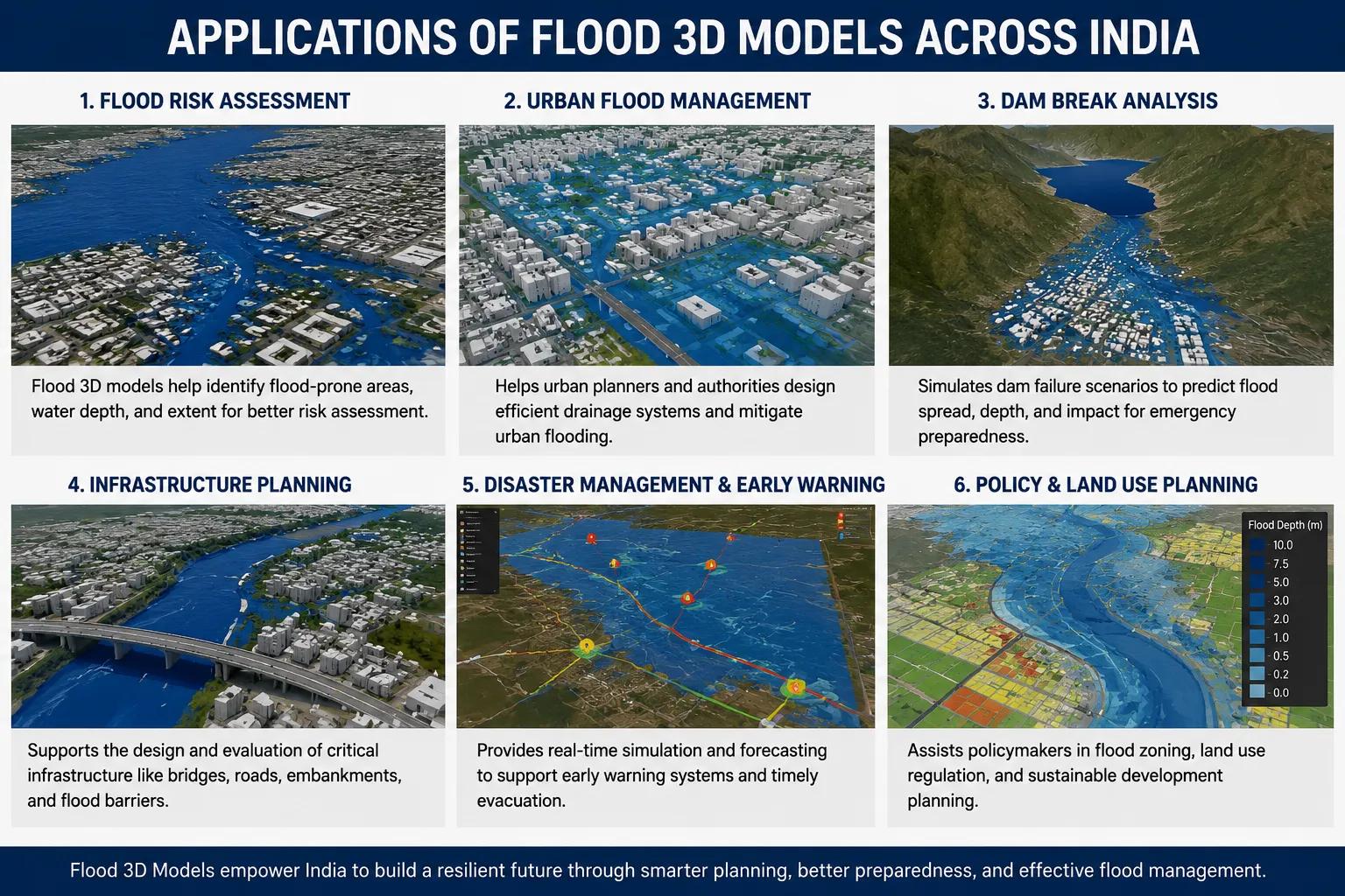
Applications of Flood 3D Models Across India
The practical applications of 3D flood modelling are wide-ranging and highly relevant across Indian infrastructure and environmental sectors:
- River Basin Projects: Watershed flood analysis and river flood simulation support integrated basin management plans for major Indian rivers.
- Smart City Planning: Urban drainage systems and stormwater management designs in smart cities depend on flood mitigation modelling for long-term resilience.
- Highway and Bridge Infrastructure: Road and bridge designers use hydraulic flood modelling to assess flood return periods and design safe waterway openings.
- Environmental Impact Assessment: Environmental flood analysis is a mandatory component of EIA reports for infrastructure projects near flood-prone zones.
- Government Flood Mitigation Programs: National and state disaster management agencies use Flood 3D Models to prioritize flood protection works under NDMA and state flood control programs.
Why Choose Bhoojal Survey for Flood 3D Modelling
Bhoojal Survey is a leading professional hydrology and flood modelling consultancy in India, offering complete flood risk and simulation solutions:
- Experienced flood modelling and GIS specialists with proven project delivery
- Advanced 3D flood simulation and hydrological modelling capabilities
- Accurate flood risk assessment and flood vulnerability reporting
- Comprehensive field investigation integrated with digital modelling workflows
- Pan-India project execution for government, infrastructure, and private sector clients
- Customized flood disaster planning and management solutions
We deliver scientifically rigorous, field-validated Flood 3D Models that support confident planning, design, and disaster preparedness decisions.
Conclusion
A Flood 3D Model is no longer a luxury in water resource and disaster management — it is a necessity. As climate variability intensifies flood risks across Indian cities, river basins, and agricultural regions, three-dimensional flood simulation delivers the precision and clarity that traditional methods simply cannot match.
Whether you are planning urban drainage infrastructure, assessing flood risk for a highway project, or developing a watershed management plan, Bhoojal Survey's expert flood modelling team is ready to support your project with advanced scientific analysis and reliable consultancy.
📞 Contact Bhoojal Survey today to discuss your Flood 3D Model, flood risk assessment, or hydrological investigation requirements.
Frequently Asked Questions (FAQs)
Q1. What is a Flood 3D Model? A Flood 3D Model is a three-dimensional digital simulation that shows how floodwaters spread, flow, and interact with real terrain during a flood event. It uses terrain elevation data, hydrological inputs, and hydraulic equations to produce accurate, visualizable flood scenarios for planning and risk assessment.
Q2. How does 3D flood modelling work? 3D flood modelling combines Digital Elevation Models, GIS flood mapping, satellite data, and hydraulic modelling software to simulate flood behaviour across a landscape. The model calculates water depth, velocity, and inundation extent under different rainfall and discharge scenarios.
Q3. Why is flood simulation important for infrastructure projects in India? India faces severe annual flood losses affecting infrastructure, agriculture, and lives. Flood simulation helps engineers and planners design flood-resilient roads, bridges, drainage systems, and urban layouts by accurately predicting how floodwaters will behave under various conditions.
Q4. What data is required to build a Flood 3D Model? Key data inputs include high-resolution Digital Elevation Models, rainfall and discharge records, land use and land cover maps, soil permeability data, and historical flood records. Field hydrological surveys add critical ground-truth accuracy to the model.
Q5. Which industries and agencies use Flood 3D Models in India? Flood 3D Models are used by government disaster management agencies, municipal corporations, highway and bridge engineers, urban planners, irrigation departments, environmental consultants, and real estate developers working in flood-prone areas across India.