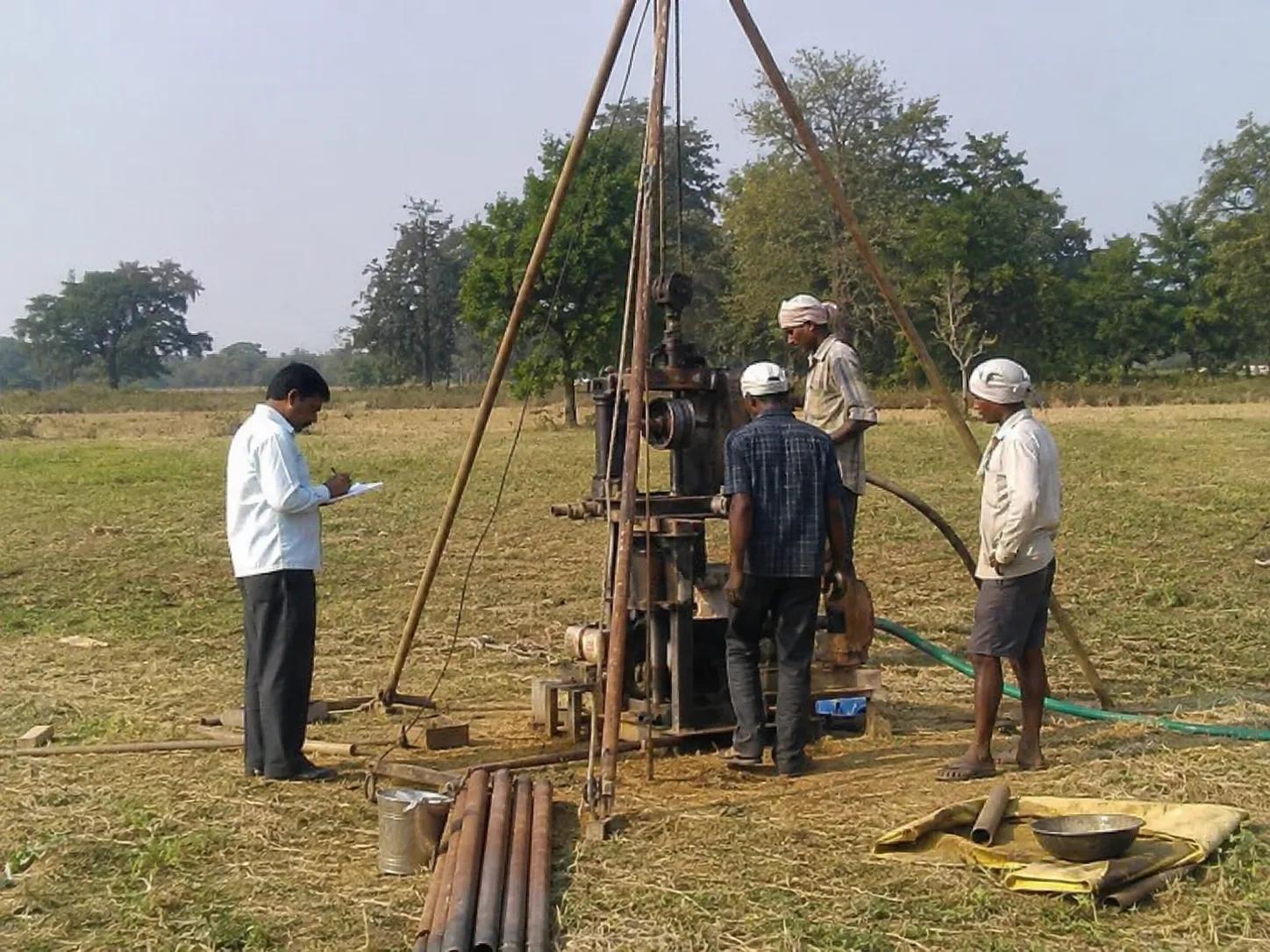
Borewell Survey
Drilling a borewell without prior underground mapping is a major financial risk. In many regions across India, unpredictable hard-rock geology and falling water tables lead to dry holes, resulting in lost capital and delayed projects.
A borewell survey is a scientific field investigation that combines hydrogeological mapping and geophysical testing to locate high-yielding, water-bearing fractured zones beneath the earth's surface. By scanning subsurface layers before heavy machinery arrives, a borewell survey identifies the optimal drilling point, estimates potential yield, and determines the precise depth required to tap into a sustainable aquifer.
Whether you are planning agricultural irrigation projects, industrial water supply systems, or infrastructure groundwater assessments, a professional borewell survey turns risky guesswork into data-driven engineering.
What is a Borewell Survey?
A borewell survey is a specialized site evaluation used to identify the best geographical spot to sink a productive well. Rather than relying on traditional, unscientific methods like water dowsing, professional hydrologists take a rigorous, empirical approach to water source identification.
The primary purpose of this investigation is to detect hidden aquifers, assess structural rock fractures, and map subsurface lithology (soil and rock layers). By analyzing these underground variations, a scientific borewell survey provides clear insights into the availability and sustainability of localized groundwater reserves. This data helps project planners select highly productive drill sites, completely bypassing shallow, depleted water zones.
Technical Methods Used in a Borewell Survey
To deliver accurate results during a groundwater detection survey, field experts combine surface observations with advanced geophysical probing:
- Hydrogeological Investigation: Analyzing local landforms, regional rock outcrops, drainage patterns, and nearby well logs to understand the broader water table characteristics.
- Electrical Resistivity Survey: Injecting controlled electric currents into the ground. Because water-bearing fractures conduct electricity far better than solid bedrock, a resistivity survey for borewell setups can precisely map out wet strata.
- Geological & Stratigraphic Mapping: Studying rock layers and vertical sediment variations to calculate the depth, thickness, and boundary lines of localized aquifers.
- Satellite & GIS Analysis: Utilizing high-resolution digital elevation models and geospatial mapping to track major catchment drainage lines and natural recharge basins.
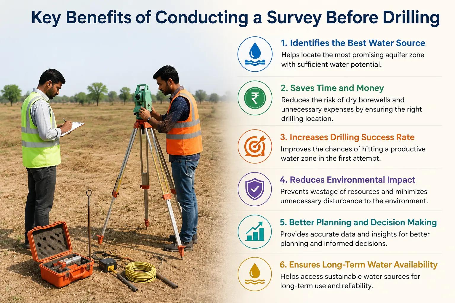
Key Benefits of Conducting a Survey Before Drilling
Skipping an engineering site assessment often leads to structural failure and financial loss. Utilizing modern scientific methods provides immediate operational advantages:
[Scientific Site Survey] │ ▼ [Subsurface Fracture Profiling] │ ┌───────┴───────┐ ▼ ▼ [Dry Holes Avoided] [Drilling Depths Optimized] │ │ └───────┬───────┘ ▼ [Sustainable Long-Term Water Yield]
Investing in a borewell site survey protects your capital by minimizing the risk of drilling deep, dry holes. Precision mapping allows drilling contractors to purchase the exact amount of casing pipe needed and configure high-efficiency submersible pumps.
To achieve this level of field precision, field crews rely on a specialized technical workflow. Bhoojal Survey provides advanced groundwater and geophysical survey solutions, conducting hydrogeological survey using SSRMPATS Instrument, GER DETECT, and PQWT at site for open well / borewell location. This rigorous approach ensures your drilling strategy is anchored in scientific groundwater investigation and analysis.
Industrial and Civil Applications
Data-backed groundwater resource survey solutions are vital across multiple sectors driving India's developmental landscape:
Agricultural Irrigation Projects
Farmers rely on precision groundwater potential assessment reports to secure dependable, year-round water for high-value crops, maximizing yields while protecting rural water tables.
Industrial and Manufacturing Water Supply
Heavy manufacturing plants, textile hubs, and processing factories use deep aquifer mapping to maintain a steady, independent water supply while complying with strict state environmental regulations.
Real Estate, Infrastructure, and Public Schemes
Urban smart cities, commercial high-rises, and rural water supply schemes leverage a systematic borewell investigation to design sustainable, independent water infrastructure for thousands of residents.
Why Choose Bhoojal Survey?
Bhoojal Survey is a premier groundwater exploration consultancy, delivering reliable borewell location services in India.
- Seasoned Geo-Experts: Our certified hydrogeologists and geophysicists bring over 15 years of field experience in complex structural terrains.
- Advanced Field Technology: We utilize the latest digital multi-channel resistivity meters and real-time frequency profiling instruments.
- Actionable Technical Reports: We deliver highly detailed subsurface maps featuring clear logging recommendations and accurate depth metrics.
- Pan-India Field Presence: From rural agricultural lands to heavy industrial zones, we provide customized, comprehensive groundwater assessment consultancy nationwide.
Conclusion
A professional borewell survey is the single most important step in securing a reliable water supply for your property or enterprise. By basing your drilling decisions on verified geological data rather than chance, you eliminate unnecessary construction expenses, extend the working life of your well, and support sustainable water resource management.
Take the financial risk out of your next drilling project. Contact Bhoojal Survey today for premium borewell survey services tailored to your specific site conditions.
Frequently Asked Questions
1. What is a borewell survey?
It is a scientific field assessment that uses geological mapping and electronic resistivity instruments to find the most productive, water-bearing aquifer locations underground before drilling begins.
2. Why should I perform a geophysical survey for borewell sites instead of traditional dowsing?
Traditional dowsing relies on guesswork and unverified techniques. A geophysical survey utilizes calibrated electrical instruments to measure real subsurface properties, providing reliable, empirical evidence of water.
3. How accurate is a scientific borewell survey?
When conducted by qualified hydrogeologists using top-tier instruments like PQWT and resistivity meters, these surveys provide excellent accuracy, vastly improving drilling success rates.
4. What data is included in a professional borewell investigation report?
A comprehensive report provides details on recommended drilling locations, estimated water-bearing fracture depths, expected rock layers, and ideal casing pipe requirements.
5. How long does a standard borewell location survey take on-site?
For most residential or agricultural properties, a standard on-site field assessment can be successfully completed within 3 to 6 hours, depending on terrain complexity.