

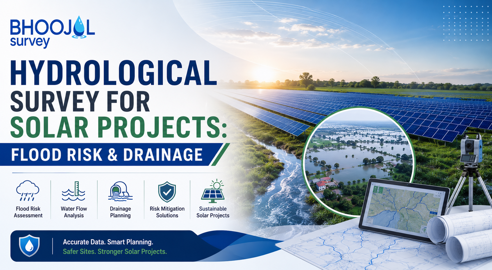
India added over 44 GW of solar capacity in FY 2025–26 alone - the highest single-year addition in the country's history - taking total installed solar capacity to over 150 GW as of March 2026, making India the third-largest solar market globally.
Utility-scale projects continue to expand across diverse terrain - arid Rajasthan flatlands, Deccan plateau, coastal Tamil Nadu, and flood-prone river basin sites across central India.
Across every terrain type, one risk consistently undermines project economics when it is not addressed in planning: flooding.
A hydrological survey for solar projects is the technical investigation that characterises how water behaves at and around a proposed or operating solar site - how rainfall-generated runoff flows across the site, whether the site lies within a floodplain, how deep and fast floodwaters can reach during design storm events, and what drainage infrastructure is needed to protect panels, mounting structures, cables, and electrical equipment.
Without this survey, a solar plant is engineered for the landscape that appears on a map, not the one that exists during a monsoon.
This guide covers the complete process of hydrological survey for solar projects, the flood damage risks it addresses, the regulatory requirements it satisfies, and what a technically sound hydrology report must contain.
Why Hydrological Survey Is Non-Negotiable for Solar Projects
The consequences of inadequate hydrology work at a solar project site are direct and expensive. According to a white paper by Sgurr Energy, river floods, flash floods, ground water flooding, sewer floods, and coastal flooding can all cause heavy damage to solar installations. Damage to PV modules, DC cables, inverters, and electrical equipment from flood events may not be covered under standard manufacturer warranties - meaning the financial burden falls entirely on the project owner or EPC contractor.
Beyond equipment loss, flooding disrupts generation. A submerged inverter station or flooded underground cable network can take weeks to restore.
Soil erosion caused by unmanaged surface runoff undermines the ground grips of module mounting structures, which are not designed to tolerate progressive foundation settlement. Corrosion of structural components accelerates in prolonged waterlogging conditions, reducing the design life of the entire mounting system.
India's climate variability amplifies these risks. The same Rajasthan site that is arid for ten months of the year can experience intense monsoon flash flooding in July and August.
Coastal Andhra Pradesh sites face cyclone-induced storm surge. River basin sites in Maharashtra and Madhya Pradesh sit within catchments that drain massive upstream areas during extreme rainfall events.
A hydrological assessment that does not account for the full range of extreme rainfall scenarios - not just the annual average - leaves the project exposed to the tail-risk events that cause total losses.
How Flooding Damages Solar Plant Infrastructure and Components
Understanding the specific failure mechanisms that flood events cause in solar projects clarifies what a flood risk assessment for solar plants must evaluate and protect against.
PV Modules and Mounting Structures are the most visible flood exposure. Complete submersion of panels causes physical damage and electrical faults.
More insidious is the soil erosion beneath pile-driven or ground-screw foundations - as fast-moving floodwater undercuts the soil around foundation elements, structural tilt develops progressively.
Module mounting structures designed to specific wind and dead load specifications are not designed to accommodate foundation settlement from erosion, and even partial tilt changes panel angles enough to trigger hot-spot damage and generation losses.
Underground Cabling is highly vulnerable. DC string cables and AC collection cables routed in shallow trenches or cable trays at or near grade are submerged during flood events.
Prolonged waterlogging degrades cable insulation at joints and terminations, which are not always rated for full submersion. Damaged cable insulation creates earth fault conditions that trip protection systems and require cable replacement - a time-consuming and expensive intervention.
Inverters and Electrical Equipment in inverter rooms or outdoor inverter skids are particularly sensitive. Inverter enclosures rated to IP54 or IP55 are designed for rain splash protection, not submersion.
Floodwater ingress into inverters, combiner boxes, or MV transformers causes immediate equipment failure. Replacement lead times for utility-scale inverters can extend to months, with significant generation revenue loss.
Stormwater Accumulation on the solar array itself - even without external flooding - causes waterlogging when site drainage is inadequate. Low-lying areas within a large solar site act as collection points for runoff generated by the impervious panel surfaces and access roads.
Without a properly designed internal drainage network, these accumulation zones remain waterlogged for extended periods after rainfall, accelerating structural corrosion and restricting maintenance access.
Hydrological Survey for Solar Projects: Process and Methodology
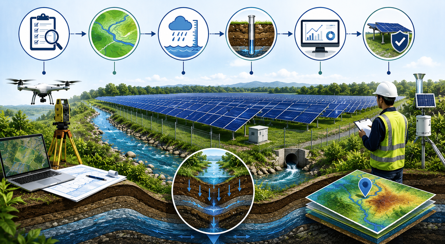
A technically complete hydrological survey for solar projects proceeds through defined stages, each generating data that feeds the subsequent stage.
Desk Study and Data Collection is the starting point. Rainfall data from IMD stations covering the project catchment, river discharge records from CWC gauging stations on nearby watercourses, historical flood occurrence data from State Flood Control Departments, topographic data from satellite-derived DEMs, and land use classification from NRSC are compiled and assessed for quality and coverage.
Existing drainage infrastructure - natural drains, agricultural channels, roads - is mapped from available survey data and satellite imagery.
Site Investigation follows. A site visit assesses the actual terrain - the natural drainage flow directions across the site, the locations of existing watercourses and drainage outfalls, any evidence of historical waterlogging or flood marks, and the general surface condition of soils relative to their permeability and erodibility.
For larger sites, drone-based topographic survey generates a high-resolution Digital Elevation Model that the desk study DEM cannot provide - essential for accurate internal drainage design.
Hydrological Modelling converts collected data into design flood estimates. Rainfall-runoff modelling using HEC-HMS or equivalent tools generates peak discharge estimates for design storm events at defined return periods - typically the 10-year, 25-year, 50-year, and 100-year events for solar project applications.
The choice of design return period is driven by the regulatory requirement, the consequence of flooding, and the project financier's risk tolerance.
Hydraulic Modelling determines how those design discharges translate into inundation depths, extents, and flow velocities across and adjacent to the project site. HEC-RAS flood simulation - in 1D for channel hydraulics and 2D for floodplain and site-level flow routing - produces the Flood Hazard Maps that define which areas of the project site are at risk, at what flood probability, and to what depth.
These maps directly inform the engineering decisions: where panel arrays can be located, what minimum plinth levels are needed for electrical equipment, where bunds or diversion channels must be designed.
Drainage Design is the applied output of the hydrological and hydraulic analysis. Internal site drainage - open channels, culverts, swales, retention ponds - is sized to manage the runoff generated by the site's impervious surfaces and convey it safely off-site without causing waterlogging within the array area.
External drainage - the interface between the site boundary and natural or artificial drainage systems - must be designed to avoid increasing flood risk to adjacent land, a requirement that hydraulic modelling must demonstrate quantitatively.
Flood Risk Assessment for Solar Plants: Scope and Deliverables
A complete flood risk assessment for solar plants is a document package rather than a single report. The standard deliverables expected by EIA appraisal committees, project financiers, and solar park developers include a hydrological analysis report covering design rainfall, catchment runoff modelling, and design flood discharge calculations a hydraulic modelling report presenting HEC-RAS model setup, calibration, and flood inundation results for each return period scenario Flood Hazard Maps showing inundation extents and depths for the 10-, 25-, 50-, and 100-year events a drainage design report covering internal site drainage network layout and sizing calculations and a flood risk mitigation report summarising recommended measures and residual risk.
The flood vulnerability assessment component identifies which project assets and which phases of the project lifecycle - construction, operation, decommissioning - are most exposed to the flood hazard characterised in the hydraulic model.
This feeds directly into the Environmental Management Plan (EMP) section on flood risk, which is a specific requirement of MoEFCC EIA submissions for solar projects above 50 MW.
Drainage Design and Stormwater Management for Solar Plant Sites
Stormwater drainage design for a solar project is distinct from conventional industrial site drainage in one important respect: the panel arrays themselves generate significant additional runoff. Rainfall that would have infiltrated into vegetated or agricultural land now runs off impervious panel surfaces in concentrated streams.
Without deliberate drainage engineering, this concentrated runoff causes erosion beneath panel rows, scours access road surfaces, and accumulates in low points within the array.
The drainage design for a solar site must handle three runoff components: runoff from panel surfaces, runoff from gravel or stabilised access roads, and natural overland flow from the wider catchment that passes across or around the site.
Natural drainage flow paths identified in the hydrological survey must be preserved or replaced with equivalent engineered channels - blocking or diverting natural drainage without compensatory design is a common error in poorly planned sites.
Catchment analysis of the contributing area upstream of the site boundary is essential. A solar project occupying a low-lying site may receive substantial runoff from agricultural land or hillslopes upslope of the project boundary.
This external runoff must be intercepted by perimeter bunds or diversion drains before it enters the panel array area. Sizing these perimeter structures requires the catchment runoff calculations from the hydrological analysis.
For sites near rivers or water bodies, a hydrogeological survey is also recommended alongside the hydrological assessment to characterise shallow groundwater behaviour during flood events - particularly important for sites where high water tables can cause uplift of buried cable infrastructure or waterlogging of cable trenches during monsoon season.
Tools and Technology Used in Solar Project Hydrological Studies
HEC-HMS handles the rainfall-runoff modelling component - catchment delineation using the SCS Curve Number method appropriate for Indian soil and land use classifications, design storm application using Indian Standard synthetic unit hydrographs or CWC regional flood estimation methods, and routing of design floods through the catchment to the project site boundary.
HEC-RAS Flood Simulation in two-dimensional mode is the standard for solar project hydraulic analysis. 2D HEC-RAS simulates flow across the full project terrain, capturing how water moves around panel rows, through gaps in arrays, and across access road embankments. This detail is not achievable in 1D modelling and is increasingly expected by sophisticated project developers and their lenders.
Drone-based topographic survey generates the high-resolution DEM that 2D hydraulic modelling requires. Commercial satellite DEMs have vertical accuracy of 3 to 8 metres - wholly insufficient for site-level drainage design where relative elevation differences of 0.3 to 0.5 metres determine internal drainage flow paths. Drone survey provides sub-10 centimetre vertical accuracy across the project footprint within a day of mobilisation.
GIS platforms - QGIS, ArcGIS - integrate topographic, hydrological, hydraulic, and land use data into the spatial products that form the final deliverables: Flood Hazard Maps, drainage network layouts, and catchment boundary maps.
Vulnerability Atlas of India (NDMA/BMTPC) provides coarse-scale flood hazard zoning at district level - useful for initial site screening but not adequate for project-level engineering design, which requires the site-specific analysis described above.
Regulatory Compliance and EIA Requirements for Solar Projects
Hydrological survey for solar projects sits within a defined regulatory framework in India. Solar projects above defined capacity thresholds require Environmental Clearance from MoEFCC or the State Environment Impact Assessment Authority (SEIAA) under the EIA Notification 2006.
While solar projects are not always listed as scheduled activities requiring mandatory EIA, large-scale utility projects (typically 50 MW and above) in ecologically sensitive areas, near water bodies, or in flood-prone zones are assessed under Category B1, which requires a full EIA study including hydrological baseline data and flood risk assessment.
The NDMA's guidelines on urban flood risk management reference Flood Hazard Mapping as an input to disaster management planning.
State-level NDRF and SDRF guidelines increasingly require flood risk documentation for large energy projects. Project financiers - particularly multilateral institutions and green finance providers - require IFC Performance Standards-compliant hydrology reports as part of project due diligence.
These financial-sector requirements often set a higher technical bar than Indian statutory requirements and demand internationally recognised hydraulic modelling methodology and documentation standards.
Approximate Cost of Hydrological Survey for Solar Projects India
Costs depend on site area, terrain complexity, proximity to rivers, and the depth of hydraulic modelling required.
A basic hydrological assessment and flood risk screening for a solar site of 100 to 500 acres typically ranges from ₹2,00,000 to ₹5,00,000. This covers desk study, catchment analysis, design flood estimation, and a screening-level flood risk report.
A comprehensive study incorporating drone DEM survey, 2D HEC-RAS hydraulic modelling, detailed Flood Hazard Maps, and a full drainage design for a 500 to 2,000 acre project site ranges from ₹8,00,000 to ₹25,00,000 depending on catchment complexity and the number of design scenarios modelled.
EIA-compliant hydrological study packages - formatted for MoEFCC or SEIAA submission - add documentation and review response support, ranging from ₹5,00,000 to ₹15,00,000 as a standalone service or included in comprehensive EIA contracts.
Common Risks When Hydrology Is Overlooked in Solar Planning
The pattern of errors in solar projects where hydrological survey is skipped or inadequately conducted is consistent. Panels are placed in natural drainage flow paths, blocking flow that then backs up and causes unexpected waterlogging. Access roads are built across natural drainage channels without properly sized culverts, causing erosion and road failure during the first monsoon. Electrical equipment is installed at grade level without reference to the site's 50-year flood inundation depth, leading to inverter losses during above-average monsoon seasons. Perimeter bunds are undersized because the contributing catchment upstream of the site was not calculated, and external overland flow overtops the bunds and floods the array.
Each of these errors is preventable through a proper hydrological survey for solar projects conducted before engineering design is finalised. Each is expensive to remediate after construction is complete.
Why Bhoojal Survey for Solar Project Hydrology Work
Bhoojal Survey delivers complete hydrological survey and flood risk assessment for solar plants across India - from initial site screening and catchment analysis through HEC-RAS hydraulic modelling, drainage design, Flood Hazard Mapping, and EIA-compliant hydrology report preparation.
The firm's team combines field survey capability - drone topographic survey, bathymetric survey of adjacent water bodies, stream gauging - with in-house hydrological and hydraulic modelling expertise.
Every hydrological survey delivered by Bhoojal Survey produces actionable engineering outputs - minimum equipment plinth levels, drainage network layouts, perimeter bund specifications, and flood risk mitigation recommendations - not just flood maps.
Reports are prepared to meet MoEFCC EIA submission standards, project lender due diligence requirements, and NDMA guideline references. With experience across solar project sites in diverse Indian terrain - arid and semi-arid, river basin, coastal, and plateau settings - Bhoojal Survey provides hydrological and drainage expertise that protects project assets and supports regulatory clearance.
Conclusion
Hydrological survey for solar projects is an engineering prerequisite, not an optional study. The financial scale of utility solar investments - hundreds of crores per project - cannot be protected by site selection criteria that ignore how water behaves during monsoon and extreme rainfall events.
The flood risk assessment for solar plants, drainage design, and hydraulic modelling that emerge from a rigorous hydrological survey directly determine whether a solar project survives its first severe monsoon season intact.
For hydrological survey, flood risk assessment for solar plants, HEC-RAS hydraulic modelling, drainage design, and EIA hydrology reports across India, contact Bhoojal Survey.
FAQ
1. Why is a hydrological survey important for solar projects?
A hydrological survey helps identify flood-prone areas, natural drainage patterns, runoff behavior, and water flow across the site. This information enables developers to optimize plant layout, protect infrastructure from water damage, and comply with environmental and engineering requirements.
2. What does a hydrological survey for a solar project include?
A hydrological survey typically includes rainfall analysis, catchment analysis, watershed assessment, runoff estimation, drainage mapping, flood risk assessment, site topography evaluation, and recommendations for stormwater management and drainage design.
3. How does flood risk assessment improve the safety of a solar power plant?
Flood risk assessment identifies potential flooding scenarios that could affect solar panels, inverter stations, transformers, internal roads, and other infrastructure. Based on the findings, engineers can design effective drainage systems and flood protection measures to improve the long-term reliability of the project.
4. When should a hydrological study be conducted for a solar project?
A hydrological study should be carried out during the site selection and feasibility stage, before engineering design and construction begin. Early assessment helps minimize design changes, reduce project risks, and avoid costly drainage or flooding issues during operation.
5. How do professional hydrological survey services benefit utility-scale solar projects?
Professional hydrological survey services provide accurate data for drainage planning, flood mitigation, regulatory approvals, and sustainable site development. They support better engineering decisions, reduce construction risks, and help ensure the long-term performance of utility-scale solar power plants.