
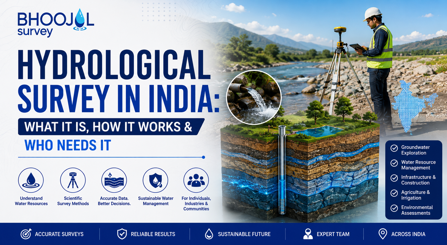
Water is central to every major infrastructure decision in India -where to build a dam, how to design a flood-resilient highway, where industries can safely extract groundwater, and how cities plan for monsoon drainage.
None of these decisions can be made responsibly without a hydrological survey. It is the systematic scientific study of water -its movement, distribution, quantity, and behaviour across river basins, aquifers, catchments, and drainage networks.
In a country where flood damage runs into thousands of crores annually, where groundwater depletion threatens agriculture across entire states, and where infrastructure projects routinely intersect with rivers and wetlands, hydrological assessment is not background paperwork.
It is the technical evidence base on which water-related engineering, environmental clearances, and resource planning depend.
This guide covers what a hydrological survey involves, how it is conducted, which sectors need it, and what regulatory frameworks govern its application in India.
Understand how Flood Modelling services use hydrological survey data to simulate and map flood behaviour across river basins.
What is Hydrological Survey?
Hydrological survey is the field-based investigation and technical analysis of the complete water cycle within a defined area -rainfall, surface runoff, river flow, infiltration, groundwater recharge, and discharge.
It produces quantitative data on how much water moves through a system, where it accumulates, how it behaves during extreme events, and what capacity exists for sustainable use or development.
A hydrological assessment goes beyond simple water measurement. It combines field data collection -stream gauging, rainfall recording, soil infiltration testing, groundwater monitoring -with hydrological modelling to generate predictive understanding of water system behaviour under different scenarios.
The output informs dam design, flood hazard mapping, irrigation planning, environmental impact assessment, municipal water supply planning, and groundwater extraction authorisation.
In India, hydrological survey is mandated or expected across a wide range of statutory processes -from Environmental Impact Assessment (EIA) requirements under the EIA Notification 2006, to CGWA NOC applications requiring groundwater recharge data, to CWC guidelines for river basin development.
The Central Water Commission (CWC), Central Ground Water Board (CGWB), Ministry of Jal Shakti, and National Disaster Management Authority (NDMA) all reference hydrological data as the technical foundation for their regulatory and planning frameworks.
Why Hydrological Survey Cannot Be Skipped
India's water-related challenges are acute. The country receives nearly 4,000 billion cubic metres of precipitation annually, yet a significant proportion is lost to unmanaged runoff and evaporation.
Simultaneously, groundwater extraction in large parts of the Indo-Gangetic Plain, Deccan Plateau, and peninsular India far exceeds natural recharge rates.
Floods cause recurring devastation across the Brahmaputra, Ganga, and Mahanadi basins. Urban drainage infrastructure in most Indian cities is designed without adequate hydrological data.
In this context, a well-executed hydrological survey performs several irreplaceable functions. It establishes baseline water availability for project planning.
It characterises flood risk, allowing infrastructure to be designed at appropriate levels of protection. It quantifies groundwater recharge, supporting sustainable extraction decisions and regulatory compliance.
It defines the hydrological impact of proposed projects on downstream communities and ecosystems -a core requirement of Environmental Clearance submissions.
Skipping or shortcutting hydrological assessment results in infrastructure undersized for actual flood events, borewells drilled in zones of poor recharge, irrigation projects that deplete rather than sustain water resources, and EIA submissions rejected for insufficient technical content.
How Hydrological Survey Works
A hydrological survey progresses through distinct phases, each building on the previous to produce a complete picture of water system behaviour.
The process begins with data collection and desk study. Existing rainfall records from India Meteorological Department (IMD) stations, streamflow data from CWC gauging stations, satellite-derived land use and topography data from ISRO, and soil classification maps from the National Bureau of Soil Survey are compiled and reviewed.
This secondary data establishes the hydrological context before any fieldwork begins.
Field investigation forms the core of the survey. Stream gauging measures river discharge at defined cross-sections using current meters or acoustic Doppler instruments.
Rainfall monitoring -either through existing gauge networks or newly installed rain gauges -captures spatial and temporal distribution across the catchment. Soil infiltration tests determine how quickly rainfall enters the soil, a critical parameter for runoff calculation.
Groundwater monitoring through observation wells records water table fluctuations tied to rainfall and pumping cycles.
Hydrological modelling follows field data collection. Software tools -HEC-HMS for rainfall-runoff modelling, HEC-RAS for river hydraulics and flood simulation, SWAT for catchment-scale water balance -are used to convert field measurements into predictive models.
These models answer specific engineering and planning questions: what is the 100-year flood discharge at this bridge site? What is the safe yield of this aquifer under projected extraction? How will proposed land use changes affect downstream runoff?
The final phase is reporting and interpretation -translating model outputs into engineering recommendations, risk assessments, and regulatory submissions that project teams and government authorities can act upon.
Types of Hydrological Survey
Hydrological survey encompasses several specialised investigation types, each suited to a different purpose.
Catchment Hydrological Assessment studies rainfall, runoff, and water yield across an entire river catchment. It is fundamental to dam design, reservoir sizing, and river basin water allocation.
Flood Risk Assessment and Flood Hazard Mapping combine hydrological and hydraulic modelling to delineate inundation zones, identify at-risk settlements and infrastructure, and support floodplain zoning decisions.
Groundwater Hydrological Survey -closely related to hydrogeological survey -investigates recharge mechanisms, aquifer behaviour, and sustainable yield, forming the technical basis for CGWA NOC applications and groundwater management plans.
River Survey and Bathymetric Survey measure channel geometry, bed levels, sediment load, and flow patterns in rivers and water bodies. This data feeds into bridge design, dredging programmes, reservoir sedimentation assessment, and navigation planning.
Urban Drainage Hydrological Survey analyses stormwater runoff from urbanised catchments, informing the design of drains, culverts, retention ponds, and flood-resilient infrastructure in expanding cities.
See how Ground Water Survey integrate hydrological recharge data with subsurface aquifer investigation for complete groundwater assessment.
Technology and Equipment Used
Modern hydrological survey practice deploys a range of field instruments and computational tools. Acoustic Doppler Current Profilers (ADCP) measure river discharge across full channel widths with far greater speed and accuracy than traditional current meters.
Automatic Weather Stations record rainfall, temperature, humidity, and wind continuously, providing high-resolution data for hydrological models. Drone-based topographic surveys generate Digital Elevation Models (DEMs) at centimetre-level accuracy, replacing laborious total station surveys for terrain characterisation.
On the modelling side, HEC-RAS Flood Simulation software from the US Army Corps of Engineers is the global standard for one-dimensional and two-dimensional hydraulic modelling of river systems.
HEC-HMS handles rainfall-runoff transformation at catchment scale. SWAT (Soil and Water Assessment Tool) models long-term water balance and land use impact at basin scale.
GIS platforms integrate spatial data from satellite imagery, survey measurements, and model outputs into the mapped products -Flood Hazard Maps, groundwater recharge zone maps, catchment boundary delineations -that form the deliverable of a complete hydrological assessment.
Government Standards and Compliance
Hydrological survey in India operates within a structured regulatory framework. The Central Water Commission sets hydrological design standards for dams and river structures.
The Bureau of Indian Standards publishes codes -including IS 2914 for streamflow measurement -that govern field data collection methods.
The EIA Notification 2006 and its amendments require baseline hydrological data as part of Environmental Impact Assessment for Category A and B projects near water bodies or in flood-prone areas.
NDMA guidelines on flood risk management reference Flood Hazard Mapping and Flood Risk Assessment as mandatory inputs to district disaster management plans.
Ministry of Jal Shakti's National Water Policy provides the overarching framework within which all water resources consultancy and hydrological planning work must be positioned.
For groundwater-focused hydrological surveys, CGWB and CGWA technical guidelines specify data collection and reporting requirements tied to regulatory submissions.
Cost of Hydrological Survey in India
Survey costs scale with the size of the study area, the complexity of the hydrological system, and the technical depth required.
A basic hydrological assessment for a small catchment -covering desk study, limited field measurement, and a standard report -typically ranges from ₹50,000 to ₹2,00,000.
Comprehensive river basin studies incorporating continuous gauging, hydrological modelling, and flood hazard mapping for regulatory or EIA purposes range from ₹3,00,000 to ₹15,00,000 or more depending on the basin size and data requirements.
Bathymetric Survey of reservoirs or river reaches adds ₹50,000 to ₹3,00,000 depending on water body dimensions and instrument deployment.
Common Challenges
The most persistent challenge in hydrological survey work in India is data scarcity. Stream gauging networks are sparse outside major river systems, historical rainfall data has gaps, and groundwater monitoring in many districts is inconsistent.
Hydrologists must often work with short data records that introduce uncertainty into flood frequency analysis and water balance calculations.
Monsoon seasonality creates fieldwork constraints -rivers in full spate are difficult and dangerous to gauge, yet peak flow data is precisely what flood design studies require.
In urban catchments, rapidly changing land use makes historical hydrological records increasingly unrepresentative of current conditions.
Climate variability adds another layer of uncertainty to long-range water availability projections. Managing and clearly communicating these uncertainties in technical reports -without obscuring the practical conclusions that clients and regulators need -is the mark of competent hydrological assessment practice.
How to Choose the Right Hydrological Survey Firm
Selecting a water resources consultancy for hydrological work requires careful evaluation. The firm must have qualified hydrologists -professionals with academic training in hydrology or water resources engineering and demonstrable field and modelling experience.
In-house modelling capability matters: firms that outsource HEC-RAS or HEC-HMS work lack control over the technical quality of the core analytical output.
Experience with Indian regulatory frameworks is essential. A hydrological report prepared for an EIA submission, a CGWA NOC application, or a CWC design clearance must meet specific technical standards -and the consultant must understand those standards from direct experience, not general familiarity.
PAN India project experience across diverse hydrological settings -arid catchments, humid tropical basins, snowmelt-dominated Himalayan rivers, urban drainage systems -reflects the breadth of competence that complex projects demand.
Bhoojal Survey delivers comprehensive hydrological survey and assessment services across India, combining field investigation, hydrological and hydraulic modelling, regulatory reporting, and flood risk assessment within a single technical engagement.
The firm's team of experienced hydrologists and water resources specialists supports projects ranging from groundwater recharge studies for CGWA NOC applications to catchment-scale flood hazard mapping for infrastructure planning.
Why Choose Bhoojal Survey
Bhoojal Survey brings integrated water resources expertise to every hydrological survey engagement.
Field data collection, hydrological modelling, HEC-RAS flood simulation, Flood Hazard Mapping, Bathymetric Survey, and statutory reporting are all delivered in-house -ensuring technical consistency from raw data to final report.
The firm operates across India's diverse geological and hydrological settings, with established experience in EIA-compliant hydrological assessments, CGWA NOC hydrogeological documentation, and river basin water balance studies.
Every hydrological report delivered by Bhoojal Survey is prepared to satisfy the technical scrutiny of regulatory authorities -CWC, CGWB, State Irrigation Departments, and EIA appraisal committees -and to serve as a reliable foundation for engineering and investment decisions.
Conclusion
Hydrological survey is the technical backbone of responsible water resource management, flood-resilient infrastructure design, and compliant groundwater development in India.
No river crossing, dam, industrial water supply, flood management scheme, or CGWA NOC application should proceed without reliable hydrological data supporting the decision.
For professional hydrological survey, flood risk assessment, hydrological modelling, and water resources consultancy services across India, contact Bhoojal Survey.
FAQ
Q1. What is the difference between a hydrological survey and a hydrogeological survey?
A hydrological survey studies rainfall, rivers, runoff, and surface water. A hydrogeological survey focuses on groundwater, aquifers, borewell yield, and subsurface water conditions.
Q2. Is a hydrological survey mandatory for Environmental Clearance in India?
Yes, for many Category A and B projects. It provides essential water resource and flood-related data required for EIA and regulatory approvals.
Q3. How long does a hydrological survey take?
A basic survey usually takes 4–8 weeks, while detailed studies involving modelling and seasonal analysis can take 3–9 months.
Q4. Can hydrological survey data be used for CGWA NOC applications?
Yes. Hydrological data helps assess groundwater recharge and supports the hydrogeological report required for CGWA NOC approval.