Why Hydrological Survey for Airport Projects is Essential
A Hydrological Survey for Airport is a scientific investigation that studies the movement, depth, quality, and recharge potential of both surface and subsurface water at a proposed airport site. In 2026, this survey has become one of the most critical pre-construction requirements for every airport infrastructure project across India and globally.
Airports are high-sensitivity infrastructure assets. Any failure in runway drainage, undetected groundwater surge, or foundation instability caused by subsurface water can lead to massive financial losses and serious safety risks. This is why every airport developer, EPC contractor, and aviation consultant must commission a detailed Hydrological Survey for Airport before construction begins.
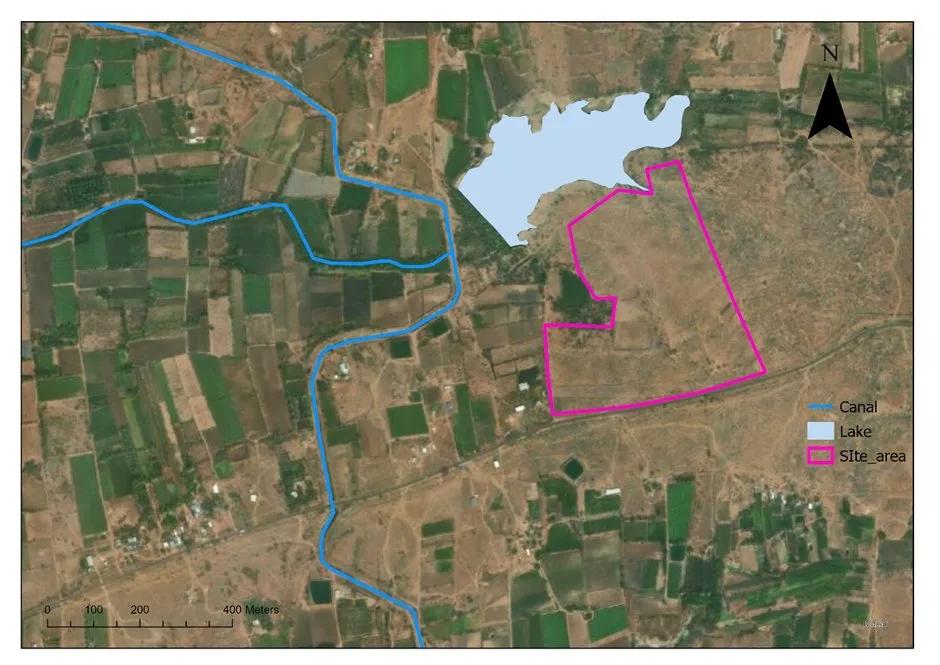
A Hydrological Survey for Airport covers the full water cycle — surface runoff, rainfall patterns, flood zones, catchment analysis, and subsurface water resources. Together, these investigations form the scientific foundation of safe airport water management and hydraulic planning.
With climate change increasing rainfall unpredictability and flood frequency, a Hydrological Survey for Airport in 2026 is no longer optional. It is a regulatory and engineering necessity for building climate-resilient aviation infrastructure.
What a Hydrological Survey for Airport Evaluates
A thorough Hydrological Survey for Airport development covers multiple critical parameters. Each evaluation provides actionable engineering data that directly impacts runway safety, foundation design, and water supply planning.
- Groundwater Level Measurement: Hydrogeologists measure water table depth across the entire airport footprint including runways, taxiways, terminal zones, and aprons. Seasonal fluctuations are recorded over multiple hydrological cycles. In high-rainfall zones of India, groundwater tables can rise by 3 to 8 metres during peak monsoon, directly threatening shallow foundations and sub-base stability.
- Soil Permeability and Water Absorption: The infiltration rate of soil determines how quickly surface runoff is absorbed. Poor drainage soils make runways highly prone to waterlogging. Detailed soil boring investigations are conducted to identify drainage behaviour across different strata.
- Aquifer Identification: Identifying whether the site sits above a confined or unconfined aquifer is critical for understanding groundwater pressure and recharge capacity. Confined aquifers can exert upward hydraulic pressure on heavy runway slabs and taxiway structures, posing a serious structural risk.
- Seasonal Water Table Variation: A Hydrological Survey for Airport must capture at least two full seasonal cycles. The difference between peak and trough groundwater levels — sometimes exceeding 5 to 7 metres in alluvial plains — determines safe depths for underground utilities and drainage pipes.
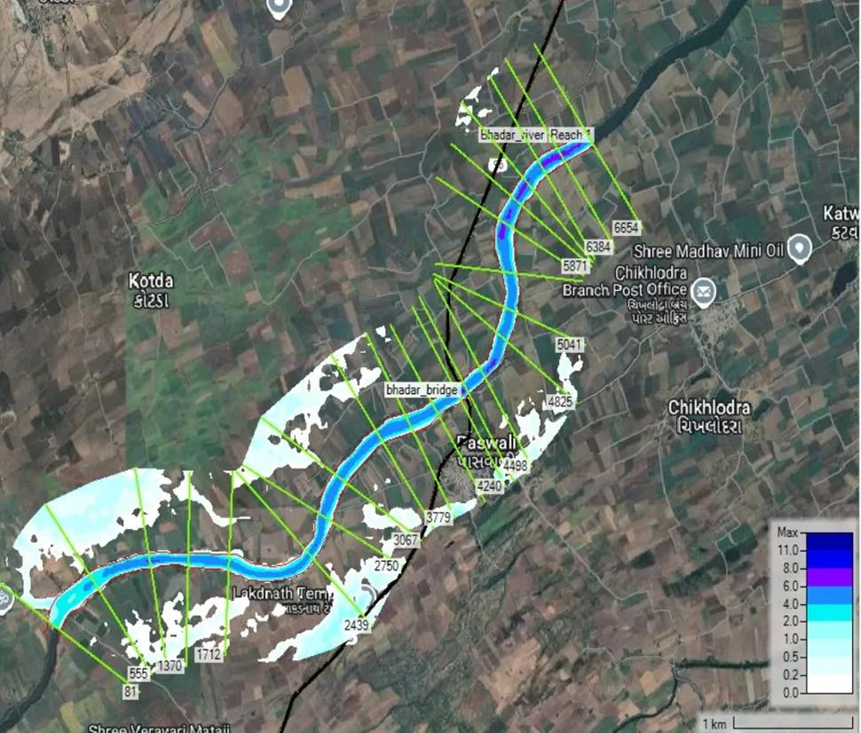
- Flood Risk Zone Assessment: Airport flood analysis identifies areas prone to inundation during extreme rainfall events. Using 25-year, 50-year, and 100-year return period rainfall analysis, engineers determine flood plain boundaries and safe finished floor levels for all airport structures.
- Sub-Surface Drainage Pattern Analysis: Understanding underground water movement and natural drainage pathways allows designers to align airport drainage infrastructure with the natural hydrological system, significantly reducing construction costs and long-term maintenance.
Survey Techniques Used in Hydrological Survey for Airport Sites
A comprehensive Hydrological Survey for Airport deploys multiple field-based and technology-driven methods to ensure accurate and complete data collection.
- Test Boring and Borehole Drilling: Borehole drilling is the most direct method of subsurface investigation. Cores extracted at depths of 15 to 50 metres reveal soil layers, water-bearing zones, and aquifer properties. Water samples from different depths are tested for quality, salinity, and contamination.
- Geophysical Surveys using ERT and Seismic Methods: Electrical Resistivity Tomography and seismic refraction surveys provide continuous subsurface profiles without extensive drilling. These methods are particularly valuable for large airport footprints where full borehole coverage is not feasible.
- Piezometer Installation: Piezometers installed at key site locations provide continuous real-time monitoring of groundwater pressure and water table levels. Data loggers record hourly fluctuations, enabling accurate rainfall-recharge correlation that directly feeds into runway drainage design.
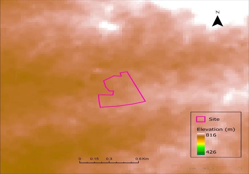
- Remote Sensing and GIS Mapping: Satellite terrain analysis, Digital Elevation Model processing, and GIS hydrological modelling enable rapid delineation of watershed boundaries, stream networks, and flood-prone zones across the airport catchment area. LiDAR terrain mapping provides centimetre-level elevation accuracy for precision drainage planning.
- Pumping Test and Yield Test: Conducted on test borewells, pumping tests determine hydraulic conductivity, transmissivity, and sustainable aquifer yield. This data is essential for planning airport water supply infrastructure including fire-fighting systems and terminal water supply.
- Advanced Instruments — SSRMPATS, GER DETECT, and PQWT: Bhoojal Survey uses SSRMPATS, GER DETECT, and PQWT instruments for precise open well and borewell location identification. These tools analyse subsurface electrical and electromagnetic properties to pinpoint high-yield groundwater zones without invasive drilling, reducing borewell failure rates significantly.
Key Benefits of Hydrological Survey for Airport Projects
A rigorous Hydrological Survey for Airport delivers compounding benefits throughout the entire project lifecycle.
- Prevent Runway Settlement: Undetected high water tables and weak sub-base soils are primary causes of differential settlement in airport pavements. Early-stage groundwater data enables engineers to design appropriate sub-base stabilisation and drainage layers.
- Improve Foundation Design: Hydrogeological data directly informs foundation type selection for terminal buildings, ATC towers, hangars, and fuel farms. Accurate water table depth prevents under-design of waterproofing systems and ensures long-term structural integrity.
- Airport Water Supply Planning: Groundwater surveys identify viable aquifer zones for sustainable borewell development, reducing dependence on municipal supply and ensuring operational water security for airport operations.
- Protect Runway from Waterlogging: A detailed runway waterlogging assessment combined with proper stormwater drainage design prevents standing water on operational surfaces, protecting aircraft operations during heavy rainfall and extending pavement life.
- Reduce Construction Risk and Save Cost: Early identification of flood-prone areas, unstable saturated soils, and artesian pressure zones allows design teams to modify alignments and implement dewatering systems proactively, eliminating expensive mid-construction remediation.
Legal and Government Compliance in Hydrological Survey for Airport
Every Hydrological Survey for Airport project in India must satisfy multiple regulatory requirements.
- AAI Guidelines require detailed drainage and hydrology reports as part of master plan approvals for all new and expanding airports.
- MoEF Environmental Clearance mandates an Environmental Impact Assessment including a dedicated hydrological impact chapter covering groundwater extraction and drainage planning.
- CGWA NOC Requirements: The Central Ground Water Authority issues mandatory No-Objection Certificates for groundwater extraction. A detailed hydrogeological report is a prerequisite for CGWA compliance.
- EIA Report Hydrological Data must include seasonal groundwater data, flood return period analysis, runoff calculations, and a drainage impact assessment.
- ICAO and FAA Considerations: Internationally, ICAO Annex 14 and FAA Advisory Circulars require airports to demonstrate hydraulic safety standards including runway drainage systems capable of handling 1-in-25-year rainfall events.
Real Airport Case Studies — Hydrological Survey for Airport in Action
- Navi Mumbai International Airport: Located on reclaimed land adjacent to Thane Creek, this project required a complex Hydrological Survey for Airport involving tidal groundwater influence, saline aquifer intrusion, and high flood risk. Advanced coastal drainage engineering including tidal gates and impermeable cut-off walls was designed based on detailed hydrological studies.
- Jewar Airport, Noida: Situated on the Yamuna floodplain with a shallow water table often within 2 to 4 metres during monsoon, Jewar Airport required extensive water table management measures including raised runway levels and deep interceptor drains based on comprehensive Hydrological Survey for Airport data.
- Bhogapuram Airport, Andhra Pradesh: Coastal location with high groundwater tables rising to within 1 to 2 metres of the surface during monsoon. Aggressive sub-surface drainage and pavement design modifications were incorporated following detailed hydrogeological investigations.
- Singapore Changi Airport: A global benchmark in airport stormwater management with underground retention tanks, tidal drainage systems, and real-time water level monitoring protecting one of the world's busiest airports from flooding.
Environmental Impact and Sustainable Water Management
Large impermeable airport surfaces significantly reduce natural rainwater infiltration and diminish groundwater recharge in surrounding regions. A responsible Hydrological Survey for Airport must assess this environmental impact and recommend mitigation measures.
- Rainwater harvesting systems can capture runway and roof runoff for landscaping, fire-fighting, and construction water use.
- Artificial groundwater recharge through recharge wells and percolation pits can offset the recharge deficit caused by impermeable surfaces, as increasingly mandated by CGWA.
- Smart drainage systems with real-time monitoring of groundwater levels and rainfall enable adaptive management of airport drainage infrastructure.
- For 2026 airport projects, climate change projections must be incorporated into all hydrological design parameters to ensure long-term operational resilience.
Bhoojal Survey — Expert Hydrological Survey for Airport Projects Across India
Bhoojal Survey is a specialist provider of comprehensive Hydrological Survey for Airport projects across India and internationally. Our expert team delivers end-to-end airport hydrological and hydrogeological investigation services trusted by airport developers, EPC contractors, and government authorities.
Our Hydrological Survey for Airport services include:
- Airport hydrological survey and groundwater investigation
- Flood risk mapping and airport catchment analysis
- Borewell location survey using SSRMPATS, GER DETECT, and PQWT instruments
- GIS-based hydrology analysis and hydraulic modelling for airport infrastructure
- Runway drainage design and stormwater management planning
- Hydrogeological report preparation
- CGWA NOC documentation support
- EIA hydrological chapter preparation for MoEF clearance
Bhoojal Survey provides Pan India services with a free initial consultation for all 2026 airport infrastructure projects. Contact us today at www.bhoojalsurvey.in for expert airport groundwater survey, flood modelling, and runway drainage planning.
Frequently Asked Questions — Hydrological Survey for Airport
Q1. What is a Hydrological Survey for Airport and why is it necessary? A Hydrological Survey for Airport is a comprehensive investigation of surface and subsurface water conditions at a proposed airport site. It assesses groundwater levels, flood risk, soil drainage, and rainfall patterns to ensure runway safety, prevent foundation failures, and comply with AAI and MoEF regulations.
Q2. How long does a Hydrological Survey for Airport take? Depending on site size and scope, a Hydrological Survey for Airport typically takes 4 to 12 weeks. For large greenfield airports, it may extend to 3 to 6 months to capture full seasonal groundwater data.
Q3. What does a hydrogeological report for an airport contain? It includes site topography, historical rainfall analysis, groundwater level data, soil lithology, aquifer characterisation, flood risk assessment, water quality test results, borewell recommendations, drainage design inputs, and CGWA and MoEF compliance data.
Q4. What is the best method for Hydrological Survey for Airport groundwater investigation? The most effective approach combines borehole drilling, ERT geophysical survey, piezometer monitoring, GIS hydrological modelling, pumping tests, and advanced instruments such as SSRMPATS, GER DETECT, and PQWT for precise borewell location.
Q5. How does runway drainage design depend on Hydrological Survey for Airport data? Runway drainage design relies on rainfall intensity curves, runoff coefficients from soil permeability tests, flood zone mapping, groundwater depth data, and catchment analysis for drain sizing and outfall design.
Q6. Is CGWA NOC mandatory for airport groundwater use? Yes. The Central Ground Water Authority NOC is mandatory for any large-scale groundwater extraction for airport construction or operations. A detailed hydrogeological report is required for the application.
Q7. What is airport flood modelling and how is it used? Airport flood modelling uses rainfall data, topographic surveys, soil infiltration rates, and hydraulic simulation to predict flood depths for various return period events, determining safe runway levels and stormwater retention requirements.
Q8. How does climate change affect Hydrological Survey for Airport projects in 2026? Climate change increases rainfall intensity and extreme weather frequency. For 2026 airport projects, surveys must incorporate IMD and IPCC climate projections to ensure drainage systems are designed for future extreme events.
Q9. What is the role of GIS in Hydrological Survey for Airport? GIS is used for watershed delineation, flood zone mapping, land use analysis, stream network extraction, drainage basin characterisation, and spatial integration of borehole and geophysical data.
Q10. How can Bhoojal Survey help with Hydrological Survey for Airport projects? Bhoojal Survey provides end-to-end Hydrological Survey for Airport services across India including site characterisation, borehole drilling, geophysical surveys, GIS modelling, flood risk mapping, hydrogeological reports, and CGWA NOC support. Contact us at bhoojal survey for a free consultation.
Conclusion
A Hydrological Survey for Airport is the scientific foundation on which safe, sustainable, and operationally resilient airports are built. From preventing runway flooding and foundation failures to ensuring long-term water supply security and environmental compliance, a comprehensive Hydrological Survey for Airport is the first and most critical step in any successful airport infrastructure project in 2026.
As India accelerates its airport development programme, the demand for expert Hydrological Survey for Airport studies, groundwater assessments, and hydrogeological investigations will only grow. Bhoojal Survey is your trusted partner for all airport hydrological survey requirements.
Contact us today for a free initial consultation. Pan India services available. Expert technical team ready to support your 2026 airport project from site investigation to regulatory submission.
Visit bhoojal survey or call us now to plan your Hydrological Survey for Airport project.