
Introduction
Drilling a borewell is a major investment, whether you're a farmer looking for a reliable irrigation source, a homeowner planning a new property, or a business requiring a steady water supply. Yet many borewells fail simply because they are drilled in the wrong location.
Groundwater is not distributed evenly beneath the earth's surface. One area may contain a productive water-bearing zone, while another spot just a few meters away may yield little or no water. This is why a professional groundwater survey has become an essential step before drilling.
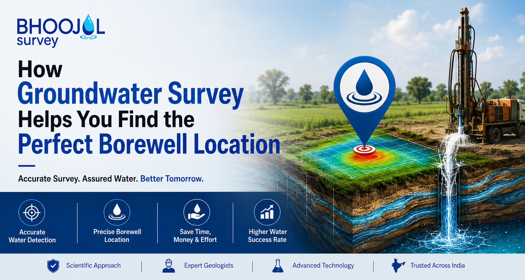
Instead of relying on assumptions or traditional guesswork, modern groundwater investigations use scientific methods to identify the most promising location for a borewell. A properly conducted survey can significantly improve drilling success rates, reduce unnecessary expenses, and help ensure long-term water availability.
What Is a Groundwater Survey?
A groundwater survey is a scientific assessment used to identify underground water-bearing formations and determine the most suitable location for borewell drilling. The process combines geological observations with geophysical techniques to understand what lies beneath the ground before any drilling equipment arrives on site.
The primary goal is to locate aquifers, fractures, weathered zones, and other geological structures that can store and transmit groundwater efficiently. By understanding these underground conditions, property owners can make informed decisions instead of taking costly risks.
This approach has become increasingly important as groundwater levels fluctuate and drilling costs continue to rise across many regions.
Why Borewell Location Is So Important
Many people assume that water can be found anywhere if the borewell is drilled deep enough. In reality, groundwater occurs within specific geological formations that may not be present across an entire property.
A borewell drilled in an unfavorable location can result in low yield, seasonal shortages, or complete failure. Such outcomes often lead to additional drilling expenses and wasted resources.
A carefully planned groundwater survey before drilling helps avoid these issues by identifying locations where groundwater is more likely to be available in sufficient quantities. This scientific approach improves confidence and reduces uncertainty before investing in drilling operations.
How a Groundwater Survey Works
The survey process begins with a detailed examination of the site. Experts study the landscape, local geology, existing borewell information, drainage patterns, and surrounding environmental conditions. These observations provide important clues about groundwater movement and storage.
The next stage involves geophysical investigations, particularly electrical resistivity surveys. This method measures how electrical current travels through underground materials. Different geological formations respond differently, allowing specialists to distinguish between dry rock, weathered formations, fractures, and water-bearing zones.
Once field data is collected, experts analyze the results to estimate groundwater depth, aquifer thickness, and the most suitable drilling point. Based on this interpretation, a recommended borewell location is marked on the property.
This scientific workflow significantly increases the likelihood of locating productive groundwater resources.
Modern Technologies Used in Borewell Groundwater Survey
Advancements in hydrogeology have transformed the way groundwater is explored. Today's surveys rely on specialized instruments and data interpretation techniques that provide far greater accuracy than traditional methods.
Electrical Resistivity Testing (ERT) is one of the most widely used technologies because it helps identify underground formations capable of storing water. Geological mapping is also used to understand rock types and structural features that influence groundwater occurrence.
Satellite imagery, hydrogeological assessments, and digital data analysis further improve the accuracy of modern surveys. Together, these methods provide a comprehensive understanding of subsurface conditions.
Organizations such as Bhoojal Survey utilize advanced groundwater investigation techniques to help clients make informed decisions before drilling.
Groundwater Survey vs Random Borewell Drilling
The difference between scientific surveying and random drilling can be substantial. Random drilling often depends on assumptions, local beliefs, or trial-and-error methods. While such approaches may occasionally succeed, they involve significant uncertainty.
A groundwater survey, on the other hand, relies on measurable geological and geophysical data. This allows specialists to identify locations where groundwater is more likely to occur and estimate the depth at which it may be encountered.
When compared with random drilling, scientific surveys generally provide higher success rates, better water yield potential, and greater cost efficiency. For property owners, this means reduced risk and a better return on investment.
Benefits of Conducting a Groundwater Survey Before Drilling
One of the most significant advantages of conducting a survey is the reduction of drilling risks. Because the drilling location is selected based on scientific evidence, the likelihood of borewell failure decreases considerably.
A survey can also help optimize drilling depth, preventing unnecessary expenditure on excessively deep drilling. In many cases, it enables property owners to access groundwater more efficiently while improving the long-term performance of the borewell.
Another important benefit is sustainability. By targeting productive groundwater zones, water extraction can be managed more responsibly, supporting long-term groundwater availability for future use.
For agricultural, residential, commercial, and industrial projects alike, investing in a survey often proves far less expensive than dealing with the consequences of a failed borewell.
Who Should Consider a Groundwater Survey?
A professional survey can benefit anyone planning to drill a borewell. Farmers frequently use surveys to improve irrigation reliability and crop productivity. Residential property owners often seek surveys to establish an independent water source for homes and housing developments.
Commercial establishments such as schools, hotels, hospitals, and office complexes also depend on reliable groundwater supplies. Industrial facilities, where water is critical for daily operations, can particularly benefit from scientific borewell planning.
Bhoojal Survey has assisted clients from diverse sectors by providing data-driven groundwater assessments that support more informed drilling decisions.
Choosing the Right Groundwater Survey Provider
Not all survey services offer the same level of expertise. Choosing an experienced provider is crucial for obtaining reliable results.
Look for professionals with a strong understanding of hydrogeology, modern survey equipment, and experience working within the local geological environment. A quality survey should include detailed analysis, data interpretation, and clear recommendations regarding drilling locations and expected groundwater potential.
Working with an established company such as Bhoojal Survey can provide greater confidence in the accuracy of the findings and the overall drilling strategy.
Common Myths About Groundwater Surveys
One common misconception is that water can be found everywhere if drilling goes deep enough. While deeper drilling may sometimes encounter groundwater, success largely depends on the geological conditions present beneath the site.
Another myth is that traditional methods alone can consistently identify productive borewell locations. While local experience may provide useful insights, modern scientific surveys offer measurable data that improves decision-making.
Some people also believe surveys are expensive. In reality, the cost of a survey is often small when compared to the financial loss associated with a failed borewell.
Organizations like Bhoojal Survey continue to demonstrate how scientific groundwater investigations help reduce uncertainty and improve drilling outcomes.
Key Takeaways
A groundwater survey is one of the most effective tools for identifying the ideal borewell location. By analyzing underground geological conditions before drilling begins, surveys help reduce risks, improve success rates, and increase the likelihood of finding sustainable groundwater resources.
Modern survey methods provide valuable insights that allow property owners to make informed decisions, save money, and improve long-term water security.
Conclusion
Finding the right borewell location should never be left to chance. As groundwater resources become increasingly valuable, scientific planning has become essential for successful drilling projects.
A professional groundwater survey before drilling provides the information needed to identify promising groundwater zones, optimize drilling investments, and improve water yield potential. Whether the project involves agriculture, residential development, commercial infrastructure, or industrial operations, a well-executed borewell groundwater survey can make the difference between success and costly failure.
By investing in expert groundwater assessment, property owners gain a clearer understanding of underground conditions and significantly improve their chances of securing a reliable water source for years to come.
FAQs
1. What is a groundwater survey?
A groundwater survey is a scientific process used to identify underground water-bearing formations and determine the best location for borewell drilling.
2. Why should I conduct a groundwater survey before drilling?
Conducting a groundwater survey before drilling helps reduce borewell failure risks, improve water yield, and optimize drilling costs.
3. How accurate is a borewell groundwater survey?
While no survey can guarantee water, modern geophysical techniques significantly improve the chances of identifying productive groundwater zones.
4. What technologies are used during a groundwater survey?
Most surveys use electrical resistivity testing, geological mapping, hydrogeological analysis, and advanced data interpretation techniques.
5. Who should get a groundwater survey done?
Farmers, homeowners, industries, commercial developers, and institutions planning a borewell should consider a professional groundwater survey.