
Groundwater is one of the most valuable natural resources, supplying water for homes, agriculture, industries, and commercial establishments. As the demand for water continues to increase, drilling a borewell without understanding the underground conditions has become a costly risk.
Many borewells fail because they are drilled without identifying productive groundwater-bearing zones, leading to wasted investment and time.
Modern groundwater exploration has transformed this process by replacing guesswork with scientific investigation. Today, experts use advanced groundwater survey methods to study geological formations, aquifers, and subsurface conditions before recommending a drilling location.
These techniques improve the chances of locating sustainable groundwater while reducing unnecessary drilling costs.
At Bhoojal Survey, groundwater investigations combine geological knowledge with advanced geophysical technologies to help clients identify the most suitable borewell locations.
Whether the project is for residential, agricultural, industrial, or commercial use, scientific surveys provide accurate data that supports informed decision-making.
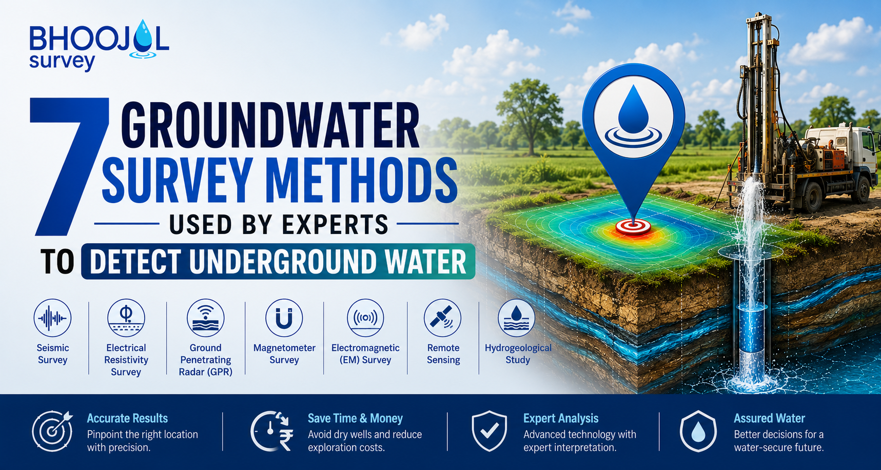
In this guide, we'll explore seven groundwater survey methods used by professionals, explain how they work, and discuss why combining multiple techniques often delivers the best results.
Why Groundwater Surveys Are Important
Groundwater is stored beneath the Earth's surface within water-bearing rock formations known as aquifers. However, these aquifers are not evenly distributed, and their depth, size, and productivity vary depending on local geological conditions.
Drilling a borewell without conducting a proper groundwater survey increases the chances of encountering dry rock, low-yield aquifers, or unsuitable drilling locations. A professional survey helps identify the most promising groundwater zones, estimate drilling depth, understand geological structures, and improve borewell success rates.
Scientific groundwater investigations also support sustainable water management by helping users extract groundwater responsibly without placing unnecessary stress on local aquifers.
1. Geological Survey
A geological survey is the foundation of every groundwater investigation. During this process, experts examine surface rock formations, soil conditions, topography, weathered zones, and natural drainage systems. These observations provide valuable insights into how groundwater may be stored beneath the surface.
Different rock types have varying capacities to store and transmit water. Fractured granite, sandstone, limestone, and weathered basalt often provide better groundwater potential than compact hard rock formations.
By understanding local geology, experts can narrow down the areas most likely to contain productive aquifers.
Although geological surveys provide valuable preliminary information, they are generally combined with geophysical methods to achieve greater accuracy before drilling.
2. Hydrogeological Survey
A hydrogeological survey focuses on studying the movement and availability of groundwater beneath the surface. Unlike geological surveys that primarily examine rocks, hydrogeology evaluates aquifers, groundwater recharge, water table conditions, rainfall patterns, and groundwater flow.
Experts also analyze nearby wells, borewells, seasonal water level variations, and historical groundwater data to estimate the sustainability of underground water resources. This information helps determine whether a location can provide a reliable long-term water supply.
Hydrogeological surveys are widely used in agriculture, infrastructure development, industrial projects, and municipal water planning because they provide a better understanding of groundwater behavior.
3. Vertical Electrical Sounding (VES) Survey
Vertical Electrical Sounding (VES) is one of the most commonly used groundwater exploration techniques in India. The method measures the electrical resistivity of underground layers by passing a controlled electrical current into the ground.
Since water-bearing formations generally have lower electrical resistivity than dry rocks, experts can interpret the collected data to estimate aquifer depth, thickness, and potential drilling locations.
VES surveys are particularly useful for residential and agricultural borewell projects because they are relatively cost-effective while providing reliable information about subsurface conditions.
Although the technique measures data at specific points, it remains one of the most trusted methods for groundwater exploration.
4. Electrical Resistivity Tomography (ERT) Survey
Electrical Resistivity Tomography (ERT) is considered one of the most advanced groundwater survey methods available today.
Unlike VES surveys that collect information from individual locations, ERT generates detailed two-dimensional and three-dimensional images of underground formations.
This advanced imaging enables experts to identify aquifers, fractures, faults, weathered zones, and geological boundaries with much greater clarity. As a result, ERT significantly improves borewell site selection and reduces the uncertainty associated with drilling.
Bhoojal Survey utilizes advanced ERT technology for projects where higher accuracy is required, particularly in regions with complex geological conditions.
The detailed subsurface images produced by ERT help experts recommend drilling locations with greater confidence and improve the overall success rate of groundwater exploration.
5. Seismic Survey
Seismic surveys investigate underground formations using controlled sound waves. As these waves travel through different geological layers, they change speed depending on the density and composition of the materials they encounter. Specialized instruments record these variations and convert them into subsurface maps.
Although seismic methods are widely used in engineering and petroleum exploration, they also provide valuable information for groundwater investigations.
In hard-rock terrains, seismic surveys help identify fracture systems, faults, and structural features that may influence groundwater storage.
When combined with geological and resistivity surveys, seismic investigations contribute to a more complete understanding of underground conditions.
6. Remote Sensing and Satellite Analysis
Advancements in satellite technology have greatly improved the efficiency of groundwater exploration over large areas. Remote sensing uses satellite imagery, aerial photography, and Geographic Information Systems (GIS) to analyze terrain features, drainage networks, vegetation patterns, watershed characteristics, and geological lineaments.
These observations help experts identify potential groundwater recharge zones before conducting detailed field investigations.
Remote sensing is especially valuable during the initial stages of large agricultural, industrial, and infrastructure projects where extensive land areas must be assessed quickly.
While satellite analysis provides valuable regional information, it is most effective when combined with ground-based geophysical surveys for accurate borewell planning.
7. Integrated Geophysical Survey
Modern groundwater investigations rarely rely on a single survey method. Instead, professionals combine geological surveys, hydrogeological studies, VES investigations, ERT imaging, remote sensing, and field verification into an integrated geophysical survey.
This comprehensive approach allows experts to compare results from multiple techniques, reducing uncertainty and improving confidence in the final drilling recommendation.
Integrated investigations are particularly useful for high-value projects where drilling failures can result in substantial financial losses.
Because different survey methods complement one another, integrated investigations generally provide the highest level of accuracy in groundwater exploration.
How Geophysics Helps Detect Underground Water
Geophysics uses measurable physical properties such as electrical resistivity and seismic wave behavior to study underground formations without excavation. These techniques allow experts to identify aquifers, locate fractures, estimate groundwater depth, and map geological structures with remarkable precision.
Compared to traditional groundwater detection methods, geophysical investigations provide objective scientific data that helps reduce drilling risks and improve borewell success rates.
As groundwater resources become increasingly valuable, geophysical surveys continue to play a central role in sustainable groundwater exploration.
Which Groundwater Survey Method Is Best?
There is no single groundwater survey method that is suitable for every location. The ideal approach depends on geological conditions, project size, groundwater characteristics, and the level of accuracy required.
For most residential and agricultural projects, a combination of geological surveys and VES investigations provides reliable results.
However, where geological conditions are complex or higher accuracy is required, Electrical Resistivity Tomography offers more detailed subsurface information.
Bhoojal Survey recommends selecting survey techniques based on site-specific conditions rather than relying on a single investigation method. Combining multiple scientific approaches generally delivers the most accurate and dependable groundwater assessment.
Conclusion
Scientific groundwater surveys have completely transformed the way borewell locations are identified.
Instead of depending on assumptions or trial-and-error drilling, modern investigations use geological studies, hydrogeological analysis, electrical resistivity surveys, seismic techniques, and satellite data to locate productive groundwater zones with greater confidence.
Choosing the right survey method before drilling not only improves the likelihood of finding sustainable groundwater but also saves considerable time and money. Whether you are planning a residential borewell, an agricultural irrigation system, or a large industrial project, investing in a professional groundwater survey is one of the smartest decisions you can make.
If you're looking for reliable groundwater investigation services, Bhoojal Survey provides comprehensive geological, hydrogeological, VES, ERT, and integrated geophysical surveys to help you identify the most suitable borewell location with confidence and accuracy.
Frequently Asked Questions
What is a groundwater survey?
A groundwater survey is a scientific investigation that identifies underground water-bearing formations, estimates aquifer depth, and recommends the most suitable location for drilling a borewell.
Which groundwater survey method is the most accurate?
Electrical Resistivity Tomography (ERT), when combined with geological and hydrogeological investigations, is considered one of the most accurate methods for groundwater exploration.
What is the difference between a VES survey and an ERT survey?
A VES survey measures electrical resistivity at selected points to estimate groundwater depth, while an ERT survey creates detailed two-dimensional or three-dimensional images of underground formations for more accurate analysis.
Why should I conduct a groundwater survey before drilling?
A groundwater survey reduces the risk of drilling dry borewells, identifies productive aquifers, improves drilling success rates, and helps optimize project costs.
Can one survey method guarantee groundwater?
No single method can guarantee groundwater. However, combining geological, hydrogeological, and geophysical investigations significantly improves the accuracy of groundwater detection and increases the chances of successful borewell drilling.