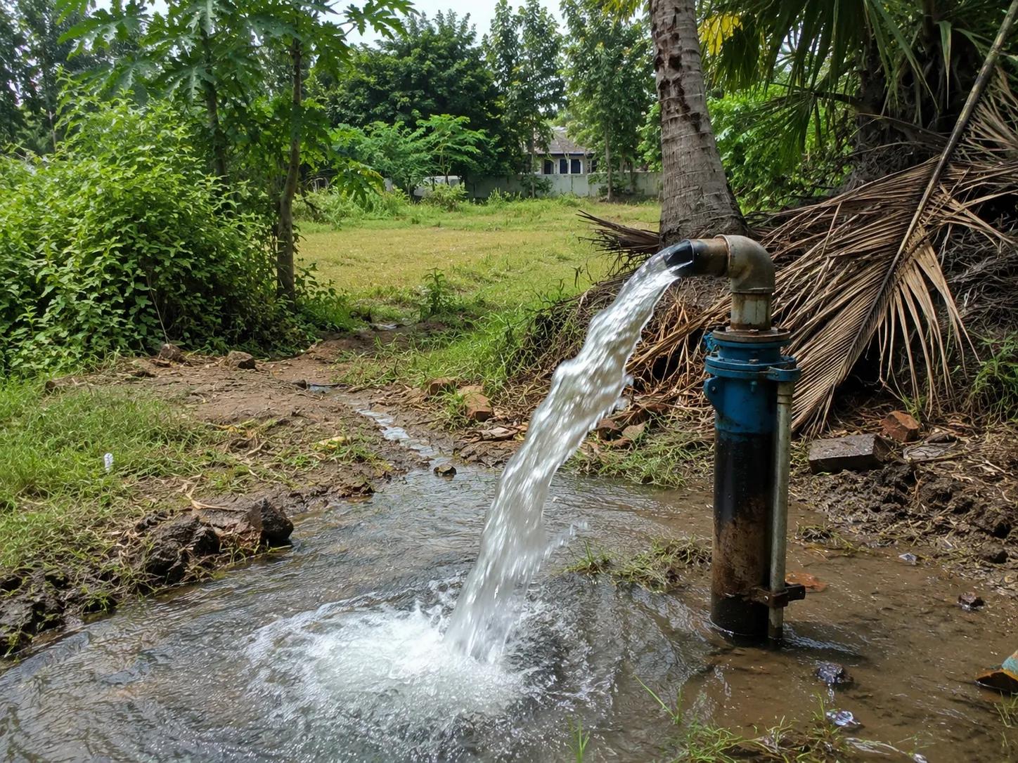
A failed borewell is one of the most expensive and frustrating problems a farmer, builder, or industrial developer can face. Drilling deep into the ground — only to find no water — wastes significant money, time, and resources. The root cause is almost always the same: drilling without a proper scientific groundwater investigation. If you are searching for borewell near me in Indore, the first step is not finding a drilling rig — it is finding the right groundwater survey expert.
Indore and the surrounding Malwa Plateau region of Madhya Pradesh have complex hydrogeological conditions. Groundwater occurs in fractured basalt formations, alluvial deposits along river valleys, and secondary aquifer zones that are highly localised. Without a proper geophysical and hydrogeological survey, even experienced drillers can miss productive aquifer zones entirely.
Bhoojal Survey provides professional borewell survey and groundwater detection services across Indore and Madhya Pradesh — combining advanced geophysical instruments with hydrogeological expertise to identify the most productive borewell locations before a single meter of drilling begins.
What Does "Borewell Near Me" Mean for Indore Residents?
When someone searches for "borewell near me" in Indore, they are typically looking for one or more of the following services: a reliable local borewell drilling company, a scientific groundwater survey expert, or a professional hydrogeologist who can identify productive borewell locations in their specific area.
However, the most important service in any borewell project is not the drilling itself — it is the groundwater investigation that comes before it. A professional borewell site survey in Indore identifies exactly where to drill, at what depth water is expected, and what yield to anticipate. This investigation dramatically reduces drilling failure risk and saves substantial investment.
Professional local borewell services near me in Indore typically include:
- Hydrogeological terrain analysis and site assessment
- Geophysical electrical resistivity survey for aquifer mapping
- Recommended borewell depth and casing design
- Drilling contractor coordination and technical supervision
- Post-drilling groundwater yield and quality assessment
Why Borewell Survey is Important Before Drilling in Indore
The Indore region sits on the Deccan Trap basalt formation — a hard rock terrain where groundwater is stored in fractures, joints, and weathered zones rather than uniform sand aquifers. This makes systematic scientific borewell location identification absolutely essential.
- Reducing Dry Borewell Risk: In hard rock terrain like Indore's basalt geology, drilling without a geophysical survey results in failure rates as high as 40–60%. A scientific resistivity survey reduces this risk significantly.
- Accurate Groundwater Identification: Electrical resistivity surveys map subsurface formations and identify water-bearing fracture zones, alluvial pockets, and productive aquifer depths specific to your site.
- Scientific Borewell Location Selection: Rather than relying on guesswork or traditional methods, geophysical data pinpoints the exact coordinates and depth where productive groundwater is most likely to be found.
- Better Groundwater Resource Planning: Understanding aquifer depth and yield potential allows you to design the right borewell casing, pump specifications, and water storage systems from the outset.
- Improved Return on Drilling Investment: A survey costing a fraction of total drilling expenses can prevent complete drilling failure, protecting your agricultural, industrial, or commercial water supply project.
Methods Used in Borewell Groundwater Survey
Bhoojal Survey uses a multi-method approach to groundwater investigation, combining geophysical, hydrogeological, and remote sensing techniques to deliver the most accurate borewell location analysis possible for Indore and Madhya Pradesh sites.
- Electrical Resistivity Survey:
The most widely used geophysical technique for groundwater detection. This method measures the electrical resistance of subsurface formations to differentiate between water-bearing zones, dry rock, and clay layers. Vertical Electrical Sounding (VES) and 2D resistivity profiling provide detailed subsurface aquifer maps.
- Hydrogeological Investigation:
Site geology, drainage patterns, topographic analysis, and regional groundwater flow data are studied to understand aquifer systems, recharge zones, and groundwater potential areas specific to the survey location.
- Geological and Terrain Analysis:
Field mapping of rock outcrops, fracture patterns, lineaments, and weathered zones provides critical structural data that guides borewell site selection in Indore's hard rock basalt terrain.
- Satellite and GIS-Based Groundwater Mapping:
Remote sensing data and GIS analysis help identify regional lineaments, fracture zones, and surface drainage features associated with productive groundwater zones — particularly useful for large project sites in Madhya Pradesh.
- Aquifer Resistivity Interpretation:
Raw field data is processed and interpreted by experienced hydrogeologists to produce a subsurface aquifer profile, recommended borewell depth, and site-specific groundwater potential rating.
Bhoojal Survey conducts hydrogeological survey using SSRMPATS Instrument, GER DETECT, and PQWT at site for open well / borewell location — delivering advanced groundwater and geophysical survey solutions with scientific groundwater investigation and resistivity analysis.
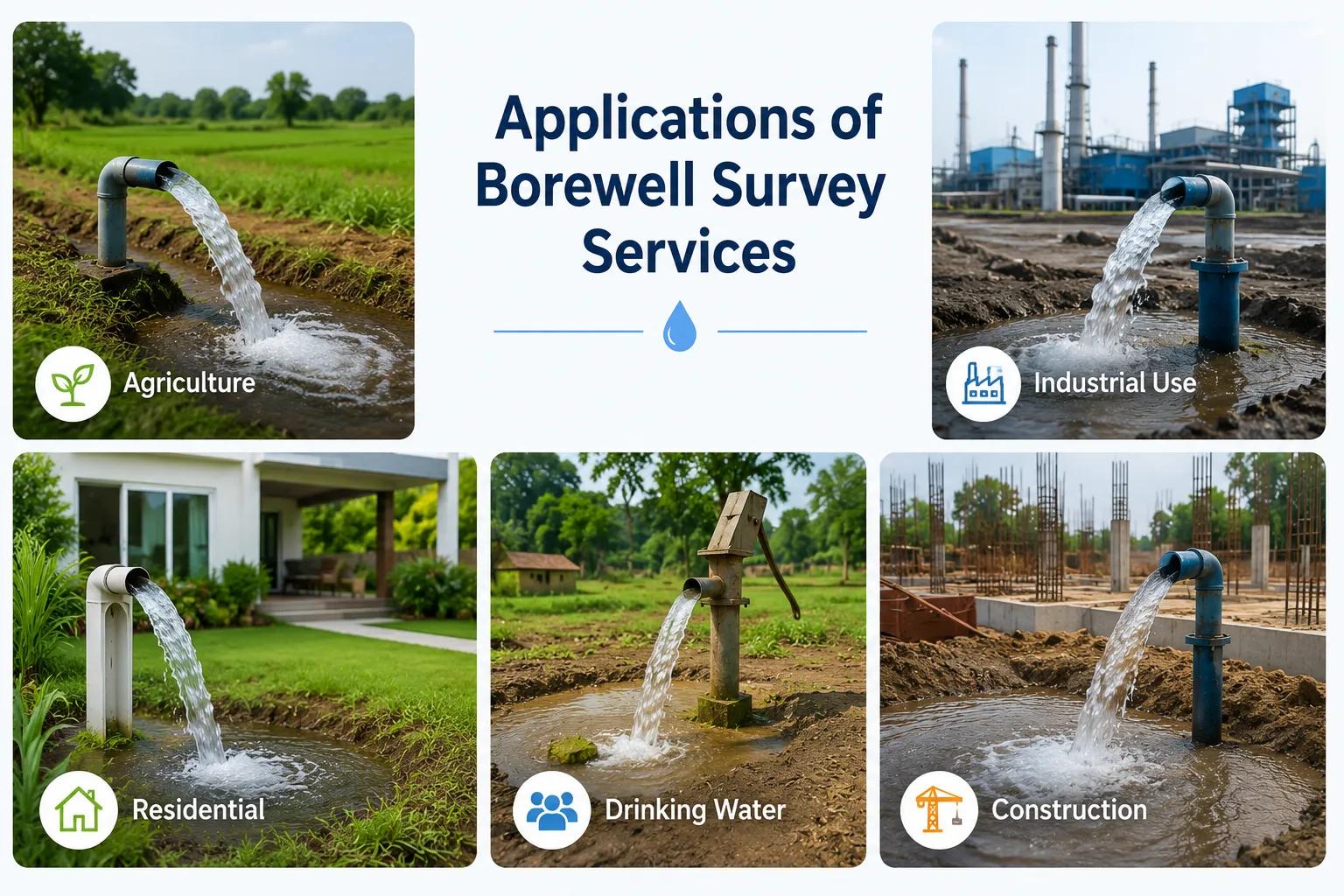
Applications of Borewell Survey Services
Bhoojal Survey has provided professional borewell survey and groundwater investigation services across a wide range of project types in Indore, Ujjain, Dewas, Pithampur, Ratlam, Khandwa, and throughout Madhya Pradesh.
- Agricultural Irrigation Borewells: Scientific groundwater detection for farmers in Malwa and Nimar agricultural zones seeking reliable irrigation water supply.
- Industrial Groundwater Projects: Borewell site investigation for factories, manufacturing units, and industrial parks in Pithampur AKVN industrial area and Sanwer Road industrial corridor near Indore.
- Commercial Water Supply Systems: Groundwater survey for hotels, hospitals, commercial complexes, and large residential townships in Indore urban and peri-urban areas.
- Infrastructure and Mining Projects: Aquifer mapping for construction dewatering, infrastructure projects, and mineral exploration across Madhya Pradesh.
- Government Rural Water Supply Schemes: Borewell location surveys for Jal Jeevan Mission and rural drinking water supply projects in MP district panchayats.
- Groundwater Recharge Projects: Identification of suitable sites for check dams, percolation tanks, and rooftop rainwater harvesting recharge structures in the Indore district.
Why Choose Bhoojal Survey for Borewell Services Near Me in Indore
When you search for borewell services near me in Indore, you need a groundwater consultancy with genuine field experience in Madhya Pradesh's hydrogeological conditions. Bhoojal Survey combines technical expertise, advanced instruments, and local geological knowledge to deliver accurate, reliable groundwater investigation results.
- Experienced Hydrogeologists & Geophysical Experts: Our team has extensive field experience in Deccan Trap hard rock groundwater investigations across Madhya Pradesh and Central India.
- Advanced Survey Instruments: We deploy state-of-the-art geophysical instruments including SSRMPATS, GER DETECT, and PQWT for accurate subsurface resistivity analysis and borewell location identification.
- Accurate Aquifer Mapping & Analysis: Every survey delivers a detailed subsurface aquifer profile, recommended borewell coordinates, target depth, and estimated yield — backed by scientific geophysical data.
- Fast Reporting & On-Site Consultancy: Survey reports are prepared promptly after field investigation, enabling your drilling project to proceed without unnecessary delays.
- Pan-India Groundwater Survey Services: While based in Central India, Bhoojal Survey provides borewell survey services across all Indian states, geological zones, and aquifer types.
- Customised Borewell Investigation Solutions: Whether for a single farm borewell in Ujjain or a multi-well industrial groundwater system in Pithampur, we design investigation programmes matched to your project scale and budget.
Conclusion
Finding a reliable borewell near me in Indore starts with choosing the right groundwater investigation partner. Indore's basalt geology demands scientific, instrument-based groundwater detection — not guesswork. Every rupee spent on a proper borewell survey before drilling is an investment that protects the far larger cost of the borewell itself.
Whether you are a farmer in Malwa seeking irrigation water, an industrialist in Pithampur needing a reliable industrial water source, or a residential developer in Greater Indore planning a water supply system, Bhoojal Survey delivers the hydrogeological expertise and field accuracy your borewell project demands.
Contact Bhoojal Survey for professional borewell survey and groundwater investigation services in Indore, Madhya Pradesh, and across India.
Frequently Asked Questions (FAQ)
1. How can I find professional borewell services near me in Indore?
To find reliable borewell services near you in Indore, look for a professional groundwater consultancy with demonstrated hydrogeological expertise in Madhya Pradesh's hard rock basalt terrain. Bhoojal Survey provides scientific borewell survey and groundwater detection services across Indore, Ujjain, Dewas, Pithampur, and all surrounding districts — combining geophysical instruments with experienced hydrogeological analysis.
2. Why is a borewell survey important before drilling in Indore?
Indore is located on the Deccan Trap basalt formation, where groundwater occurs in localised fracture zones rather than uniform aquifers. Drilling without a prior electrical resistivity survey or hydrogeological investigation carries a high risk of a dry or low-yield borewell. A scientific borewell survey identifies the most productive drilling location, target depth, and expected water yield before any drilling begins.
3. What methods are used for groundwater detection before borewell drilling?
The primary method is the electrical resistivity survey (Vertical Electrical Sounding / 2D resistivity profiling), which maps subsurface formations and identifies water-bearing fracture zones. This is combined with hydrogeological terrain analysis, geological mapping, and GIS-based lineament analysis. Bhoojal Survey uses advanced instruments including SSRMPATS, GER DETECT, and PQWT for accurate subsurface groundwater detection.
4. Why do borewells fail without proper investigation in Madhya Pradesh?
Most borewell failures in Madhya Pradesh occur due to drilling at locations chosen without geophysical investigation. In hard rock terrain, productive fracture zones are narrow and highly localised — often just a few metres wide. Without a resistivity survey mapping these zones, drillers frequently miss them entirely, resulting in dry borewells or very low water yields insufficient for agricultural or industrial use.
5. How accurate is the electrical resistivity survey for borewell location in Indore?
When conducted by an experienced hydrogeologist using calibrated instruments, electrical resistivity surveys achieve borewell success rates significantly higher than random drilling. The accuracy depends on field data quality, interpretation expertise, and local geological knowledge. Bhoojal Survey's team brings all three together, providing reliable aquifer mapping and borewell location recommendations backed by scientific geophysical data.