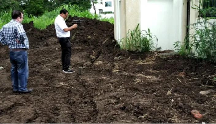
ground water survey
Borewell failure is one of the most common and costly groundwater problems faced by farmers, builders, and industries across Indore. Drilling without scientific investigation leads to dry borewells, insufficient yield, and wasted investment. A professional ground water survey in Indore is the essential first step that separates successful borewell projects from expensive failures.
Indore and the surrounding Malwa Plateau region of Madhya Pradesh sit on the Deccan Trap basalt formation — one of India's most challenging hard rock hydrogeological environments. In this terrain, groundwater does not exist in uniform sandy aquifers. It is stored in narrow fractures, joints, and weathered zones that are highly localised and impossible to identify without advanced geophysical survey techniques.
Bhoojal Survey provides professional ground water survey services in Indore and across Madhya Pradesh, combining electrical resistivity surveys, hydrogeological investigation, and scientific groundwater analysis to identify the most productive borewell locations before any drilling begins.
What is Ground Water Survey in Indore
A ground water survey in Indore is a scientific field investigation that maps subsurface geological formations, identifies water-bearing aquifer zones, and determines the most suitable locations and depths for borewell drilling. It combines geophysical measurement techniques, hydrogeological terrain analysis, and advanced instrument-based data collection to produce a reliable picture of subsurface groundwater conditions at a specific site.
In Indore's hard rock basalt geology, groundwater surveys are particularly critical because productive aquifer zones are narrow, irregularly distributed, and highly sensitive to local geological structure. Without survey data, even experienced drillers cannot reliably locate productive fracture zones — making scientific investigation the most important investment in any borewell project.
A professional groundwater survey in Indore delivers:
- Subsurface geological and aquifer profile for the survey site
- Identification of water-bearing fracture zones and weathered basalt layers
- Recommended borewell coordinates — precisely located for maximum yield
- Target drilling depth based on aquifer depth interpretation
- Expected groundwater yield estimate based on resistivity data
- Borewell casing design recommendation for the identified aquifer zone
Why Groundwater Survey is Important Before Borewell Drilling
Across Indore and the Malwa region, a significant proportion of borewells drilled without prior geophysical investigation either fail completely or deliver insufficient yield for their intended purpose. The hard rock geology of this region demands a scientific approach — random drilling simply does not work reliably in fractured basalt terrain.
- Reducing Dry Borewell Risk: In Indore's basalt geology, productive fracture zones can be just a few metres wide and separated by hundreds of metres of dry rock. Geophysical resistivity survey data pinpoints these zones before drilling begins — dramatically reducing the probability of a dry or low-yield borewell.
- Accurate Groundwater Identification: Electrical resistivity surveys map subsurface formations and distinguish between water-bearing fractured zones, dry compact basalt, and clay-rich weathered layers — providing reliable aquifer location data that guesswork cannot replicate.
- Scientific Borewell Location Selection: Survey data identifies the exact coordinates and orientation of productive fracture zones at your site, allowing the driller to target the borewell precisely rather than drilling speculatively.
- Better Groundwater Resource Management: Understanding aquifer depth, yield potential, and seasonal behaviour allows informed decisions about pump specifications, water storage design, and sustainable extraction rates.
- Improving Drilling Success Rate: Sites investigated by Bhoojal Survey before drilling consistently achieve higher success rates than uninvestigated sites — protecting your investment and ensuring your water supply objectives are met.
Methods Used in Ground Water Survey in Indore
Bhoojal Survey uses a multi-method scientific approach to groundwater investigation in Indore, integrating geophysical field surveys, hydrogeological terrain analysis, and remote sensing interpretation to deliver the most reliable borewell location recommendations possible.
- Electrical Resistivity Survey:
The primary geophysical method for groundwater detection in hard rock terrain. The survey measures the electrical resistance of subsurface formations at different depths, distinguishing productive water-bearing fractures from dry compact basalt. Vertical Electrical Sounding (VES) profiles provide a detailed subsurface aquifer map for the survey location.
- Hydrogeological Investigation:
Field assessment of site geology, drainage patterns, topographic position, rock outcrops, and regional groundwater flow direction. In Indore's Deccan Trap terrain, structural geology — particularly fault zones, lineaments, and dyke contacts — strongly controls groundwater occurrence and is carefully mapped during field investigation.
- Geological and Terrain Analysis:
Systematic mapping of surface geological features including rock type, weathering profile, joint systems, and fracture orientation. These features directly reflect subsurface aquifer conditions in basalt formations and guide resistivity survey interpretation.
- Satellite and GIS-Based Groundwater Mapping:
Multi-spectral satellite imagery and GIS analysis identify regional lineaments, fracture zones, and surface drainage anomalies associated with productive groundwater zones in the Indore area.
This analysis supports site selection for detailed field investigation.
- Aquifer Resistivity Interpretation:
Raw field resistivity data is processed and modelled by experienced hydrogeologists to produce subsurface aquifer profiles showing productive zone depth, thickness, and lateral extent — the direct basis for borewell location and depth recommendations.
Bhoojal Survey conducts hydrogeological survey using SSRMPATS Instrument, GER DETECT, and PQWT at site for open well / borewell location — delivering advanced groundwater and geophysical survey solutions with scientific groundwater investigation and resistivity analysis.
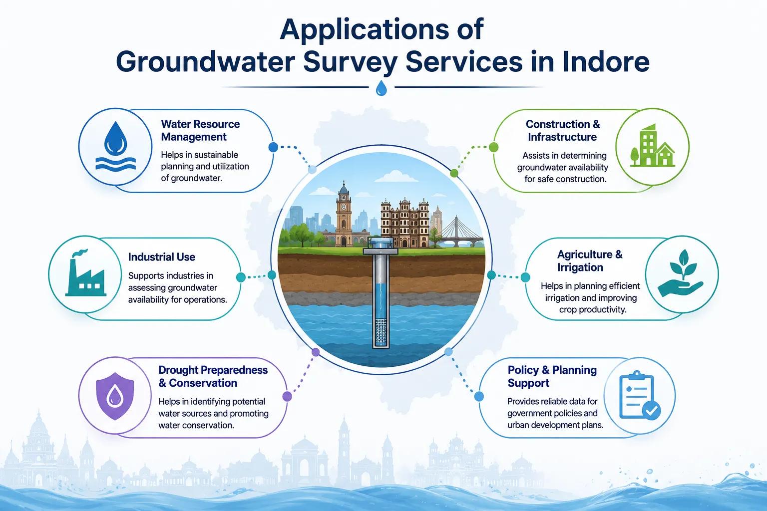
Applications of Groundwater Survey Services in Indore
Bhoojal Survey has delivered professional ground water survey services across diverse project types in Indore, Dewas, Ujjain, Pithampur, Ratlam, and throughout Madhya Pradesh. Our groundwater investigation consultancy supports the following application sectors:
• Agricultural Irrigation Borewells — Malwa & Nimar Farming Zones
• Commercial Water Supply — Hotels, Hospitals & IT Parks, Indore
• Industrial Groundwater Supply — Pithampur AKVN Industrial Area
• Government Rural Water Supply — Jal Jeevan Mission MP Projects
• Infrastructure & Highway Projects — MP Road Development
• Residential Townships — Greater Indore & Peripheral Development
• Mining Area Water Investigation — MP Mineral Belt Projects
• Groundwater Recharge — Rainwater Harvesting Site Assessment
For every application, Bhoojal Survey delivers a complete groundwater survey report including geophysical field data, subsurface aquifer interpretation, recommended borewell location and depth, expected yield estimate, and drilling guidelines — all prepared to professional hydrogeological reporting standards.
Why Choose Bhoojal Survey for Ground Water Survey in Indore
When it comes to ground water survey in Indore, Bhoojal Survey brings together local geological knowledge, advanced geophysical instruments, and experienced hydrogeological expertise that generic drilling contractors cannot match. Our scientific approach consistently delivers higher borewell success rates and better long-term groundwater outcomes for our clients.
- Experienced Hydrogeologists & Geophysical Experts: Our team has extensive hands-on experience conducting groundwater surveys in Indore's Deccan Trap basalt geology, as well as alluvial and hard rock formations across Madhya Pradesh and Central India.
- Advanced Groundwater Survey Instruments: We use state-of-the-art geophysical instruments including SSRMPATS, GER DETECT, and PQWT for precision subsurface resistivity measurement and accurate aquifer zone identification.
- Accurate Aquifer Mapping and Analysis: Every survey produces a detailed subsurface aquifer profile with recommended borewell coordinates, target depth, expected yield, and casing specifications — backed by scientific field data.
- Fast Reporting and On-Site Technical Consultancy: Survey reports are prepared and delivered promptly after field investigation, enabling your borewell project to proceed without delays.
- Pan-India Groundwater Survey Services: While deeply experienced in Indore and Madhya Pradesh's hydrogeological conditions, Bhoojal Survey provides professional groundwater investigation services across all Indian states and geological environments.
- Customised Groundwater Investigation Solutions: Whether you need a single farm borewell survey in Sanwer taluka or a multi-site industrial groundwater investigation in Pithampur, we design the programme precisely matched to your project scale, geology, and budget.
Conclusion
In Indore's hard rock basalt geology, a scientific ground water survey is not an optional extra — it is the most important step in any borewell project. The cost of a professional hydrogeological investigation is a fraction of total borewell drilling expenditure, yet it determines whether that investment succeeds or fails completely.
Whether you are a farmer planning irrigation in Sanwer, an industrialist requiring water at Pithampur, a developer building a township in Greater Indore, or a contractor planning boreholes for a government scheme, Bhoojal Survey provides the scientific groundwater investigation expertise your project needs to succeed.
Contact Bhoojal Survey for professional ground water survey in Indore and hydrogeological investigation services across Madhya Pradesh and India.
Frequently Asked Questions (FAQ)
1. What is a ground water survey in Indore and why is it necessary?
A ground water survey in Indore is a scientific geophysical and hydrogeological investigation conducted before borewell drilling to identify the precise location and depth of productive aquifer zones. It is necessary because Indore sits on the Deccan Trap hard rock basalt formation, where groundwater is stored in narrow fracture zones that cannot be located by visual inspection or guesswork. Without a survey, borewell failure rates in this geology are very high.
2. What makes groundwater survey different in Indore compared to other areas?
Indore and the Malwa Plateau region are underlain by the Deccan Trap basalt — a hard rock formation where groundwater does not exist in uniform sandy aquifers but is confined to irregular fractures, joints, and weathered zones. This geology requires specialised geophysical resistivity survey techniques to map productive aquifer zones, making professional hydrogeological investigation far more critical here than in alluvial plains regions of India.
3. What methods are used for groundwater detection in Indore?
The primary method is the electrical resistivity survey — specifically Vertical Electrical Sounding (VES) — which maps subsurface geological formations and distinguishes productive water-bearing fractured basalt from dry compact rock. This is combined with hydrogeological terrain analysis, geological fracture mapping, and where applicable, satellite GIS-based lineament analysis. Bhoojal Survey uses advanced instruments including SSRMPATS, GER DETECT, and PQWT for accurate subsurface groundwater detection.
4. How accurate is geophysical resistivity survey for borewell location in Indore?
When conducted by qualified hydrogeologists using calibrated instruments, electrical resistivity surveys achieve significantly higher borewell success rates than uninvestigated drilling in Indore's basalt geology. Accuracy depends on data quality, instrument calibration, and the expertise of the hydrogeologist interpreting the results. Bhoojal Survey combines rigorous field methodology with experienced local geological knowledge to deliver reliable borewell location recommendations backed by scientific data.
5. How long does a ground water survey take and what report is provided?
A standard groundwater survey in Indore for a single borewell location takes one to two field days including site reconnaissance, geophysical measurements, and initial data interpretation. The formal hydrogeological survey report is typically delivered within 3–5 working days of field investigation. The report includes subsurface aquifer profile, recommended borewell coordinates, target drilling depth, expected yield estimate, and borewell casing design recommendations.