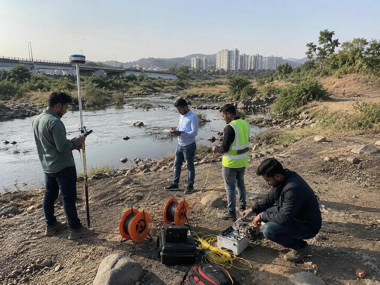
Hydrological Survey in Pune | Rainfall Analysis, Flood Risk Assessment & Drainage Design
Bhoojal Survey provides professional hydrological survey services in Pune, covering rainfall analysis, surface water flow assessment, drainage system design, runoff estimation, and flood risk mapping. Our scientifically driven approach helps infrastructure developers, government agencies, and industries make accurate, data-backed water management decisions across Pune and surrounding regions.
Overview of Hydrological Survey in Pune
Hydrology is the scientific study of the movement, distribution, and quality of water on and above the Earth's surface — including rainfall, river flow, surface runoff, and drainage patterns.
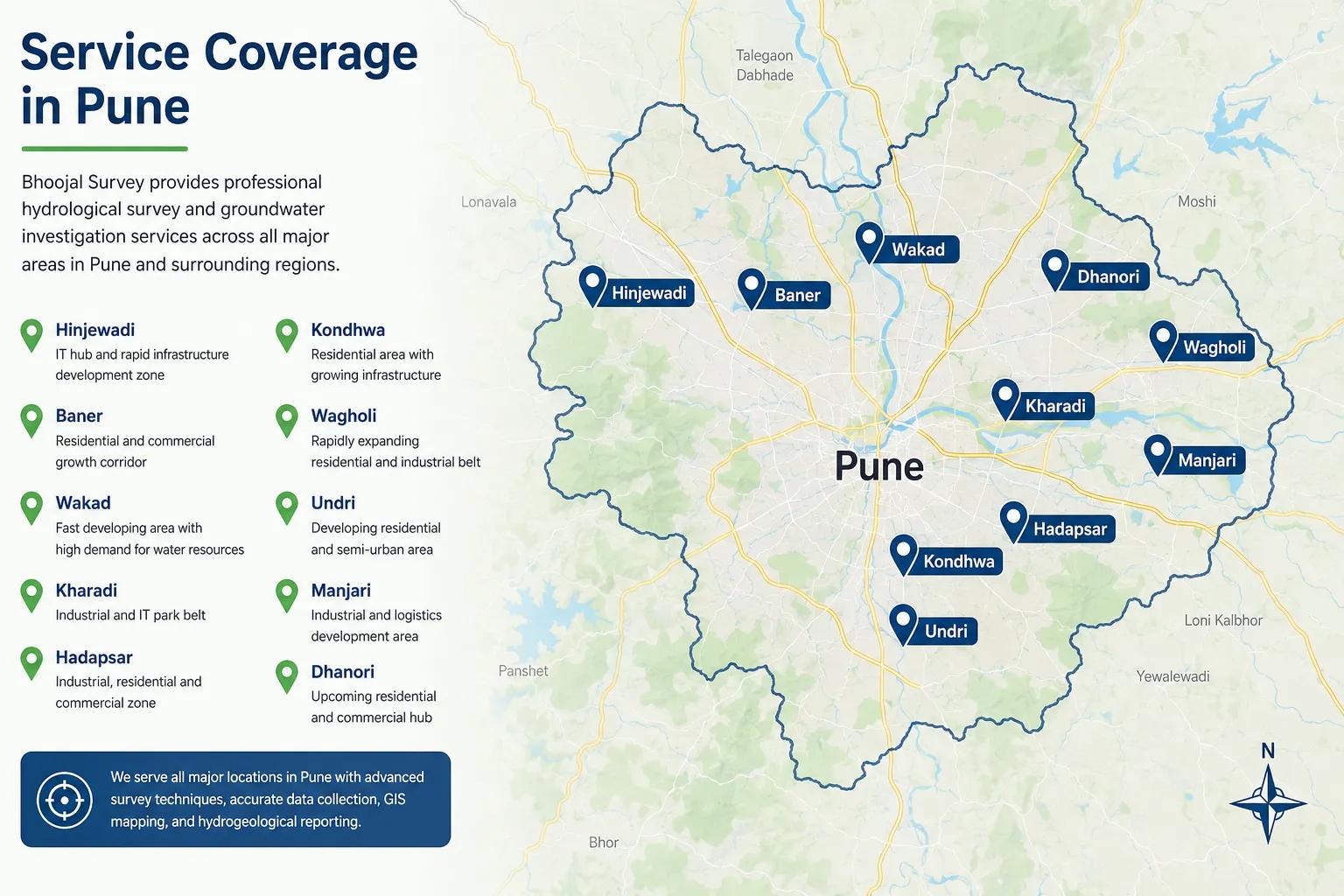
Pune presents a unique hydrological landscape. Located at the foothills of the Western Ghats, the city receives significant monsoon rainfall, and its rapidly expanding urban fabric — across Hinjewadi, Wagholi, Hadapsar, and Kharadi — has dramatically altered natural drainage patterns. Industrial corridors like Chakan, Talegaon, and Ranjangaon further intensify surface runoff challenges.
Bhoojal Survey provides end-to-end hydrological survey services in Pune that capture the true water flow behavior of your project site and translate it into engineering-ready reports.
Importance of Hydrological Survey in Pune
A hydrological survey is the foundation of any project that involves land, construction, roads, or water infrastructure. In Pune's context, where monsoon flooding, urban waterlogging, and drainage failures are recurring concerns, accurate hydrological data is critical.
Infrastructure Safety: Roads, bridges, culverts, underpasses, and buildings must be designed to handle peak rainfall and runoff loads. Without a proper hydrological study, structures risk failure during heavy monsoons.
Drainage System Design: Urban planners and developers in Pune need hydrological data to size stormwater drains, retention ponds, and outfall channels correctly.
Environmental Clearance (EC): MoEFCC requires a hydrological impact study for large infrastructure and industrial projects, covering surface water drainage and flood zone assessment.
Flood Zone Compliance: Development near the Mula, Mutha, Indrayani, and Bhima rivers requires detailed flood line mapping and high flood level (HFL) determination as mandated by the Pune Municipal Corporation (PMC), PMRDA, and Maharashtra state norms.
Government Project Design: Highways, smart city stormwater systems, and urban drainage masterplans depend on credible hydrological survey data.
Our Hydrological Survey Process in Pune
Bhoojal Survey follows a structured, multi-stage hydrological survey process that produces accurate, regulation-ready results.
Stage 1 – Data Collection & Rainfall Analysis
We collect 30+ years of rainfall data from IMD (Indian Meteorological Department), state rain gauge stations, and satellite sources for your project location in Pune. We prepare rainfall Intensity-Duration-Frequency (IDF) curves using Gumbel or Log-Pearson III distribution methods to determine design rainfall for 2, 5, 10, 25, 50, and 100-year return periods.
Stage 2 – Catchment Area Delineation Using GIS & DEM
Using Survey of India toposheets, satellite imagery, and Digital Elevation Models (DEM), we delineate the catchment area contributing runoff to your project site. Drainage divides, sub-watershed boundaries, and flow accumulation paths are mapped using ArcGIS and Arc Hydro tools.
Stage 3 – Surface Runoff & Discharge Estimation
We estimate surface runoff using the Rational Method and SCS-CN (Soil Conservation Service Curve Number) method, accounting for land use, soil type, slope, and imperviousness — critical in Pune's increasingly urbanized zones.
Stage 4 – Hydrological Modelling Using HEC-HMS & HEC-RAS
We use industry-standard hydrological modelling tools:
HEC-HMS (Hydrologic Modeling System) for rainfall-runoff simulation, flood hydrograph generation, and peak discharge estimation
HEC-RAS for river hydraulics, water surface profile analysis, and flood inundation mapping
SWMM (Storm Water Management Model) for urban stormwater and drainage network simulation
Stage 5 – Flood Risk & Drainage Analysis
We prepare High Flood Level (HFL) maps, inundation zone maps, and drainage analysis reports identifying vulnerable areas, choke points, and flood-prone zones relevant to your Pune project.
Stage 6 – Hydrological Study Report Preparation & Submission
A comprehensive hydrological study report is prepared covering all data, methodology, maps, results, and design recommendations — ready for submission to PMC, PMRDA, MoEFCC, NHAI, or other concerned authorities.
Applications of Hydrological Survey in Pune
Highway & Road Projects: NHAI and state highway projects require hydrological studies for culvert design, bridge span determination, and road drainage planning.
Urban Stormwater Drainage Design: Smart city and municipal drainage projects in Pune use hydrological data to plan stormwater networks that can handle extreme rainfall events.
Residential & Commercial Developments: Large housing townships and commercial complexes near river banks or low-lying areas require hydrological assessment for flood-safe construction planning.
Industrial Zones: Factories and warehouses in Chakan MIDC, Ranjangaon MIDC, and Talegaon MIDC need drainage impact assessments to prevent waterlogging and regulatory non-compliance.
Flood Risk Assessment & Disaster Management: Municipalities and disaster management agencies use hydrological survey data for flood early warning systems and emergency response planning.
Environmental Clearance Projects: Real estate and infrastructure projects requiring EC from MoEFCC must include a hydrological impact assessment covering surface water drainage and flood zones.
Check Dam & Irrigation Planning: Rural watershed development in Pune's outer talukas requires hydrological analysis to determine suitable sites and capacities for check dams and retention structures.
Why Choose Bhoojal Survey for Hydrological Survey in Pune
Experienced Hydrological Team: Our hydrologists and water resource engineers bring 15+ years of experience in hydrological studies across Maharashtra and Pan India.
Advanced Software & Tools: We use globally recognized tools — HEC-HMS, HEC-RAS, SWMM, ArcGIS, and Arc Hydro — to deliver technically sound and court-ready hydrological reports.
IMD Data Integration: We source authentic 30-year rainfall datasets from IMD and cross-validate with state gauge station records for Pune-specific accuracy.
Nearby Districts (on request): Nashik, Solapur, Ahmednagar, Satara, Kolhapur
Frequently Asked Questions – Hydrological Survey in Pune
Q1. What is a hydrological survey in Pune and what does it cover?
A hydrological survey in Pune is a scientific study of surface water movement — including rainfall analysis, runoff estimation, drainage patterns, river flow, and flood zone mapping. It does not cover groundwater; it focuses on how water flows on and above the ground surface across your project site.
Q2. When is a hydrological survey required in Pune?
It is required for infrastructure projects, highway design, urban drainage planning, environmental clearance applications, flood risk assessments, and development near river corridors in Pune as per PMC, PMRDA, MoEFCC, and NHAI guidelines.
Q3. How long does a hydrological survey take in Pune?
A standard hydrological survey and report typically takes 10 to 21 working days, depending on project size, data availability, and complexity of modelling required.
Q4. What tools and software does Bhoojal Survey use for hydrological surveys?
We use HEC-HMS for rainfall-runoff modelling, HEC-RAS for river hydraulics and flood mapping, SWMM for urban drainage simulation, and ArcGIS with Arc Hydro for GIS-based catchment and drainage analysis.
Q5. Is a hydrological survey different from a hydrogeological survey?
Yes — completely different. A hydrological survey studies surface water: rainfall, runoff, drainage, and river flow. A hydrogeological survey studies groundwater: aquifers, water table, and borewell siting. Bhoojal Survey offers both as separate, specialized services.
Conclusion – Expert Hydrological Survey Services in Pune
Whether you need a hydrological survey in Pune for drainage design, flood risk assessment, environmental clearance, or infrastructure project compliance, Bhoojal Survey delivers accurate, scientifically grounded, and regulation-ready results. Our use of HEC-HMS, HEC-RAS, GIS, and IMD rainfall data ensures that your hydrological study stands up to any regulatory review.
📞 Call Us Now | 💬 WhatsApp Inquiry | 📧 Send Project Enquiry
Bhoojal Survey – Trusted Hydrological Consultants | Pune | Pan India Service
Get Free Expert Assistance
What Our Clients Say
I recently used the soil resistivity website and was impressed with the accuracy and ease of use of the tools provided. The site helped me to accurately measure the resistivity of the soil on my property and provided me with all the necessary information I needed for my project. I highly recommend this site to anyone looking for reliable soil resistivity data.
Raman Arora
Geotechnical Engineer
Bhoojal Survey website is a game-changer for our business. I recently used the earth resistivity testing services provided by Bhoojal Survey, and I must say I was thoroughly impressed. The website was easy to navigate and provided all the information I needed to understand the testing process and the benefits it could provide for my business.
Vivek Agrawal
Environmental Scientist
I recently had to obtain a NOC from CGWA for groundwater extraction, and I must say that the process was made extremely simple and efficient thanks to the team at Bhoojal Survey. The website provided all the necessary information, and the team was always available to answer any questions I had throughout the process.