Engineering Hydrogeology for Solar & Infrastructure
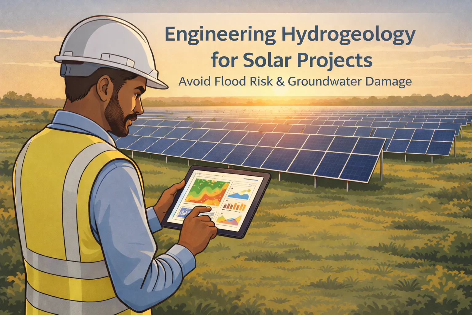
Why Engineering Hydrogeology Is Critical in 2026
India's infrastructure and solar energy sectors are growing at a rapid pace. Large land parcels are being acquired for solar parks, highways, industrial zones, and urban townships every single day. But beneath every project site lies a complex world of groundwater, soil layers, and subsurface flow — and ignoring it is one of the most expensive mistakes a developer can make.
Engineering Hydrogeology is the scientific study of how groundwater behaves within geological formations and how it interacts with built infrastructure. It covers everything from aquifer mapping and water table monitoring to seepage risk and foundation safety analysis.
When a solar park is installed on land with a high seasonal water table, panel foundations can shift and crack. When a road embankment crosses an underground seepage zone, the road can sink within months. These are not rare events — they are predictable consequences of skipping a proper subsurface evaluation.
Modern engineering hydrogeology uses integrated surveys, drone-based terrain mapping, electrical resistivity testing, and aquifer characterization to give project teams a complete picture of the subsurface before construction begins. This guide explains what the study involves, why it matters, and what professional surveys deliver.
Why Large Projects Need Hydrogeology Studies
Large-scale projects — especially solar parks spanning 50 to 500 acres — present unique hydrogeological challenges. A single site can have highly variable soil types, different slope gradients, and multiple groundwater zones at different depths. Without a detailed survey, engineers are designing structures on assumptions rather than facts.
Here is why engineering hydrogeology is essential for large infrastructure and solar projects:
- • Variable soil and slope conditions — Different parts of the same site can have drastically different bearing capacity and drainage behaviour. A hydrogeological study maps these variations so foundation depths and drainage designs match actual ground conditions.
- • Groundwater table fluctuation — Seasonal water tables rise and fall significantly in many parts of India. A foundation designed for dry-season conditions can become unstable during monsoon if groundwater was not properly studied.
- • Subsurface seepage risks — Hidden underground seepage paths can cause erosion, piping, and structural failure below the surface. These are invisible without geophysical investigation.
- • Erosion and soil instability — Groundwater pressure combined with poor drainage can trigger soil erosion and slope failures, especially in regions with black cotton or clayey soils.
- • Long-term structural safety — Engineering decisions made in the planning phase directly determine whether the structure stands for 25 years or develops serious problems within 5. Subsurface data is what makes those decisions reliable.
Bhoojal Survey's Integrated Study Method
Professional agencies like Bhoojal Survey have developed integrated engineering hydrogeology frameworks specifically designed for solar and infrastructure projects. Rather than conducting single-point investigations, they combine multiple survey methods to build a complete, three-dimensional picture of the subsurface across the entire project area.
A professional integrated engineering hydrogeology study typically includes:
- • Subsurface water investigation — Identifying the depth, quality, and movement of groundwater across the project site using field instruments and geophysical methods.
- • Soil and aquifer analysis — Understanding the geological layers, soil permeability, and aquifer behaviour to predict how groundwater will respond to construction and seasonal changes.
- • Integrated hydrological and hydrogeological assessment — Combining surface water flow analysis with groundwater behaviour for a complete picture of the water environment at the site.
This integrated method ensures that no subsurface risk goes undetected. It is what separates a scientifically sound engineering study from a basic desk report.
Drone Terrain Mapping for Hydrogeology
High-resolution drone survey is now a standard first step in professional engineering hydrogeology for large project sites. Traditional topographic maps are often outdated and lack the resolution needed for accurate drainage or groundwater flow modeling. Drone surveys solve this problem efficiently and cost-effectively.
Drone terrain mapping provides the following critical inputs:
- • Contour mapping — Accurate elevation contours at 0.5m to 1m intervals across the entire site, showing the real shape of the land at engineering-grade precision.
- • Digital Elevation Model (DEM) — A detailed 3D surface model used as the base layer for all hydrogeological and drainage analysis throughout the study.
- • Slope analysis — Identification of steep slopes, gentle slopes, and flat areas where water accumulation is most likely during monsoon events.
- • Drainage flow pattern identification — Mapping of natural water flow paths, catchment boundaries, and discharge points across the site to guide drainage system placement.
- • Groundwater flow modeling support — Terrain data is used as input for subsurface groundwater flow direction models, helping predict how water moves below the surface.

Groundwater Level & Aquifer Analysis
Understanding the groundwater table is at the heart of engineering hydrogeology. For solar parks and infrastructure projects, groundwater depth directly affects foundation design, drainage system placement, and long-term structural safety. Seasonal fluctuation data is just as important as the current water level reading.
A professional groundwater and aquifer study covers:
- • Static and dynamic water level monitoring — Measuring groundwater levels during dry and wet seasons to understand the full range of fluctuation at the site over time.
- • Aquifer characterization — Identifying the type, depth, thickness, and water-yielding capacity of the subsurface aquifer layers present below the site.
- • Permeability testing — Testing soil and rock permeability to understand how quickly water moves through the subsurface and how easily it can be drained or controlled.
- • Pumping test interpretation — Conducting and analyzing pumping tests to determine aquifer hydraulic properties for dewatering and water supply calculations.
- • Recharge potential study — Identifying zones where groundwater recharge naturally occurs, which is critical for planning drainage layouts without disrupting the natural water balance.
Electrical Resistivity & Subsurface Investigation
Geophysical investigation is one of the most powerful tools in engineering hydrogeology. It allows engineers to see below the surface without expensive drilling across the entire site. Electrical resistivity methods measure how easily electrical current passes through different soil and rock layers, identifying water-bearing zones, fractures, and impermeable barriers.
The instruments and methods commonly used include:
- • Electrical Resistivity Survey (ERS) — Multi-electrode profiling and vertical electrical sounding (VES) to map subsurface layers and identify groundwater zones at varying depths.
- • SSR-MPATS instrument — A high-sensitivity resistivity system used for detailed multi-layer subsurface profiling across large project sites efficiently.
- • PQWT groundwater detector — Advanced electromagnetic detection equipment for locating water-bearing fractures and fault zones in hard rock terrain areas.
- • GER Detect system — A multi-frequency geophysical detector used for identifying subsurface anomalies including water pockets and buried drainage channels.
- • Fracture and water-bearing zone identification — Mapping structural discontinuities in rock formations that act as conduits for groundwater movement below the site.
Catchment & Subsurface Flow Analysis
One of the most overlooked aspects of site hydrogeology is the contribution of groundwater coming from outside the project boundary. A site sitting at the base of a sloping terrain may receive significant subsurface inflow from upgradient land. This off-site groundwater contribution is often the main cause of unexpected waterlogging and seepage problems during and after construction.
Catchment and subsurface flow analysis in engineering hydrogeology covers:
- • On-site and off-site groundwater contribution — Mapping and quantifying groundwater inflow from within the site and from the surrounding contributing catchment area.
- • Flow direction mapping — Determining the direction in which groundwater moves below the surface, using water level data and terrain analysis together.
- • Hydraulic gradient study — Measuring the pressure gradient that drives groundwater movement to quantify seepage velocity and potential inflow rates.
- • Water table fluctuation assessment — Documenting how the water table changes over time in response to rainfall, drought periods, and human water extraction nearby.
Flood & Waterlogging Risk Assessment
Flood and waterlogging risk is a serious concern for any large project site in India. Monsoon rainfall events can overwhelm surface drainage quickly, and when combined with a high groundwater table, the result is prolonged waterlogging that damages foundations, electrical infrastructure, and access roads — sometimes taking weeks to resolve.
A professional engineering hydrogeology study identifies the following flood and waterlogging risks:
- • Water accumulation zones — Mapping depressions, flat areas, and blocked drainage paths where water pools during and after heavy rainfall events.
- • Basement and trench seepage risk — Identifying areas where groundwater pressure is high enough to cause seepage into cable trenches, equipment pits, and substation basements.
- • Foundation instability zones — Areas where saturated soils lose bearing capacity, creating a risk of settlement and progressive structural distress.
- • Drainage failure risk — Mapping sections of the site where natural drainage is obstructed or where planned drainage channels are likely to be undersized for actual peak flows.
In Central India projects, detailed hydrogeological investigation in Indore has helped prevent groundwater seepage issues in solar installations, protecting both foundation integrity and electrical systems from monsoon-season damage.
Terrain, Soil & Runoff in Engineering Hydrogeology
Surface and subsurface water behaviour are closely linked through the physical properties of the soil and terrain. Understanding this relationship is essential for accurate engineering hydrogeology analysis and for designing drainage systems that will perform reliably over the full project lifetime without maintenance failures.
Key parameters studied in terrain, soil, and runoff interaction include:
- • Soil permeability — How quickly water infiltrates through the soil. Sandy soils allow fast infiltration; clayey soils promote surface runoff. This directly affects how much water reaches the groundwater table versus how much flows overland.
- • Runoff coefficient — The fraction of rainfall that becomes surface runoff. This coefficient changes with land use and soil cover, and is used to calculate peak discharge for drainage design.
- • Slope influence — Steeper slopes generate faster runoff and higher erosion potential. Flatter slopes accumulate water and are more prone to waterlogging problems.
- • Subsurface water pressure — Elevated pore water pressure in the soil reduces its shear strength, which is the key parameter in slope stability and foundation safety calculations.
- • Time of concentration — The time it takes for runoff from the farthest point of a catchment to reach the drainage outlet, used to calculate peak flow rates for culvert and channel design.
Design Inputs & Engineering Recommendations
The final output of any engineering hydrogeology study is not just data — it is actionable engineering guidance. Survey results are translated into specific recommendations that the design and construction teams can directly use for project planning, foundation design, and drainage layout decisions.
Standard engineering recommendations from a hydrogeological study include:
- • Safe foundation depth — Recommended depth for foundations based on groundwater levels, soil bearing capacity, and the full range of seasonal water table fluctuation.
- • Drainage alignment — Suggested routes and gradients for surface and subsurface drainage channels based on actual terrain and flow analysis data.
- • Subsurface water diversion — Design of cut-off drains, French drains, or subsurface barriers to redirect groundwater away from sensitive structures and excavation zones.
- • Dewatering recommendations — Guidance on temporary dewatering during excavation and construction phases to keep work zones dry, safe, and on schedule.
- • Long-term monitoring plan — A programme of periodic groundwater level monitoring to detect changes over the project lifetime and enable early intervention if subsurface conditions shift.
What You Receive: Study Deliverables
A professional engineering hydrogeology study delivers a comprehensive set of technical documents and maps that support every stage of project planning, design, and regulatory approval. These deliverables are prepared to engineering standards and are directly usable by structural engineers, EPC contractors, and environmental consultants.
Typical deliverables from a full hydrogeology study include:
- • Detailed technical report — A full written report covering survey methodology, field findings, technical analysis, and clear engineering recommendations.
- • Subsurface maps — Spatial maps showing soil layers, aquifer depth, and groundwater zones plotted across the full project site area.
- • Groundwater contour map — A map showing equal-depth groundwater contours, used to determine the direction and gradient of groundwater flow.
- • Resistivity sections — Interpreted cross-sections from the electrical resistivity survey showing subsurface layer sequences and the locations of water-bearing zones.
- • Risk assessment summary — A clear, structured summary of all identified hydrogeological risks, their severity level, and recommended mitigation measures for each.
- • Engineering recommendations table — A structured table of specific design inputs for foundation, drainage, dewatering, and long-term monitoring design teams to act on directly.
Why Get Expert Help Before Construction
Subsurface risks are invisible until they cause problems. Once construction has started, addressing unexpected groundwater issues becomes exponentially more expensive and time-consuming. The only way to manage subsurface risk proactively is through a detailed pre-construction hydrogeological survey conducted by qualified specialists.
Professional agencies offering detailed hydrogeological survey services ensure accurate subsurface analysis before major infrastructure investment. They bring the instruments, trained field teams, and technical expertise needed to identify what lies beneath your project site — and to translate that data into practical engineering guidance your team can act on.
Expert hydrogeologists understand local geology, regional groundwater regimes, and the specific challenges of solar and infrastructure development in Indian conditions. This local and technical knowledge is what separates a genuinely useful study from a generic desk report with no real engineering value.
Risks of Skipping Engineering Hydrogeology
Choosing to skip or cut corners on engineering hydrogeology is a false economy. The short-term saving is almost always wiped out — and often exceeded — by the cost of dealing with problems after construction is complete and the site is operational.
Common consequences of ignoring subsurface investigation include:
- • Foundation cracks and settlement — Saturated or unstable soils cause uneven settlement, leading to structural cracking that can compromise the entire solar or civil installation.
- • Basement and trench flooding — Substation basements, cable ducts, and equipment pits fill with water when groundwater levels are not accounted for in the initial design.
- • Unexpected excavation water inflow — Construction work halts when excavations hit the water table at unexpected depths, causing costly delays and unplanned dewatering expenses.
- • Increased project cost — Retrofit drainage, emergency dewatering, and structural repairs are far more expensive than a preventive survey conducted before work begins.
- • Regulatory and approval delays — Environmental and structural approvals may be held up if hydrogeological evidence is absent or insufficient in the documentation package.
- • Long-term structural instability — Repeated seasonal groundwater fluctuation around inadequately designed foundations causes progressive damage that compounds over years of operation.
Engineering Hydrogeology Trends: 2026 to 2030
The next five years will see engineering hydrogeology become an even more central part of infrastructure and renewable energy project planning across India and globally. Several important trends are shaping how the field is evolving and what project teams will need to prepare for.
- • Climate change impact on groundwater — Shifting monsoon patterns and longer dry periods are changing groundwater recharge rates and seasonal water table behaviour across India, requiring studies to use updated climate baselines.
- • Smart solar parks — Next-generation solar installations are integrating real-time groundwater monitoring sensors that feed data into automated drainage management and alert systems.
- • AI-based groundwater modeling — Machine learning algorithms are being applied to hydrogeological datasets to predict seasonal water table movements and identify subsurface anomalies faster than traditional methods allow.
- • Sustainable infrastructure planning — Environmental clearance processes are increasingly requiring groundwater impact assessment as a standard component of EIA documentation for large projects.
- • Government compliance requirements — CGWA regulations, state groundwater boards, and renewable energy development guidelines are moving toward mandatory pre-construction hydrogeological assessment for projects above a defined scale.
Conclusion: Build on Facts, Not Assumptions
Engineering hydrogeology is not an optional add-on for solar parks, highways, or industrial projects. It is the scientific foundation that determines whether your infrastructure survives its first monsoon season — or faces costly repair, redesign, and reputational damage.
Every project site has a unique subsurface story. Knowing that story before you pour concrete is what separates a successful project from a problematic one. A professional hydrogeological study costs a small fraction of what even a single structural failure will cost — in money, time, and investor confidence.
From groundwater level analysis and electrical resistivity surveys to aquifer mapping and flood risk assessment, engineering hydrogeology gives your project team the complete subsurface intelligence needed to design with confidence and build without regret.
If you are planning a solar park, highway, industrial zone, or any large infrastructure project in India, commission your engineering hydrogeology study before the first stake goes in the ground. The data you collect today will protect your investment for the next 25 years.
Get Your Site Survey Done Before Construction
Do not let hidden groundwater problems damage your solar park or infrastructure project. Our certified team conducts complete engineering hydrogeology surveys — from drone terrain mapping and electrical resistivity investigation to aquifer analysis and flood risk assessment. We deliver clear technical reports with specific engineering recommendations your design team can use immediately.
Frequently Asked Questions
What is engineering hydrogeology?
Engineering hydrogeology is the applied study of how groundwater occurs, moves, and interacts with soil, rock, and built structures. It combines geophysical surveys, aquifer testing, groundwater level monitoring, and terrain analysis to provide the subsurface data needed for safe foundation design, drainage planning, and flood risk management on infrastructure and solar energy projects.
Why is it needed for solar park projects?
Solar parks cover large areas of land with variable soil and groundwater conditions. Without an engineering hydrogeology study, panel foundations can be placed in zones with seasonal high water tables, causing settlement and structural cracking. Cable trenches and substation basements can flood if groundwater depth is not properly understood before design begins. A pre-construction survey eliminates these risks before they become expensive problems on site.
What does an electrical resistivity survey show?
An electrical resistivity survey maps subsurface layers by measuring how different materials resist the flow of electric current through them. Water-saturated zones, fractured rock, clay layers, and hard rock all have distinct resistivity signatures. The results are interpreted to produce cross-section profiles showing the depth and extent of water-bearing zones, helping engineers identify where groundwater risks are highest across the site.
What does a hydrogeology study report include?
A professional engineering hydrogeology study delivers a detailed technical report, subsurface and groundwater contour maps, electrical resistivity cross-sections, a flood and waterlogging risk assessment summary, and a structured table of engineering recommendations covering foundation depth, drainage design, dewatering guidance, and a long-term groundwater monitoring plan for the operational project lifetime.
Is a hydrogeological study mandatory in India?
For projects requiring CGWA groundwater NOC, Environmental Impact Assessment (EIA) clearance, or state-level infrastructure approvals, a hydrogeological study is increasingly required as part of the documentation. Beyond regulatory requirements, it is also a practical engineering necessity. Projects that proceed without proper subsurface data consistently face higher construction costs, longer timelines, and greater long-term maintenance problems than those supported by a proper engineering hydrogeology survey.