Hydrological Modeling
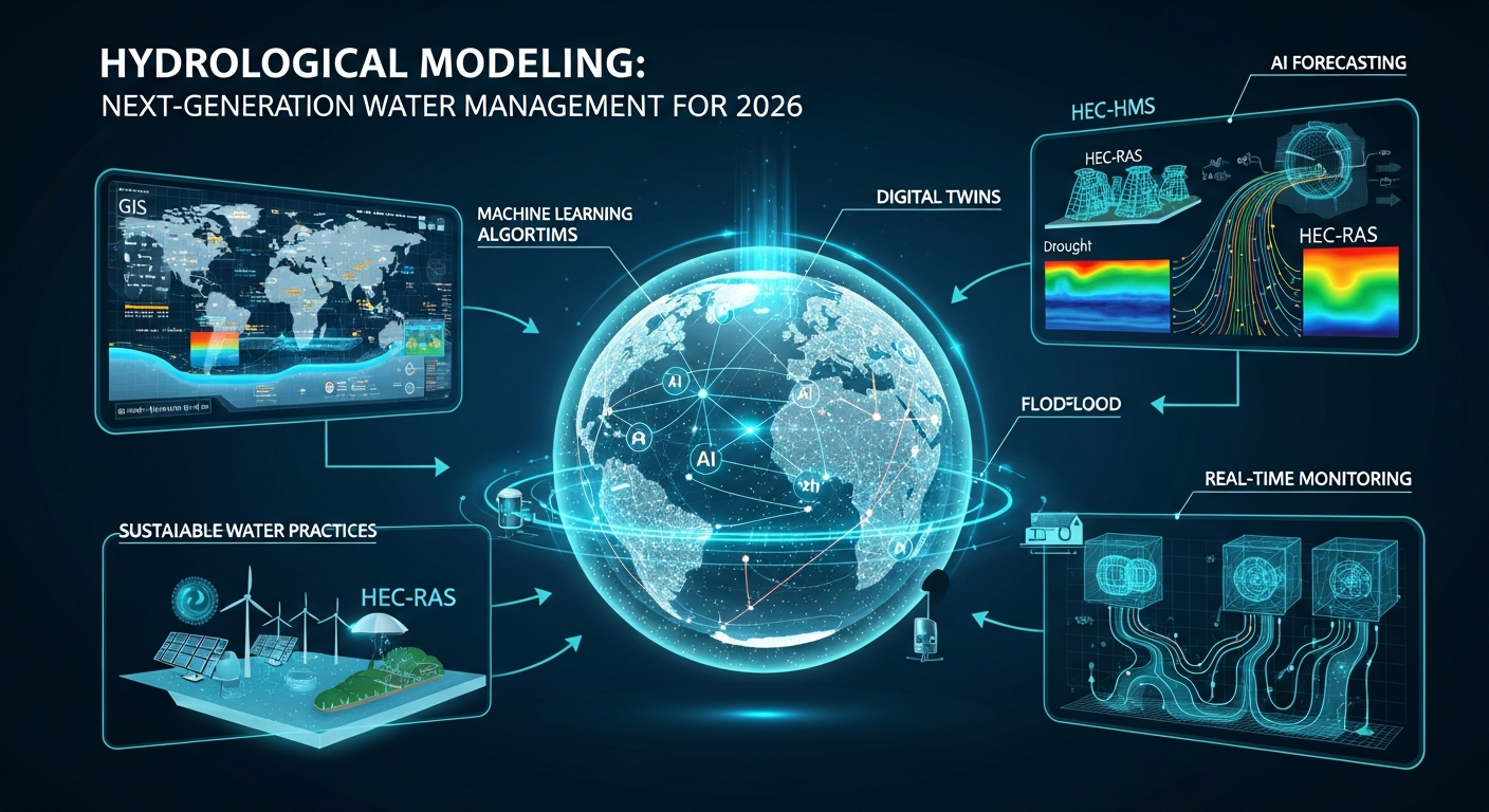
Hydrological Modeling: Next-Generation Water Management for 2026
Hydrological modeling is a smart way to understand how rain turns into runoff and moves through our land, rivers, and drainage systems. As we step into 2026, this field is getting a big upgrade with artificial intelligence (AI) and machine learning (ML). These new technologies help engineers predict water availability, forecast floods, and manage our water resources with amazing accuracy. For cutting-edge hydrological solutions you can trust, connect with Bhoojal Survey.
Instead of just using old assumptions or basic calculations, today's hydrological modeling mixes traditional science with clever AI tools. This blend gives us data-driven insights that save money, prevent big infrastructure problems, and help us manage water sustainably, especially as India faces more unpredictable weather and water shortages.
What Exactly is Hydrological Modeling?
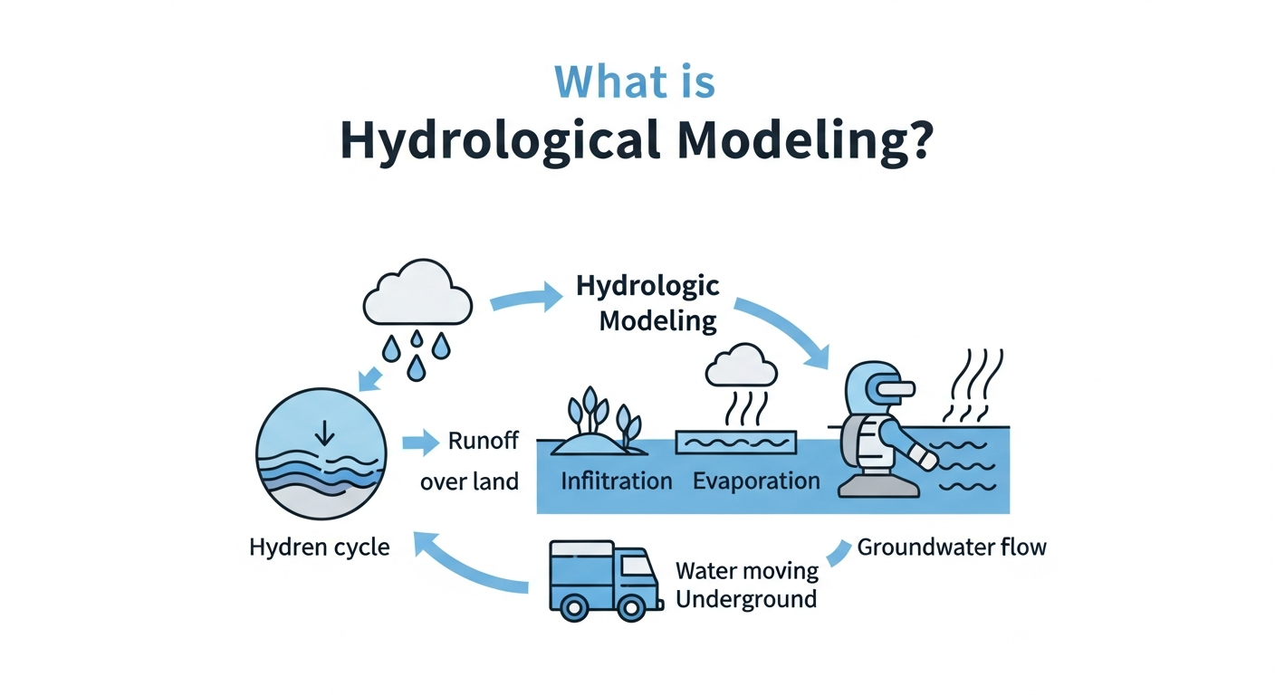
Simply put, hydrological modeling uses math and computer programs to mimic the natural water cycle in a specific area. It looks at things like rainfall patterns, different soil types, how land is used (like cities or farms), plants growing there, and the shape of the land. All this helps us guess how much water will flow, where it will collect, and when water levels will be highest.
In 2026, these models are getting even smarter by using AI and ML algorithms. These algorithms learn from huge amounts of data, including satellite images, weather station reports, and past river flow records. Advanced tools now combine Geographic Information Systems (GIS) with AI prediction engines. This creates detailed simulations that show complex water movements through easy-to-understand maps, charts, and live dashboards.
Why is Hydrological Modeling So Important in 2026?
Every construction or development project needs answers to key water questions: How much rain will run off during heavy monsoons? Can our drains handle unusual weather? How much water will be left during long dry spells? Modern hydrological modeling gives us solid answers to these questions. It protects our investments and helps projects succeed in a time when climate changes bring more uncertainty.
Recent studies show that water patterns are changing a lot, with predictions of tougher droughts and more intense wet periods from 2026 to 2035. This makes accurate, AI-powered modeling more important than ever for planning new infrastructure and keeping our water secure across India.
- It helps prevent design mistakes and expensive changes by giving accurate predictions.
- It optimizes how we use water resources with real-time data and AI analysis.
- It makes it easier to get legal approvals with strong, scientific analysis.
- It reduces the risks of floods and droughts using advanced early warning systems.
- It helps us plan for a changing climate (2026 and beyond) by testing different future scenarios.
- It connects to IoT sensors and remote sensing for continuous monitoring.
Real-World Uses for Hydrological Modeling
Hydrological modeling helps many industries across India plan and manage water resources more effectively:
- Flood Forecasting: Predicting when and where floods will happen, how big they'll be, and how long they'll last to issue early warnings and keep people safe.
- Rainfall-Runoff Analysis: Figuring out how much rain becomes surface water, which is key for designing good drainage and collecting rainwater.
- River Basin Planning: Looking at entire river systems to see how much water is available, how to share it, and how to balance different needs.
- Urban Stormwater Management: Designing drainage systems in growing cities to prevent flooding.
- Agriculture and Irrigation Planning: Helping farmers use water wisely, plan when to irrigate crops, and get better harvests.
- Water Resource Management: Supporting efforts to recharge groundwater, operate dams, and plan for droughts to ensure a steady water supply.
- Infrastructure Development: Checking water impacts for big projects like highways, airports, factories, and city growth.
- Environmental Protection: Ensuring enough water flows naturally to protect wetlands and keep our water clean.
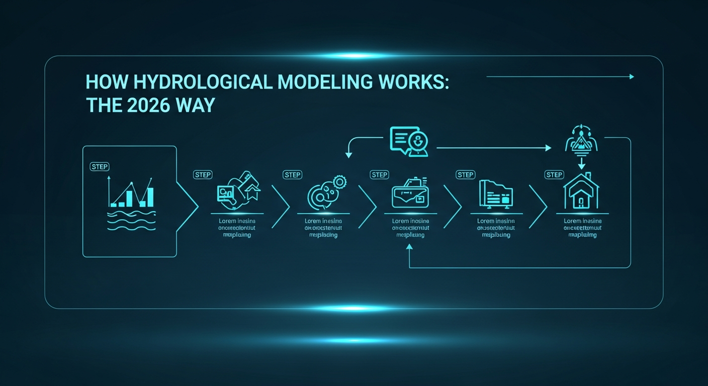
How Hydrological Modeling Works (The 2026 Way)
Today's professional hydrological modeling combines traditional science with AI and big data to create systems that are more accurate and responsive:
Step 1: Gathering Rainfall and Climate Data
We start by collecting historical rainfall data, information on how intense rain can get, temperature, and how much water evaporates. In 2026, we use satellite data (like CHIRPS and PERSIANN), automatic IoT weather stations, and climate predictions from advanced global models. Machine learning then sifts through this massive data to find patterns that older methods might miss.
Step 2: Analyzing Catchment Areas (Watersheds)
Next, we map out the study area, known as a catchment or watershed. This uses high-resolution digital elevation models from laser scans (LiDAR) and satellites. AI-powered GIS tools automatically draw watershed boundaries, measure drainage areas, map river networks, and find natural divides. Deep learning models then analyze soil maps, land use, and plant cover to understand how water soaks in or runs off, with incredible detail.
Step 3: AI-Enhanced Runoff Estimation
Advanced machine learning models (like Random Forest and XGBoost) calculate how much rainfall actually turns into surface runoff. These AI methods look at complex interactions between soil type, land cover, slope, initial wetness, city development, and climate changes. Neural networks learn from years of past data to make predictions far better than simple equations.
Step 4: Simulating and Forecasting Streamflow
The estimated runoff then moves through the river and drainage networks using hybrid models. These models combine traditional physics with deep learning (like LSTM networks) to predict peak river flows, flood amounts, and exactly when they will happen. Live data from IoT sensors feeds into the system, constantly improving the model and sending immediate flood warnings if conditions suddenly change.
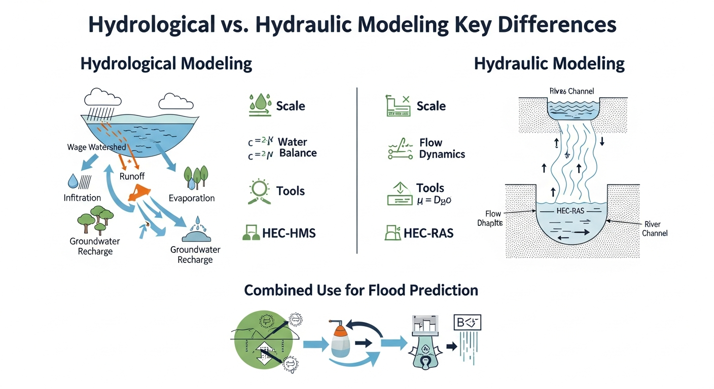
Hydrological vs. Hydraulic Modeling: What's the Difference?
While both are about water, they answer different questions:
Hydrological Modeling focuses on the overall water cycle – how rain becomes runoff across the landscape. It asks: How much water will be generated? When will it peak? What total volumes can we expect?
Hydraulic Modeling focuses on how that water moves through specific channels, pipes, or structures. It asks: How deep will the water be here? How fast will it flow? Where exactly will it flood?
Most big projects use both: hydrological models figure out the water amounts, and then hydraulic models show what happens when those amounts enter specific systems.
Smart Tools We Use for Hydrological Modeling in 2026
Modern hydrological modeling uses both established software and cutting-edge AI technologies:
- AI & Machine Learning: Algorithms like XGBoost for runoff prediction; LSTM networks for forecasting river flows over time.
- GIS Platforms: Advanced mapping tools to process land data, draw watershed boundaries, and create visual maps.
- HEC-HMS & SWAT: Popular software for simulating rainfall-runoff and managing water in watersheds, from small areas to large regions.
- Remote Sensing & Satellites: Data from satellites (like CHIRPS, PERSIANN, GRACE) to estimate rainfall, soil moisture, and even groundwater levels.
- Digital Twin Technology: AI-powered virtual copies of real water systems that combine science with live data for dynamic updates.
- IoT Sensors: Small devices that constantly monitor rainfall, soil moisture, and river flow in real-time.
- Climate Models: Advanced global climate projections (like CMIP6) to plan for future climate scenarios.
Why Choose Professional Hydrological Modeling Services in 2026?
- You get accurate water assessments using AI to analyze complex data.
- Real-time flood forecasts give you minutes of warning time through IoT.
- Infrastructure designs are cost-effective because they're optimized by machine learning.
- Risks are lowered by spotting water problems early with predictive analytics.
- It ensures you meet regulations with technically strong, defensible documents.
- Project approvals are smoother thanks to advanced modeling.
- You can plan for climate change using the latest projections.
- It leads to sustainable water management, boosting long-term resilience.
- Decision-making is transparent with Explainable AI (XAI) that everyone can trust.
- Models can adapt to new regions by learning from similar areas.
Advanced Hydrological Modeling for India's Future
Hydrological modeling is changing fast as AI transforms how we plan for water and build new infrastructure. As we move through 2026, combining machine learning, IoT sensors, and live data gives us amazing new ways to handle India's water challenges.
Research shows that India will see more varied water conditions in the coming years, with climate models predicting both serious droughts and intense floods. Projects designed with AI-enhanced hydrological analysis can adjust to these changes, work well in different climate situations, and help ensure water security for today and for future generations.
Mixing traditional water science with artificial intelligence is a game-changer for water management. While there are still challenges – like data quality and making models easy to understand – the benefits are huge. Organizations that use these advanced modeling techniques will be leaders in sustainable water resource management.
Bhoojal Survey plays a vital role in advancing hydrological modeling by combining deep understanding of groundwater, detailed surface water analysis, and cutting-edge AI-powered GIS tools. We deliver reliable and practical water solutions for 2026 and beyond. We work on a wide range of projects, from national highways and airports to industrial sites, urban infrastructure, and agricultural planning. Bhoojal Survey helps make smart choices at both project and policy levels, using the very latest machine learning and deep learning techniques.
Through scientifically developed hydrological models, boosted with artificial intelligence, our organization helps improve water resource management, reduce flood and drought risks, and promote sustainable water use in a time of unpredictable climate. By integrating IoT sensors, satellite data like CHIRPS and GRACE, and advanced AI algorithms including XGBoost and LSTM networks, Bhoojal Survey offers real-time monitoring and predictive power that traditional methods simply can't match.
Our team's wide-ranging expertise and involvement in major development projects show our strong capability in next-generation hydrological modeling. This contributes not just to immediate water management solutions, but also to long-term groundwater conservation, resilience against climate change, and water security efforts across India as the country faces the complex water challenges of 2026-2035 and beyond.