Hydrology Survey
A Hydrology survey is essential for assessing water resources and potential risks in various projects, including solar installations. At Bhoojal Survey, we specialize in conducting comprehensive Hydrology survey services to evaluate water flow, drainage patterns, and flood risks.
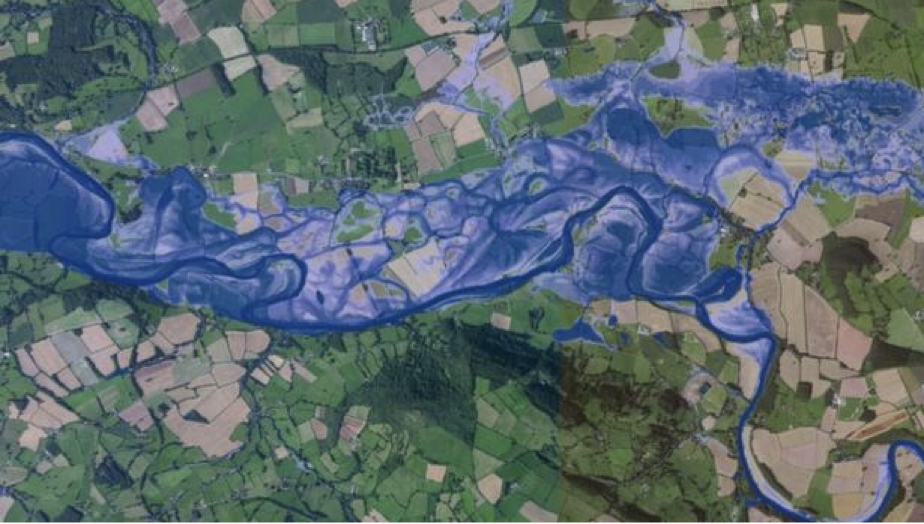
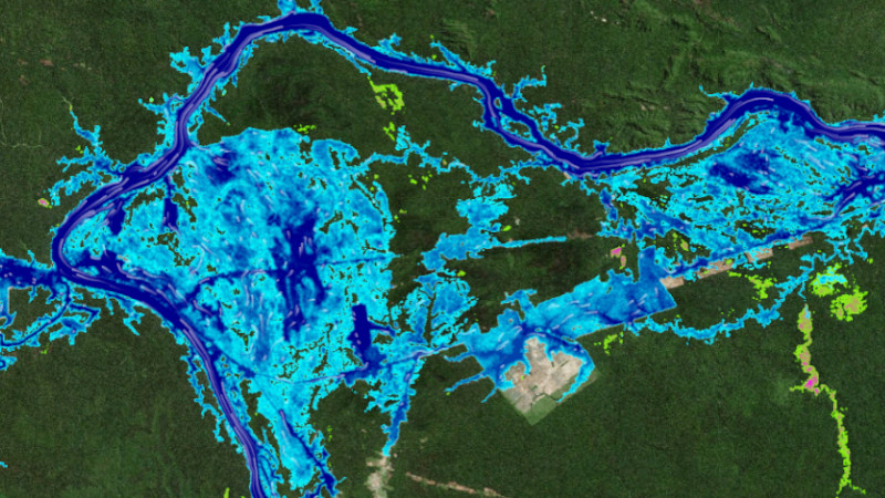
Our Hydrology report for solar project provides detailed insights into site-specific water dynamics, ensuring sustainable development and compliance with environmental standards. We incorporate Flood Modelling for solar project to simulate potential flood scenarios and mitigate risks effectively.
Key aspects of our Hydrology survey include analyzing Maximum rainfall Intensity, determining HFL (High Flood Level), and identifying areas prone to flooding to protect infrastructure investments.
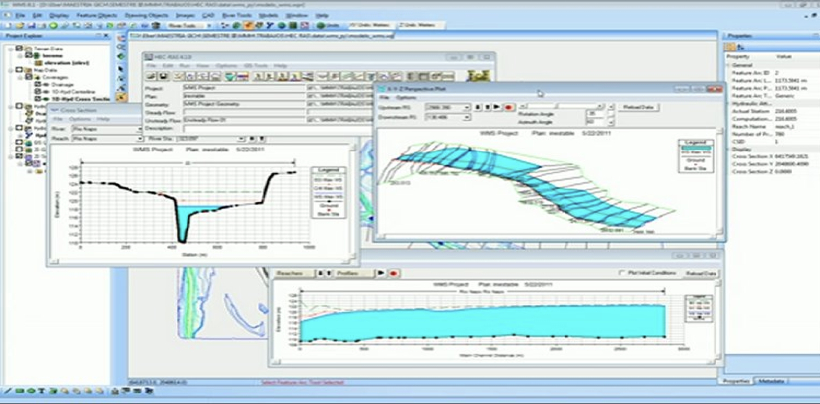
HYDROLOGY SURVEY USING ADVANCED SIMULATION – ASSESSING WATER FLOW AND FLOOD ZONES FOR PEAK RAINFALL EVENTS
At Bhoojal Survey, we utilize high-resolution digital elevation models, meteorological data for Maximum rainfall Intensity, geological assessments for runoff estimation, and contour mapping to deliver precise Hydrology survey results. This helps in managing HFL and High Flood level risks effectively.
Our key service areas include:
- 1. Site-specific Hydrology survey for infrastructure projects
- 2. Flood Modelling for solar project and risk assessment
- 3. Preparation of Hydrology report for solar project compliance
- 4. Evaluation of Maximum rainfall Intensity and drainage systems
- 5. Determination of HFL and High Flood level for site planning
- 6. Catchment area analysis and water resource management
- 7. Stormwater management and mitigation strategies
- 8. Hydraulic structure sizing and design support
- 9. Hydrographic surveys and data collection
- 10. Urban and rural hydrology investigations
- 11. 3D hydrological rendering and visualization
Hydrology survey approaches include
Hydrological modeling: Employs advanced software to simulate water cycles and predict flows in streams and rivers, crucial for Hydrology report for solar project.
Hydraulic analysis: Uses hydrological outputs to model water movement, assessing HFL and High Flood level during extreme events.
Hydrology survey has become vital in water resource management, aiding experts in predicting hydrological behaviors and making informed decisions to manage water-related risks, especially in projects requiring Flood Modelling for solar project.
FAQs: Hydrology Survey
What is a Hydrology survey?
A Hydrology survey involves studying water movement, distribution, and quality in a specific area, essential for projects like solar installations to assess risks from Maximum rainfall Intensity and determine HFL.
Why is a Hydrology report for solar project necessary?
A Hydrology report for solar project ensures site suitability by evaluating water resources, flood risks, and drainage, helping to avoid damages from High Flood level events.
What data is used in Hydrology survey?
Hydrology survey requires topographic maps, rainfall data for Maximum rainfall Intensity, soil profiles, land use information, and historical flood records to model HFL accurately.
How accurate is Flood Modelling for solar project?
The accuracy depends on data quality and model sophistication. High-resolution inputs enhance predictions for High Flood level and flood extents in solar projects.
Can Hydrology survey predict extreme weather impacts?
Yes, Hydrology survey models can simulate scenarios involving Maximum rainfall Intensity to forecast potential floods and determine HFL for better preparedness.
How long does a Hydrology survey take?
The timeline varies by project size; basic Hydrology survey may take weeks, while detailed ones with Flood Modelling for solar project can extend to months.
What is the cost of Hydrology survey services?
Costs depend on scope, data needs, and complexity. Contact us for a customized quote on your Hydrology report for solar project.
Does Hydrology survey aid in climate adaptation?
Yes, Hydrology survey is key for adapting to climate changes by assessing increased risks from Maximum rainfall Intensity and rising High Flood level.
Do Hydrology survey models include infrastructure effects?
Advanced models in Hydrology survey can simulate impacts of structures like dams on water flow and HFL determinations.


