At Bhoojal Survey, we provide professional Hydrogeological Survey services for identifying underground water potential zones for Borewells and Openwells across India. Our hydrogeological and geophysical investigations help in locating suitable aquifer zones beneath the earth’s surface for groundwater extraction purposes.
With more than 30 years of experience in the field of Hydrogeology and Groundwater Investigation, Bhoojal Survey has successfully served 10,000+ clients across India with accurate and scientific groundwater survey solutions.
We follow a Scientific Approach and Instruments for Hydrogeological survey purposes
Our team of expert Hydrogeological Consultants follows a scientific approach for groundwater exploration using advanced geophysical survey methods and modern resistivity instruments.
Hydrogeological survey
Hydrogeological Survey Methodology
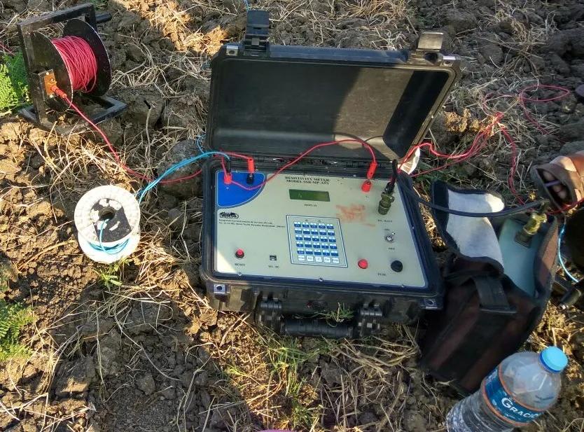
Hydrogeological Survey is conducted using Electrical Resistivity Survey methods to identify groundwater-bearing formations beneath the subsurface.
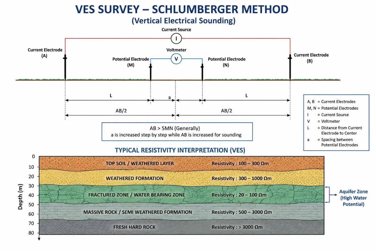
The VES Survey provides resistivity values of subsurface formations. Variations in resistivity values help identify:
1. Water-bearing formations
2. Fractured rock zones
3. Weathered formations
4. Aquifer zones
5. Groundwater potential areas
VES Survey
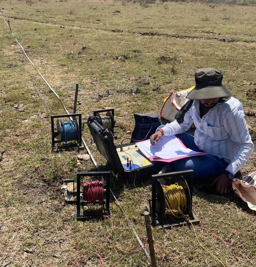
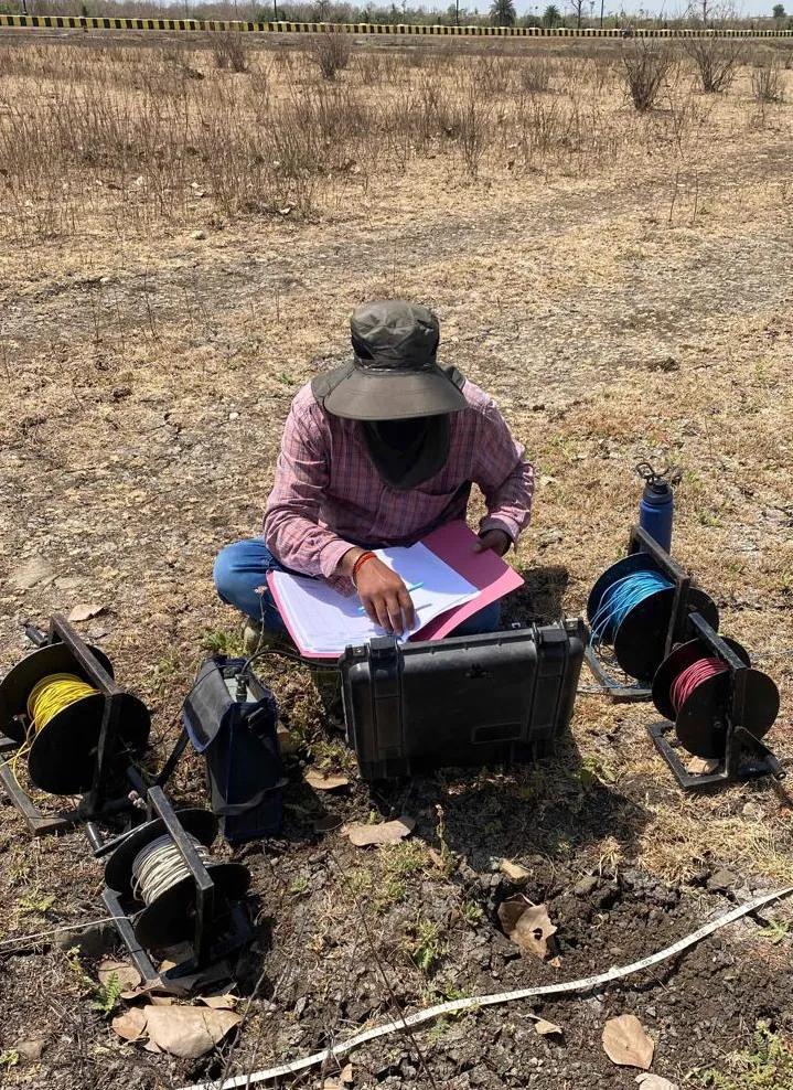
Site Work Photos
Hydrogeological and Geophysical survey
Electrical Resistivity Tomography (ERT) Survey
We also conduct Electrical Resistivity Tomography (ERT) Surveys for detailed subsurface investigation and groundwater exploration purposes.
ERT Survey is an advanced geophysical survey method which provides 2D subsurface resistivity imaging for identification of groundwater-bearing formations and subsurface geological conditions.
ERT Survey helps in identification of:
1. Fracture Zones
2. Aquifer Continuity
3. Lithological Variations
4. Weathered Formations
5. Water Bearing Zones
6. Subsurface Geological Structures
ERT Surveys are widely used for:
1. Groundwater Exploration
2. Borewell Investigation
3. Mining Projects
4. Infrastructure & Engineering Projects
5. Dam & Geological Studies
6. Environmental Investigations
Advanced Instruments & Software Used
We use advanced hydrogeophysical instruments and interpretation software for conducting precise Hydrogeological Studies.
Instruments
1. SSR-MP-ATS Resistivity Meter
2. Terrameter
3. Garmin GPS Device for pinpoint borewell location marking
Software
1. IPI2WIN
2. WinResist
The collected field data is scientifically interpreted using resistivity analysis software to prepare Hydrogeological Reports with maximum accuracy.
Applications of Hydrogeological Survey
Our Groundwater Survey Services are widely used for:
1. Borewell Site Selection
2. Openwell Investigation
3. Industrial Water Supply Projects
4. Residential & Township Projects
5. Agricultural Irrigation Borewells
6. Mining & Infrastructure Projects
7. Groundwater Resource Assessment
8. Water Availability Studies
Why Choose Bhoojal Survey?
1. 30+ Years of Hydrogeological Experience
2. 10,000+ Successful Surveys Across India
3. Scientific Groundwater Investigation Approach
4. Advanced Resistivity Survey Instruments
5. Accurate Borewell Point Identification
6. Expert Hydrogeological Consultants
7. Detailed Technical Reporting
8. GPS-Based Borewell Location Marking
Hydrogeological Survey Process
Site Inspection & Geological Assessment
Electrical Resistivity Survey at Site
Vertical Electrical Sounding (VES) Testing
Resistivity Data Collection & Interpretation
Aquifer Zone Identification
Borewell Depth Recommendation
Final Hydrogeological Report Preparation
Hydrogeological Survey Across India
We provide Hydrogeological Survey Services across:
1. Madhya Pradesh
2. Maharashtra
3. Gujarat
4. Rajasthan
5. Uttar Pradesh
6. Chhattisgarh
7. Odisha
8. Bihar
9. Assam
10. Other regions across India
Looking for accurate Groundwater Investigation or Borewell Survey Services?
Contact Bhoojal Survey for scientific Hydrogeological Survey, VES Survey, Resistivity Survey, Aquifer Mapping, and Groundwater Exploration Services across India.
1. Hydrogeological and Geophysical Survey work for Industrial Site Adani Wilmar limtied – Neemuch, Madhya Pradesh
2. Hydrogeological and Geophysical Survey for Industrial Site Graphite India – Titlagarh, Odisha
3. Vertical Electrical Sounding (VES) Test for Openwell – Village Palsud, Madhya Pradesh
4. Hydrogeological Survey for Groundwater Investigation for Textile Park, MIDC – Amravati, Maharashtra
5. Groundwater Survey for Borewell for Township Project – Bangalore, Karnataka
6. Hydrogeological and Geophysical Survey for Borewell for PSU IOCL Patan, Gujarat
7. Geophysical Survey for Industry NPL – Udaipur, Rajasthan
8. Hydrogeological and Geophysical Survey to Locate Borewell Point for P&G – Baddi, Chandigarh Region
9. Groundwater Survey for Township Project – Sarojini Nagar, Delhi
10. Groundwater Investigation for Metro Project – Tata Projects, Pune, Maharashtra
11. Groundwater Survey for Road Project – GR Infra, Jhabua, Madhya Pradesh
12. Groundwater Survey for Jio BP Petrol Pump Projects – Madhya Pradesh & Gujarat
Frequently Asked Questions
1. What is a Hydrogeological Survey and why is it required?
A Hydrogeological Survey is a scientific investigation used to map underground water layers (aquifers) and rock formations. It is essential before drilling a borewell to minimize financial risks, ensure high data accuracy, and pinpoint the most productive water source.
2. Which is the best scientific method to detect groundwater for a borewell?
Vertical Electrical Sounding (VES) and Electrical Resistivity Tomography (ERT) are the most advanced and globally accepted scientific methods. Bhoojal Survey uses these modern resistivity instruments and interpretation software to select the perfect borewell point.
3. How long does it take to get a Bhoojal Survey technical report?
Once the on-site Electrical Resistivity Survey is completed, our hydrogeological experts interpret the field data using advanced software like IPI2WIN and WinResist. The final certified technical report is delivered within 2 to 3 working days.
4. Is a hydrogeological survey report mandatory for commercial and solar projects?
Yes, in most Indian states, getting a Central Ground Water Authority (CGWA) or state-level NOC requires a government-approved hydrogeological survey report. It is compulsory for industrial, infrastructure, and large-scale solar projects.
5. Where does Bhoojal Survey provide its groundwater investigation services?
Bhoojal Survey provides pan-India services, actively operating in states like Madhya Pradesh, Maharashtra, Gujarat, Rajasthan, Uttar Pradesh, Chhattisgarh, Odisha, and Bihar. Click the button below to schedule a free consultation for your location.
Get Free Expert Assistance
What Our Clients Say
I recently used the soil resistivity website and was impressed with the accuracy and ease of use of the tools provided. The site helped me to accurately measure the resistivity of the soil on my property and provided me with all the necessary information I needed for my project. I highly recommend this site to anyone looking for reliable soil resistivity data.
Raman Arora
Geotechnical Engineer
Bhoojal Survey website is a game-changer for our business. I recently used the earth resistivity testing services provided by Bhoojal Survey, and I must say I was thoroughly impressed. The website was easy to navigate and provided all the information I needed to understand the testing process and the benefits it could provide for my business.
Vivek Agrawal
Environmental Scientist
I recently had to obtain a NOC from CGWA for groundwater extraction, and I must say that the process was made extremely simple and efficient thanks to the team at Bhoojal Survey. The website provided all the necessary information, and the team was always available to answer any questions I had throughout the process.