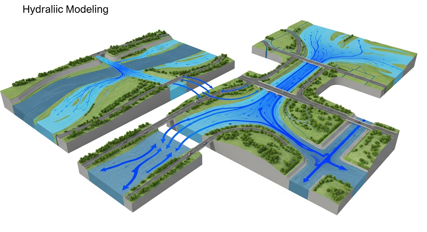
Hydraulic Modeling
Hydraulic Modeling: Understanding Water Flow for Safe Infrastructure
Hydraulic modeling is a scientific technique used to simulate how water moves through rivers, channels, drains, and infrastructure systems. Think of it as creating a digital twin of water systems to predict behavior under different conditions—from normal flow to extreme floods.
Instead of waiting for the next monsoon to discover design problems, hydraulic modeling lets engineers test scenarios on computers first. This saves money, prevents disasters, and ensures infrastructure performs as designed throughout its service life.
What is Hydraulic Modeling?
Hydraulic modeling uses mathematical equations and computer software to recreate how water flows in real-world systems. The process analyzes rainfall patterns, river discharge rates, channel shapes, drainage networks, and terrain elevation to predict water depth, velocity, and flood extent.
Modern hydraulic models combine Geographic Information Systems (GIS) with specialized hydraulic software to visualize results through detailed maps and charts. This makes complex engineering data easy for decision-makers to understand and act upon.

Why Hydraulic Modeling Matters
Every infrastructure project near water faces critical questions: Will this road flood during monsoon? Is the bridge opening large enough? Can the drainage system handle peak storm flow? Hydraulic modeling provides reliable answers before construction begins.
- Prevents costly design mistakes and construction delays
- Ensures regulatory compliance and faster project approvals
- Protects investments from flood damage and structural failure
- Optimizes designs to balance cost and performance
- Supports climate-resilient infrastructure planning
Applications of Hydraulic Modeling
Hydraulic modeling serves multiple infrastructure sectors across India, helping engineers design safer, more efficient water management systems:
- Roads and Highways: Design drainage systems, size culverts correctly, prevent roadway flooding
- Bridges and Culverts: Calculate flow forces, determine foundation depths, optimize opening sizes
- Urban Drainage: Design storm drain networks for growing cities and prevent street flooding
- Rivers and Floodplains: Assess flood risks, design protection measures, guide land use planning
- Industrial Projects: Protect facilities from flooding, design water intake and discharge systems
- Airports: Prevent runway waterlogging and ensure safe operations during storms
- Railways: Design track drainage and prevent monsoon service disruptions
- Agricultural Infrastructure: Optimize irrigation systems and protect farm investments
How Hydraulic Modeling Works
Professional hydraulic modeling follows a systematic methodology that combines field data collection with advanced computer simulation:
Step 1: Data Collection
Engineers gather topographic maps, river cross-sections, historical flood records, rainfall data, soil characteristics, and land use patterns. Modern projects use satellite imagery and LiDAR surveys to build accurate digital terrain models.
Step 2: Model Development
The collected data feeds into hydraulic modeling software like HEC-RAS. Engineers map water channels, noting width, depth, slope, and obstacles. Man-made structures like bridges, weirs, and drains are incorporated into the model geometry.
Step 3: Flow Simulation
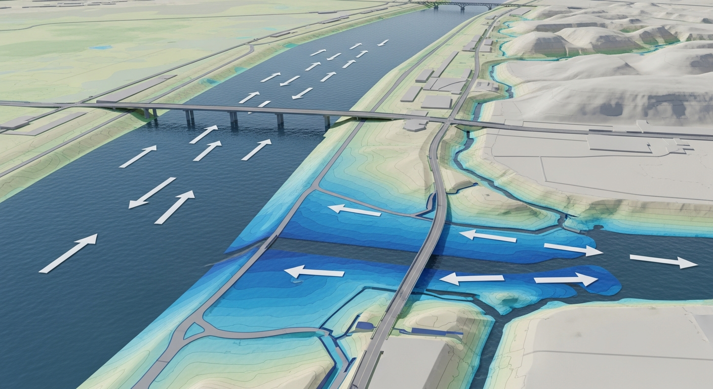
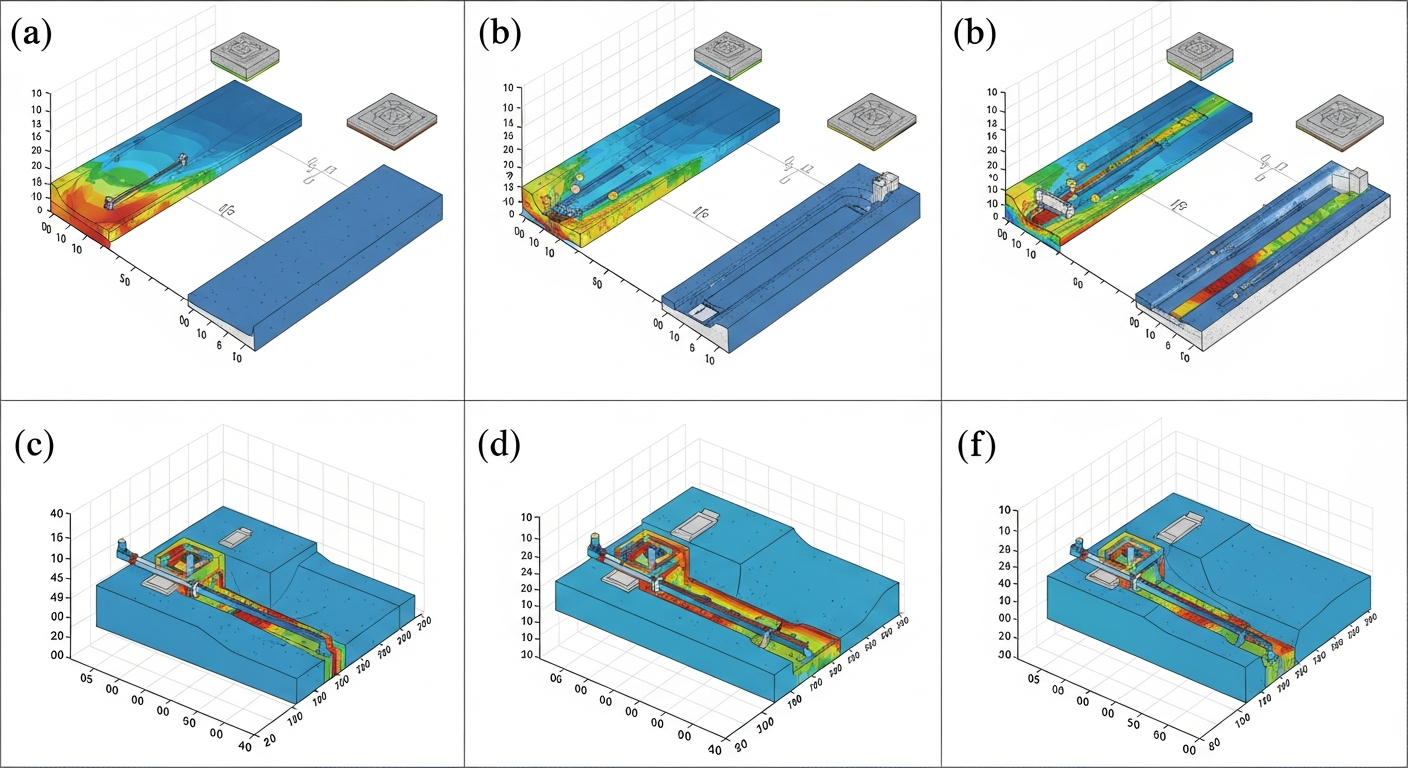
Engineers run multiple scenarios—normal conditions, design storms, extreme floods. The software calculates how water moves through the system, showing depth, velocity, and inundation extent for each scenario. Two-dimensional models reveal detailed flow patterns across wide areas.
Step 4: Analysis and Recommendations
Results are analyzed to identify problem areas, test design alternatives, and develop solutions. Engineers prepare detailed maps, technical reports, and practical recommendations for project teams.
Tools and Technology
Modern hydraulic modeling relies on proven software platforms and advanced geospatial tools:
- HEC-RAS: Widely used for river and channel modeling, simulates 1D and 2D flow conditions
- GIS Platforms: Process elevation data, create terrain models, produce flood maps and visualizations
- Remote Sensing: Satellite imagery and LiDAR provide high-resolution terrain data
- SWMM: Specialized software for urban drainage network analysis
- MIKE FLOOD: Advanced tool for complex hydrodynamic modeling
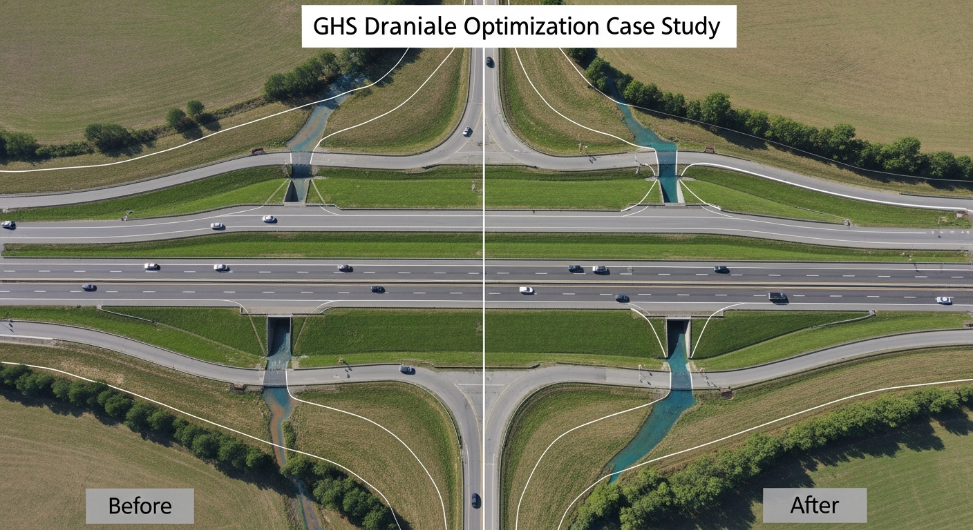
Real-World Case Study: Highway Drainage Optimization
The Challenge: A state highway department designed a bypass road crossing three seasonal streams using standard culvert sizing guidelines. Pre-construction review raised concerns about monsoon flood risks.
Hydraulic Modeling Solution: Engineers conducted comprehensive hydraulic analysis modeling 25-year, 50-year, and 100-year flood events. Simulations revealed two undersized culverts that would cause highway flooding, while the third culvert was oversized and wasteful.
Results: The design was optimized based on model outputs. Two culvert sizes increased, one reduced, and relief culverts added at strategic locations. The revised design cost 15% less while providing superior flood protection.
Performance Verification: During the first monsoon after construction, the highway performed exactly as modeled—no flooding occurred and drainage handled peak flows efficiently.
Benefits of Professional Hydraulic Modeling
- Accurate predictions backed by scientific analysis and proven methodologies
- Cost optimization through right-sized infrastructure design
- Risk reduction by identifying problems before construction
- Regulatory compliance with defensible technical documentation
- Faster approvals from authorities and stakeholders
- Long-term reliability and performance assurance
- Climate resilience through scenario testing
Conclusion
Hydraulic modeling is essential for modern infrastructure planning and water resource management. It transforms complex engineering challenges into clear, actionable solutions. By predicting water behavior before construction, projects avoid costly mistakes and perform reliably throughout their design life.
As India continues rapid infrastructure development and faces increasing climate variability, hydraulic modeling becomes even more critical. Projects designed with proper hydraulic analysis protect lives, safeguard investments, and contribute to sustainable development.
Bhoojal Survey brings specialized expertise in hydraulic modeling by integrating surface water analysis with groundwater science and advanced GIS-based hydrological tools to deliver reliable and practical water flow solutions. Working across diverse infrastructure projects such as national highways, airports, industrial developments, urban drainage systems, and agricultural planning, Bhoojal Survey supports informed decision-making at both project and policy levels. Through scientifically developed hydraulic models, the organization helps optimize infrastructure design, reduce flood risks, and improve water management efficiency. Its multidisciplinary expertise and involvement in large-scale development projects reflect strong institutional capability, contributing not only to immediate engineering solutions but also to long-term water resource sustainability and climate resilience initiatives across India.