Flood Modeling
Flood Modeling: Scientific Approach to Flood Risk Assessment
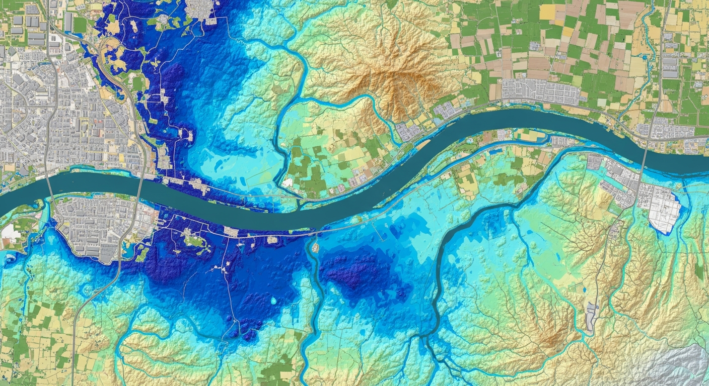
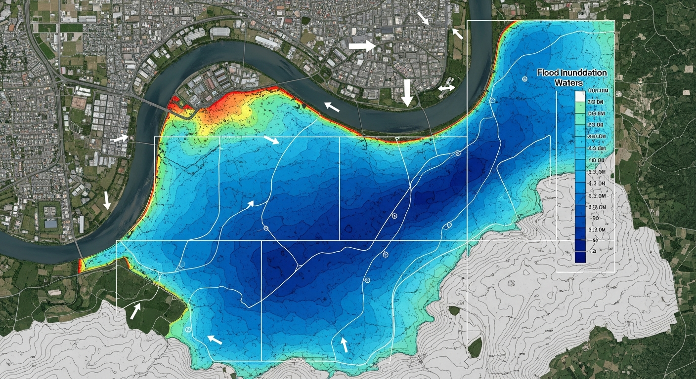
Flood modeling is a scientific technique used to simulate and analyze the behavior of floodwater under different rainfall, river flow, and terrain conditions. It helps predict flood extent, depth, velocity, and inundation duration.
In India, rapid urbanization, climate change, and unplanned development have increased flood risks. Flood modeling supports infrastructure safety, disaster preparedness, and sustainable water management.
What is Flood Modeling?
Flood modeling uses hydrological and hydraulic models to recreate real-world flood scenarios using rainfall data, river discharge, drainage networks, land use, and elevation models.
Importance of Flood Modeling
Flood modeling enables proactive flood risk management and helps reduce loss of life, infrastructure damage, and environmental impact.
- Identification of flood-prone zones
- Improved drainage and flood mitigation design
- Support for urban and infrastructure planning
- Compliance with environmental and regulatory norms
Applications of Flood Modeling
- Roads, highways, and bridge projects
- Airports and aviation infrastructure
- Urban development and smart city projects
- Industrial and manufacturing plants
- Railway and metro corridors
- Renewable energy projects
- Agricultural and crop planning
Tools and Methodology
Bhoojal Survey uses advanced GIS-based hydrological tools and the HEC-RAS model to assess flood depth, velocity, and inundation extent under various scenarios.
Conclusion
Flood modeling is a critical component of modern water resource management and infrastructure planning. It enables early flood risk identification and supports resilient development.
Bhoojal Survey plays a vital role in flood modeling by combining groundwater science, surface water analysis, and advanced GIS-based hydrological tools to deliver reliable and practical flood risk solutions. Working across diverse projects such as national highways, airports, industrial developments, urban infrastructure, and agricultural planning, Bhoojal Survey supports informed decision-making at both project and policy levels. Through scientifically developed flood models, the organization helps reduce flood damage, improve water management, and promote sustainable use of bhoojal resources. Its multidisciplinary expertise and involvement in large-scale development projects reflect a strong institutional capability, contributing not only to flood risk mitigation but also to long-term groundwater conservation and water security initiatives.