


Understanding Flood Risk in Tamil Nadu
Tamil Nadu faces recurring flood challenges every year—from Chennai's urban flooding to cyclone impacts along the coast and river overflow in the Cauvery delta. Flood risk assessment helps identify vulnerable areas and guides smart planning to protect lives, infrastructure, and economic assets before disasters strike.
This scientific process studies rainfall patterns, river behavior, coastal dynamics, drainage systems, and historical flood data to predict where flooding will occur. For Tamil Nadu's diverse geography—from coastal plains to delta regions—understanding flood risk is essential for sustainable development in 2026 and beyond.
Why Flood Risk Assessment is Critical in Tamil Nadu
Tamil Nadu's unique geographical position makes it highly vulnerable to multiple flood triggers. The state faces northeast monsoon rainfall, cyclones from the Bay of Bengal, and complex river systems that require careful flood management.
Risk to Population and Infrastructure
Chennai, with over 10 million people, experiences severe urban flooding when drainage systems fail during heavy rainfall. The 2015 floods showed how quickly normal life can collapse—roads became rivers, homes were submerged, and economic activity stopped for weeks.
Beyond Chennai, cities like Kanchipuram, Tiruvallur, Cuddalore, and Nagapattinam face regular flood threats. Industrial zones, port areas in Thoothukudi and Ennore, and agricultural lands in the Cauvery delta all need proper flood risk assessment to function safely.
Regulatory and Planning Requirements
State authorities now require flood hazard studies for major construction projects. Smart city initiatives in Chennai, Coimbatore, Madurai, Salem, and Vellore demand comprehensive flood vulnerability mapping before approvals. Highway projects, metro extensions, and SEZ developments cannot proceed without addressing flood risks.
Flood-Prone Cities and Regions of Tamil Nadu
Urban Flood Zones
Chennai faces the most severe urban flooding in Tamil Nadu. The Adyar, Cooum, and Kosasthalaiyar rivers overflow during heavy rainfall, while blocked drainage and wetland encroachment worsen flooding. Low-lying areas in Velachery, Madipakkam, and parts of North Chennai flood repeatedly.
Coimbatore, though inland, faces flash floods during intense rainfall. Erode and Salem experience urban waterlogging when drainage systems cannot handle peak monsoon flow. These cities need urgent flood risk assessment to guide infrastructure upgrades.
Coastal Flood Zones
Cuddalore, Nagapattinam, and coastal areas of Kanchipuram district face cyclone-induced flooding and storm surge. When cyclones make landfall, sea water floods coastal settlements, damages fishing infrastructure, and impacts agricultural land with saltwater intrusion.
Thoothukudi and Tirunelveli districts along the southern coast also face flood risks during intense monsoon events. Coastal flood assessment must account for sea-level rise and changing cyclone patterns in 2026.
Delta and River Basin Zones
The Cauvery delta—covering Thanjavur, Tiruvarur, and Nagapattinam—is Tamil Nadu's rice bowl but also highly flood-prone. When Cauvery or its tributaries overflow, thousands of hectares of agricultural land get submerged. Dam releases from Karnataka add complexity to flood management.
The Vaigai river basin around Madurai and the Tamirabarani river in Tirunelveli district also experience flooding during heavy monsoon. These agricultural regions need flood hazard mapping to protect crops and rural infrastructure.
Major Causes of Flooding in Tamil Nadu
- Northeast Monsoon: October to December brings heavy rainfall, especially to coastal and delta regions
- Cyclones: Bay of Bengal cyclones bring extreme rainfall and coastal flooding within hours
- River Overflow: Cauvery, Vaigai, and Tamirabarani rivers flood during peak monsoon and dam releases
- Urban Drainage Failure: Chennai and other cities face waterlogging when storm drains cannot handle rainfall intensity
- Wetland Encroachment: Building on natural water bodies and wetlands eliminates flood absorption capacity
How Flood Risk Assessment is Conducted
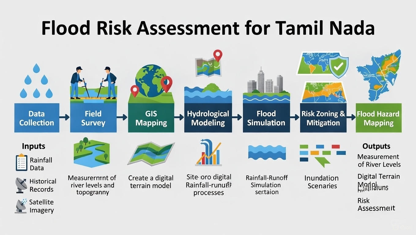
Professional flood risk study in Tamil Nadu follows a systematic technical approach:
Data Collection and Analysis
Experts gather rainfall data from IMD stations, river discharge records, historical flood information, satellite imagery, and land elevation data. This creates a comprehensive picture of flood behavior in the region.
Flood Modeling and Mapping
Advanced GIS software and hydraulic models simulate different flood scenarios—normal monsoon, extreme rainfall, cyclone events, and dam releases. These models show flood depth, extent, velocity, and duration for various return periods.
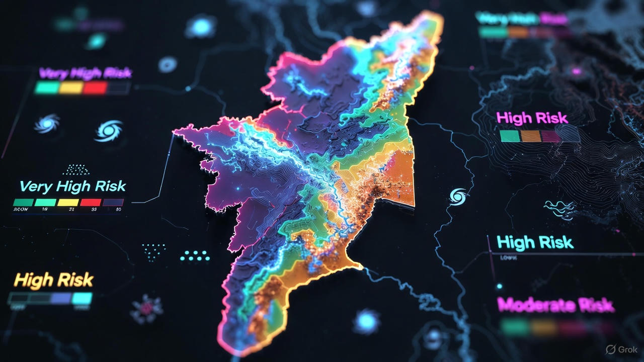
Risk Zoning
Based on modeling results, detailed flood hazard maps are created showing low, medium, and high-risk zones. These maps guide construction planning, drainage design, and emergency response preparation.
Applications in Tamil Nadu
- Urban Planning: Chennai, Coimbatore, Madurai smart city projects use flood risk assessment for drainage upgrades
- Infrastructure Projects: Highway corridors, metro extensions, and bridges incorporate flood safety design
- Industrial Development: SEZ planning in Sriperumbudur and port expansions consider flood vulnerability
- Disaster Management: State and district authorities use flood mapping for emergency planning and early warning systems
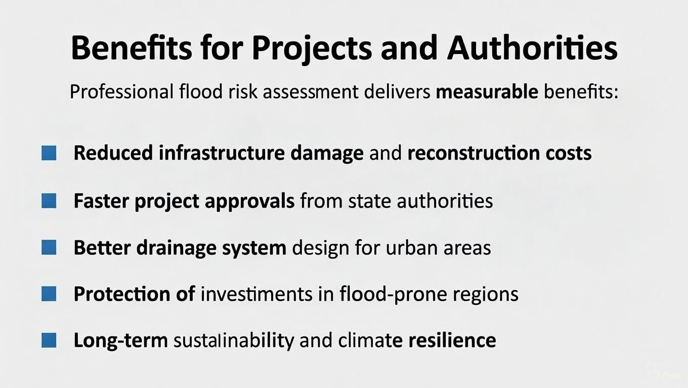
Benefits for Projects and Authorities
Professional flood risk assessment delivers measurable benefits:
- Reduced infrastructure damage and reconstruction costs
- Faster project approvals from state authorities
- Better drainage system design for urban areas
- Protection of investments in flood-prone regions
- Long-term sustainability and climate resilience
Building Flood-Resilient Tamil Nadu
Climate change is intensifying rainfall events and cyclone frequency. Tamil Nadu's 2026 development trajectory must integrate flood risk assessment into all planning decisions—from urban expansion to industrial development to agricultural management.
Early flood studies prevent costly mistakes. Professional assessment using scientific methods, accurate modeling, and local expertise ensures projects succeed despite flood challenges. Tamil Nadu can build safer cities, protect coastal communities, and maintain agricultural productivity through smart flood risk management.
Bhoojal Survey's Work in Tamil Nadu
Bhoojal Survey provides comprehensive flood risk assessment services across Tamil Nadu, combining hydrological expertise, GIS technology, and local knowledge of the state's unique flood patterns. Our team supports government departments, urban planners, infrastructure developers, and industrial projects from Chennai to Madurai, from coastal Cuddalore to the Cauvery delta.
We deliver authority-accepted reports, practical mitigation recommendations, and technical guidance that protects investments while ensuring regulatory compliance. Whether addressing urban flooding in Chennai, coastal vulnerability in Nagapattinam, or river basin flooding in Thanjavur, our expertise helps build flood-resilient development across Tamil Nadu.