Hydrogeological Survey – Complete Guide (2026)
Introduction
India is facing a severe groundwater crisis. According to recent data from the Central Ground Water Board, over 65% of districts across the country are experiencing critical levels of groundwater depletion. Water tables are falling rapidly, borewells are running dry within months of drilling, and farmers are struggling to find adequate water for irrigation. Urban areas are equally affected, with residential complexes and industries facing acute water shortages despite investing lakhs of rupees in deep borewells.
The primary reason behind these borewell failures is the lack of scientific planning before drilling. Most people drill borewells based on neighbor's advice, water diviner suggestions, or random guesswork, which results in a success rate of less than 40%. This not only wastes money but also damages precious groundwater resources through improper extraction.
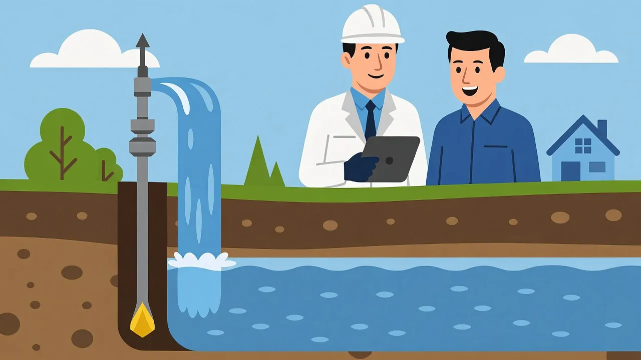
This is where a professional hydrogeological survey becomes absolutely essential. A hydrogeological survey is a scientific investigation conducted by trained hydrogeologists to study underground water resources, identify aquifer zones, assess groundwater potential, and recommend the most suitable locations for successful borewell drilling. In 2026, with advanced technology and scientific methods, Hydrogeological Survey Services have become more accurate and accessible, helping property owners, farmers, and industries make informed decisions about groundwater development and ensuring long-term water security.
What is a Hydrogeological Survey?
A hydrogeological survey is a specialized scientific study that combines geology and hydrology to understand how groundwater exists, moves, and gets stored beneath the earth's surface. The word "hydrogeology" comes from three Greek words: hydro (water), geo (earth), and logos (study). Therefore, hydrogeology is literally the study of water within the earth.
Unlike surface water like rivers and lakes that we can see, groundwater is hidden deep underground in porous rock layers called aquifers. A hydrogeological survey uses scientific instruments and methods to locate these hidden water-bearing zones and understand their characteristics.
Key aspects of hydrogeological survey include:
- Study of groundwater occurrence: Identifying where underground water exists and at what depths
- Understanding groundwater movement: Analyzing how water flows through underground rock formations and soil layers
- Assessment of groundwater storage: Estimating how much water is available in aquifers and for how long it can be sustainably extracted
- Combination of geology and hydrology: Using both geological mapping and hydrological principles to understand the complete groundwater system
- Essential before borewell drilling: Providing scientific data to select the most promising drilling location and recommended depth
Professional hydrogeologists conduct these surveys using advanced geophysical equipment, field observations, and laboratory analysis to create detailed groundwater reports. To understand more about this specialized field, explore our comprehensive guide on Hydrogeology and Hydrogeological Surveys that explains the science and practical applications in detail.
Objectives of Hydrogeological Survey
Every hydrogeological survey is conducted with specific goals and objectives that help solve groundwater-related challenges. Understanding these objectives helps property owners and decision-makers appreciate the value of professional survey services.
Groundwater Assessment: The primary objective is to assess the overall groundwater potential of a specific area. This includes determining whether adequate groundwater exists beneath the surface, at what depth it can be found, and whether the quantity is sufficient for the intended purpose. The assessment considers geological formations, rainfall patterns, and existing groundwater usage in the surrounding areas.
Aquifer Identification: Not all underground water is easily accessible. Water is stored in specific geological structures called aquifers, which are porous rock layers that can hold and transmit water. A key objective of hydrogeological survey is to identify these productive aquifer zones, distinguish them from impermeable layers, and map their extent and thickness. This information is crucial for successful borewell drilling.
Borewell Planning and Site Selection: Based on the survey findings, hydrogeologists recommend the exact location where a borewell should be drilled for maximum success. The survey identifies spots where aquifers are closest to the surface, where water yield will be highest, and where drilling will be most cost-effective. This scientific approach increases borewell success rates from 40% (random drilling) to over 85% (survey-based drilling).
Sustainable Groundwater Extraction: Perhaps the most important long-term objective is ensuring sustainable groundwater usage. The survey assesses natural recharge rates, determines safe extraction limits, and recommends practices that prevent aquifer depletion. This protects groundwater resources for future generations while meeting current water needs.
Scope of Hydrogeological Survey
The applications of hydrogeological survey extend across multiple sectors in India. Understanding the scope helps different stakeholders recognize when professional survey services are necessary for their specific projects.
Residential Applications: Homeowners planning to construct individual houses, villas, or residential plots require reliable groundwater sources. A hydrogeological survey for residential purposes typically covers small to medium-sized areas and focuses on identifying shallow to medium-depth aquifers suitable for domestic water supply. The survey helps avoid the common problem of dry borewells that plague many residential areas.
Agricultural and Irrigation Uses: Farmers depend entirely on groundwater for crop irrigation in most parts of India. Agricultural hydrogeological surveys cover larger land areas, assess seasonal water availability, and recommend optimal borewell locations for farm wells. The survey considers crop water requirements, irrigation scheduling, and aquifer sustainability to ensure farmers can continue cultivation for decades without depleting groundwater.
Industrial Water Supply: Manufacturing units, processing plants, and industrial establishments need continuous, reliable water supply for their operations. Industrial hydrogeological surveys are comprehensive, involving detailed aquifer testing, water quality analysis, and long-term sustainability assessment. Industries often require large water volumes, so survey accuracy is critical to avoid production disruptions.
Infrastructure and Construction Projects: Large construction projects like residential townships, commercial complexes, educational institutions, and hospitals require detailed groundwater assessment for both construction planning and long-term water supply. These surveys also evaluate potential groundwater-related construction challenges like seepage, waterlogging, and foundation stability.
Each application requires different survey methodologies, equipment, and reporting formats. For detailed information about how survey scope varies by project type, refer to our guide on Hydrogeological Survey Report Scope and Types that explains customized survey approaches for different requirements.
Role of a Hydrogeologist
A hydrogeologist is a specialized professional who has studied geology, hydrology, and groundwater science. Their expertise is essential for accurate hydrogeological survey work and successful groundwater development projects.
Field Investigation and Data Collection: The hydrogeologist begins work by conducting detailed field investigations at the survey site. This involves walking the terrain, observing geological features, identifying rock outcrops, studying soil types, and noting any surface water bodies or natural springs. They also gather information about existing borewells in the area, their depths, water yields, and any drilling failures. This ground-truthing is critical because geological conditions vary significantly even within short distances.
Geophysical Survey Operations: Hydrogeologists operate sophisticated geophysical instruments like electrical resistivity meters, electromagnetic detectors, and ground-penetrating radar. They strategically select survey points, conduct measurements following scientific protocols, and ensure data quality throughout the investigation. Their experience allows them to adjust survey parameters based on local geology and achieve optimal results even in challenging terrain.
Data Interpretation and Analysis: Perhaps the most critical role is interpreting the raw data collected from field surveys. Geophysical readings need expert analysis to distinguish actual water-bearing zones from misleading signals caused by clay layers, weathered rocks, or moisture content. Hydrogeologists use their knowledge of local geology, regional hydrogeological patterns, and years of experience to accurately identify productive aquifers.
Drilling Recommendations and Reporting: Based on comprehensive analysis, the hydrogeologist prepares a detailed report containing specific drilling recommendations. This includes exact GPS coordinates for borewell location, recommended drilling depth, expected water yield, aquifer characteristics, and post-drilling management suggestions. They also provide guidance during actual drilling to make real-time adjustments if geological conditions differ from initial assessment.
Methods Used in Hydrogeological Survey
Professional hydrogeological survey employs multiple scientific methods to build a complete understanding of subsurface groundwater conditions. Each method provides different types of information that together create a comprehensive picture.
Geological Mapping and Field Reconnaissance: This traditional but essential method involves systematic observation and documentation of surface geological features. Hydrogeologists prepare geological maps showing rock types, structural features like faults and fractures, soil characteristics, and landforms. They study how surface geology relates to groundwater occurrence. For example, areas with granite outcrops may have fracture zone aquifers, while alluvial plains typically have porous sediment aquifers. Field mapping also identifies recharge zones where rainwater infiltrates underground and discharge zones where groundwater naturally emerges.
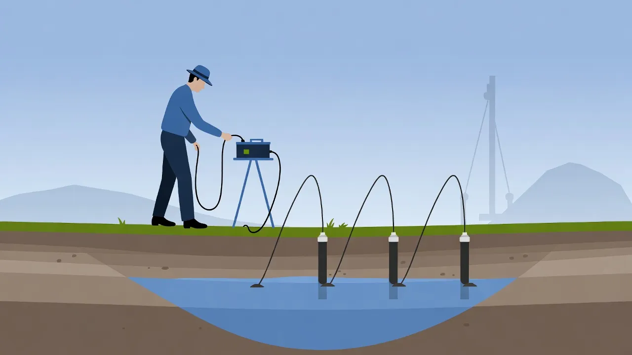
Geophysical Surveys: Modern hydrogeological surveys rely heavily on geophysical techniques that "see" underground without drilling. Electrical Resistivity Surveys are most common, where electric current is sent into the ground and resistance measurements reveal water-bearing layers. Electromagnetic methods detect groundwater by analyzing natural electromagnetic fields. Ground Penetrating Radar uses radio waves to image shallow subsurface structures. Each geophysical method has advantages for different geological settings, and experienced hydrogeologists select the most appropriate technique for each site.
Groundwater Monitoring and Testing: Where existing borewells are present, hydrogeologists conduct water level monitoring, pumping tests, and water quality analysis. Long-term water level measurements show aquifer behavior, seasonal variations, and sustainability. Pumping tests determine how much water an aquifer can yield and how quickly it recovers. These methods provide direct information about aquifer properties that complement indirect geophysical data. For those interested in understanding all survey methodologies in depth, our Complete Hydrogeological Survey Guide offers detailed explanations of each technique with practical examples.
Tools and Technologies Used in Hydrogeological Survey (2026)
The year 2026 has brought significant technological advancements in hydrogeological survey equipment and methodologies. Modern survey companies now use a sophisticated combination of field instruments, digital technologies, and analytical software to achieve unprecedented accuracy in groundwater detection.
Electrical Resistivity Survey Equipment: The backbone of most hydrogeological surveys remains the electrical resistivity system. Current-generation resistivity meters are fully automated, GPS-integrated, and capable of multi-electrode configurations. They measure how easily electrical current flows through different subsurface layers. Water-saturated zones show low resistivity, while dry rocks show high resistivity. Advanced processing software converts raw resistivity data into detailed cross-sectional images showing aquifer depth, thickness, and lateral extent. Modern systems can investigate depths up to 500 meters with high resolution.
Groundwater Detection Instruments: Specialized devices like PQWT groundwater detectors and GER DETECT systems use electromagnetic principles to locate water-bearing zones quickly. These portable instruments are particularly useful for preliminary surveys or in areas where traditional resistivity surveys are difficult to conduct. They provide real-time results displayed on digital screens, showing groundwater depth and approximate yield potential within hours of field deployment.
Piezometers and Monitoring Wells: For long-term groundwater studies, hydrogeologists install piezometers—small diameter pipes inserted into aquifers to measure water levels accurately. Modern piezometers are equipped with automatic data loggers that record water level fluctuations continuously. This time-series data reveals how aquifers respond to rainfall, pumping stress, and seasonal changes, providing insights essential for sustainable groundwater management.
GIS and Remote Sensing Technologies: Geographic Information Systems have revolutionized hydrogeological analysis. Survey data, geological maps, satellite imagery, and historical information are integrated in GIS platforms to create comprehensive groundwater potential maps. Remote sensing using satellite data helps identify regional-scale groundwater indicators like vegetation patterns, soil moisture, geological structures, and land use changes. These technologies allow hydrogeologists to analyze vast areas efficiently before conducting detailed ground surveys.
Digital Modeling Software: Advanced computer programs now simulate groundwater flow, predict aquifer behavior under different pumping scenarios, and optimize borewell placement. Three-dimensional subsurface models created from survey data help visualize complex geological structures and aquifer geometry. This combination of field data and digital modeling significantly improves survey accuracy and decision-making. To learn how these technologies work together in integrated survey approaches, visit our page on Hydrogeological, Geophysical and Remote Sensing Surveys that explains modern multi-technique investigations.
Step-by-Step Hydrogeological Survey Process
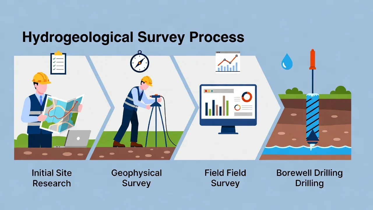
Understanding how a professional hydrogeological survey is conducted helps clients know what to expect and appreciate the thoroughness of the scientific approach. Here is the typical step-by-step process followed by expert hydrogeologists:
- Initial Consultation and Project Planning: The process begins with understanding client requirements—whether for residential, agricultural, or industrial use. Hydrogeologists discuss water quantity needs, budget constraints, site accessibility, and project timelines. They also collect preliminary information like location coordinates, existing borewell data from neighbors, and any previous survey reports.
- Site Visit and Desktop Study: Before conducting field surveys, hydrogeologists perform desktop analysis using geological maps, satellite imagery, and government hydrogeological reports for the region. This helps understand regional groundwater conditions and plan the field survey strategy. A preliminary site visit confirms ground conditions and identifies any practical challenges.
- Geological Mapping and Field Reconnaissance: During field work, hydrogeologists walk the survey area documenting geological features, rock types, soil conditions, natural springs, surface water bodies, and land use patterns. They note structural features like faults and fractures that influence groundwater occurrence. This ground-truthing provides context for interpreting geophysical data.
- Geophysical Survey Operations: The main field investigation involves deploying geophysical equipment according to planned survey layouts. For resistivity surveys, electrodes are placed at specific intervals along survey lines. Measurements are taken at each station, with careful quality control to ensure accurate data. Multiple survey lines may be conducted to understand spatial variations in subsurface conditions. This fieldwork typically takes 4 to 8 hours depending on site size.
- Data Processing and Interpretation: Back at the office, raw field data is processed using specialized software. Resistivity data is inverted to create subsurface cross-sections showing geological layers. Hydrogeologists interpret these images to identify water-bearing aquifers, distinguish them from clay layers or weathered zones, and determine optimal drilling locations. This interpretation requires expertise and experience to avoid misreading geological signals.
- Final Groundwater Report Preparation: All findings are compiled into a comprehensive hydrogeological survey report. This document includes site details, survey methodology, geophysical cross-sections, geological interpretation, specific borewell location recommendations with GPS coordinates, expected drilling depth, anticipated water yield, aquifer characteristics, and post-drilling management suggestions. The report serves as a scientific guide for drilling contractors and provides a permanent record of groundwater conditions.
- Drilling Supervision and Post-Survey Support: Many professional survey companies provide drilling supervision services to ensure the contractor follows recommendations accurately. During drilling, hydrogeologists can examine rock cuttings, identify water strikes, and recommend depth adjustments based on actual subsurface conditions. Post-drilling support includes water quality testing recommendations and aquifer management advice.
This systematic process ensures that every hydrogeological survey delivers reliable, actionable information that maximizes borewell success rates and promotes sustainable groundwater development.
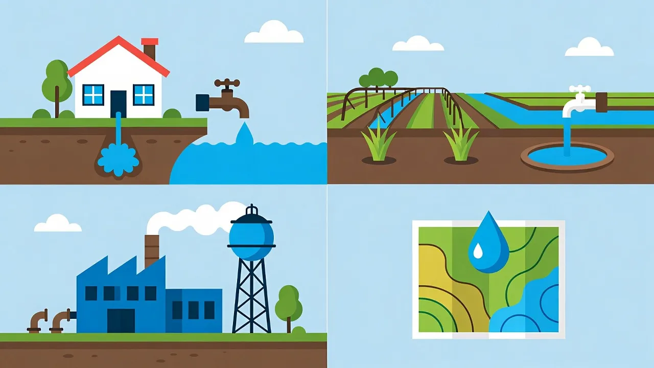
Applications of Hydrogeological Survey
The practical applications of hydrogeological survey span across diverse sectors and purposes in India. Understanding these applications helps different stakeholders recognize when professional survey services become essential.
- Borewell and Open Well Planning: This is the most common application. Whether drilling a new borewell for home, farm, or factory, a hydrogeological survey identifies the most promising location, recommended depth, and expected water yield. The survey significantly reduces the risk of dry borewells, which are increasingly common due to groundwater depletion.
- Agriculture and Irrigation: Farmers face severe challenges due to erratic rainfall and declining groundwater levels. Hydrogeological surveys help plan farm wells, assess seasonal water availability, and design sustainable irrigation systems. The survey can also identify potential sites for groundwater recharge structures that enhance long-term farm water security.
- Construction and Real Estate: Builders and developers conducting large residential or commercial projects require detailed groundwater assessment. The survey helps plan water supply infrastructure, assess potential waterlogging or seepage issues during construction, and ensure long-term water availability for the development. Many municipal authorities now require hydrogeological surveys as part of construction approval processes.
- Industrial Water Supply: Industries require continuous, high-volume water supply. Hydrogeological surveys for industrial applications involve detailed aquifer characterization, sustainable yield assessment, water quality evaluation, and long-term monitoring recommendations. The survey helps industries comply with environmental regulations regarding groundwater extraction.
- Groundwater Recharge Projects: Artificial recharge structures like recharge wells, infiltration ponds, and check dams need proper site selection to be effective. Hydrogeological surveys identify favorable recharge zones where water can percolate quickly into aquifers. The survey assesses soil permeability, aquifer connectivity, and optimal recharge structure design for maximum efficiency.
- Water Resource Management and Planning: Government agencies, municipalities, and watershed development programs use large-scale hydrogeological surveys to map groundwater resources, identify critical depletion zones, and plan regional water management strategies. These surveys support evidence-based policy making for sustainable groundwater governance.
Each application requires tailored survey methodology and reporting to meet specific technical and regulatory requirements.
Importance of Hydrogeological Survey in India
The relevance of professional hydrogeological survey in India's context cannot be overstated, especially given the country's unique groundwater challenges and dependence on this critical resource.
Groundwater Depletion Crisis: India is the world's largest groundwater user, extracting over 250 billion cubic meters annually—more than the combined extraction of USA and China. This over-extraction has caused water tables to fall by 20 to 40 feet in many regions over the past two decades. Without scientific surveys guiding extraction, the situation will worsen rapidly. Hydrogeological surveys enable targeted drilling at depths where water still exists and help avoid drilling in completely depleted zones.
Climate Change Impact: Changing rainfall patterns due to climate change make historical groundwater knowledge unreliable. Areas that once had abundant groundwater now face scarcity, while some regions experience waterlogging. Current hydrogeological surveys using 2026 data provide accurate, updated information reflecting present conditions rather than outdated assumptions about groundwater availability.
High Borewell Failure Rates: Studies indicate that 40-60% of borewells drilled without scientific surveys fail to yield adequate water. Each failed borewell represents wasted investment of ₹50,000 to ₹2,00,000 and contributes to aquifer damage. Hydrogeological surveys reduce failure rates to below 15%, saving millions of rupees collectively and preventing environmental damage from excessive, unsuccessful drilling.
Government Water Regulations: Many state governments now mandate hydrogeological surveys for borewells deeper than certain thresholds or for commercial water extraction. States like Karnataka, Tamil Nadu, and Maharashtra have introduced regulations requiring survey reports for obtaining borewell drilling permissions. Compliance with these regulations necessitates professional survey services from qualified hydrogeologists.
Hydrogeological Survey vs Hydrological Survey
Many people confuse these two terms, but they represent distinct scientific disciplines with different focuses, methodologies, and applications. Understanding this difference helps clients request the appropriate survey type for their needs.
Hydrogeological Survey: As explained throughout this article, a hydrogeological survey focuses specifically on groundwater—water stored beneath the earth's surface in aquifers. It studies subsurface geology, aquifer properties, groundwater occurrence, movement, and extraction potential. The primary goal is identifying suitable locations for borewells and assessing sustainable groundwater yield. Hydrogeological surveys use geophysical instruments that investigate underground conditions and are essential for borewell planning.
Hydrological Survey: A hydrological survey takes a broader view, studying all aspects of water resources in an area—both surface water (rivers, lakes, streams) and groundwater. It examines the complete water cycle including rainfall, runoff, evaporation, infiltration, and streamflow. Hydrological surveys are typically conducted for watershed management, flood control projects, irrigation system design, and regional water resource planning. These surveys use different tools like flow meters, rain gauges, and water level recorders.
When Each Survey is Required: Choose a hydrogeological survey when your primary need is groundwater assessment for borewell drilling, aquifer characterization, or subsurface water investigation. Choose a hydrological survey when planning projects involving surface water management, watershed development, flood control, or integrated water resource management covering both surface and groundwater components.
For most residential, agricultural, and industrial borewell projects, a hydrogeological survey is the appropriate choice. Large infrastructure projects may require both survey types for comprehensive water resource assessment.
Benefits of Professional Hydrogeological Survey
Investing in professional hydrogeological survey services delivers multiple tangible and long-term benefits that far outweigh the survey cost:
- Higher Borewell Success Rate: Scientific surveys identify precise aquifer locations, increasing drilling success probability from 40% (random drilling) to over 85% (survey-based drilling). This dramatically reduces the risk of investing in unsuccessful borewells that yield insufficient water or run dry within months.
- Significant Cost and Time Savings: While a survey involves upfront cost, it prevents much larger expenses associated with failed borewells, repeated drilling attempts, or drilling unnecessarily deep when water exists at shallower depths. A survey costing ₹10,000 to ₹20,000 can save ₹1,00,000 or more by avoiding drilling failures and optimizing drilling depth.
- Optimal Drilling Depth Determination: Surveys identify the shallowest productive aquifer, avoiding unnecessary deep drilling. Drilling deeper than needed increases costs significantly—each additional 100 feet adds ₹15,000 to ₹30,000 to drilling expenses. Survey recommendations ensure you drill only as deep as necessary for adequate water yield.
- Long-term Groundwater Sustainability: Professional surveys assess aquifer recharge rates and recommend sustainable extraction limits. This prevents over-exploitation that causes premature aquifer depletion. By following survey recommendations, borewells remain productive for 20-30 years instead of running dry within 3-5 years due to excessive pumping.
- Scientific Decision Making: Surveys replace guesswork with concrete data. The detailed report provides documented evidence of groundwater conditions, justifies drilling investments to stakeholders or financiers, and creates a baseline record for future reference and monitoring.
- Compliance with Regulations: As mentioned earlier, many states now require survey reports for drilling permissions. Professional surveys ensure regulatory compliance and smooth approval processes, avoiding legal complications or penalties for unauthorized groundwater extraction.
- Environmental Protection: By preventing multiple unnecessary drilling attempts and promoting sustainable extraction, hydrogeological surveys reduce environmental damage to aquifers and contribute to responsible groundwater stewardship for future generations.
These benefits make professional hydrogeological survey services an essential investment rather than an optional expense for anyone serious about successful groundwater development.
FAQs – Hydrogeological Survey
A hydrogeological survey is a scientific investigation conducted by trained hydrogeologists to study underground water resources. It uses geophysical instruments and field observations to identify aquifer locations, assess groundwater potential, determine optimal borewell drilling sites, and recommend sustainable extraction practices. The survey combines geology and hydrology to understand how groundwater exists, moves, and can be accessed beneath the earth's surface.
While not legally mandatory in all states, a hydrogeological survey is highly recommended before borewell drilling. It increases drilling success rates from 40% to over 85%, prevents costly failures, determines optimal drilling depth, and ensures sustainable groundwater extraction. Many states now require survey reports for drilling permissions, especially for deep borewells or commercial extraction. The survey cost is minimal compared to the risk of drilling a failed borewell.
Professional hydrogeological surveys using modern geophysical equipment achieve 85-95% accuracy in identifying productive aquifer zones. Accuracy depends on geological complexity, equipment quality, and hydrogeologist expertise. While surveys cannot guarantee 100% success due to natural subsurface variability, they dramatically improve outcomes compared to random drilling. Experienced hydrogeologists consider multiple data sources and local geological knowledge to maximize accuracy.
A hydrogeological survey focuses specifically on groundwater beneath the earth's surface—studying aquifers, subsurface geology, and borewell planning. A hydrological survey takes a broader approach, examining all water resources including both surface water (rivers, lakes) and groundwater, studying the complete water cycle, rainfall, runoff, and watershed behavior. For borewell projects, you need a hydrogeological survey. For watershed management or surface water projects, a hydrological survey is appropriate.
Hydrogeological surveys should be conducted by qualified hydrogeologists or geological engineers with specialized training in groundwater science and geophysical survey methods. Professional survey companies like Bhoojal Survey employ experienced hydrogeologists equipped with advanced geophysical instruments. Avoid unqualified operators using basic equipment without proper expertise, as this leads to inaccurate results and failed borewells despite paying for surveys.
Hydrogeological survey costs vary based on site size, geological complexity, and investigation depth required. Basic surveys for residential borewell planning typically cost ₹8,000 to ₹20,000. Agricultural surveys covering larger areas range from ₹15,000 to ₹35,000. Industrial or large infrastructure surveys requiring detailed investigation may cost ₹40,000 to ₹1,00,000 or more. This investment prevents much larger losses from failed borewells and ensures optimal drilling outcomes.
Field work for a basic residential hydrogeological survey takes 4 to 8 hours depending on site size and accessibility. Complex surveys covering larger areas or requiring multiple investigation points may need 1 to 3 days of fieldwork. After field data collection, processing and report preparation typically requires an additional 3 to 7 days. Total turnaround time from site visit to final report delivery is usually 7 to 14 days for standard projects.
Conclusion
In 2026, as India faces unprecedented groundwater challenges driven by climate change, population growth, and decades of unsustainable extraction, the role of professional hydrogeological survey has never been more critical. This scientific approach to groundwater assessment transforms borewell drilling from a gamble into a calculated, data-driven decision. By combining geological knowledge, advanced geophysical technology, and hydrogeological expertise, these surveys identify productive aquifers, optimize drilling locations, and promote sustainable water resource management. Whether you are a homeowner seeking reliable domestic water supply, a farmer planning irrigation infrastructure, or an industry requiring high-volume water sources, investing in a professional hydrogeological survey significantly increases your success probability while contributing to the larger goal of groundwater conservation. As an experienced hydrogeologist with years of field work across India, I can confidently state that the upfront cost of a scientific survey is the most valuable investment you can make before drilling a borewell—it protects your financial resources, ensures water security for your family or enterprise, and helps preserve this precious resource for future generations. Choose science over guesswork, choose sustainability over exploitation, and choose professional hydrogeological survey services for your groundwater development projects.