The Complete Guide to Flood Modeling: Understanding Its Importance and Best Practices
- Home
- Blogs
Get Free Expert Assistance

Introduction
Floods are one of the most common and destructive natural disasters, causing extensive damage to lives, property, and infrastructure every year. With the impacts of climate change leading to more unpredictable weather patterns, flood risks are becoming increasingly severe. This makes flood modelling a vital tool in disaster preparedness, urban planning, and water resource management. In this comprehensive guide, we will delve into the fundamentals of flood modelling, its importance, various methods and tools, and the best practices to ensure accurate and effective results.
What is Flood Modeling?
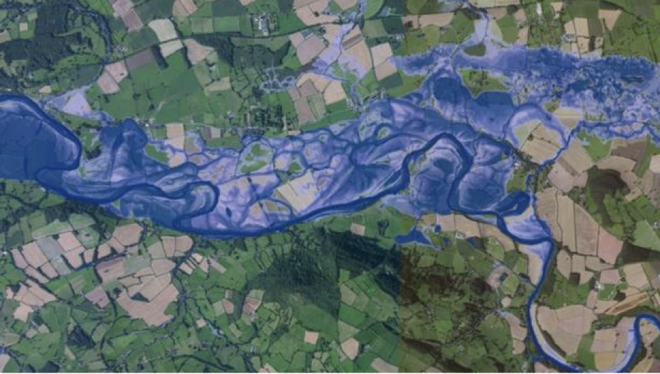
Flood modelling is the process of simulating water movement during flood events using scientific data and computational tools. It helps predict flood extents, depths, and velocities under different scenarios. By analyzing these factors, stakeholders can implement measures to minimize flood-related damage and improve disaster response.
Why Flood Modeling is Important
1. Risk Mitigation: Identifies areas at high risk and allows for preventive measures. 2. Infrastructure Planning: Ensures the design of flood-resilient roads, bridges, and buildings. 3. Emergency Preparedness: Supports evacuation planning and resource allocation. 4. Insurance and Financial Planning: Helps in assessing flood insurance policies. 5.Environmental Protection: Prevents degradation of ecosystems from unmanaged flood events.
Types of Floods Addressed in Modeling
1. Pluvial Flooding: Caused by intense rainfall and overwhelming drainage systems. 2. Fluvial Flooding: Results from rivers exceeding their capacity. 3. Coastal Flooding: Occurs due to storm surges, high tides, or tsunamis. 4. Flash Floods: Rapid flooding from heavy rains or dam/levee failures. 5. Groundwater Flooding: Arises when water tables rise above the surface.
Key Components of Flood Modeling
1. Hydrology: Studies rainfall-runoff relationships in watersheds. 2. Hydraulics: Examines water flow dynamics in channels and floodplains. 3. Topography: Utilizes digital elevation models (DEMs) to map terrain. 4. Meteorology: Analyzes rainfall patterns, intensity, and duration.
Common Tools and Techniques
1. HEC-HMS: Models hydrological processes like precipitation and runoff. 2. HEC-RAS: Simulates hydraulic conditions, such as river flow and floodplain inundation. 3. MIKE FLOOD: Integrates 1D and 2D hydraulic modelling for detailed analysis. 4. 6TUFLOW: Focuses on 2D flood simulations for urban and coastal areas. 5. GIS Integration: Combines spatial data with flood models for better visualization.
The Process of Flood Modeling
1. Data Collection: Gather rainfall records, topographical data, and soil properties. 2. Model Setup: Define the catchment area, boundary conditions, and input parameters. 3. Simulation: Run scenarios using computational tools to predict flood behaviour. 4. Calibration and Validation: Adjust the model based on historical flood data for accuracy. 5. Output Analysis: Generate flood maps showing inundation extents, flow velocity, and depth.
Challenges in Flood Modeling
1. Data Availability: Limited access to high-resolution and accurate data. 2. Model Uncertainty: Variability in input parameters affects predictions. 3. Computational Demand: High-resolution simulations require advanced hardware. 4. Changing Climate: Increased variability makes future predictions complex.
Best Practices for Flood Modeling
1. Use Accurate Data: High-quality input data improves reliability. 2. Leverage Multi-Model Approaches: Combine hydrological and hydraulic models. 3. Engage Stakeholders: Collaborate with local authorities and communities. 4. Update Regularly: Incorporate new data to reflect current conditions. 5. Test Multiple Scenarios: Prepare for worst-case and climate change impacts.
Applications of Flood Modeling
1. Urban Development: Ensures flood-resilient cities through smart planning. 2. Disaster Management: Guides rescue operations during flood emergencies. 3. Agricultural Planning: Protects farmlands from recurrent flooding. 4. Environmental Conservation: Safeguards natural habitats from waterlogging.
How Bhoojal Survey is Leading the Way
Bhoojal Survey & Recharging brings decades of expertise in hydrology and flood risk assessment. Using a blend of advanced software like HEC-HMS and HEC-RAS and field data, we create models tailored to specific site conditions. Our approach ensures:
- 1. Accurate flood risk maps.
- 2. Effective disaster response strategies.
- 3. Customized solutions for sustainable water management.
We are committed to empowering communities and businesses with actionable insights to build resilience against floods.
Conclusion
Flood modelling is not just a scientific endeavour; it is a vital step toward building flood-resilient communities and protecting valuable resources. By leveraging expert guidance and modern tools, businesses and governments can significantly reduce the impact of flooding. Partner with Bhoojal Survey & Recharging to gain access to reliable flood modelling services that prioritize accuracy, sustainability, and your specific needs. Together, we can make a difference in managing water resources effectively.
