Introduction
Flood modelling is a critical component of water resource management. It involves simulating flood events to understand their dynamics and impacts on the environment and human settlements.
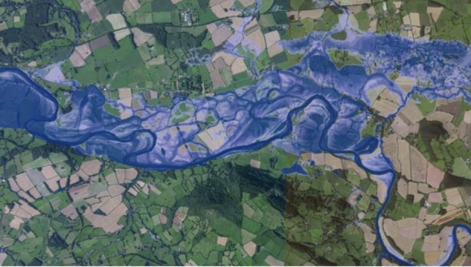
Techniques Used in Flood Modelling
Several techniques are employed in flood modelling:
- HEC-RAS: The Hydrologic Engineering Center's River Analysis System is widely used for simulating river flow and floodplain dynamics.
- GIS Integration: Geographic Information Systems (GIS) are used to analyze spatial data related to flood risks and impacts.
- Hydrodynamic Models: These models simulate the movement of water in rivers and floodplains to predict flooding scenarios.
- Statistical Methods: Historical data analysis helps estimate the probability of flooding events based on past occurrences.
Flood Modelling Software
A variety of software tools are available for flood modelling:
- HEC-RAS: A popular choice for river analysis.
- SURFER: Used for surface modeling and contour mapping.
- ArcGIS Pro: Integrates GIS capabilities with hydrological modeling tools.
- DHI's MIKE FLOOD: Offers advanced modeling capabilities for complex flood scenarios.
- A free option: Some software is available for free, making it accessible for educational purposes or small projects.
Conclusion
The significance of flood modelling cannot be overstated. It provides essential insights that help in planning, risk assessment, and disaster management. By understanding potential flood scenarios, communities can implement effective mitigation strategies to protect lives and property.
Contact Us
If you need assistance with flood modelling or want more information about our services, please contact us!