Satellite Survey for Road Projects using High-Resolution Data
Satellite Survey for Road Projects using High-Resolution Data
At Bhoojal Survey, we Conduct satellite survey for various project using high-resolution satellite data in an efficient, cost-effective, and scalable method for preliminary planning, feasibility studies, alignment analysis, and even monitoring during construction.
These surveys specialize in 3D mapping, utility GIS, and urban planning, and are often powered by both satellite and drone data. Leading solutions offer high-resolution imagery, advanced GIS and remote sensing tools, and integration with design workflows for infrastructure, land use, and agriculture.
Key Applications
- 1. Road alignment and corridor planning.
- 2. Contour survey and topographical mapping.
- 3. Elevation survey for terrain analysis.
- 4. Land acquisition and Right of Way (RoW) planning.
- 5. Urban and zoning analysis.
- 6. Infrastructure & utility mapping.
- 7. Construction progress monitoring.
Data Sources and Software
- 1. Imagery used: WorldView-3, Pleiades Neo, SkySat, Cartosat.
- 2. Processing software: QGIS, ArcGIS, ERDAS Imagine.
- 3. Outputs: SHP, GeoTIFF, DWG files with elevation and feature data.
These surveys also provide GIS and mapping solutions, with satellite and drone integration, allowing for seamless workflows from remote data acquisition to actionable maps and design inputs.
Recent Project – Road Planning in Sikkim
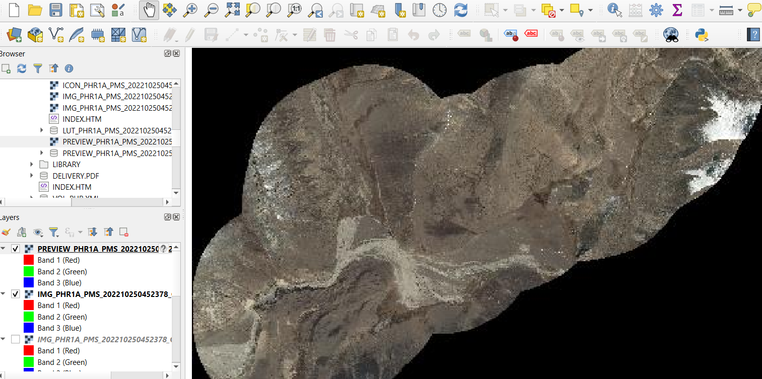
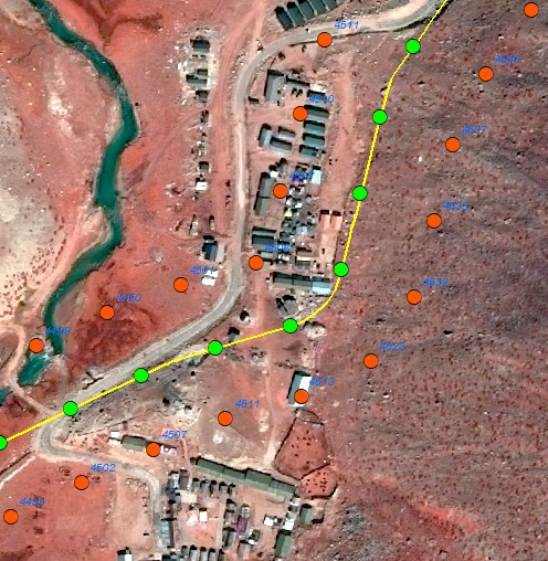
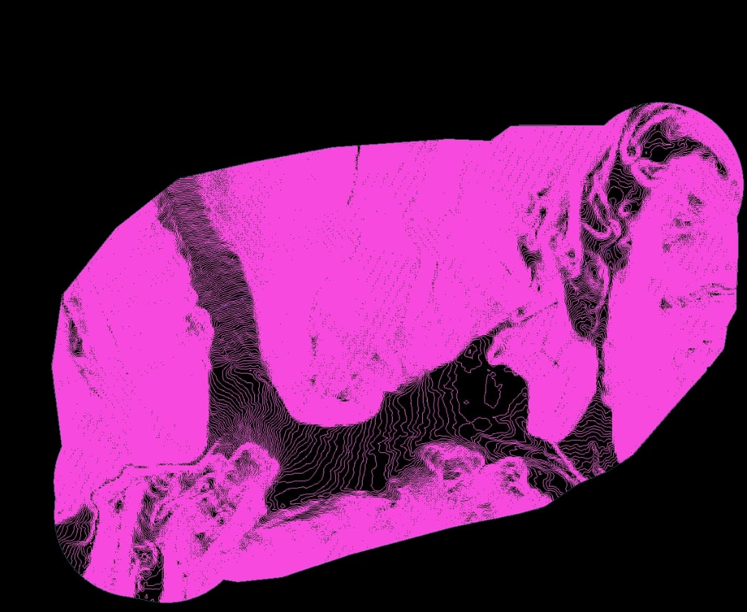
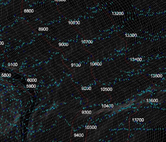
Bhoojal Survey has recently completed a satellite-based topographical survey for a road development project in Sikkim. We procured high-resolution 30 cm satellite imagery from Airbus data provider and processed the data using QGIS , ARCGIS , ERDAS Imagine to generate a detailed SHP , GeoTIFF , DWG feature file. The output included topographical features, individual trees, huts, and rivers on both sides of the proposed road alignment — enabling accurate planning and environmental assessment without the need for extensive field visits.
- 1. Accurate elevation and terrain contours.
- 2. Mapped rivers, huts, and vegetation.
- 3. Complete corridor digitization and road alignment layer.
Topographical mapping and contour generation , Route alignment and corridor planning
DWG file with Marking of Topographical features
Our Expertise
Bhoojal Survey ecels in providing solutions related to 3D mapping, utility GIS, and urban planning using satellite data. We help in Providing high-resolution satellite imagery and mapping services.
We Offer GIS and satellite remote sensing services for land use, utilities, and agriculture , flood modeling , hydrological survey for airport.
- 1. 3D Mapping and utility GIS
- 2. Flood modeling and hydrological planning
- 3. Satellite & drone data integration
- 4. GIS solutions for infrastructure, agriculture, and urban planning
Why Choose Bhoojal Survey?
With high-resolution imagery and robust GIS expertise, we empower infrastructure teams to design smarter, safer roads using accurate remote data — all while saving on time and manpower. Satellite-based surveys are rapidly becoming the go-to solution for planning and managing road infrastructure projects. They offer GIS and satellite remote sensing services for land use, utilities, and agriculture, minimizing field work and maximizing data quality and speed.
Call +91‑96918 58058